Volcanoes
S


Fire

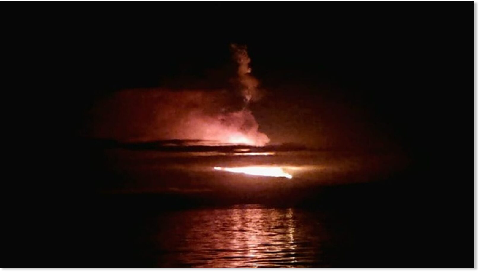
Wolf Volcano in Galapagos Islands erupts spewing lava and clouds of ash over the Pacific Ocean

Eruption of the Wolf Volcano
© Wilson Cabrera - Galapagos National ParkEruption of the Wolf Volcano
The tallest volcano in the Galapagos Islands has erupted, spewing lava and clouds of ash over the Pacific Ocean.

The Wolf Volcano, situated on Isabela Island, sent gas and ash around 3,793 metres (12,444ft) above sea level following the eruption, Ecuador's Geophysical Institute said.

Beginning just before midnight on Wednesday, the explosion caused lava to flow down the southern and southeastern flanks of the volcano, which is also known as Mount Whiton.

There was no immediate danger to populated areas located on the opposite side of the island, which is the largest in the Galapagos chain.


Attention

Tongans warned of acid rain after volcanic eruption

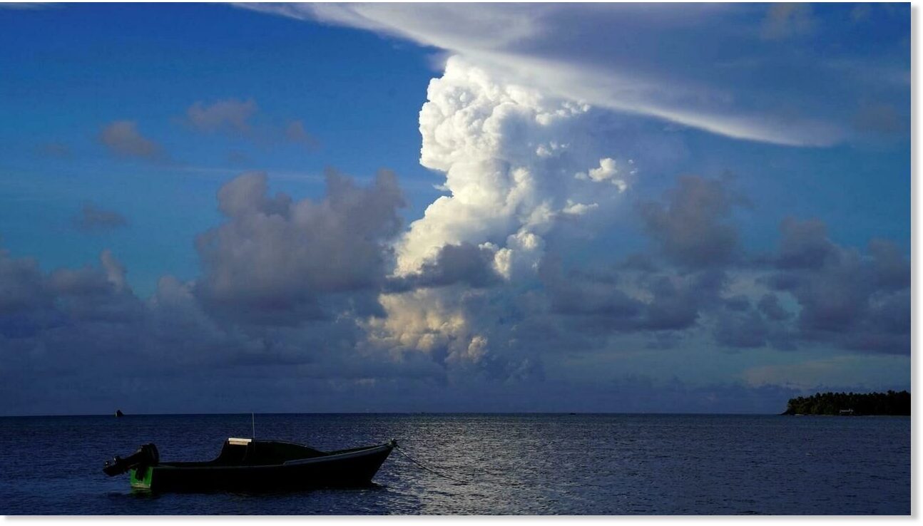
White gaseous clouds rise from the Hunga Ha'apai eruption, seen from near Tonga's capital Nuku'alofa
© Mary LynWhite gaseous clouds rise from the Hunga Ha'apai eruption, seen from near Tonga's capital Nuku'alofa
A toxic cloud spewing from an erupting volcano in Tonga could dump acid rainfall across the Pacific kingdom, potentially poisoning drinking water and damaging people's skin and eyes, emergency services have warned.

The remote Hunga Tonga-Hunga Ha'apai volcano erupted Monday, sending plumes 18 kilometres (11 miles) into the air, Tonga Geological Services (TGS) said.

Police reported no injuries from the eruption but TGS said late Tuesday that the dust and gas could result in acidic rainfall if mixed with water in the atmosphere.

It advised residents to remove guttering systems from their rainwater storage systems until the all-clear was given.


Info

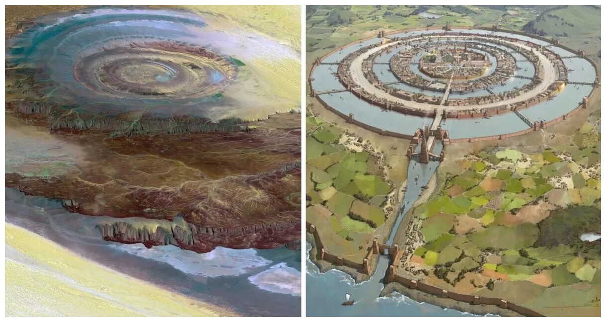
Is the Eye of the Sahara 'the Lost City of Atlantis'?


Comment: Short answer; no it is not. It's an impact site (caused by an overhead cometary explosion)...


Atlantis and Richat Structure
© Chubbinsure Net
Could a curious geological formation in the Mauritanian part of the Sahara desert anything to do with the lost city of Atlantis?

If you type the word "Atlantis" into Google, around 120 million results will pop up. Obviously, Plato's legend of Atlantis has long occupied many people, from scientists to mysticists, with many candidates being cited as the possible location of this lost and sunken civilization. But did such a city ever exist at all? And if yes, where could the ruins be?

The only mention of Atlantis by name in historical texts is in Plato's Dialogues (written around 360 B.C.), which gives dozens of precise details about what Atlantis looked like, and where it may have been located in relation to other landmarks in the ancient world. It was this level of detail that has set many people off thinking that Atlantis actually existed.

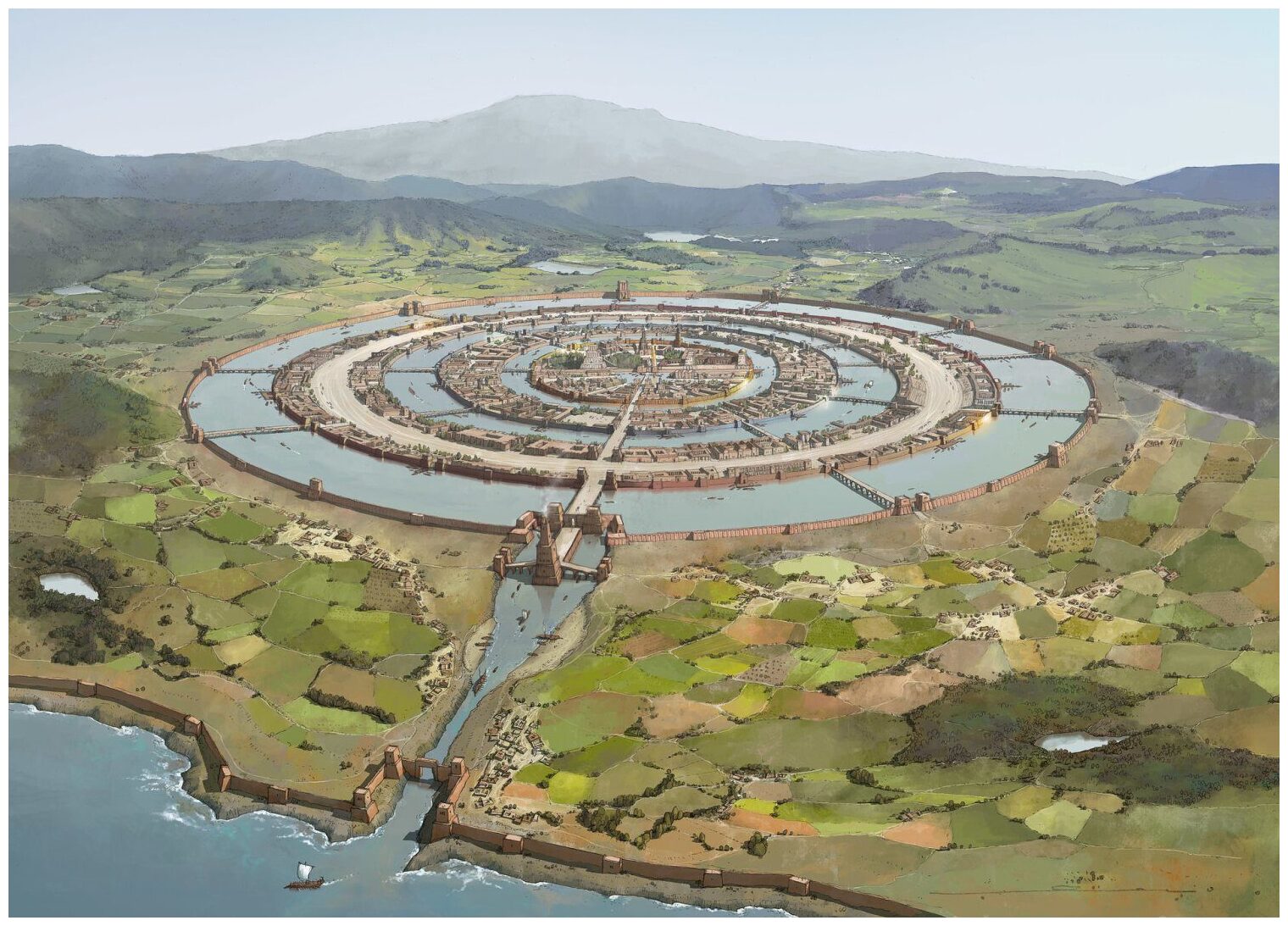
One of the best clues that Plato gives about Atlantis is that there was a series of concentric circles around the city, black and red stone, and of course it was a seafaring society:
Poseidon carved the mountain where his love dwelt into a palace and enclosed it with three circular moats of increasing width, varying from one to three stadia and separated by rings of land proportional in size. The Atlanteans then built bridges northward from the mountain, making a route to the rest of the island. They dug a great canal to the sea, and alongside the bridges carved tunnels into the rings of rock so that ships could pass into the city around the mountain; they carved docks from the rock walls of the moats. Every passage to the city was guarded by gates and towers, and a wall surrounded each ring of the city. The walls were constructed of red, white, and black rock, quarried from the moats, and were covered with brass, tin, and the precious metal orichalcum, respectively.
So, according to Plato, Atlantis looked something like this:
Atlantis Artist Drawing
© Rocío Espín Piñar

Comment:

Watch Randall Carlson's discussion of the Richat Structure.


Blue Planet

Rare mud volcano erupts in New Zealand, throws large rocks 50 metres away

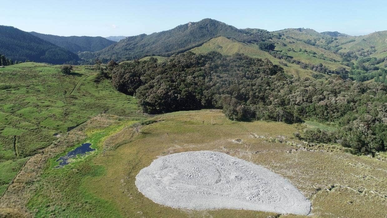
mud volcano
Murry Cave: The mud volcano on Monowai Station spewed large rocks 50metres.
A mud volcano that burst to the surface on a farm near Gisborne threw large rocks 50 metres and is continuing to "bubble away", 10 days after it erupted.

Gisborne District Council scientist Murry Cave​ said the mud volcano appeared on Monowai Station in the head of the Waimata Valley, about 25km north of Gisborne, about 7.45pm on December 10.

"It was accompanied by a sound that the landowners initially thought was thunder," Cave said.

He said mud volcanoes were a natural but rare phenomenon in New Zealand, and Gisborne/Tairawhiti had quite a few. This latest one is about 2km from the last mud volcano eruption in the area, which occurred in December 2018.

Comment: Other mud volcanoes in the news in the last few years:


Fire

Indonesia's Semeru Volcano erupts again prompting evacuation

Mount Semeru
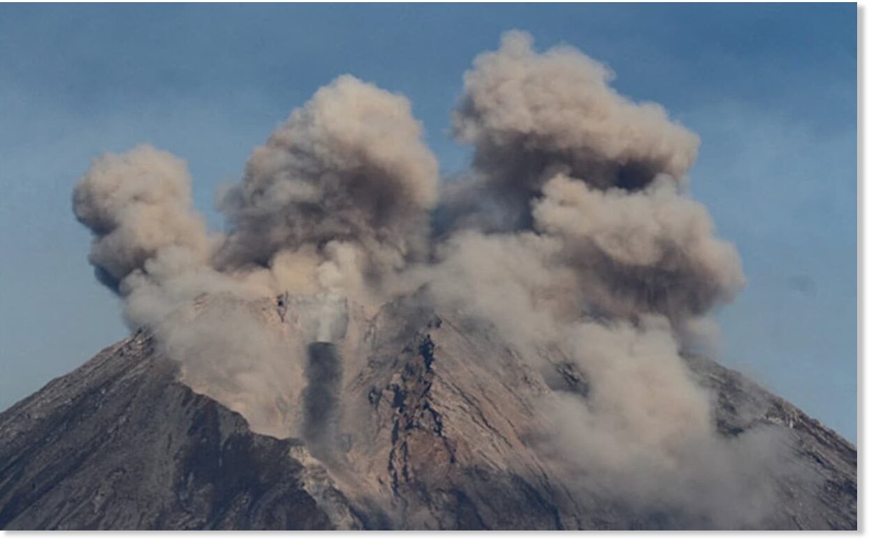
Indonesia's Mount Semeru, the highest peak on the island of Java and an active volcano, awoke on 4 December, spewing a plume of smoke high into the air with fast-moving currents of hot gas and ash rolling down the hillside, swallowing nearby villages.

Early Sunday morning, Indonesia's Semeru volcano erupted, spewing a 2 km high column of ash into the sky.

According to Reuters, authorities announced an evacuation of everyone living nearby.


Phoenix

With just weeks to go until 2022, the Ring of Fire is suddenly ROARING to life

Ring of Fire
© Gringer/wikimediacommonsSomewhere between 80 to 90 per cent of the world's earthquakes occur along an area commonly known as the 'Ring of Fire'
Why are so many earthquake swarms suddenly happening all along the Ring of Fire? For those that don't know, the Ring of Fire is a series of fault zones that run roughly along the perimeter of the Pacific Ocean. 75 percent of the Earth's active volcanoes are located within the Ring of Fire, and it accounts for more than 80 percent of all global earthquakes. So the fact that the Ring of Fire is starting to become so active should definitely trouble us all.

As I write this, we are less than three weeks away from 2022.

And as I have expressed on numerous occasions, I have such a bad feeling about 2022.

So many pieces of the puzzle are starting to come together, and that includes an alarming rise in seismic activity.

Let me start by discussing what just happened in Oregon. Starting last Tuesday and continuing through Wednesday, we witnessed a very strange swarm of earthquakes along the Blanco Fault Zone...

Fire

Residents flee massive ash cloud from erupting Semeru volcano in Indonesia - At least 39 dead (UPDATES)

Mount Semeru: Indonesia volcano erupts sending ash '40,000ft into sky' as locals flee
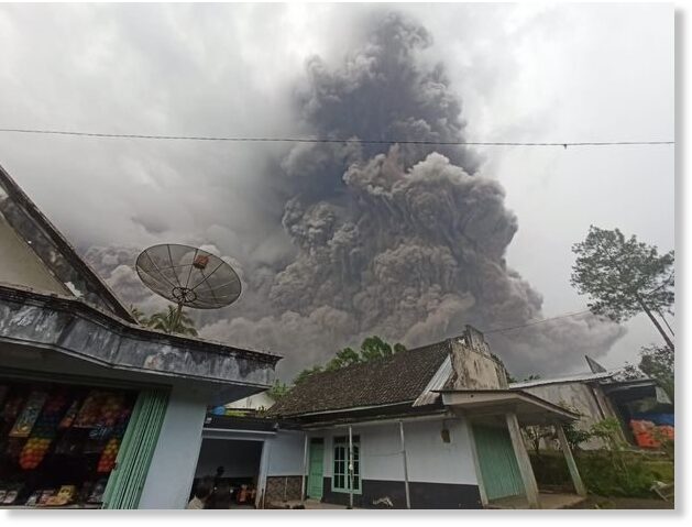
A volcano erupted on the Indonesian island of Java on Saturday, reportedly obscuring the sun with a massive cloud of ash, and sending locals into a panic.

A clip on social media has captured people, who live at the foot of Semeru volcano, fleeing in fear ahead of a cloud of black ash descending from the 3,676-meter-tall mountain.

The author of the footage is heard shouting "Allahu Akbar" (God is great) in face of this truly apocalyptic sight.


Comment: Update: TASS reported on December 6:
At least 22 people died and 20 more are reported missing after Mount Semeru, a volcano on Indonesia's Java island, erupted, a spokesman for the local emergencies agencies told the DetikNews portal on Monday.

"Rescuers found more dead bodies, so, the overall death toll has reached 22," he said, adding that five bodies have not yet been identified.


The local authorities said earlier that at least 27 local residents were reported missing after the volcano spewed ash on December 4. More than 50 people were injured.

Semeru, the highest mount on Java, is one of Indonesia's nearly 130 active volcanoes.

Update 2: Devdiscourse.com reported on December 8:
Death toll from Indonesia's Semeru volcano eruption rises to 39

The death toll from the eruption of Semeru volcano in Indonesia's island of Java has risen to 39 and 105 others were injured, the Lumajang District Disaster Management Agency said on Wednesday. "A total of 23 people were seriously injured, and 82 others slightly wounded," the agency's head of the rehabilitation and reconstruction division Joko Sambang said, adding that the injured are receiving medical treatment in nearby health facilities.

In addition, thousands of houses were damaged by the volcanic ash and many people have been evacuated to safer places.Sambang said that the evacuation process was very difficult due to the hot volcanic ash. Semeru volcano erupted on Saturday at 3:20 p.m. local time with the worst hit areas in Pronojiwo sub-district. (ANI/Xinhua)


Attention

Iceland raises alert level for Grímsvötn volcano after deformation, glacial flooding, and rise in earthquakes

Grímsvötn volcano iceland
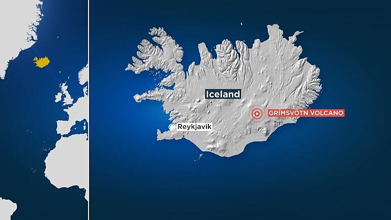
© EuronewsThe Grímsvötn is located in a remote area of central Iceland.
Iceland has raised its eruption alert level for the country's most active volcano, Grímsvötn, after several recent earthquakes.

Authorities said on Monday that one of the nearby quakes was recorded at a magnitude of 3.6.

But although seismic activity had increased, officials say they have not detected any tremors that have caused a surge in underground magma.

The volcano last erupted in 2011, generating a major ash cloud that partially disrupted air traffic across Europe and cancelled 900 flights.

Comment: On the 4th December, Volcano Discovery reported on the glacial flooding at Grimsvötn:
The meltwater rate has been increasing since the last update. The IMO's hydrologists measured 1600 cubic meters per second at 10:15 and 12:20 local time today in Gígjukvísl.

The latest measurements confirm estimated forecasts and if continue to be in line with them, the glacial flood will likely reach its peak on Sunday. Based on the latest data, the maximum discharge rate is expected to be about 4000 m3/s.
Grímsvötn volcano iceland
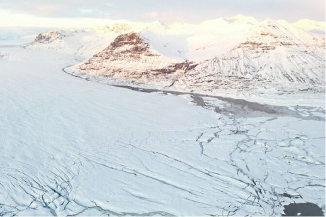
© IMOEastern view from Skeiðarárjökull glacier where meltwater flow runs from Grimsvötn
The ice sheet has continued to drop and reached already about 27 m in total subsidence.

Higher-than-usual gas emissions levels have been detected at the glacier rim of the volcano.

Recent eruptions at the volcano occurred every 5-10 years and based on current measurements and observations, volcanologists agree that an impending eruption is highly expected.
The following tweets, translated by Twitter, show the flooding, deformation, and melt at Grimsvötn volcano:
'The water that was under the glacier that covers the volcano Grímsvötn , began to come out. A Jökulhlaup began to be created that rose more than 4 m, it is a matter of days before we begin to see columns of steam and ash in the main crater.'


1st Tweet: 'The last flyby of the ice cap at Vatnajökull shows that part of the ice sheet covering the volcano's craters Grímsvötn is collapsing. The volcanic danger traffic light has been raised to orange due to the recent earthquakes and collapses.'

2nd post: 'The boiler limits of Grímsvötn also show shear and collapse effects. After the water comes out, the volcanic system is losing pressure which may generate an eruption in the next few days, creating plumes of steam and ash.'


Whilst Grímsvötn volcano may be considered to erupt with some regularity, this comes amidst an uptick of seismic and volcanic activity elsewhere in Iceland, as well as across much of the planet: Also check out SOTT radio's: As well as SOTTs monthly documentary SOTT Earth Changes Summary - October 2021: Extreme Weather, Planetary Upheaval, Meteor Fireballs


Info

Scientists racing to Canary Island volcano to study it

Cumbre Vieja volcano
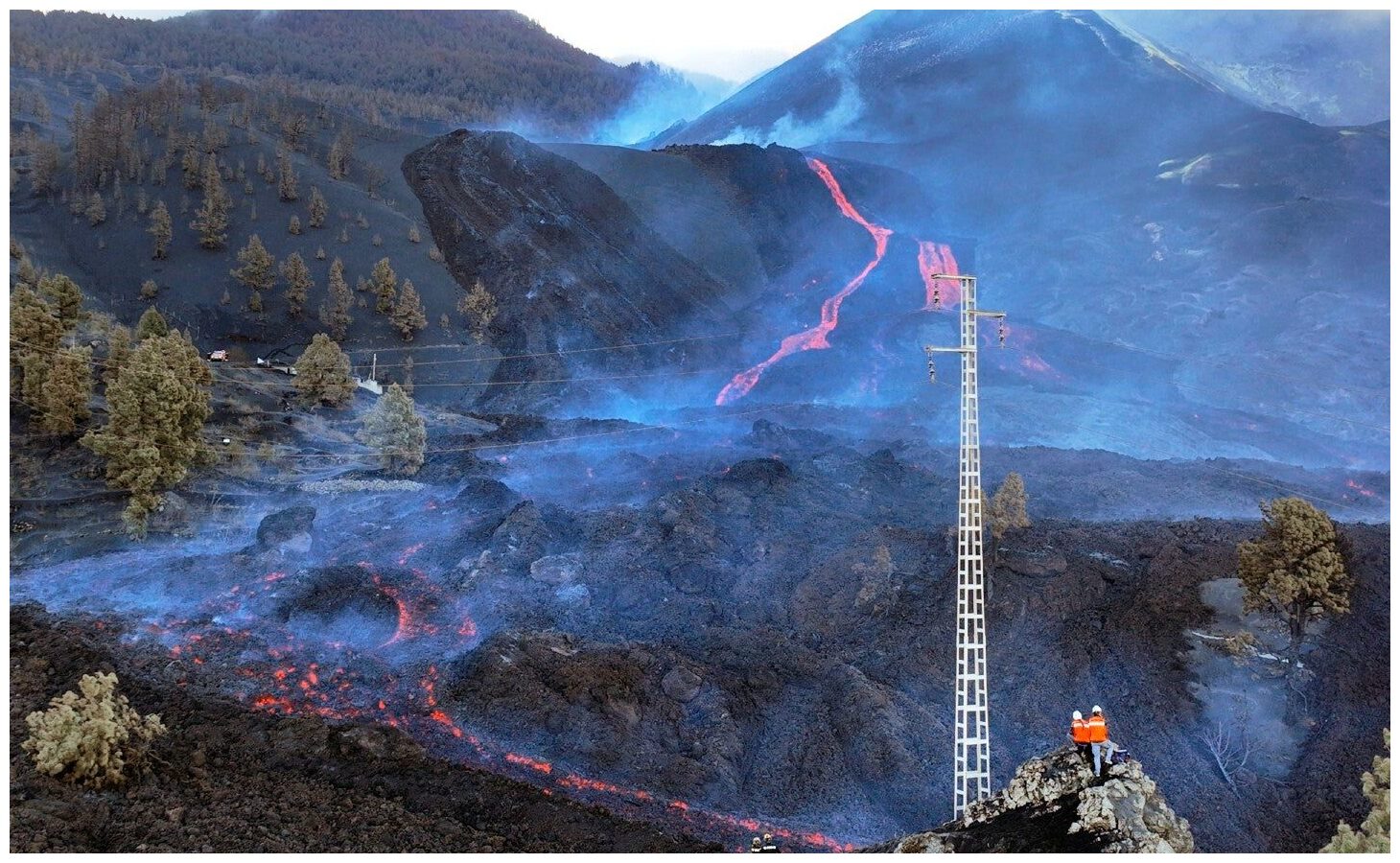
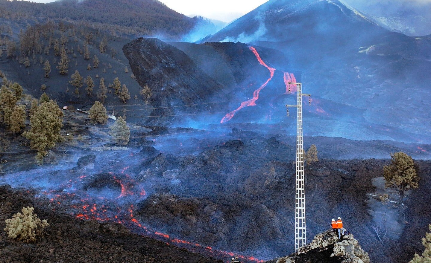
© Emilio Morenatti/ APScientists with the Canary Islands' volcanology institute, Involcan, inspect as the lava flows from a volcano on the Canary island of La Palma, Spain, Saturday, Oct. 30, 2021.
As a volcano continues to spew hot lava on a little island in Spain, scientists from around the world are racing to the area to study and learn about the rare eruption.

The Cumbre Vieja volcano has been erupting since September on La Palma, a small island in the Canary Islands of Spain. So far, nearly 1,150 buildings and surrounding land has been destroyed, according to Reuters.

According to an analysis by The Associated Press, volcanic eruptions to this degree are incredibly rare, occurring once, or at most twice, in a generation in the Canary Islands. Parts of the Canary Islands are actually still growing, as magma accumulates underneath and, as is happening in La Palma, lava peninsulas are forming beyond the coastline.

The Smithsonian Institution estimates there are currently 48 volcanoes currently in "continuing eruption status" worldwide.

In order to help ease the devastation the Cumbre Vieja volcano continues to cause, scientists are flocking to La Palma to study the eruption up close. They're hoping to learn how volcanoes form, develop and how and when they stop erupting.

Attention

'Weak explosion' & unusual seismic signals recorded at Mount Pinatubo - last erupted in 1991, considered 2nd largest eruption of the 20th century

Pinatubo
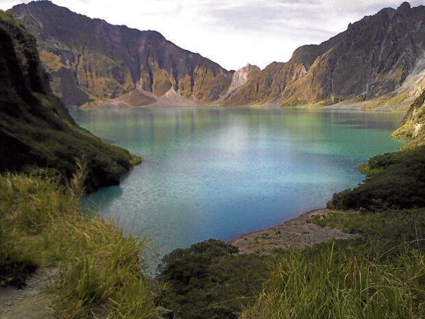
© INQUIRERFILE - The crater lake formed after Mt. Pinatubo erupted in 1991, shown in this file photo, has become a major attraction for outdoor enthusiasts, with trails opened in Tarlac and Zambales provinces.
A "weak explosion" was recorded at Mt. Pinatubo on Tuesday, said the Philippine Institute of Volcanology and Seismology.

In its latest bulletin, Phivolcs said the explosion was recorded between 12:09 p.m. and 12:13 p.m.

"The event produced a plume that was detected by the Himawari-8 Satellite and reported to Phivolcs by the Tokyo Volcanic Ash Advisory Center," said Phivolcs.