Earthquakes
S


Attention

5.7 magnitude earthquake SW of Ferndale, California

Image
© NBC
A magnitude-5.7 earthquake struck 25 miles southwest of Ferndale, California, on Wednesday afternoon, the U.S. Geological Survey reported.

The quake was reported 40 miles southwest of Eureka.

Attention

2.9 magnitude earthquake and 'boom sound' in Hampshire, England

Image
The epicentre of the quake was at Headbourne Worthy, just north of Winchester
An earthquake with a magnitude of 2.9 has been recorded in Hampshire, the British Geological Survey has confirmed.

Postings on social media reported buildings in the Winchester area shaking following a tremor shortly after 18:30 GMT.

A police spokeswoman said no injuries or serious damage had been reported.

Matthew Emery, from South Wonston, near Winchester described the experience as "almost as if Concorde had flown over".

The British Geological Survey (Bgs) reported a tremor at a depth of 3km (1.9miles) at Headbourne Worthy, just north east of Winchester.

BGS Seismologist David Galloway said the UK experienced about 10 quakes of such a size each year which were "usually quite widely felt around the area".

Bizarro Earth

USGS: Earthquake Magnitude 6.8 - 84km NNE of Port-Vila, Vanuatu

Port-Vila Quake_230115
© USGS
Event Time
  1. 2015-01-23 03:47:27 (UTC)
  2. Times in other timezones
Nearby Cities
  1. 84km (52mi) NNE of Port-Vila, Vanuatu
  2. 218km (135mi) SE of Luganville, Vanuatu
  3. 453km (281mi) NNE of We, New Caledonia
  4. 610km (379mi) NNE of Dumbea, New Caledonia
  5. 84km (52mi) NNE of Port-Vila, Vanuatu
Scientific Data

Road Cone

4.7 magnitude earthquake strikes Eastern Turkey

Magnitude
ML 4.7

Region
Eastern Turkey

Date time
2015-01-21 13:58:03.4 UTC

Location
38.25 N ; 42.86 E

Depth
4 km

Distances
214 km N of Al Mawşil al Jadīdah, Iraq / pop: 2,065,597 / local time: 16:58:03.4 2015-01-21
53 km SW of Van, Turkey / pop: 371,713 / local time: 15:58:03.4 2015-01-21
15 km N of Bahçesaray, Turkey / pop: 3,731 / local time: 15:58:03.4 2015-01-21

Source parameters provided by:
Kandilli Observatory and Earthquake Research Institute -- Istanbul, Turkey (KAN)
Image
© emsc-csem.org

Comment: According to the Hungarian National Association of Radio Distress-Signalling and Infocommunications there have been several earthquakes in Turkey since January 17, 2015:

Image


Map

5.6 magnitude earthquake hits Santa Maria Chiquimula, Guatemala

Image
© USGS
Event Time
  1. 2015-01-20 06:59:52 UTC
  2. 2015-01-20 00:59:52 UTC-06:00 at epicenter
  3. 2015-01-20 01:59:52 UTC-05:00 system time
Location

15.022°N 91.339°W depth=161.9km (100.6mi)

Nearby Cities
  1. 1km (1mi) SW of Santa Maria Chiquimula, Guatemala
  2. 7km (4mi) ESE of Momostenango, Guatemala
  3. 12km (7mi) NNE of Totonicapan, Guatemala
  4. 14km (9mi) NE of San Francisco El Alto, Guatemala
  5. 98km (61mi) WNW of Guatemala City, Guatemala
Tectonic Summary

Seismotectonics of the Caribbean Region and Vicinity


Extensive diversity and complexity of tectonic regimes characterizes the perimeter of the Caribbean plate, involving no fewer than four major plates (North America, South America, Nazca, and Cocos). Inclined zones of deep earthquakes (Wadati-Benioff zones), ocean trenches, and arcs of volcanoes clearly indicate subduction of oceanic lithosphere along the Central American and Atlantic Ocean margins of the Caribbean plate, while crustal seismicity in Guatemala, northern Venezuela, and the Cayman Ridge and Cayman Trench indicate transform fault and pull-apart basin tectonics.

Comment: Earthquakes worldwide for the past week:


Attention

4.4 magnitude earthquake near King City, California

Image
© USGS
A light earthquake has shaken a Central California region southeast of Monterey Bay.The U.S. Geological Survey says the magnitude-4.4 tremor struck at 5:21 a.m. Tuesday.

The epicenter was 17 miles northeast of King City. The USGS says the quake occurred at a depth of 6 miles.

The immediate area is largely rural and lightly populated. The USGS public reporting pages show it was felt lightly or weakly around Monterey Bay and to the east in some San Joaquin Valley cities.

Bizarro Earth

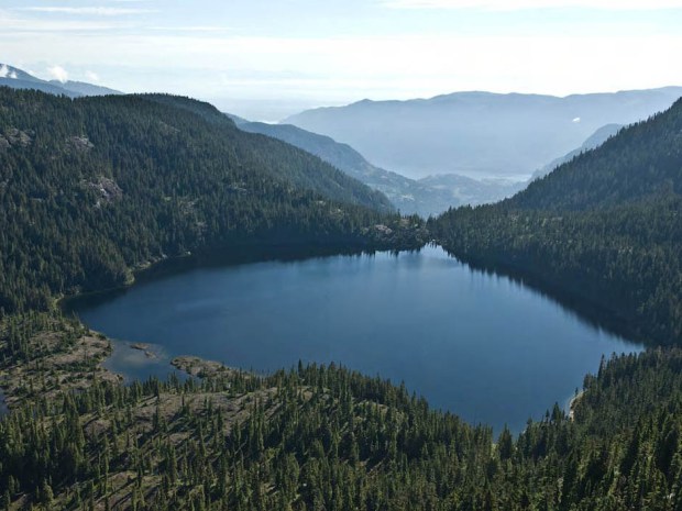
Vancouver Island will 'rip open like a zipper' when overdue megathrust earthquake strikes, experts say

Capes Lake, Vancouver Island
© National Post, CanadaCapes Lake, Vancouver Island. The odds of another megathrust earthquake and tsunami on Vancouver Island happening within the next 50 years are about one-in-10, experts say.
Pachena Bay , B.C. - The low tide, bright sunshine and constant roar of endlessly approaching waves display the full power of the wide-open Vancouver Island shoreline at the remote beach handed down to Stella Peters and her family as a wedding dowry.

For generations, Peters and her relatives have been the keepers of Pachena Bay, the picturesque beach that scientists forecast as an epicentre for the next massive earthquake and tsunami.

The bay is also the home to the Huu-ay-aht First Nations village of Anacla, about 300 kilometres northwest of Victoria, which aboriginal oral history says was devastated when an ancient earthquake convulsed the West Coast of North America.

First Nations from Vancouver Island to northern California describe the earthquake and tsunami in similar legends and artwork involving a life-and-death struggle between a thunderbird and a whale that caused the earth to shake violently and the seas to wash away their people and homes.

When the next megathrust quake hits, residents on the west side of Vancouver Island will barely have 20 minutes to get to higher ground.

Attention

Unprecedented earthquake in Playa del Carmen and Tulum, Mexico - areas not known for seismic acivity

Yucatan Earthquake Seismograph
An earthquake was registered on the evening of Sunday January 10th, with an epicenter near Playa del Carmen, Quintana Roo, an area traditionally considered non seismic. According to Margarita Vidal Amaro of the National Seismological Service, an earthquake of magnitude 4.2 on the Richter scale occurred at 9:49 pm on Sunday January 10th 2015. The epicenter was located exactly 67 kilometers (41 miles) southwest of Playa del Carmen, in Quintana Roo.

Several Twitter users such as @FerDelor, @arnulfo_26, @CarlosQuikeYam and @linachapa among others, posted comments regarding this unusual event in this part of the country.

The government of Quintana Roo requested support from national institutions on Monday January 12th, to help determine the causes of this earthquake that occurred off the coast of Tulum. But the National Seismological Service in Mexico City officially confirmed the event since Sunday January 11th. Vidal Amaro explained that the quake occurred on the mainland and so there was no danger of a tsunami in the area. She added that even though earthquakes are unprecedented in the area, there are tectonic plates all over Mexico, which can lead to earthquakes. The quake was felt with greater magnitude in the town of Tulum, according to reports on social networks.

Source
Comment: And if it's not tectonic plates, then WHAT is causing the increase in earthquakes or ones deemed "unprecedented"?

Also see:


Bizarro Earth

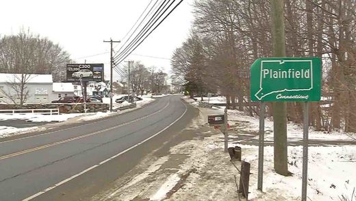
Earthquake in eastern Connecticut is 4th straight day of quakes in area

Image
A 2.2-magnitude earthquake has rattled eastern Connecticut again.

In what's becoming a daily seismic event, the Weston Observatory of Boston College said the earthquake occurred at about 4:40 a.m. Thursday near Plainfield, where previous earthquakes were recorded.

It says two minor earthquakes were recorded on Wednesday and another on Tuesday.

Several were recorded on Monday and last week, too.

The observatory says that while the greatest earthquake activity in the United States is in the west, earthquakes are "quite common" in many areas of the eastern United States, including New England.

Plainfield officials have invited Alan Kafka, director of the observatory, to an informational meeting at 6:30 p.m. Friday at the town's high school.

Comment: While this earthquake activity is being described as "quite common", it certainly seems as though something strange is going on in Connecticut for all this earthquake activity to be happening.


Bizarro Earth

Loud explosion precedes series of earthquakes in New England

Image
© WFSBThe Weston Observatory recorded four small earthquakes in the Plainfield area on Monday morning.
Five small earthquakes rattled New England on Monday.

It was the third day in less than a week that rumbles shook the Plainfield region.

Plainfield police said they received dozens of calls about homes shaking in the Plainfield, Killingly, Brooklyn and Sterling areas. They received even more around the noon hour.

"They just started pouring in regarding a loud explosion," said Capt. Mario Arriaga, with the Plainfield Police Department. "However, this time, people were reporting earthquakes since last time we had one on the 12th."

Authorities released a few of the 911 calls they received. Police said they received well over 100 calls.

"We just had a massive earthquake again," one caller reported.

"It sounded like a bomb and everything was shaking," another caller said.

Comment: Loud booms and explosion-like sounds are more and more frequently associated with earthquakes these days. There is also the possibility that some earthquakes could have been caused by meteorites breaking up in the atmosphere in New England. However, you are unlikely to hear this from the mainstream media.

Breaking: Meteor outburst over 6 Northeastern U.S. states - Connecticut, New York, New Hampshire, New Jersey, Massachusetts and Maine (so far...)