Wildfires
S


Fire

Wildfire grows to more than 10,000 acres in Monterey County, California; 10 wildfires burning in the state

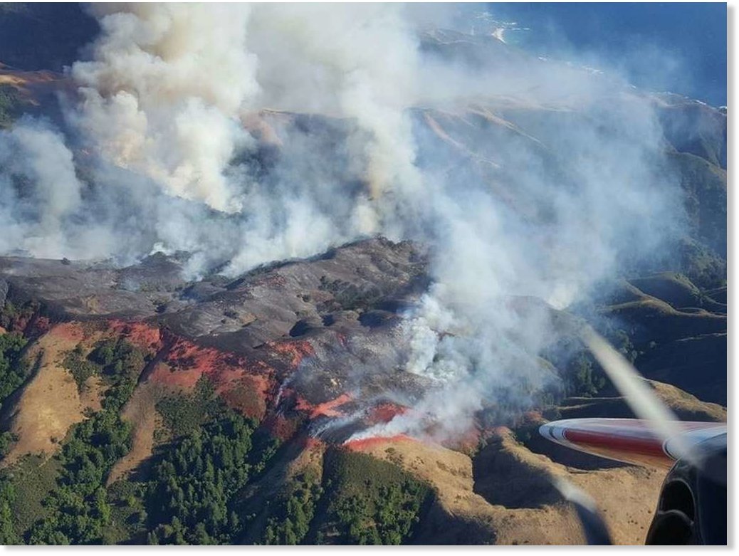
The Soberanes Fire
© Cal Fire / California Department Of Forestry And Fire ProtectionThe Soberanes Fire
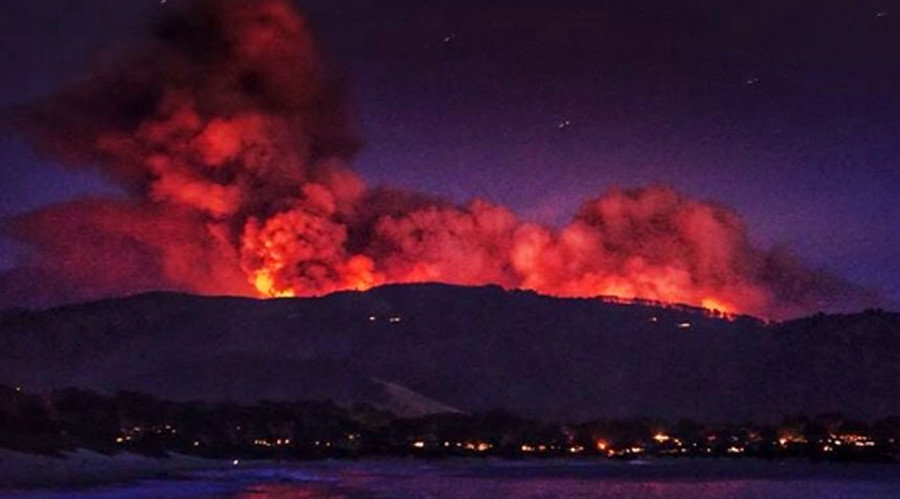
A wildfire burning south of Carmel in Monterey County grew to more than 11,000 acres Sunday, as residents were warned to be ready to flee while crews battle the stubborn blaze amid soaring temperatures.

The Soberanes Fire — one of about 10 wildfires burning around the state, including the Sand Fire in Los Angeles County — grew to 11,000 acres by Sunday night and remained only 5 percent contained, according to the California Department of Forestry and Fire Protection.

Six houses and two outbuildings were destroyed and 1,650 others are threatened by the fire that started Friday morning near Garrapata State Park between Carmel and Big Sur.

Residents in the community of Palo Colorado south of the fire were ordered to evacuate, while other residents, particularly those in Carmel Highlands, were told to get ready to flee in case the fire takes off, Cal Fire officials said.

Fire

Out-of-control California wildfire grows to more than 33,000 acres in Santa Clarita Valley

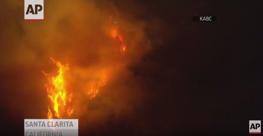
Santa Clarita wildfire
© YouTube/Associated Press (screen capture)
The brush fire raging in the rugged mountains of the Santa Clarita Valley grew by more than 10,000 acres on Sunday, scorching an estimated 33,172 acres by the late evening as the blaze continued to threaten hundreds of homes while firefighters battled to keep flames from spreading, authorities said.

Fueled by 20-mph winds and hillsides carpeted with tinder-like chaparral, the wildfire was burning in hills toward Acton by late Sunday afternoon. Hundreds of residents were ordered to evacuate.

Mandatory evacuations were still in place Sunday for about 1,500 residents in parts of Sand and Placerita canyons, as well as for others along Little Tujunga Canyon Road.

So far, at least 18 structures have been destroyed and one damaged in the Bear Divide and Sand Canyon areas, according to the Los Angeles County Fire Department. One fatality has been reported, but it is not yet clear if it is fire-related.

The 14 Freeway in the Santa Clarita Valley was closed in both directions late Sunday afternoon but was later reopened.

At least one drone was spotted over the fire near the Bear Divide area, about 2,000 feet above Lake View Terrace, according to the U.S. Forest Service. The sighting of a drone over a wildfire typically prompts officials to ground aircraft for 30 minutes. The Forest Service said that those caught flying private aircraft or drones could face criminal charges.


Fire

Wildfire burns almost half of Antelope Island, Utah

Firefighters work to set a back fire as favorable winds allow for the strategy on Antelope Island, Saturday, July 23, 2016.
© Scott SommerdorfFirefighters work to set a back fire as favorable winds allow for the strategy on Antelope Island, Saturday, July 23, 2016.
Fanned by steady winds, a wildfire had burned 13,740 acres of Antelope Island by Saturday night — nearly half the acreage at one of Utah's best-known landmarks.

No injuries were reported Saturday, nor were there reports of fire consuming any of the island's iconic mammals.

"The total acreage for Antelope Island is 28,000," said Jeremy Shaw, manager of Antelope Island State Park. "We're approaching half the island pretty rapidly. The wind's not helping us right now."

The blaze has been dubbed the West Antelope Fire. It is spreading north and east, was 35 percent contained as of Saturday evening. Ground crews and aircraft battled the blaze throughout the day.

Fire

Update: Charred corpse found at 'Sand Fire' site as raging flames consume 20k acres (PHOTOS, VIDEOS)

California fire
© brian_obrien / InstagramFire fighters have 10 percent containment of the fire.
A charred corpse has been found in an area of Santa Clarita, California, under threat from wildfires that have consumed over 20,000 acres. Firefighters are struggling to contain the fire that has raged since Friday.

The body was found on Iron Canyon Road, an area of Santa Clarita that authorities had ordered to be evacuated. A resident in the area told KTLA that the deceased man was found burned in a car after being separated from his partner.

Comment: See also: Wildfires force mass evacuations north of Los Angeles,California, prompt warnings of extreme danger


Fire

Wildfires force mass evacuations north of Los Angeles,California, prompt warnings of extreme danger

Ca wildfire
© Noah Berger / ReutersThe Erskine Fire burns above South Lake, California.
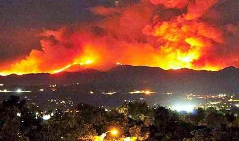
Huge wildfires burning in the mountains north of Los Angeles and near Big Sur on California's Central Coast are posing a threat to more than 1,300 households and already caused forced evacuations of about 300 homes, according to local authorities.

A fire that erupted on Friday in the Sand Canyon area near Santa Clarita located north of Los Angeles has already incinerated some 4,450 hectares and has grown to more than eight and a half square miles.

Comment: See also: California wildfire nearly doubles in size to 20,000 acres


Fire

California wildfire nearly doubles in size to 20,000 acres

California wildfire
© TwitterHundreds have fled their homes as the Califormia fire remains largely out of control
Evacuation orders remained in place for around 1,500 homes near a wildfire north of Los Angeles early Sunday, after the blaze nearly doubled in size Saturday.

The mandatory evacuation orders were prompted by the so-called Sand Fire burning in the Angeles National Forest and areas near Santa Clarita, the Los Angeles County Fire Department said. Earlier, evacuation orders affected around 300 homes.

Authorities discovered a burned body Saturday evening outside a home on Iron Canyon Road in Santa Clarita, just north of Los Angeles.

Detectives were trying to determine whether the person was killed by the blaze or another cause, Los Angeles County sheriff's Lt. Rob Hahnlein said. The home also may have burned, he said.

The fire broke out at around 2:11 p.m. local time Friday (5:14 p.m. ET) and swelled to 11,000 acres by noon Saturday and then to 20,000 acres by Saturday evening, fire officials said. More than 900 firefighters were battling the blaze, the Angeles National Forest said.


Comment: Could 2016 be California's worst wildfire season?


Fire

Raging wildfire burns more than 3,300 acres north of Los Angeles, forcing hundreds of evacuations

As of last night, no deaths or injuries were reported except one injury of a fireman
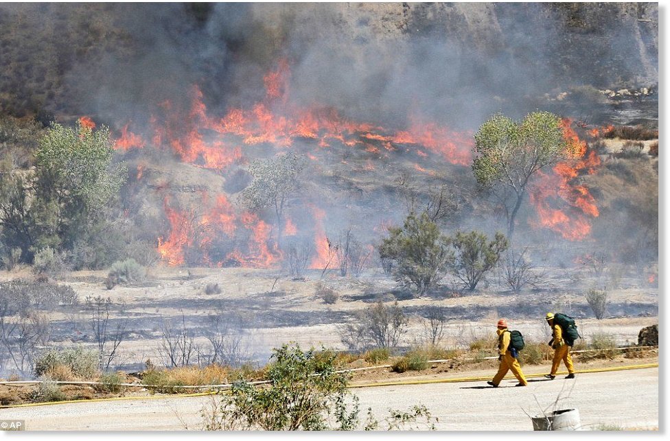
An out-of-control wildfire is eating up thousands of acres of land outside of Los Angeles and hundreds of firefighters are still battling the raging flames by land and air.

The quick moving Sand Fire broke out Friday about 2pm on northbound 14 Freeway in Santa Clarita, also known as Antelope Valley Freeway, 40 miles north of Los Angeles.

The fire has so far claimed over 3,300 acres, according to the fire department. There have been no deaths reported thus far and only one injury, that of a fireman.

The fire is being battled by four water-dropping helicopters and two fixed-wing firefighting aircraft were also called in to attack the blaze. Cal Fire and the U.S. Forest Service were also assisting in the firefight, according to NBC Los Angeles.

The blaze is being fueled by a heat wave with temperatures reaching between 108 and 112 degrees Fahrenheit and wind gusts of up to 40 miles per hour, according to the National Weather Service.


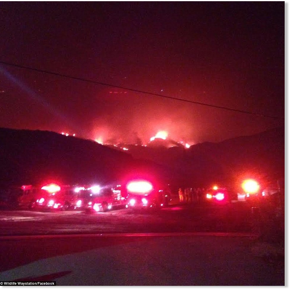
Wildlife Waystation in Sylmar, home of more than 400 rescued exotic animals, including lions and tigers. It was evacuating on Friday

Fire

Wildfire smoke stretches for 2,000 miles in Russia

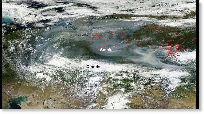
Smoke across Russia on satellite July 20, 2016. Each red dot shows fire/thermal anomalies detected by satellite.
© NASASmoke across Russia on satellite July 20, 2016. Each red dot shows fire/thermal anomalies detected by satellite.
Wildfires burning in central and eastern Russia this week have contributed to an eye-popping amount of smoke that is trapped under a dome of high pressure.

You can see the smoke - the milky white area - extending for nearly 2,000 miles from west to east across Russia in the NASA satellite image below from Wednesday. Each red dot on the map is a fire and thermal anomaly detected by satellite, illustrating where some of the active fires were occurring at that time.

The smoky conditions were also widespread on Monday and Tuesday. Here's what it looked like on Monday.

Smoke across Russia on satellite July 18, 2016. Each red dot shows fire/thermal anomalies detected by satellite.
© NASASmoke across Russia on satellite July 18, 2016. Each red dot shows fire/thermal anomalies detected by satellite.

Airplane

Russian IL-76 plane with 10 on board disappears while fighting forest fire in Siberia

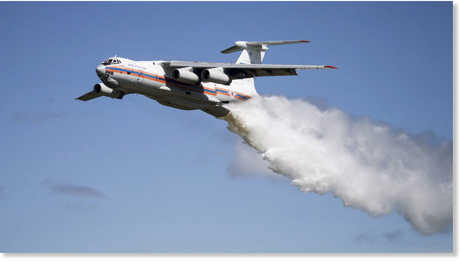
An Ilyushin Il-76TA Candid aircraft of the Russian Ministry for Civil Defense
© EMERCOM of Russia / Sputnik An Ilyushin Il-76TA Candid aircraft of the Russian Ministry for Civil Defense
Contact was lost with a Russian IL-76 fighting a blaze near the city of Irkutsk when it was at an altitude of 3,000 meters (9,900ft). The emergencies ministry plans to parachute in 100 rescue workers to search for the missing plane and the 10 people on board.

"Contact was lost in the Kachug area of the Irkutsk Region, where smoke from forest fires was extremely thick," RIA Novosti reports, citing a source within the emergencies ministry.

A large search operation has been launched to find the missing plane, with nearly 450 people involved in the rescue effort.

"All in all the search-and-rescue operation involves 441 people and 28 units of equipment, including 16 aircraft," an official told RIA Novosti.

According to the local administration, the search is being conducted by planes because the territory is too large and inaccessible for a ground search and there are no roads in the area.


Fire

Wildfires devastating parts of southern Spain

Southern Spain wildfires
© aeafma / Instagram
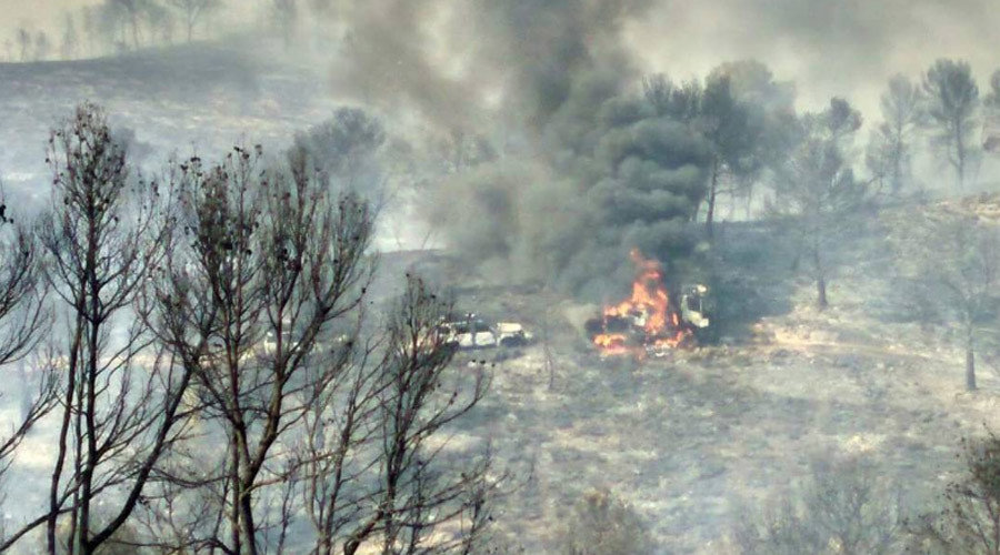
Authorities in the Spanish province of Albacete are desperately trying to tackle forest fires, fueled by strong winds in the area. Almost 150 firefighters and troops have been mobilized to try and put out the blazes.

The fire started in the small municipality of Lietor, around 110km northwest of Murcia. Around 500 hectares of woodland have been affected by the fires, which are still not under control.

The blaze has put two local roads out of use, while the authorities have managed to call in aerial help from a number of amphibious aircraft in order to try and put out the fires. The proximity of a local reservoir is helping efforts to tackle the fire as the firefighters are being given a regular supply of water.

There have been no fatalities; however, several firefighting vehicles have been lost due to the raging inferno.