

© NASASmoke across Russia on satellite July 20, 2016. Each red dot shows fire/thermal anomalies detected by satellite.
You can see the smoke - the milky white area - extending for nearly 2,000 miles from west to east across Russia in the NASA satellite image below from Wednesday. Each red dot on the map is a fire and thermal anomaly detected by satellite, illustrating where some of the active fires were occurring at that time.
The smoky conditions were also widespread on Monday and Tuesday. Here's what it looked like on Monday.
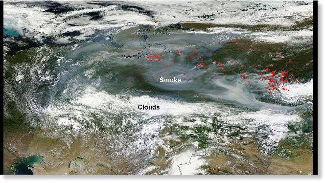
© NASASmoke across Russia on satellite July 18, 2016. Each red dot shows fire/thermal anomalies detected by satellite.
Portions of central Russia, where the fires are located, are coming off a June that had temperatures much above average, according to NOAA's State of the Climate report. In addition, precipitation was below average in this region during June, giving the fires dry fuel to burn.
Even prior to June, fires were severely impacting parts of Russia. In May, the area covered by fires was as large as Vermont and Delaware combined.
Greenpeace said in early June that this year's Russian wildfires were close to becoming some of the most devastating in the country's recent history.
The smoke from these recent fires is trapped under a dome of high pressure in the upper atmosphere. Air sinks under the area of high pressure, leading to stagnant weather conditions and causing the smoke to linger around for days as the fires continue to burn.
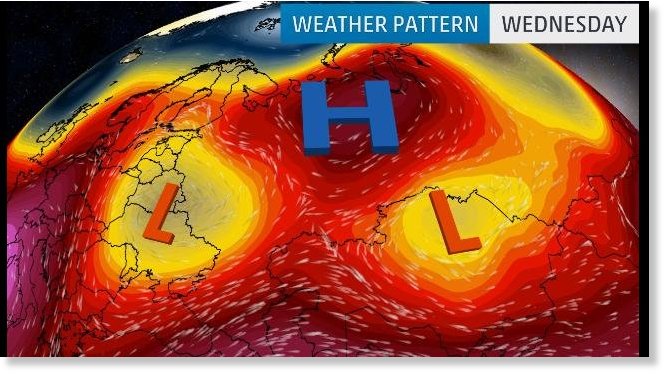
Weather pattern in Asia July 20, 2016 with high pressure centered over central Russia leading to stagnant conditions.


Reader Comments
to our Newsletter