Volcanoes
S


Attention

Best of the Web: Worldwide volcanic uptick: Multiple eruptions to 45,000+ ft (13.7+ km) - Direct cooling effect

Volcanic uptick

These past few days have seen a violent worldwide volcanic uptick, sending us all further signs that the next Grand Solar Minimum is dawning.


HIMAWARI-8 (a Japanese weather satellite) recorded two HIGH-LEVEL eruptions on May 16, both occurring in Indonesia.

The first took place at Ibu -a relatively new volcano with only 3 notable eruptions; in 1911, 1998, and 2008- and was confirmed by the Volcanic Ash Advisory Center (VAAC) Darwin which warned of an ash plume rising to an estimated 45,000 ft (13.7 km).

The second high-level eruption took place just a few hours later at Semeru -a very active volcano with an eruptive history peppered with VEI 2s and 3s; the first coming in 1818, the most recent in 2014- and as with Ibu's, Semeru's eruption was picked up by both HIMAWARI-8 and the VAAC Darwin, with the latter confirming the generation of "a dark ash plume which reached an altitude of 46,000 ft (14 km)."

In addition, and as recently reported by VolcanoDiscovery.com, active lava flows remain active on the Semeru's southeast flank, currently about 4,921 ft (1.5 km) long (as of the morning of May 18).

Comment: It is likely that atmospheric dust loading from increased volcanic and comet activity is contributing to recent extreme hailstorms, the cooling effect of which causes ice crystals to form. See also:


Bizarro Earth

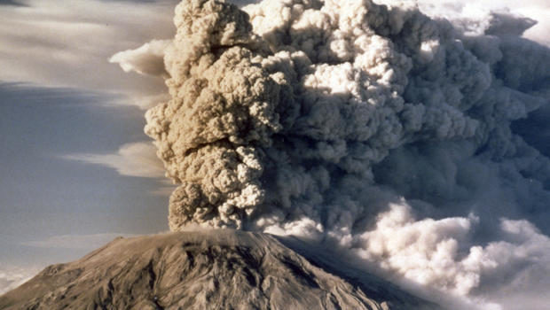
Remembering Mount St. Helens eruption: 40 years later

Mount St. Helens spews smoke, soot and ash into the sky in Washington state following a major eruption on May 18, 1980
© JACK SMITH/APMount St. Helens spews smoke, soot and ash into the sky in Washington state following a major eruption on May 18, 1980.
May 17, 1980, 40 years ago today, was a beautiful day on the mountain in southwest Washington. It was also the most significant day of Carolyn Driedger's life.

She and a colleague had traveled to the active volcano Mount St. Helens to drop off equipment at a U.S. geological station. They planned to stay the night, but geologist David Johnston, tasked with monitoring the mountain, warned them against it.

"He said, 'Let's just have as few people here as possible,'" Driedger recalled. "We were very disappointed that we were not going to spend the night looking at this beautiful volcano. The sun was just starting to set. We stopped and I took a couple of last photos of Mount St. Helens."

The next morning, at 8:37 a.m., Mount St. Helens erupted - a disaster unlike any other in American history.

The news reported it as "the most violent eruption of this volcano in 32,000 years."

"The energy that came out of Mount St. Helens that day is bigger than any nuclear weapon than we have in our arsenal," said Steve Olson, author of "Eruption: The Untold Story of Mount St. Helens" (W.W. Norton). "The whole northern flank of the volcano collapsed into this valley," he said, "and that let out this burst of pressure that had been building up inside the volcano."

The blast triggered the largest landslide in recorded history, flattening trees for 220 square miles, with a cloud of smoke, ash and pumice. In all, 57 people died.


Comment: Scientist reveals molten rock 'rising five metres a day' at Mount St Helens, Washington


Attention

Sakurajima volcano erupts in Japan

erupts
At 18:55 JST an explosion was registered. Clouds/heavy dew obscured.


Arrow Up

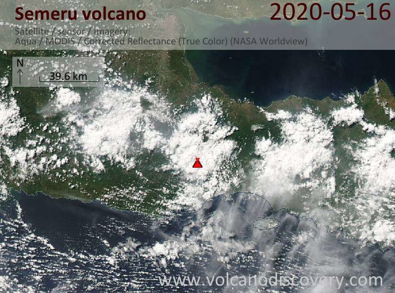
High-impact eruption to 14 km (46 000 feet) a.s.l. at Semeru volcano, Indonesia

Satellite image of Semeru volcano on 16 May 2020
© Volcano DiscoverySatellite image of Semeru volcano on 16 May 2020
Explosive activity continues. Volcanic Ash Advisory Center (VAAC) Darwin warned about a volcanic ash plume that rose up to estimated 46000 ft (14000 m) altitude or flight level 460 .
The full report is as follows:

Info

Fossil footprints in Africa a snapshot of past behaviour

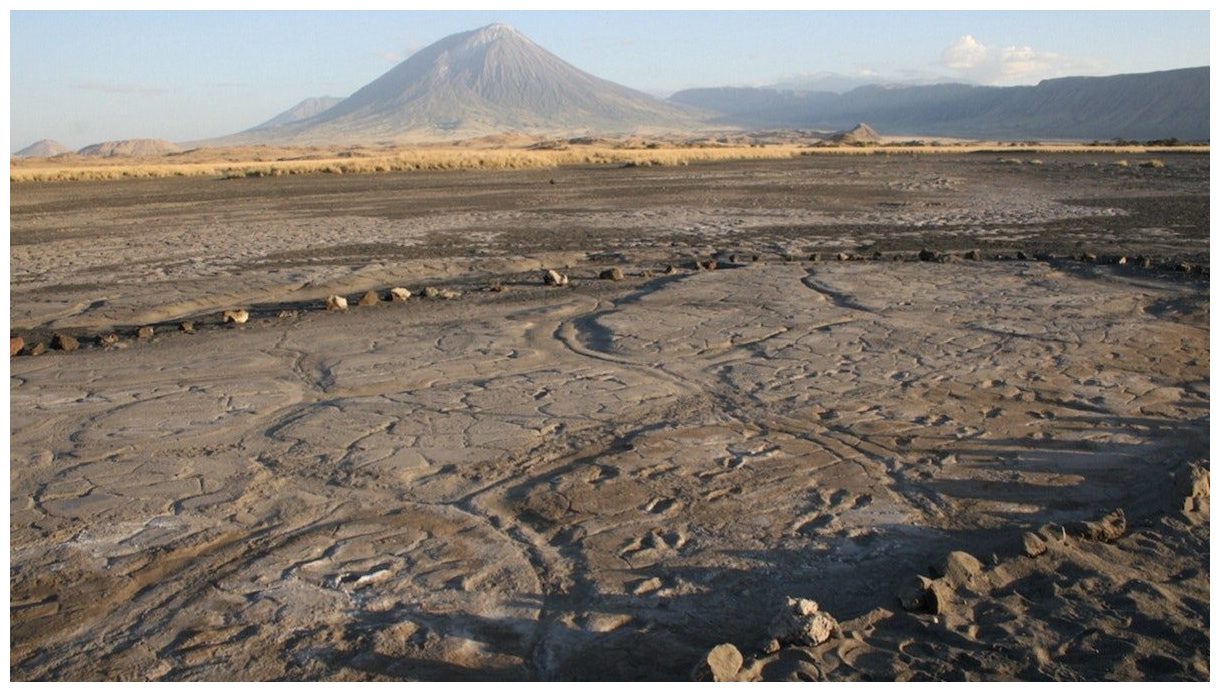
The Engare Sero footprint site
© CYNTHIA LIUTKUS-PIERCEThe Engare Sero footprint site. An eruption of Oldoinyo L'engai, the volcano in the background, produced the ash in which the footprints were preserved.
Thousands of years ago, a group of people trekked across African soil, and their footprints remain to shine a torch on our ancestors' movements and behaviours.

More than 400 indents were left by bare human feet in Engare Sero, Tanzania, originally spotted by members of a local Maasai community more than a decade ago and their age and formation described in 2016.

Geological analyses revealed the prints, all preserved on the same surface of hardened ash from nearby volcano Ol Doinyo Lengai, were made sometime between 6000 and 19,000 years ago, placing them around the Late Pleistocene.

Now, paleoanthropological analyses, published in the journal Scientific Reports, explore what the fossilised tracks reveal about the people who made them.

"Footprints are rare components of the human fossil record," says lead author Kevin Hatala from Chatham University in Pittsburgh, US, "yet they can preserve exceptional snapshots of behaviour in our distant past."

Seismograph

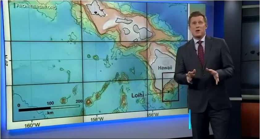
Scientists closely monitor underwater volcano off Hawaii after rare earthquake swarm

Big Island earthquake swarm
© Hawaii News Now (screen capture)
Volcanologists are keeping a close eye on their instruments after a rare earthquake swarm off the Big Island the past two days.

Twenty miles off the southeast coast of the Big Island, Hawaii's newest volcano rises 10,000 feet from the ocean floor with its summit about 3,000 feet under the surface.

When Loihi starts shaking, scientists pay attention.

"Think of it as a younger version of Kilauea or Mauna Loa volcanoes," said David Phillips, deputy scientist in charge at Hawaiian Volcano Observatory.

Phillips said there's no significant hazard at the moment, but at one point HVO recorded 14 earthquakes per hour on the Loihi Seamount.

"The peak did take place yesterday afternoon, whether it continues to subside or come back is hard to say," Phillips said.

On a seismogram, more than a hundred temblors struck in the 2- to 3-magnitude range, suggesting magma is on the move.

Attention

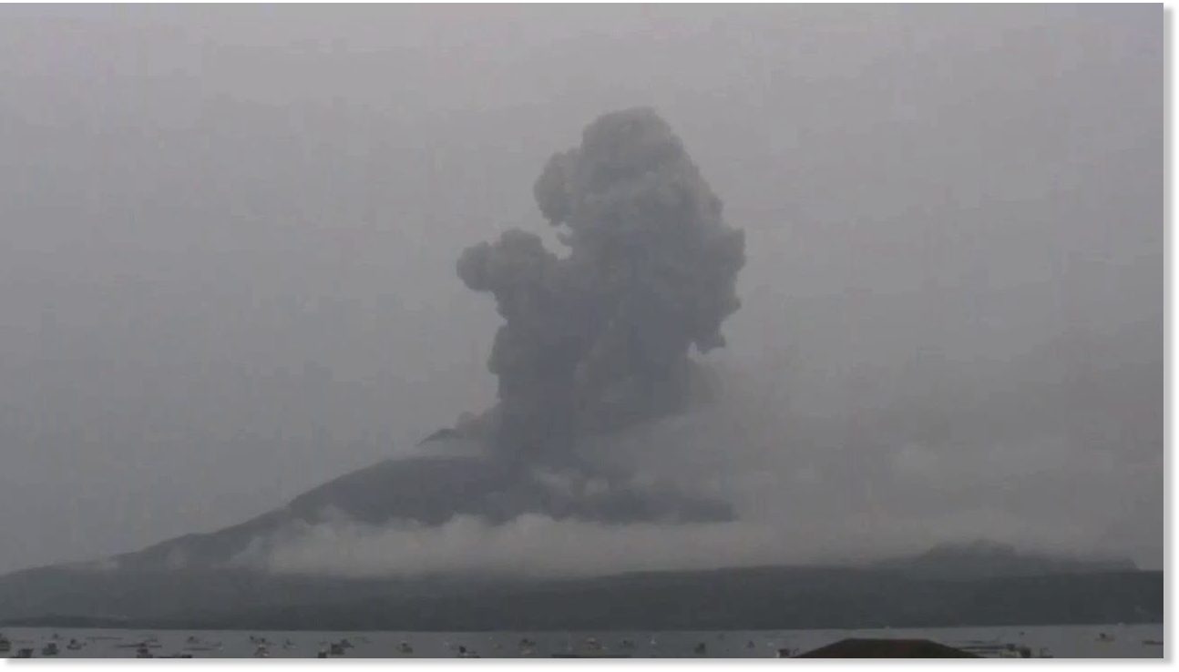
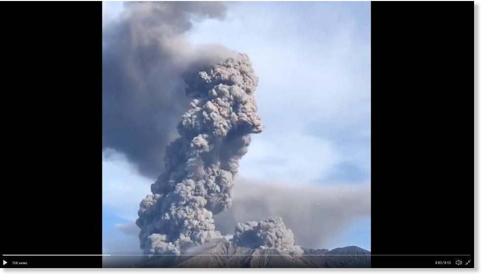
Strong eruptions in past few last days at Sakurajima volcano, Japan

Strong explosion from Sakurajima volcano on 8 May
© @chematierra/twitterStrong explosion from Sakurajima volcano on 8 May
The activity of the volcano continues at high levels associated with strong eruptions during the past days.

On 8 May at 07:04 local time a powerful explosion occurred from its crater. A dense dark ash plume rose 6,561 ft (2,000 m) above the summit.

On 9 May at 05:32 local time another vigorous eruption occurred when ash plumes reached 13,779 ft (4,200 m) altitude.


Info

Ancient volcano discovered on Dutch seafloor

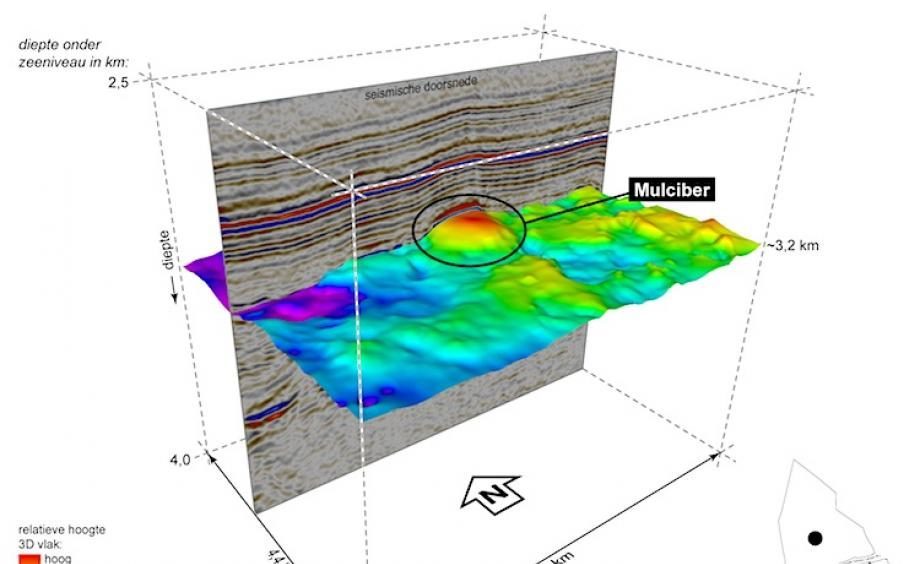
The Mulciber volcano (in red) found at the bottom of the North Sea.
© TNO/TNOThe Mulciber volcano (in red) found at the bottom of the North Sea. Three kilometers of sediment lies on top of it.
An extinct volcano has been discovered about 100 kilometers off the coast of Texel, the Netherlands Organisation for Applied Scientific Research (TNO) confirmed this week. The 150-million-year-old volcano, named 'Mulciber' after the Roman god of fire, was discovered accidentally by TNO researchers during a reanalysis of old seafloor maps while on the search for oil.

The ancient formation was recognized by deviations in the seafloor's structure, combined with measurements of the earth's magnetic field. According to Michiel van der Meulen, who headed up the Geological Survey of the Netherlands for the TNO, the discovery marks an important moment in the understanding of volcanism in the North Sea.

"The North Sea and the geological deposits in it seem to me to be reading an exciting story. We think we know the big story now. But if as you reread it, characters and storylines become more and more apparent, so this discovery adds to the general knowledge about our living environment," Van Der Meulen explained to public broadcaster NOS on Saturday.


Seismograph

Iranians spill into the streets after 5.1 earthquake centering on sleeping volcano hits Tehran

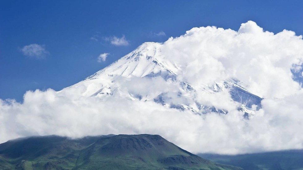
Mount Damavand, Iran
© Global Look Press / imago stockMount Damavand, Iran
A 5.1 magnitude earthquake has jolted an area in northern Iran, home to a sleeping volcano, forcing panicked residents in and around Tehran to rush onto the streets despite the Covid-19 lockdown.

The quake sent ripples across Iran's north shortly after midnight local time on Friday, striking at a shallow depth of just 7 km, less than 10 km (6.2 mi) north of the city of Damavand. The city is located close to Mount Damavand, the second-highest volcano in Asia.

The dormant volcano sits some 70 km (43 mi) north-east of the Iranian capital Tehran, where locals reported moderate to severe shaking from the Friday morning tremor.

Photos and videos have emerged on social media showing residents flooding the streets in the aftermath of the quake.

Iranian emergency services said that at least two people died and 13 were injured in the ensuing chaos.

Radar

Hundreds of towering hydrothermal chimneys discovered on seafloor off Washington

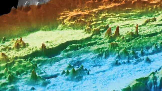
hydrothermal vent washington
© MBARIAn autonomous diving robot captured the vents in unprecedented detail.
In the dark ocean depths off the coast of the Pacific Northwest, a magical fairyland of towering spires and hydrothermal chimneys sprout from the seafloor, a stunning new underwater map reveals.

These towers belch superheated liquid warmed by magma deep inside Earth.

The field of hydrothermal chimneys stretches along the ocean bottom on the Juan de Fuca Ridge to the northwest of coastal Washington state, in an area known as the Endeavor Segment.

Research on the Endeavor vents began in the 1980s, and scientists had previously identified 47 chimneys in five major vent fields. But recent expeditions, using an autonomous underwater vehicle operated by the Monterey Bay Aquarium Research Institute (MBARI) revealed more than 500 chimneys in a zone about 9 miles (14 kilometers) long and 1 mile (2 km) wide.

Comment: See also: