Earthquakes
S


Bizarro Earth

6.6 Magnitude earthquake shakes Valparaiso, Chile

Image
© USGS
A 6.6-magnitude earthquake rocked the region around Valparaiso, Chile on Saturday, the U.S. Geological Survey reported.No injuries or serious damage from the strong quake that occurred at 7:23 p.m. ET were reported, but electricity and telephone service was interrupted in some areas.Earthquakes in the range of 6.1 to 6.9 happen about 100 times a year, according to the Department of Geological Engineering and Sciences at Michigan Technological University. But they can cause a lot of damage in populated areas and can be felt hundreds of miles from the epicenter.

The seismological service said a preliminary report showed the quake was centered about 11 miles west-northwest of a community called Hacienda La Calera, about 67 miles northwest of the capital of Santiago. It had a depth of about 19 miles.

The largest recorded earthquake was the Great Chilean Earthquake of May 22, 1960, which had a magnitude of 9.5. Each whole-number increase on the Richter scale represents a tenfold increase in an earthquake's strength.

USGS data

Bizarro Earth

USGS: Earthquake Magnitude 4.7 - 104km SSE of Akureyri, Iceland

Image
© USGS
Event Time
2014-08-23 18:33:06 UTC
2014-08-23 18:33:06 UTC+00:00 at epicenter

Location

64.792°N 17.380°W depth=2.5km (1.5mi)

Nearby Cities
104km (65mi) SSE of Akureyri, Iceland
229km (142mi) ENE of Reykjavik, Iceland
230km (143mi) ENE of Kopavogur, Iceland
233km (145mi) ENE of Hafnarfjordur, Iceland
613km (381mi) NW of Torshavn, Faroe Islands

Blue Planet

250 injured after strong earthquake hits Iran near border with Iraq

Iran earthquake
© AFP Photo/Frederick FlorinThe US Geological Survey, reporting the magnitude of the quake at 6.3, said it struck 36 kilometres (22 miles) southeast of the city of Abdanan, near the border with Iraq.
A powerful earthquake struck early Monday in western Iran, injuring at least 250 people in a region near the border with Iraq.

Local authorities said they fear the quake may have caused widespread destruction in rural areas.

The 6.2-magnitude earthquake hit at a depth of around 10 kilometers (6 miles) in an area 36 kilometers southeast of the Iranian city of Abdanan, the U.S. Geological Survey said. It was followed by a series of aftershocks.

The quake injured at least 250 people in the province of Ilam, Iran's official news agency IRNA reported, citing local disaster management authorities. The tremors cut off water, electricity and phone lines in Abdanan.

Attention

Bárdarbunga volcano: Earthquake swarm continues, possible sub-glacial eruption

Image
© Theextinctionprotocol.wordpress.com
An intense earthquake swarm started yesterday under Bárðarbunga volcano, located under the northwestern part of the Vatnajökull ice cap. It is continuing at the moment and accompanied by elevated harmonic tremor. This might indicate a sub-glacial eruption at the volcano, but this needs yet to be confirmed. The last eruption of Bárðarbunga volcano was in 1797, while another eruption in 1910 took place at neighboring Hamarinn volcano.

Comment: Earthquake swarm in Iceland raises threat level on Bárðarbunga volcano


Bizarro Earth

USGS: Earthquake Magnitude 6.2 - 36km SE of Abdanan, Iran

Iran Quake_810814
© USGS
Event Time
2014-08-18 02:32:05 UTC
2014-08-18 07:02:05 UTC+04:30 at epicenter

Location
32.739°N 47.670°E depth=10.0km (6.2mi)

Nearby Cities
36km (22mi) SE of Abdanan, Iran
37km (23mi) E of Dehloran, Iran
78km (48mi) WNW of Dezful, Iran
81km (50mi) NW of Shush, Iran
312km (194mi) ESE of Baghdad, Iraq

Scientific Data

Bizarro Earth

Earthquake swarm in Iceland raises threat level on Bárðarbunga volcano

Readers may recall that the Grímsvötn volcano caused quite an overwrought mess with air travel in 2011 when it erupted. FergalR writes in WUWT Tips and Notes about the nearby Bárðarbunga volcano becoming seismically active:
A large sub-glacial volcano in Iceland - Bárðarbunga - has been having a huge earthquake swarm for the last 24 hours.

The IMO have just raised the eruption alert level on it.
Iceland Earthquake Swarm
© en.vedur.is

Bizarro Earth

Big earthquake looms for Chile, experts say

Tsunami Damage Northern Chile
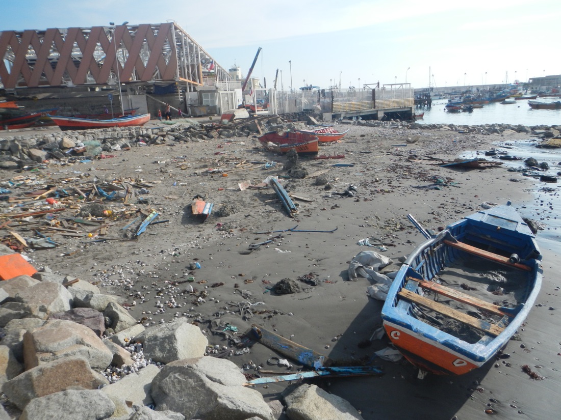
© Juan González-Carrasco (Universidad Catolica del Norte, Chile)Damage in northern Chile caused by the tsunami associated with the magnitude-8.2 earthquake that struck in April 2014.
The powerful earthquake that rocked Chile in April ruptured the earth in a way that suggests major quakes may still hit the region in the future, researchers say.

On April 1, a magnitude-8.2 earthquake struck about 58 miles (94 kilometers) northwest of Iquique in northern Chile, a major port city and hub for Chile's copper mining industry. It killed six people, damaged or destroyed at least 13,000 homes, caused power failures and triggered a tsunami wave nearly 7 feet (2.1 meters) high. Preliminary estimates suggest total economic losses from the temblor are close to $100 million.

The powerful earthquake originated in a seismic hot spot that has produced some of the world's strongest known tremors. The area is a subduction zone, where one tectonic plate dives beneath another - specifically, the oceanic Nazca Plate is plowing under the Pacific coast of the South American Plate at an average rate of about 2.75 inches (7 centimeters) per year. Major quakes that burst at subduction zones, the most tectonically active places on Earth, are known as megathrust earthquakes.

Map

Double earthquake in Ecuador: Two dead, several trapped

ecuador quake
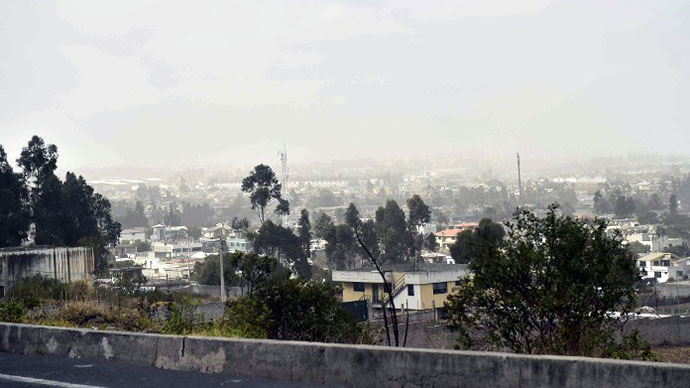
© Agence France-Presse/Rodrigo BuendiaView of a dust cloud on August 12, 2014 in Quito, after a 5.1-magnitude earthquake rattled the Ecuadoran capital and the surrounding area causing buildings and homes to shake violently
A 5.1 earthquake has struck around 22.5 km northeast of Ecuador's capital, Quito, followed by a 4.3 magnitude aftershock. At least two people have been killed as the tremors caused several landslides and trapped at least three people in a collapsed mine.

At least eight people were injured, a government office said via Twitter, Reuters reports. The country's Risk Management office said firemen were working to rescue those who had been trapped in Catequilla mine.

The epicenters of both earthquakes were recorded at a depth of around 5 kilometers, according to preliminary data from the Geophysical Institute of Ecuador.

Following the quakes, the Mariscal Sucre International Airport in Quito suspended operations as a precaution and urged passengers to leave the terminals. Operations were resumed an hour later, after airport officials ensured the infrastructure wasn't damaged.

Bizarro Earth

4.5 Magnitude earthquake rattles Hawaii's Big Island

Image
© NSW
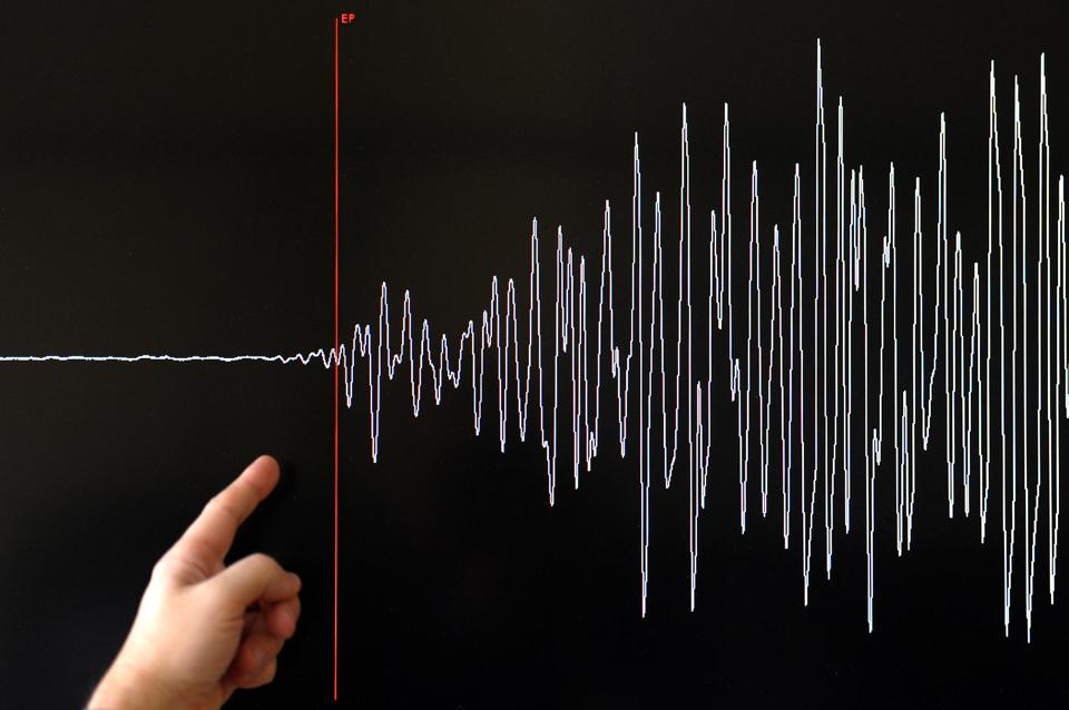
A magnitude-4.5 earthquake struck the Big Island at 6:24 a.m. today, the U.S. Geological Survey's Hawaiian Volcano Observatory reported.

The earthquake was located beneath the Island of Hawaiʻi and no damaging tsunami was generated.

Wes Thelen, HVO's Seismic Network Manager, said the earthquake was centered about four miles east-northeast of Kawaihae and nine miles west-northwest of Waimea, at a depth of 10.4 miles.

The USGS "Did you feel it?" Web site received more than 145 felt reports within an hour of the earthquake, HVO said. Only light shaking was reported. Most reports were posted from the Islands of Hawai'i and Maui. There were also a few reports from the Kahuku and Hickam areas on Oʻahu, over 155 miles from the epicenter, HVO reported.

Over the past 50 years, the area around Kawaihae has experienced 11 earthquakes greater than magnitude-4.0, including today's event, at depths of 6 - 12 miles. Deep earthquakes in this region are most likely caused by structural adjustments within the Earth's crust to accommodate the heavy load of Mauna Kea and surrounding volcanoes. Today's earthquake is in the general region of the 2006 Māhukona earthquake, but is not close enough to the 2006 event to be an aftershock of it.
Comment: And they have this to deal with as well: Hawaii in the path of two hurricanes, first hurricane in 22 years


Bizarro Earth

USGS: Earthquake Magnitude 6.1 - Kepulauan Barat Daya, Indonesia.

Indon Quake_060814
© USGS
Event Time
2014-08-06 11:45:22 UTC
2014-08-06 20:45:22 UTC+09:00 at epicenter

Location

7.272°S 128.046°E depth=10.0km (6.2mi)

Nearby Cities
307km (191mi) ENE of Dili, East Timor
395km (245mi) S of Ambon, Indonesia
402km (250mi) ENE of Atambua, Indonesia
446km (277mi) SSW of Amahai, Indonesia
307km (191mi) ENE of Dili, East TimorScientific Data