Earthquakes
S


Alarm Clock

USGS: Earthquake Magnitude 6.1 - Easter Island region

Earthquake 6.1 Easter Islands
© USGS
Event Time
2014-09-06 06:53:13 UTC
2014-09-05 22:53:13 UTC-08:00 at epicenter

Location

26.625°S 114.456°W depth=10.0km (6.2mi)

Nearby Cities
502km (312mi) W of Hanga Roa, Chile
3736km (2321mi) ESE of Papao, French Polynesia
3740km (2324mi) ESE of Mahina, French Polynesia
3742km (2325mi) ESE of Paea, French Polynesia
1576km (979mi) E of Adamstown, Pitcairn

Scientific data

Attention

At least 10 volcanic quakes recorded at Taal, Mayon

Image
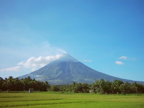
© UnknownClassified as a stratovolcano (a volcano made up of layers of lava alternating with cinder and ash) Mount Mayon or Mayon Volcano is very much active and is located in the in the Bicol Region, in the province of Albay, on Luzon Island, Philippines.
At least 10 volcanic quakes were recorded at two restive volcanoes in Luzon - Taal Volcano in Batangas and Mayon Volcano in Albay - over the last 24 hours, the National Disaster Risk Reduction and Management council said Monday.

Citing data from the Philippine Institute of Volcanology and Seismology, the NDRRMC said seven volcanic quakes were recorded at Taal, and three at Mayon.

While the NDRRMC said there was no sign yet of an imminent eruption, it reminded residents near the two volcanoes to stay away from the permanent danger zones.

The NDRRMC said Alert Level 1 remained at Taal as of 8 a.m. It reminded the public to stay away from the main crater due to the danger of sudden steam explosions and high concentrations of toxic gases.

Bizarro Earth

USGS: Earthquake Magnitude 6.0 - 175km E of 'Ohonua, Tonga

Tonga Quake_040914
© USGS
Event Time
2014-09-04 05:33:46 UTC
2014-09-03 17:33:46 UTC-12:00 at epicenter

Location
21.396°S 173.258°W depth=11.8km (7.4mi)

Nearby Cities
175km (109mi) E of 'Ohonua, Tonga
203km (126mi) E of Nuku'alofa, Tonga
826km (513mi) SSW of Tafuna, American Samoa
833km (518mi) SSW of Pago Pago, American Samoa
851km (529mi) S of Apia, Samoa

Scientific Data

Map

5.6 quake shakes southern Greece

S greece quake
An earthquake with magnitude 5.6 occurred between the Peloponesse and the Cyclades in Greece at 6:44 am on Aug 28, 2014.

The epicenter was located beneath the seabed about 140 kilometers (86 miles) south of Athens and near the island of Milos.

There have been no reports of injuries or damages, however, the shock was widely felt in Athens and Crete.

The U.S. Geological Survey gave a preliminary magnitude of 5.6, while the Greek Institute of Geodynamicsr gave it as 5.7.

Comment: With the increase in volcanic and seismic activity around the world, this one is too close for comfort to the volcano of Thera (modern day Santorini).


Blue Planet

Some San Francisco bay area residents report mysterious flashes in the sky during Napa quake


Several people called the KPIX 5 newsroom after Sunday morning's magnitude 6.0 earthquake in Napa, reporting mysterious flashes of light in the sky. Witnesses said the strange phenomenon looked like lightning.

Similar flashes of light have been reported in earthquakes around the world, from Japan to Peru.

Friedemann Freund, a scientist with the SETI Institute in Mountain View, said the same thing happened during Sunday morning's earthquake. And it wasn't a transformer blowing up or UFOs.

"What they are, are a consequence of the stresses building up deep below the earth, seven miles like in the case of the Napa Valley earthquake," Freund told KPIX 5.

He calls the phenomenon "earthquake lights," the quick buildup of stress that causes an electric current to flow to the surface and burst through the earth. This typically happens before or during an earthquake.

Attention

Sub-glacial eruption of Iceland's Bardarbunga volcano forms deep 'cauldrons' of melted ice

Icelandic volcano activity increased on Wednesday, with scientists detecting 10-15 meters deep cauldrons of melted ice at the Vatnajökull glacier, prompting fears of an imminent eruption.
Image
© Reuters / Sigtryggur Johannsson

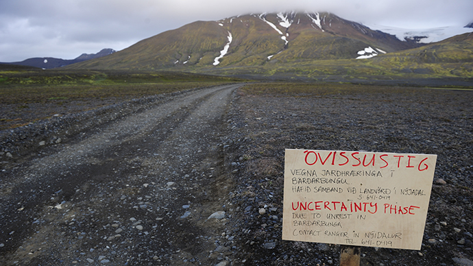
A warning sign blocks the road to Bardarbunga volcano, some 20 kilometres (12.5 miles) away, in the north-west region of the Vatnajokull glacier August 19, 2014.
Icelandic scientists have detected a series of 10-15m deep cauldrons at Bardarbunga volcano glacier. They apparently are a result of melting following a sub-glacial eruption, the Icelandic Civil Protection Scientific Advisory Board reported. A surveillance flight over the surface of Vatnajokull has shown the cauldrons to be 1 km wide, located in a straight line some 4-6 kilometers south of the Bardarbunga caldera.
The 10-15 m deep cauldrons, 1 km wide, south of the #Bárðarbunga caldera. Picture by https://t.co/ZiKocZlLJSpic.twitter.com/lSLWDJZnEO
- Almannavarnir (@almannavarnir) August 28, 2014
"The cauldrons have been formed as a result of melting, possibly a sub-glacial eruption, uncertain when," country's Meteorological Office said, pointing out that the data is still being analyzed.

"During the night (Wednesday) we have had three larger events, two of them in the Bardarbunga caldera. Those were 5.2 and 5.3, and very similar to the events that we have seen there before," Palmi Erlendsson, a geologist at the Met Office told the country's RTE news.

At the same time, scientists have registered more than 1,300 earthquakes since midnight Wednesday. Meanwhile 50km to the north, a 4.5 magnitude quake shook the Askja volcano, presumably because magma from Bardarbunga crater is traveling in that direction.
Comment: Earthquakes, volcanic eruptions, sinkholes and flooding all in one: Iceland examines Bardarbunga volcano 'cauldrons'


Attention

Persistently high methane concentrations show up over Beaufort Sea in the Arctic

Image

High methane concentrations have been showing up over Beaufort Sea over the past few days, as shown on the image above. This follows the recent high methane concentrations over the East Siberian Sea.

The persistent character of these very high methane concentrations over the Arctic Ocean indicates that methane has started to erupt from clathrates under the seabed, triggered by very warm water reaching the bottom of the Arctic Ocean.


Comment: Perhaps the true trigger is seismic activity, which then also warms the water at the bottom of the ocean, see : Earthquakes, volcanic eruptions, sinkholes and flooding all in one: Iceland examines Bardarbunga volcano 'cauldrons'


Methane eruptions from hydrates in sediments under the Arctic Ocean helped mean methane levels reach new records, with mean global methane readings as high as 1835 parts per billion recorded at several altitudes on August 17, 2014.

Comment: See also: Hundreds of methane plumes erupting along U.S. Atlantic coast


Bizarro Earth

Earthquakes, volcanic eruptions, sinkholes and flooding all in one: Iceland examines Bardarbunga volcano 'cauldrons'

barbarbunga cauldrons
Scientists in Iceland say they are examining several 'cauldrons' found near Bardarbunga volcano, which could potentially be a sign of an eruption.

The cauldrons, depressions in the volcano's surface, each between 10-15m (49 ft) deep and 1km (0.6 miles) wide, were seen during a flight on Wednesday.

Iceland's Met Office said they were formed "as a result of melting, possibly a sub-glacial eruption."

Bardarbunga volcano has been hit by several recent tremors.

The area experienced a magnitude 5.7 earthquake on Tuesday. Experts say these earthquakes are caused as magma flows beneath the ground, cracking the rocks as it moves.

The Met Office has kept its aviation warning level - indicating the potential threat of volcanic activity to air travel - at orange, its second-highest.

Comment: Iceland's Bardarbunga volcano: Magma moving towards new volcanic system


Attention

Iceland's Bardarbunga volcano: Magma moving towards new volcanic system

monitoring volcano
The University of Cambridge is monitoring the area with 70 seismometers
The magma from Iceland's Bardarbunga volcano could be moving towards another large volcanic system.

Data recorded by a team from the University of Cambridge suggests that 50 million cubic metres of molten rock has moved in the last 24 hours.

If it continues on a northern trajectory it could feed into the Askja volcanic system, potentially triggering a large eruption.

Prof Bob White said: "It's headed straight for it."

But he cautioned that volcanoes were hard to predict.

"It's moving at about 4km a day towards Askja, and if it keeps going it will get there in a few days," he told BBC News.

"We know there is a lot of molten rock sitting under the ground beneath Askja, which is a major volcanic system. If this molten rock hits that, we know it is likely to trigger it to erupt.

"But who knows, it may just stop. It is still at 5km-depth, and it is possible it could freeze there and not a lot more will happen. That is perfectly plausible."

Comment: Click Play below to see the volcanic activity around the world map for the month of August. The Ring of Fire is active as well as the "usual suspects" in Europe:


Map

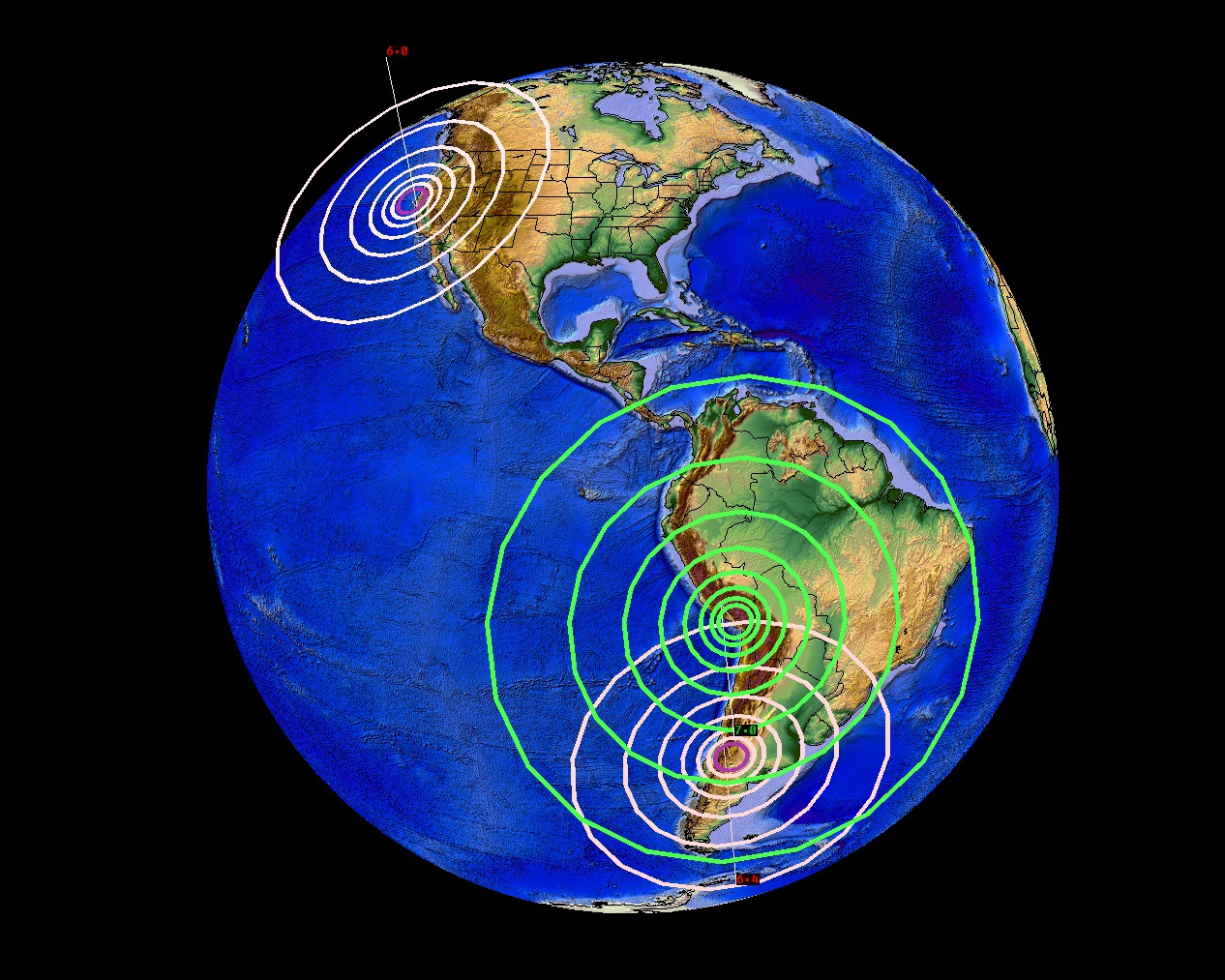
August 24, 2014: 7.0 earthquake strikes Peru + 6.7 in Chile + 6.0 in California + Iceland erupting = major unrest occurring

earthquakes 24 august
Past 36 hours of earthquakes (up to 700pm CDT Aug. 24, 2014) shows a series of large events in South and North America. California having its first “destructive” earthquake in 25 years near San Francisco, Peru having a 7.0M event, and Chile having a 6.4M event.

Another large earthquake has struck the Pacific ring of fire.

On top of today's 6.0M in Central California, on top of yesterdays 6.7M earthquake in Chile, now we see a 6.8 magnitude (upgraded to 7.0M) event in Peru.

Overall, we are seeing a major uptick in earthquake activity occur. On top of Icelands large volcanic eruption, I would say now is a good time to have a plan and be prepared.

I'd still be watching near Vancouver Island. Salton Sea should show something soon as well. Notice the earthquakes stopped in Oklahoma temporarily.. the pressure has been "transferred" temporarily...

But to where? Where has the pressure transferred? Since we first saw the 6.7M yesterday in Chile.. now the 6.0M in California.. this makes me think its a NW pressure transfer which is occurring like all those deep asthenosphere earthquakes which were happening at the 350mile deep range.

Comment: Why is our Earth so seismically and volcanically active this summer? And don't forget that hundreds of methane plumes are erupting along the U.S. Atlantic coast! Things must be reaching a tipping point of sorts. Earth Changes and the Human Cosmic Connection has all the answers. A little spoiler: each one of us help create - or not - these conditions on our planet.