Storms
S


Tornado2

Rare tornado forms at 13,200 feet in Bolivia - Possibly one of the highest-altitude tornadoes ever observed

El Alto International Airport, Bolivia
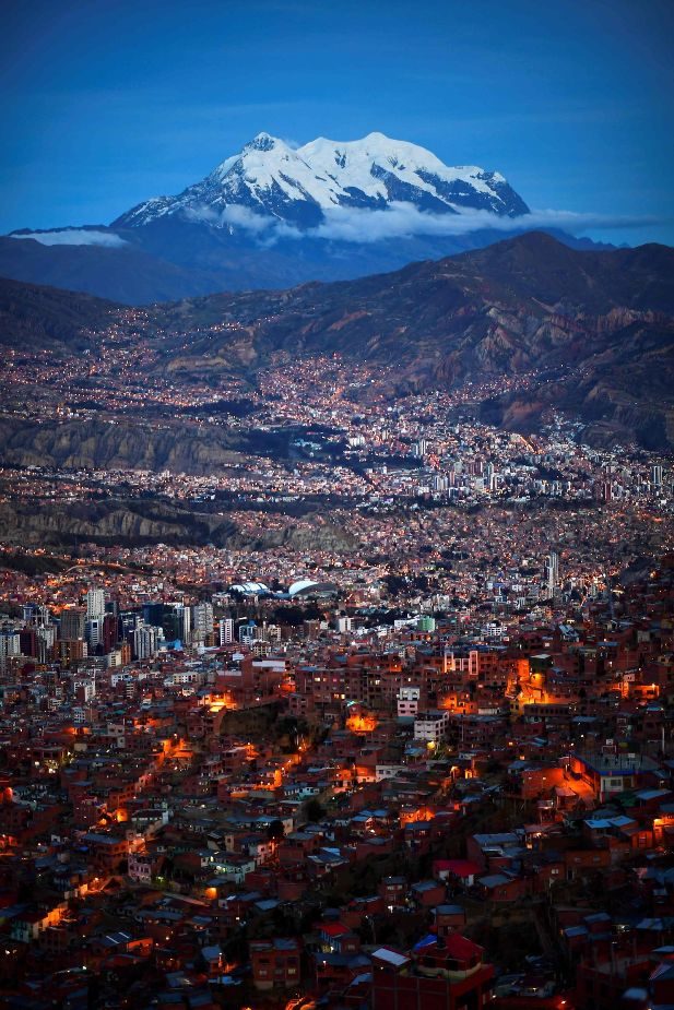
© Ronaldo Schemidt/AFPEl Alto International Airport is the highest international airport in the world and serves the Bolivian city of La Paz.
A rare tornado touched down near the El Alto International Airport in Bolivia on Sunday, tossing debris into the air and possibly swirling its way into record books as one of the highest-altitude tornadoes ever observed.

The tornado descended Sunday afternoon, causing minor damage as it passed along the northern periphery of the airport and into nearby neighborhoods. El Alto International Airport is the highest international airport in the world at 13,313 feet, serving the city of La Paz.

The whirlwind reportedly came without warning from El Servicio Nacional de Meteorología e Hidrología, Bolivia's equivalent to the National Weather Service. The main weather hazard highlighted before the tornado had been river flooding well to the east amid recent heavy rainfall.


Comment: Some other rare, unseasonal and very large tornadoes to have formed around the planet this year include: Mainstream science does not consider the importance of atmospheric dust loading and the winning Electric Universe model in their research.

Such information and much more, are explained in the book Earth Changes and the Human Cosmic Connection by Pierre Lescaudron and Laura Knight-Jadczyk.
The accumulation of cometary dust in the Earth's atmosphere plays an important role in the increase of tornadoes, cyclones, hurricanes and their associated rainfalls, snowfalls and lightning. To understand this mechanism we must first take into account the electric nature of hurricanes, tornadoes and cyclones, which are actually manifestations of the same electric phenomenon at different scales or levels of power.
See also: Thunderbolts Space News: Tornadoes - The Electric Model


Cloud Precipitation

Severe storm hits Northern California, causing flooding and rock slides

Flooding at 15th Avenue and Wawona Street in San Francisco.
© TWITTER / AGUSTININSFFlooding at 15th Avenue and Wawona Street in San Francisco.
A severe storm flooded parts of Northern California, including San Francisco, and led to rock slides near Big Sur this weekend. In San Francisco's West Portal neighborhood, torrential rains overwhelmed intersections and waist-deep floodwaters poured into homes, CBS San Francisco reported.

The storm system will track from the Rockies to the Great Lakes through Monday, the National Weather Service said. The storm is expected to bring heavy snow, gusty winds and hazardous travel conditions.

Storm total snowfall of 4 to 8 inches is expected by Monday evening from North Dakota into north-central Minnesota and northern Wisconsin, the National Weather Service said. Some of the snow will be heavy at times, with accumulations approaching 1 foot over northern Wisconsin and Minnesota.


Cloud Precipitation

Delays in citrus and leaf vegetable deliveries due to storms in southern Spain

floods
Heavy and persistent rains and storms, accompanied by hail in some cases, have hit the southern half of Spain's Mediterranean regions: Almeria, Murcia, Alicante, Valencia and the Balearic Islands. Between Wednesday and Thursday, the storms have moved towards Castellón and Catalonia.

The worst damages have again been recorded in the Region of Murcia and Alicante, where roads have been cut to traffic and classes have been suspended. The most affected Murcian municipalities have been San Javier and Los Alcázares, where there have been significant floods.

Campo de Cartagena is the area where agriculture has been most affected, even though the rain actually seems to have been beneficial for some producers. Hail has fallen in San Javier, where more than 120 liters per square meter have been recorded.

Snowflake

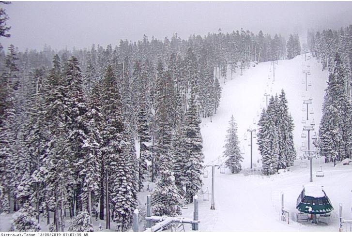
Another storm delivers up to 28 inches of snow on mountains at Lake Tahoe in 3 days

at the base of Sierra at Tahoe
The base of Sierra at Tahoe
A three-day storm exiting Lake Tahoe Sunday evening has so far dropped about 2 feet of snow on the mountains and a few more inches are expected before the clouds move out of the area.

Mt. Rose Ski Tahoe received 16 inches Saturday and leads the Tahoe Basin with 28 inches of fresh snow heading into Sunday.

Several mountain resorts received a foot or over Saturday including Northstar California with 16 inches, Heavenly got 15, Homewood received 13 and Kirkwood got a foot of fresh snow overnight. Sierra at Tahoe received 6 inches.


Cloud Precipitation

Floods kill at least 12 people in western Uganda as country is battered by torrential rain

Red Cross volunteers are assisting with relief and recovery efforts in Uganda
© UGANDA RED CROSSRed Cross volunteers are assisting with relief and recovery efforts in Uganda
Twelve people have been swept to their deaths by floods in western Uganda, the Red Cross said on Saturday, as the East African country is battered by torrential rain.

"We have recovered 12 bodies from the water and one person has been rushed to hospital with serious injuries," said Diana Tumuhimbise, Red Cross branch manager in the Bundibugyo district.

"The rain started last night and continued until 9:00 am (0600 GMT)," she told AFP on Saturday.

"Several houses have been swept away, roads have been blocked and some washed away completely."


Cloud Lightning

It's a record: 109,000 lightning strikes in 24 hours for New Zealand

lightning
News from MetService

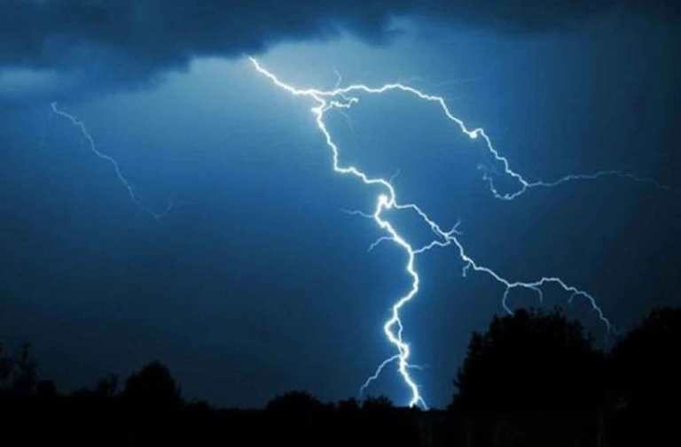
In the 24 hours leading up to 7am this morning, 109,000 lightning strikes were recorded over New Zealand and our surrounding waters, with 18,000 over the land.

Previously our records had only seen 44,000 strikes over both land and sea.


Thunderstorms can bring localized flooding and downpours which have caused disruptions to travel.

Tornado1

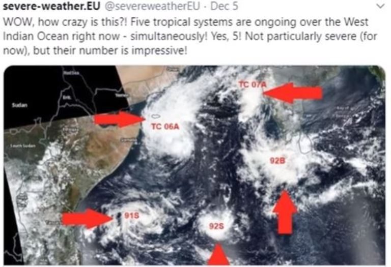
Adapt 2030 Ice Age Report: Antarctic rescues, five cyclones and coded messages

Indian Ocean cyclones
© YouTube/Adapt 2030 (screen capture)
French Antarctic researchers were stranded and awaited extraction because the two year old French icebreaker's propeller broke. Australia sent a different icebreaker to finish the rescue. This is summer in the S. Hemisphere. U.N running out of money and using Extinction Rebellion to push global carbon taxes. Five cyclones form at the same time in the Indian Ocean.


Comment: Three tropical cyclones lurk near Africa and one has set a new rapid intensification record


Tornado1

Three tropical cyclones lurk near Africa and one has set a new rapid intensification record

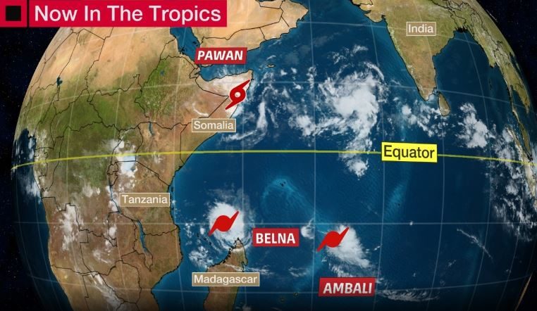
Current Tropical Systems in the Indian Ocean
© The Weather ChannelCurrent Tropical Systems in the Indian Ocean
The tropics are getting crowded once again during this record season in the Indian Ocean as a phenomenon similar to a strong El Niño keeps waters warm near Africa.

Three hurricanes - or tropical cyclones, as they are called in that part of the world - continue to spin in the western Indian Ocean as of late Thursday.
  • Tropical Cyclone Pawan (locally, Cyclonic Storm Pawan) is a weak system that will bring increased moisture and may bring heavy rain and flooding to Somalia and other parts of eastern Africa into this weekend.
  • Tropical Cyclone Belna is intensifying well off the northern coast of Madagascar, and could become a heavy rain and wind threat to the Comoros and Madagascar early next week.
  • Tropical Cyclone Ambali is also spinning well to the northeast of Madagascar as the equivalent of a Category 2 hurricane, but is not expected to threaten land before dissipating. Ambali rapidly intensifying by 115 mph in 24 hours, making it the most rapid intensification in a 24-hour period in the Southern Hemisphere by a name storm on record and the second most rapid intensification globally. It also reach the equivalent of a strong Category 4 hurricane.

Windsock

Thanksgiving 'bomb cyclone' set record for biggest wave (75 feet) and lowest pressure in California

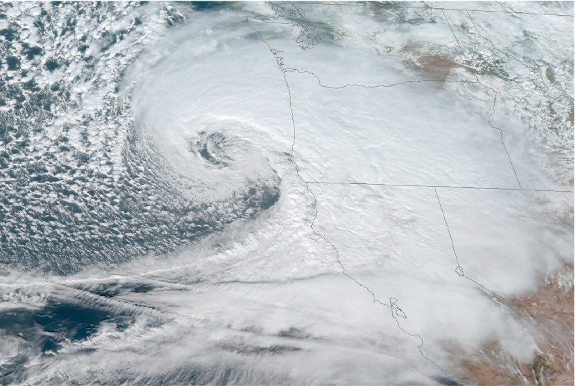
A satellite image shows the storm off the Oregon coast on Nov. 26.
© National Oceanic and Atmospheric AdministrationA satellite image shows the storm off the Oregon coast on Nov. 26.
The Thanksgiving-week "bomb cyclone" storm that drenched California not only set a record for the lowest pressure recorded in the state, but also generated a 75-foot wave off Cape Mendocino.

At 7:33 p.m. on Nov. 26, the No. 94 Cape Mendocino buoy operated by Scripps Institution of Oceanography Coastal Data Information Program recorded a maximum significant wave height of 43.1 feet, and that night also measured a wave of 75 feet. These waves were in water 1,132 feet deep and were at 13.3-second intervals.

Also at 7:33 p.m., the program's No. 168 Humboldt Bay North Spit buoy recorded significant wave heights of 37.6 feet, but in shallower water.

Significant wave height is the average of the biggest one-third of waves over a 30-minute period, according to James Behrens, a program manager at the Coastal Data Information Program. Typically, some waves at a given station are expected to be about twice as large as that average, hence the 75-footer.

The only significant wave height that the program has measured — higher than the one recorded at Cape Mendocino — was on a buoy at Ocean Station Papa, far out in the North Pacific, in December 2012. That was 49.8 feet.

Snowflake

Early winter storm pummels Northeast

midwest snowstorm
© Rick Friedman for The New York TimesThe bad weather that swept across the Midwest during the holiday weekend is now pelting the Northeast with rain and snow.
Parts of New England are in for more heavy snow on Tuesday.

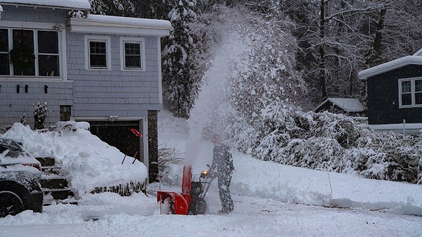
The winter storm that blanketed much of the Northeast with snow on Monday, disrupting travel and closing schools, is expected to keep hammering parts of New England on Tuesday.

As the storm system moves slowly northeastward, some areas could get an additional foot of snow overnight and into the morning, forecasters said. Winter storm warnings and advisories were posted for most of Massachusetts, New Hampshire, Vermont and Maine.

"It's going to get cranking tonight and tomorrow morning," said Frank Nocera, a meteorologist with the National Weather Service in Norton, Mass. Metropolitan Boston, which already had four to eight inches of snow in some suburbs, could see those amounts double by Tuesday, he said, and further school closings and commuting problems were possible.

The storm delivered the first major snowfall of the season in the Northeast, but other than coming at a relatively early date, it did not pack many surprises for weather experts.