Wildfires
S


Fire

Fort McMurray wildfire expands into Saskatchewan; massive blaze now 483,084 hectares in size

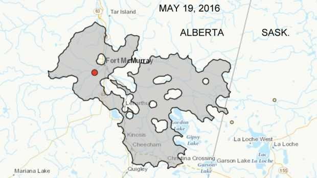
Fort McMurray fire has entered Saskatchewan - map
© Canadian Wildland Fire Information SystemAccording to the latest fire perimeter map from the Canadian Wildland Fire Information System, the Fort McMurray fire has entered Saskatchewan at two points.

About 771 hectares have burned in the province so far


The massive forest fire surrounding Fort McMurray, Alta., is now confirmed to have crossed the border into Saskatchewan.

According to Alberta fire information officer Travis Fairweather on Thursday morning, the fire is now estimated to be 483,084 hectares in size and is confirmed to have expanded east of the border.

So far, about 771 hectares have burned in Saskatchewan, he said.

The nearest village, La Loche, Sask., is more than 30 kilometres from the border, but smoke and ash has been a growing concern in the community of 2,600.

The Saskatchewan government will provide an update later this morning.
Fire

Canada wildfire threatens Fort McMurray again as 12,000 evacuated from nearby oil sand camps

Fort McMurray wildfire
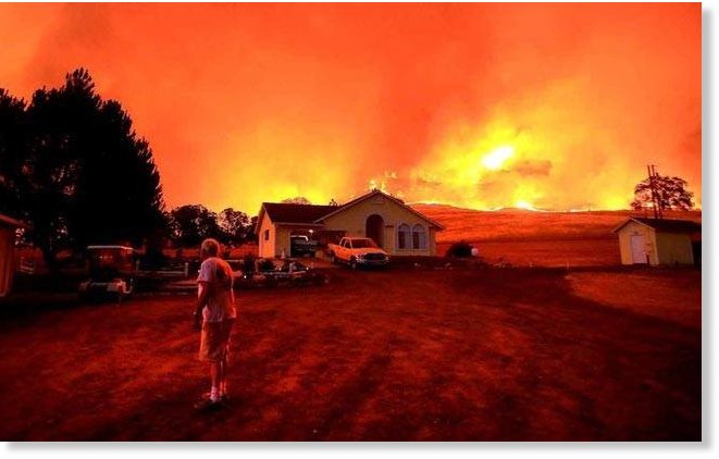
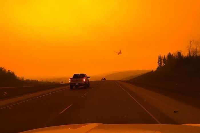
© Instagram: officialladysaintFort McMurray's sky turns orange as fire forces oil workers to evacuate camps.
At least 12,000 people have been asked to evacuate oil sand camps close to the Canadian town of Fort McMurray after a fresh wildfire began to shift to the north.

According to the BBC, more than 8,000 people were urged to leave the area on Monday night, in addition to 4,000 people who had already been issued with evacuation orders.

Suncor Energy Inc was among several operators which confirmed on Tuesday that it had been forced to shut down operations as a precautionary measure.

A spokesman said there had been no damage to the company's assets and that fire defences were in place around the facilities.

Suncor and Syncrude Canada also confirmed they had evacuated workers from the area.

"Suncor has enhanced fire mitigation and protection around all of its facilities," one Suncor official told AFP.

"When it is safe to do so, we will continue implementing our restart plans," they added.


Fire

Another 'out-of-control' wildfire forces evacuation in Alberta; state of local emergency issued in province's northwest

Fox Creek wildfire, Alberta
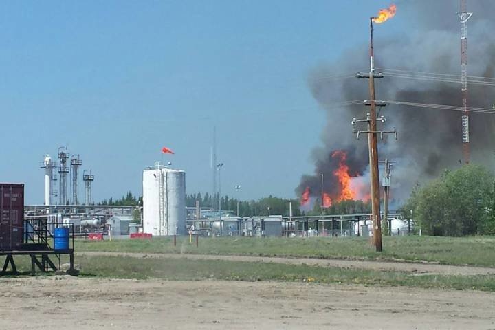
© Fox Creek Fire Department, FacebookAn out of control wildfire is burning 10 kilometres north of Fox Creek, near the North Trilogy plant.
A rapidly growing wildfire has sparked another mandatory evacuation order in Alberta, this time in the province's northwest.

A state of local emergency was issued Sunday evening in the Municipal District of Greenview because of a blaze between Fox Creek and the hamlet of Little Smoky, about 260 km northwest of Edmonton.

Provincial officials say the fire is near an energy industry plant and is burning on either side of Highway 43.

The evacuation order does not apply to the Town of Fox Creek or the Hamlet of Little Smoky. No road closures are in effect at this time.

Evacuees have been asked to report to a reception centre at the Paradise Inn in Valleyview, east of Grande Prairie. Residents are asked to check in even if they don't want to stay at the hotel.

Small pets are welcome at the hotel. Large animals and outside pets will be sheltered at the Valleyview Agricultural Grounds.

The temperature is expected to rise through the week, with rain not expected until Wednesday. The muncipality had previously instituted a fire ban, applying to any outdoor fires and use of off-road vehicles on public land due to the extremely dry conditions.

Comment: Wildfire seasons are more destructive and lasting longer almost everywhere on Earth


Fire

Huge blaze threatens bird sanctuary in Battambang, Cambodia

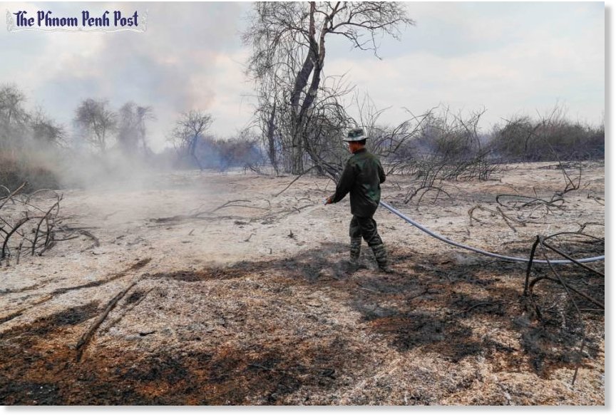
A man hoses down smouldering patches of scorched earth in Battambang province after a fire ripped through a flooded forest.
© Alessandro Marazzi SassoonA man hoses down smouldering patches of scorched earth in Battambang province after a fire ripped through a flooded forest.
Twenty six men armed with plastic jugs and three hoses drawing water from the Sangke River are all that stand between what's left of the Prek Toal bird sanctuary, and a fire that has already destroyed more than 5,000 hectares of flooded forest.

Prek Toal forms the "core area" of the Tonle Sap biosphere, an area some experts have called the single most important breeding ground for water fowl in Southeast Asia.

"In 16 years of patrolling, I have never seen a fire like this," said one Environment Ministry ranger who declined to be named as he was not authorised to speak to the press. The men, who have been divided into three teams, are trying to contain a fast-moving fire on difficult terrain.

Suspected negligence started the fire in early April and it has since spread across the wetlands thanks to exceptionally dry conditions related to the El Niño-induced drought, climate change and yet-to-be-understood changes of the Tonle Sap flood cycle.

For the past 10 days, the conflagration has come within hundreds of metres of Prek Toal village, and on Wednesday, a column of smoke loomed over the floating settlement.

Fire

Huge forest fires blaze in Russia's Siberia and far east

Forest fire in Siberia
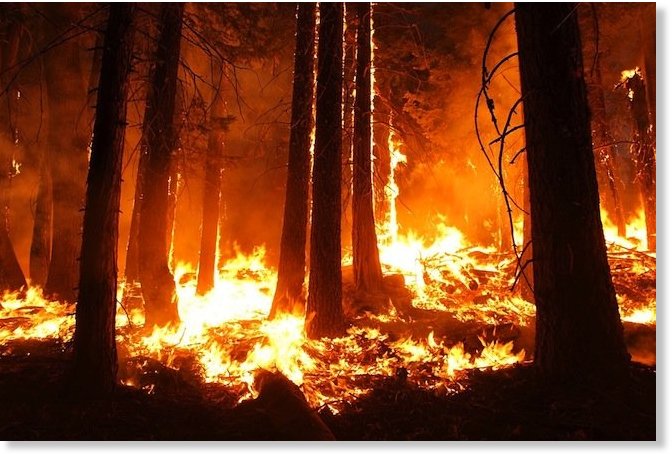
© Skeeze / Pixabay
Large-scale wildfires that erupted this week in Siberia are worsening, Russia's local forest services have warned.

Firefighters in the far eastern Amur region are to focus on protecting local towns and villages as the fast spread of the fire is making the flames too difficult to extinguish in the forest, the RIA Novosti news agency reported Wednesday.

A wide range of equipment, including tractors, bulldozers and water carriers, is used to fight 24 wildfires raging in the area of more than 42,000 hectares, said a statement published on the region's governmental website.

The Russian Emergency Ministry has mobilized aircraft including B-200 and An-2 planes and Mi-8 helicopters to help firefighters cope in the most affected areas, RIA Novosti reported.


Fire

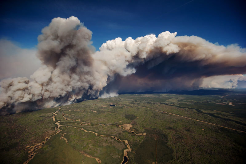
Fort McMurray wildfire so extreme it creates its own weather

fort mcmurray wildfire
In between a succession of media interviews, Mike Flannigan pauses to refresh his computer screen with the latest meteorological satellite information of the Fort McMurray wildfire. A short animated loop of clouds swirling across Western Canada pops up, with small concentrations of white dots—the heat from wildfires—glowing in the vicinity of Alberta's oilpatch capital.

"It's waking up again. Not as bad as yesterday, but it's starting," says Flannigan, a professor of wildland fire and director of the Western Partnership for Wildland Fire Science at the University of Alberta.

It's mid-morning on May 4, the day after more than 80,000 people fled the Fort McMurray area and the raging wildfire that has proved the most devastating to a populated settlement in Alberta history.

In the initial hours after the blaze reached the community's boundaries, the need for answers—some level of insight into the science of wildfires—is unrelenting. Flannigan figures he's already done 20 interviews with local, national and international journalists, with another 40 requests piling up, including some well into the evening.

"What's happening in Fort McMurray is unprecedented, but this isn't a one-off," Flannigan tells an Ontario-based reporter over the phone. There was Kelowna in 2003. Slave Lake in 2011. And now Fort McMurray. All communities devastated due to their proximity to tinder-dry wild areas.

"As long as we have these boreal forests—fire is part of the environment of the boreal forest; people live, work and play in the boreal forest—we will get this intersection between people and fire."

The Fort McMurray wildfire shows just how quickly and unpredictably a blaze can rage out of control.

Fire

Wildfires in Alberta expected to double in size and burn for months

wildfire
© Getty Images
The wildfires that began in the Fort McMurray area in Alberta last week are expected to double in size, with officials saying that it could take months to get the situation under control.

According to an update provided late Saturday, a total of 43 wildfires are burning, seven of them out of control, while 12 new wildfires ignited on Friday.

Due to increasing temperatures, excessive winds and low humidity, officials fear that the fire could move to bordering Saskatchewan. Over the weekend, the weather worsened for firefighters, with temperatures reaching up to 82 degrees and winds gusting up to 25 mph.

"In no way is this fire under control," Alberta Premier Rachel Notley said on Saturday, "Officials tell us the fire may double in size in the forested areas today. As well, it may actually reach the Saskatchewan border."

Fire

Fort McMurray wildfire update: Massive Canadian blaze remains 'out of control'; set to double in size to 300,000 hectares; approaching oil sands project & Saskatchewan

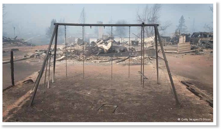
Fort McMurray devastation
© Getty Images/S.OlsonSeveral Fort McMurray neighborhoods have been destroyed
A raging Canadian wildfire grew explosively on Saturday as hot, dry winds pushed the blaze across the energy heartland of Alberta and threatened to burn close to an oil sands project.

The fire that has already prompted the evacuation of all 88,000 people who lived in the city of Fort McMurray was set to double in size on Saturday, the seventh day of what is expected to be the costliest natural disaster in Canada's history.

Provincial officials praised evacuees for their patience and, in a sign of how long the crisis could drag on, said the cities of Calgary and Edmonton, many hundreds of miles to the south, were the best place to receive longer-term support such as medical care and emergency payments.

Firefighting officials said the inferno, propelled northeast towards neighboring Saskatchewan by high winds and fueled by tinder-dry forests, was set to double in size to 300,000 hectares (740,000 acres) - almost twice the size of Houston - by the end of Saturday.

Fort McMurray is the center of Canada's oil sands region. About half of the nation's crude output from the sands, or one million barrels per day (bpd), had been taken offline as of Friday, according to a Reuters estimate.

Officials said they expected the fire would burn up to the edge of a project operated by Suncor Energy Inc, but noted the site and others like it were resilient to fire damage.


Comment: See also:


Fire

From Uttarakhand to Canada, the world sees a flurry of forest fires

Forest fire.
© APForest fire.
Here is a list of recent forest fires which have spoiled acres of woodlands and interrupted lives in India and elsewhere in the world.

As drought sucks regions of Maharastra and Telangana dry, the Himalayas are getting singed by forest fires.

From Uttarakhand to Jammu and Kashmir, lack of rainfall and scorching heat are sparking wildfires in dry forests which are getting wafted into residential areas by strong winds. Apart from losing acres of lands to these flames, human as well as animals are literally in the line of fire.

However, India is not the only country suffering. Wildfires seem to be springing up in different parts of the world.

Last year, Indonesia was hit by some devastating wildfires that killed 19 people and led to at least 5 lakh cases of respiratory tract infections as well as 100,000 premature deaths.

This year, the world continues to battle raging wildfires, with India being high on the list:

Fire

Massive wildfires sweep through mountain forests in North India

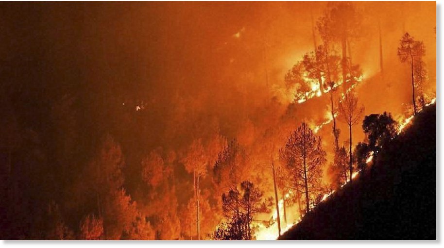
A major fire in the forests at Ahirikot in Srinagar, Uttarakhand state, India, Monday, May 2, 2016. Massive wildfires that have killed at least seven people in recent weeks were burning through pine forests in the mountains of northern India on Monday, in
© Press Trust of India
Massive wildfires that have killed at least seven people in recent weeks were burning through pine forests in the mountains of northern India on Monday, including parts of two tiger reserves.

With dense black smoke billowing in the skies for kilometers (miles), authorities were urging villagers to be on alert and tourists to avoid traveling to the Himalayan foothills, popular during the summer for their cooler temperatures.

Dozens of fires were spreading unpredictably in the states of Uttarakhand and neighboring Himachal Pradesh, officials said.

"We are struggling to bring the situation under control," forest officer Bhanu Prasad Gupta said in the state of Uttarakhand.

After state firefighters were unable for months to put out the fires, the Indian government sent air force helicopters over the weekend to drop water on blazes covering nearly 23 square kilometers (8 square miles) of pine forests.

After areas were soaked from above, groups of villagers fanned out into the steaming jungle forests and used green-leafed branches to beat out the embers still glowing on the ground.