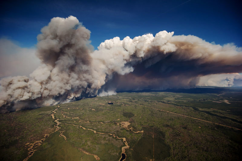
According to an update provided late Saturday, a total of 43 wildfires are burning, seven of them out of control, while 12 new wildfires ignited on Friday.
Due to increasing temperatures, excessive winds and low humidity, officials fear that the fire could move to bordering Saskatchewan. Over the weekend, the weather worsened for firefighters, with temperatures reaching up to 82 degrees and winds gusting up to 25 mph.
"In no way is this fire under control," Alberta Premier Rachel Notley said on Saturday, "Officials tell us the fire may double in size in the forested areas today. As well, it may actually reach the Saskatchewan border."
So far, 80,000 people have been evacuated from Fort McMurray since thefire began on May 3. Officials said that they hope to complete evacuations of the area by this weekend. Despite a state of emergency being declared in Alberta, some residents have refused to leave. For those who have left, it might be a while before they can return.
"I know the people of Fort McMurray want to get back into their homes as quickly as possible. And I am hoping we will be able to give you a sense of when you can go home shortly,"So far, the wildfire has spread to around 200,000 hectares (494,211 acres), and has destroyed about 770 square miles of forest. More than 1,400 firefighters are fighting the wildfires with about 133 helicopters, 200 pieces of heavy equipment and more than 27 air tankers.
The fire can be seen from the International Space Station. UK Astronaut Tim Peake posted an image to Instagram yesterday, showing the size of the blaze.
While officials haven't identified the source of the current blaze, Fort McMurray has seen its share of fires in recent years. As officials work to identify the origin of the wildfire with drones later this week, scientists believe that weather patterns connected to El Niño have likely played a role. according to NASA, the area has received less rainfall than average, while satellite imagery shows warmer than usual ground temperatures leading up to May.
Officials will be working to investigate the source of the fire this week. The government will use drones to pinpoint the hottest areas and will take around 800 images to map out the extent of the fire.


Reader Comments
to our Newsletter