Extreme Temperatures
S


Snowflake

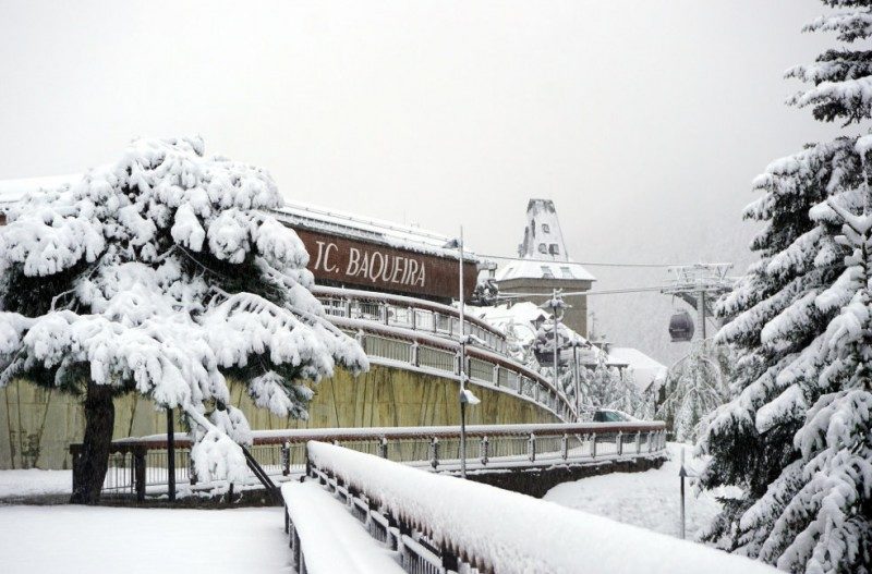
Heavy snowfall hits the mountains of northern Spain blocking roads

Baqueira-Beret in the Catalan Pyrenees
Snow at Baqueira-Beret in the Catalan Pyrenees
Yellow and orange snow alerts as winter arrives abruptly in the north of Spain

Only a week ago the Region of Murcia was basking in temperatures of 29 degrees during the long holiday weekend but as mid-November approaches the weather has taken a turn for the colder, and in the Pyrenees and the Picos de Europa in northern Spain copious snowfalls have blocked roads and set the scene for ski resorts to open for the winter, possibly at the end of the month.


Attention

Permafrost coastlines' contribution to climate change possibly underestimated

Shoreline retreat and erosion along Arctic coasts
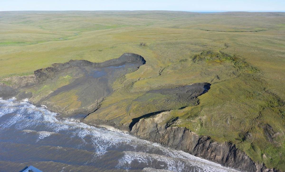
© G. Tanski, Vrije Universiteit AmsterdamShoreline retreat and erosion along Arctic coasts (Qikiqtaruk- Herschel Island, Yukon Territory, Canada) rapidly mobilize organic carbon from permafrost deposits, which can be transformed quickly into carbon dioxide or methane.
Permafrost coasts make up about one third of the Earth's total coastline. As a result of accelerated climate change, whole sections of coastline rapidly thaw, and erode into the Arctic Ocean. A new study published in the journal Geophysical Research Letters now shows that large amounts of carbon dioxide are potentially being produced along these eroding permafrost coastlines in the Arctic.

"Carbon budgets and climate simulations have so far missed coastal erosion in their equations even though it might be a substantial source of carbon dioxide," says George Tanski of Vrije Universiteit Amsterdam, lead author of the study. "Our research found that the erosion of permafrost coastlines can lead to the rapid release of significant quantities of CO2, which can be expected to increase as coastal erosion accelerates, temperatures increase, sea ice diminishes, and stronger storms batter Arctic coasts."

The study was carried out during Tanski's time at the Alfred Wegener Institute, Helmholtz Centre for Polar and Marine Research (AWI), and the GFZ German Research Centre for Geosciences. Co-Authors come from AWI, GFZ, and the Universities of Hamburg and Potsdam. The study is part of the Nunataryuk research project, coordinated by AWI. The project aims to analyse permafrost thaw, understand its impacts on indigenous communities and other populations, and develop mitigation and adaptation strategies.

Attention

Changes in high-altitude winds over the South Pacific produce long-term effects

Changes in Ocean-Atmosphere System
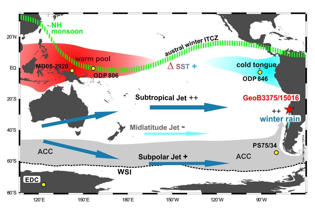
© Graphic: Helge Arz, IOWSchematic depiction of changes in the ocean-atmosphere system in the South Pacific in comparison, throughout the precession cycles (21,000 years).
In the past million years, the high-altitude winds of the southern westerly wind belt, which spans nearly half the globe, didn't behave as uniformly over the Southern Pacific as previously assumed. Instead, they varied cyclically over periods of ca. 21,000 years. A new study has now confirmed close ties between the climate of the mid and high latitudes and that of the tropics in the South Pacific, which has consequences for the carbon budget of the Pacific Southern Ocean and the stability of the West Antarctic Ice Sheet. The study was prepared by Dr Frank Lamy, a geoscientist at the Alfred Wegener Institute, Helmholtz Centre for Polar and Marine Research, together with researchers from Chile, the Netherlands, the USA and Germany, and has just been released in the Proceedings of the National Academy of Sciences of the United States of America (PNAS).

Changes in the southern westerly wind belt produce fundamental effects on the intensity and position of the Antarctic Circumpolar Current, which is the world's largest ocean current and shapes ocean circulation worldwide. In this regard, one key factor is the wind-driven upwelling of CO2-rich deep-water masses, which, due to their comparative warmth, influences both the stability of the West Antarctic Ice Sheet and the carbon budget of the Southern Ocean.

On the basis of sediment cores, the team of researchers investigated precipitation-driven changes in sediment input in the Pacific off the coast of Chile. Assessing the past 1 million years, they identified what are known as precession cycles: changes caused by natural variations in the Earth's orbital parameters; in this case, cyclical changes in the rotation of its axis that occurred roughly every 21,000 years. Changes in these and other orbital cycles are generally considered to be a major driver for the alternation between extended glacials and interglacials over the past million years.
Snowflake Cold

Bitter blast of Arctic air sends temperatures plunging from Montana to Texas

weather
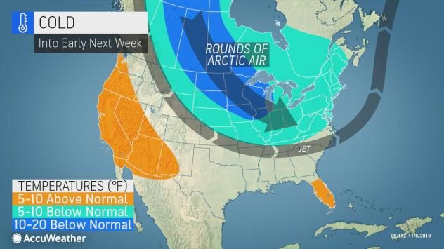
Winterlike temperatures that pushed into the northern Plains through the middle of this week will continue charging south and east through the into the weekend.

Cold air arrived in the northern Plains on Wednesday into Wednesday night. Temperatures dropped into the single digits from Montana to the Dakotas and into northern Iowa throughout Wednesday night.

The normal low temperature for this region during the beginning of November is in the middle to upper 20s F.

The cold air did not stop in the northern Plains as near-freezing temperatures followed a cold front sinking south into Texas through Wednesday night.

Snowflake

Up to 80cm of fresh snowfall hits the Alps

Val Thorens
Val Thorens
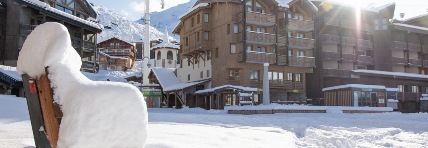
The heavy snowfall in the Alps is continuing to mount up and two French ski areas, Tignes and Val Thorens, have both reported 80cm of fresh snow up high.

Tignes is already open for winter 2019-20 and the new snow has transformed conditions there, which were previously fairly marginal. The resort is one of several to say it's base has now gone through the metre mark for the first time since the previous winter levels thawed down below a metre in late spring/early summer.

Val Thorens, pictured top, is likely to be the next French area to open in just over a fortnight, it reports 40cm of fresh snow in resort and 80cm up high.


Snowflake Cold

16 hours of heavy incessant snowfall in Kashmir valley with 7 people killed - up to 4 feet of snow

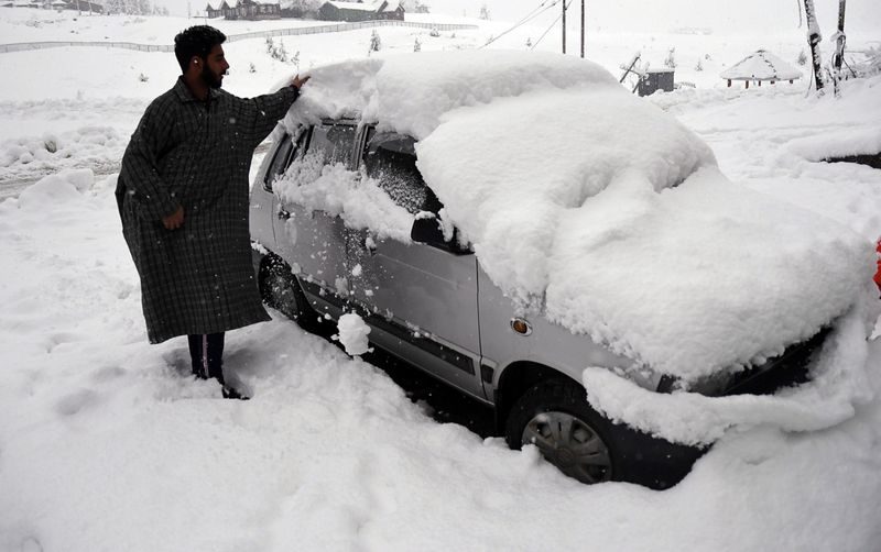
A man removing snow from a car during the first snowfall of the season in Gulmarg. While the snowfall has been moderate in the plains of Kashmir, the upper reaches have witnessed heavy snowfall.
© ANIA man removing snow from a car during the first snowfall of the season in Gulmarg. While the snowfall has been moderate in the plains of Kashmir, the upper reaches have witnessed heavy snowfall.
Normal life paralysed, power lines down after 16 hours of incessant snowfall

Seven people were killed as 16 hours of incessant snowfall paralysed life in the Kashmir valley on Thursday. Surface as well as air traffic was completely disrupted.

This season's first heavy snowfall started on Wednesday night and continued all day on Thursday. It triggered avalanches at many places in the valley and turned the narrow tracks on the hill slopes dangerously slippery.

Traffic on all major highways connecting the valley to the rest of the country, including the Srinagar-Jammu Highway, the Srinagar-Poonch Highway and the Srinagar-Kargil Highway, was completely disrupted. Around 2,000 vehicles were left stranded on these highways, officials said.


Snowflake

Late snow surprises travellers at Mt Hotham, Victoria, Australia

November Snow
November snow
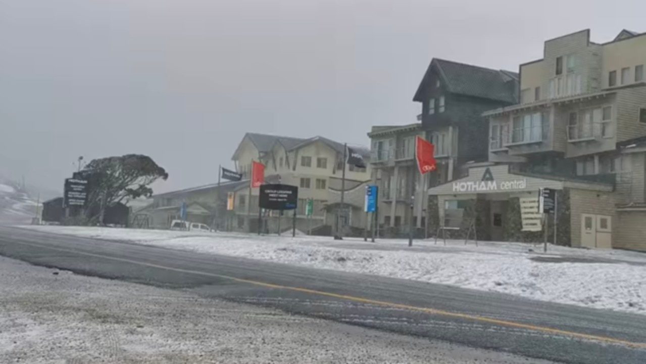
Snow fell at Victoria's Mt Hotham on November 7 despite the ski season ending a month ago.

The dusting was posted on Mt Hotham's official page, with the caption: "Bit cool up at Hotham today and yes, it is snowing. Please take care on the road and check weather and road conditions on our website before travelling up here. If you are hiking, please ensure you are well prepared for the weather changes we get up here!"

The video shows snow falling on Hotham Central, which is a collection of retail businesses, including a supermarket, and office accomodation.

In the Facebook post, Mt Hotham officials also reminded travellers that the Dargo Road entry from Great Alpine Road had been closed, and urged motorists to check traffic.vicroads.vic.gov.au for more info.


Credit: Mt Hotham via Storyful

Comment: Further south on the same day: Late spring snow blankets parts of Tasmania a week after bushfires raged


Snowflake Cold

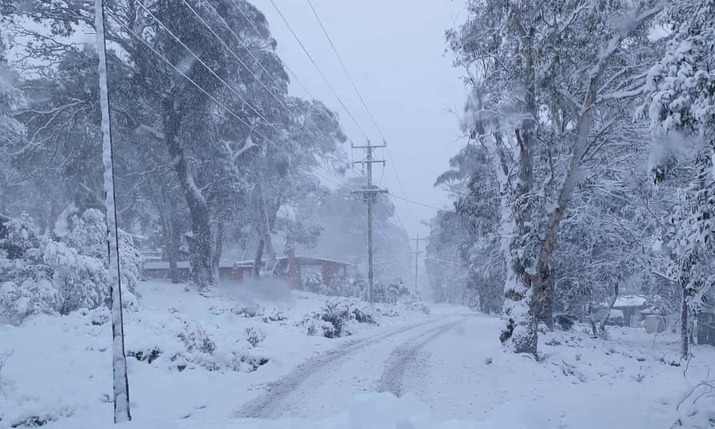
Late spring snow blankets parts of Tasmania a week after bushfires raged

A cold front has brought snow to Tasmania’s central highlands just a week after bushfires threatened shacks in the area.
© Rob MortonA cold front has brought snow to Tasmania’s central highlands just a week after bushfires threatened shacks in the area.
Springtime snow has blanketed parts of Tasmania, including the state's centre where bushfires raged a mere week ago.

Tourists and residents at Miena in the central highlands woke on Thursday morning to a thick covering of snow.

"White - there's no other way to describe it. It's beautiful," Great Lake Hotel general manager Rob Morton said.

"We've had a couple of campers that had a bit of a shock overnight, but we got them into the hotel and warmed them up."

The cold front follows a wildfire that threatened shacks near Miena in late October when authorities declared the official start of the bushfire season.

Comment: Related: Late snow surprises travellers at Mt Hotham, Victoria, Australia


Better Earth

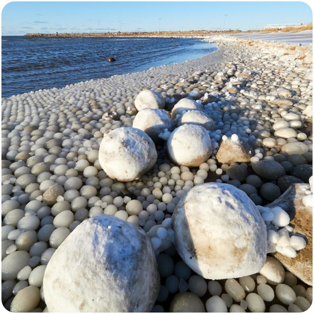
'Super cooled' ice ball phenomenon covers swathes of beach in Finland

ice balls finland
© InstagramIce balls cover beach in remote island in Finland.
Egg-like ice balls are piled up on a beach in Hailuoto, Finland, delighting people who braved the cold to visit the island.

"This was [an] amazing phenomenon, [I've]never seen before," Tarja Terentjeff told CNN.

"The whole beach was full of these ice balls."

Hailuoto is in the Gulf of Bothnia, which separates Finland and Sweden in the northernmost arm of the Baltic Sea.Terentjeff lives about 35 miles away in Oulu, and will drive and take a 30-minute ferry ride from the mainland out to the island because it's such a beautiful place.

Comment: The rise of unusual cold weather phenomena such as ice balls, spinning ice discs, ice tsunamis, softball sized hail, and so on, are likely linked to the period of cooling our planet is entering:


Snowflake Cold

Persistent drizzle at sub-zero temps in Antarctica, first time ever recorded

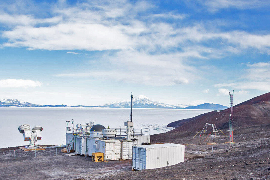
McMurdo
© US Department of Energy Atmospheric Radiation Measurement (ARM) user facilityThe Atmospheric Radiation Measurement (ARM) Mobile Facility (AMF2) was deployed to McMurdo Station, Antarctica, as part of a 14-month field campaign to gather sophisticated data with cloud radars and high spectral resolution lidar, and a complete aerosol suite.
When the temperature drops below freezing, snow and ice are expected to follow. That is not always the case in Antarctica, where for the first time, persistent drizzle has been recorded at temperatures well below freezing, according to a team of researchers.

Using both ground-based and satellite measurements, researchers recorded drizzle conditions below minus 13 degrees Fahrenheit lasting for more than 7.5 hours at McMurdo Station, Antarctica. Previous reports recorded supercooled drizzle at these temperatures, but only for brief durations. The presence of drizzle over several hours could have some implications for climate model predictions. The researchers published their findings in the Journal of Geophysical Research: Atmospheres.

"We're familiar with drizzle as a process that takes place in warm temperatures," said Israel Silber, assistant research professor in the Department of Meteorology and Atmospheric Science at Penn State and lead author of the study. "At lower temperatures, processes like ice formation and growth make the probability for drizzle production significantly lower."

Comment: What doesn't appear to be addressed in the article is why, suddenly, drizzle is occurring for hours on end rather than the brief periods that have been documented before. Is this a new phenomena, and if so, what's changed?