Earthquakes
S

Bizarro Earth

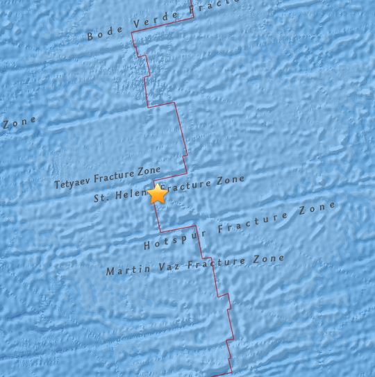
USGS: Earthquake Magnitude 6.3 - Southern Mid-Atlantic Ridge

Mid Atlantic Ridge Quake_240515
© USGS
Time
  1. 2015-05-24 04:53:22 (UTC)
  2. Times in other timezones
Nearby Cities
  1. 910km (565mi) W of Jamestown, Saint Helena
  2. 2436km (1514mi) ESE of Sao Jose da Coroa Grande, Brazil
  3. 2437km (1514mi) ESE of Tamandare, Brazil
  4. 2438km (1515mi) ESE of Maragogi, Brazil
  5. 2585km (1606mi) S of Monrovia, Liberia
Scientific Data

Attention

4.8 magnitude earthquake rattles Nevada

earthquake near Calienta
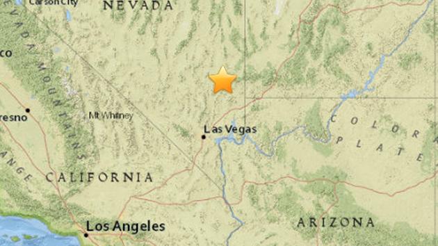
A map shows the area of Calienta, Nevada where an earthquake struck on Friday, May 22, 2015.
An earthquake that struck a rural area of southern Nevada has been downgraded to magnitude 4.8.

The U.S. Geological Survey revised its earlier report that pinned the magnitude of Friday's earthquake at 5.4.

The temblor hit around midday about 24 miles southwest of the small town of Caliente, Nevada. It could be felt about 100 miles away in Las Vegas.

The Nevada Highway Patrol reported damage to one of the state's busiest highway transition ramps. The ramp from southbound U.S. 95 to Interstate 15 near downtown Las Vegas has been shut down indefinitely.

The Nevada Seismological Laboratory at the University of Nevada Reno says several aftershocks, from magnitude 1.0 to 3.8, followed the larger temblor.

The USGS website recorded hundreds of reports from people who say they felt the shaking.

Bizarro Earth

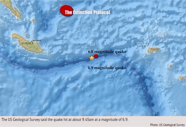
Two earthquakes, 6.8, 6.9-magnitude, strike off Solomon Islands; third day in a row Islands rocked by 6.0 or higher

Image
It is the third day in a row that the Solomons have been rocked by a quake of 6.0-magnitude or higher. Two strong 6.8-magnitude earthquakes struck off the Solomon Islands early Saturday, May 23 US geologists said, but there were no initial reports of damage and no tsunami warnings were issued. The first quake hit at a depth of 10 kilometers (6 miles), 205 kilometers from Kirakira and 448 kilometers from the capital Honiara and the second shallow quake struck just over two hours later about 159 kilometers from Kirakira. The Solomons have been rocked by several quakes of 6.0-magnitude or higher in recent days, with the most recent a 6.0 magnitude quake which hit the islands early Friday, May 22 and a 6.9 magnitude tremor the day before. No major damage was caused by the earlier tremors.

The Hawaii-based Pacific Tsunami Warning Center said there was no threat of a Pacific-wide tsunami from the Saturday tremors. Geoscience Australia initially estimated the two latest quakes at the magnitudes of 7.1 and 6.9 but said they were unlikely to cause local tsunamis in the quake-prone region, in part due to their location. Seismologist Mark Leonerd said it was slightly unusual to have two big quakes "right next to each other" but that seismic activity was common in the region. The quakes have been followed by fairly typical aftershocks, he said, adding there had also been recent activity in nearby Papua New Guinea.

"That sort of area is putting on a little bit of activity at the moment," he said. The Solomons are part of the Pacific "Ring of Fire," a zone of tectonic activity known for its frequent earthquakes and volcanic eruptions. In 2013, the Solomons were hit by a tsunami after an 8.0-magnitude quake, leaving at least 10 people dead and thousands homeless after buildings were destroyed. -

Bizarro Earth

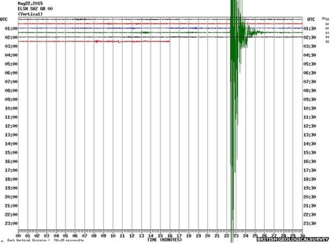
A 4.2 magnitude earthquake 'causes homes to shake' in Kent, UK

Kent earthquake
© British Geological surveyThe British Geological survey's monitoring stations showed seismic activity on Friday morning
A 4.2 magnitude earthquake has been recorded in Kent, the British Geological Survey (BGS) has said.

The tremor originated near Sandwich at a depth of 15km (9.5 miles) underground at 02:52 BST, it reported.

Residents in areas including Margate, Canterbury and Southend-on-Sea in Essex felt the tremor, with some saying they thought it was a plane crash or a bomb.

Kent Police said a number of calls had been received but no injuries or structural damage had been reported.

But Herbert Smith tweeted that he and his wife Doreen were taking refuge in their caravan after being evacuated from their damaged home in Flete.

Bizarro Earth

Six earthquakes rattle parts of San Diego, California

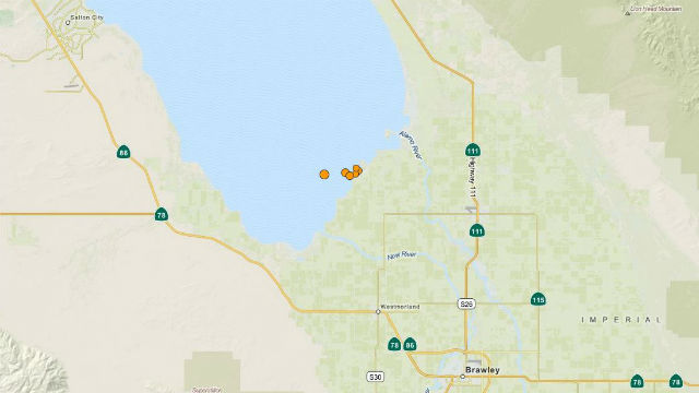
six earthquakes in the Salton Sea.
U.S. Geological Survey map shows the location of the six earthquakes in the Salton Sea.
A series of six earthquakes ranging in magnitude from 2.8 to 4.1 rattled the Imperial County city of Calipatria and were felt in the San Diego area Wednesday night.

All the earthquakes occurred near the southern edge of the Salton Sea. The strongest, a magnitude-4.1, occurred at 8:15 p.m., about 10 miles northwest of Westmorland.

The first earthquake was reported at 8:18 p.m., and the last at 10:06 p.m., according to the U.S. Geological Survey.

The epicenter for five of the six earthquakes was about eight miles north north-west of Calipatria.

The magnitude-4.1, which occurred at a depth of five-eighths of a mile, was felt in parts of San Diego, La Mesa and Alpine, U-T San Diego reported.

Two of the earthquakes had a magnitude of 3.3. The first, at 8:51 p.m., occurred at a depth of 1.8 miles, and the second, at 10:06 p.m., was at ground level, according to the USGS.

City News Service

Bizarro Earth

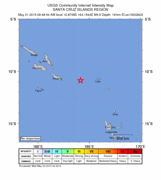
USGS: Earthquake Magnitude 6.9 - 184km W of Lata, Solomon Islands

Lata Quake_200515
© USGS
Time
  1. 2015-05-20 22:48:54 (UTC)
  2. Times in other timezones
Nearby Cities
  1. 184km (114mi) W of Lata, Solomon Islands
  2. 487km (303mi) ESE of Honiara, Solomon Islands
  3. 609km (378mi) NNW of Luganville, Vanuatu
  4. 881km (547mi) NNW of Port-Vila, Vanuatu
  5. 1079km (670mi) ESE of Arawa, Papua New Guinea
Scientific Data

No Entry

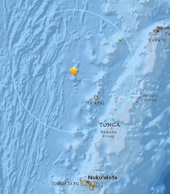
USGS: Magnitude 6.0 earthquake hits Northwest of Tonga

Image
© USGS
Time
  1. 2015-05-20 00:30:51 (UTC)
  2. 2015-05-19 20:30:51 (UTC-04:00) in your timezone
  3. Times in other timezones
Nearby Cities
  1. 128km (80mi) WNW of Pangai, Tonga
  2. 204km (127mi) N of Nuku'alofa, Tonga
  3. 632km (393mi) ESE of Lambasa, Fiji
  4. 655km (407mi) ESE of Suva, Fiji
  5. 722km (449mi) SSW of Apia, Samoa

Bizarro Earth

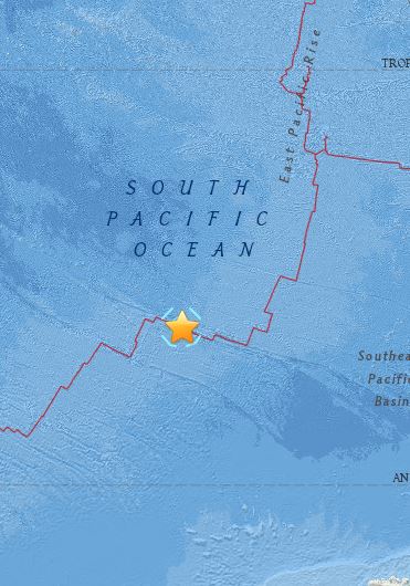
USGS: Earthquake Magnitude 6.7 - Pacific-Antarctic Ridge

South Pacific Quake_190515
© USGS
Time
  1. 2015-05-19 15:25:21 (UTC)
  2. Times in other timezones
Nearby Cities
  1. 2144km (1332mi) N of Siple, Mount, Antarctica
  2. 3892km (2418mi) WSW of Puerto Natales, Chile
  3. 3912km (2431mi) WSW of Punta Arenas, Chile
  4. 3983km (2475mi) WSW of Ushuaia, Argentina
  5. 3257km (2024mi) S of Adamstown, Pitcairn
Scientific Data

Red Flag

Scientists: Series of earthquakes could signal new eruptions at Hawaii's Kilauea volcano

Image
© AP/Cathy Bussewitz
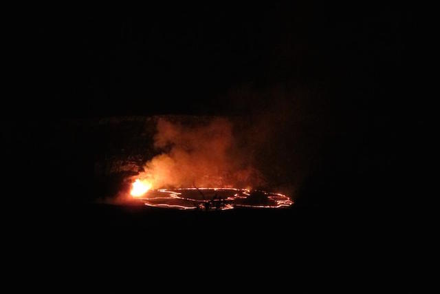
A series of earthquakes and shifting ground on the slopes of Kilauea have scientists wondering what will happen next at one of the world's most active volcanos.

A lake of lava near the summit of Kilauea on Hawaii's Big Island had risen to a record-high level after a recent explosion. But in the past few days, the pool of molten rock began sinking, and the surface of the lava lake fell nearly 500 feet.

Meanwhile, a rash of earthquakes rattled the volcano with as many as 20 to 25 quakes per hour, and scientists' tilt meters detected that the ground was deforming.

"Clearly the lava, by dropping out of sight, it has to be going somewhere," said Steven Brantley, deputy scientist in charge of Hawaiian Volcano Observatory of the U.S. Geological Survey.

One possibility is that a new lava eruption could break through the surface of the mountain, Brantley said.

Right now, there are two active eruptions on Kilauea. One is the eruption spewing into the lava lake in the Halemaumau Crater, which is visible in Hawaii Volcanoes National Park. The other is Puu Oo vent, in Kilauea's east rift zone, which sent fingers of lava toward the town of Pahoa before stopping outside a shopping center last year.
Bizarro Earth

Fresh tremors in Nepal as 5.7 magnitude earthquake hits Kathmandu

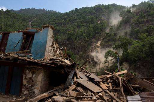
A collapsed house in Nepal
© Athit PerawongmethaA collapsed house during a landslide after Tuesday's earthquake at Singati Village in Nepal

A 5.7 magnitude earthquake has struck in Nepal, sending tremors across Bihar and parts of northern India
.

Buildings shook throughout the Uttar Pradesh and Bihar regions on Saturday, as the the US Geological Survey recorded a "shallow quake" about 76 km east south east of the capital Kathmandu.

Centering on Nepal, the quake is the third so far this month and lead to fresh panic among those trying to rebuild after an earthquake killed 8,000 people in April and leveled more than 250,000 homes throughout the region.

There has been no reports yet of deaths from this most recent quake, though at least 17 people are thought to have been killed in northern India.

Some 117 persons were killed, and more than 1000 were injured, when a 7.3 magnitude earthquake hit Nepal on May 12.

The quake shook neighbouring countries including India, China, Pakistan, Bangladesh and China.

Reuters