Earthquakes
S


Bizarro Earth

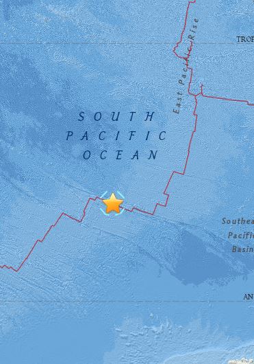
USGS: Earthquake Magnitude 6.7 - Pacific-Antarctic Ridge

South Pacific Quake_190515
© USGS
Time
  1. 2015-05-19 15:25:21 (UTC)
  2. Times in other timezones
Nearby Cities
  1. 2144km (1332mi) N of Siple, Mount, Antarctica
  2. 3892km (2418mi) WSW of Puerto Natales, Chile
  3. 3912km (2431mi) WSW of Punta Arenas, Chile
  4. 3983km (2475mi) WSW of Ushuaia, Argentina
  5. 3257km (2024mi) S of Adamstown, Pitcairn
Scientific Data

Red Flag

Scientists: Series of earthquakes could signal new eruptions at Hawaii's Kilauea volcano

Image
© AP/Cathy Bussewitz
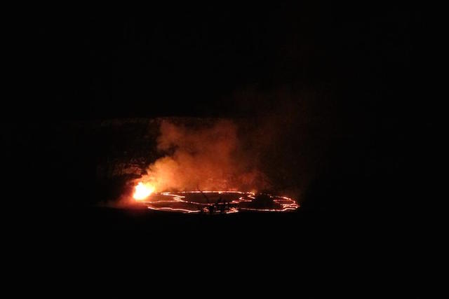
A series of earthquakes and shifting ground on the slopes of Kilauea have scientists wondering what will happen next at one of the world's most active volcanos.

A lake of lava near the summit of Kilauea on Hawaii's Big Island had risen to a record-high level after a recent explosion. But in the past few days, the pool of molten rock began sinking, and the surface of the lava lake fell nearly 500 feet.

Meanwhile, a rash of earthquakes rattled the volcano with as many as 20 to 25 quakes per hour, and scientists' tilt meters detected that the ground was deforming.

"Clearly the lava, by dropping out of sight, it has to be going somewhere," said Steven Brantley, deputy scientist in charge of Hawaiian Volcano Observatory of the U.S. Geological Survey.

One possibility is that a new lava eruption could break through the surface of the mountain, Brantley said.

Right now, there are two active eruptions on Kilauea. One is the eruption spewing into the lava lake in the Halemaumau Crater, which is visible in Hawaii Volcanoes National Park. The other is Puu Oo vent, in Kilauea's east rift zone, which sent fingers of lava toward the town of Pahoa before stopping outside a shopping center last year.

Bizarro Earth

Fresh tremors in Nepal as 5.7 magnitude earthquake hits Kathmandu

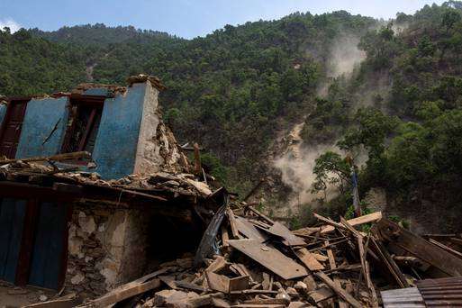
A collapsed house in Nepal
© Athit PerawongmethaA collapsed house during a landslide after Tuesday's earthquake at Singati Village in Nepal

A 5.7 magnitude earthquake has struck in Nepal, sending tremors across Bihar and parts of northern India
.

Buildings shook throughout the Uttar Pradesh and Bihar regions on Saturday, as the the US Geological Survey recorded a "shallow quake" about 76 km east south east of the capital Kathmandu.

Centering on Nepal, the quake is the third so far this month and lead to fresh panic among those trying to rebuild after an earthquake killed 8,000 people in April and leveled more than 250,000 homes throughout the region.

There has been no reports yet of deaths from this most recent quake, though at least 17 people are thought to have been killed in northern India.

Some 117 persons were killed, and more than 1000 were injured, when a 7.3 magnitude earthquake hit Nepal on May 12.

The quake shook neighbouring countries including India, China, Pakistan, Bangladesh and China.

Reuters

Attention

4.6 earthquake rocks central New Zealand

Image
The Upper South Island and Wellington were rattled by the quake.
A strong earthquake measuring 4.6 has hit Marlborough.

GeoNet is reporting it was located 5km south east of Seddon, south of Blenheim followed by a 3.3 located 30km east of Turangi.

The quakes hit shortly after 5.30pm.

Chris Sutherland was enjoying a pint in Paddy Barry's pub in Blenheim when he felt the jolts.

"I was sitting on a bar stool and it rocked a bit and the drinks on the table moved a little bit. Luckily my drink wasn't spilled. If it had I would have licked it off the table."

Pam Tawhara said it knocked over her cuppa and she had to hold onto her desk and computer.

"It took years off my life."

Jodi Cane from Seddon said it "felt like a train coming though our lounge, quite a shake."

Robyn Thomson said her car parked in Springlands in Blenheim rocked as a result of the jolts.

Wendy Gibson described it as a "rumbling jolt".

A St John spokesman said there were no reports of injuries or damage.

A Marlborough District Council spokeswoman said it was "no biggie" and there had been no reports of buildings damaged.

Bizarro Earth

Scientists image gravity waves through atmosphere

Gravity Waves
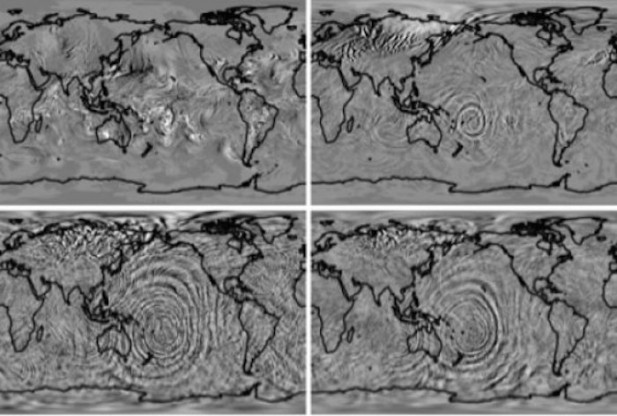
© Hanli Liu, NCARA model simulation illustrates how gravity waves kicked off by a cyclone east of Australia build as they travel toward space.
Whether it's a drunk camper diving carelessly into a river, or a mass of air rising over a mountain, the rule is the same: What goes up must come down.

With respect to the latter, the rising and falling of air also generates gravity waves. While such atmospheric changes usually only have a regional impact on the lower atmosphere, these ripples can stretch all across the globe in the upper atmosphere and their impact is far more dramatic.

For the first time, researchers have found a way to observe what happens when gravity waves rise towards into the upper atmosphere. A team of researchers at the University Corporation for Atmospheric Research led by Senior Scientist Hanli Liu improved upon the Whole Atmosphere Community Climate Model, pushing it to a resolution fine enough to pick up small gravity waves at their source.

Previously able to clearly view only phenomena that were 2,000 kilometers across, they are now able to view gravity waves when they are still relatively small—only 200 kilometers across—and accurately model how this activity appears later in the upper atmosphere.

Attention

Nepal hit by 7.3 magnitude earthquake near Mount Everest

Tremor strikes country still recovering from devastating quake that killed more than 8,000 people and injured 18,000 just weeks ago

nepal earthquake 12.05.15
© Prakash Mathema/AFP/Getty Images Patients are carried out of a hospital building in Kathmandu after a 7.3 magnitude earthquake in Nepal on Tuesday.
Nepal has been hit by another strong earthquake, sending people in the capital Kathmandu rushing out on to the streets just weeks after a devastating quake killed more than 8,000 people and destroyed hundreds of thousands of homes.

The US Geological Survey initially said the quake had a magnitude of 7.1 and struck 42 miles (68km) west of the town of Namche Bazaar, close to Mount Everest. The quake was later upgraded to a magnitude of 7.3. Shockwaves were felt as far away as the Indian capital, Delhi, and Dhaka, the capital of Bangladesh.

There were no immediate reports of casualties or major damage. Residents in the Indian town of Siliguri, near the border with Nepal, said chunks of concrete fell off one or two buildings.

Tuesday's quake came from a depth of 11.5 miles, deeper than the 9.3-mile depth of the quake on 25 April. More shallow earthquakes tend to cause more damage at the surface.

People in Kathmandu, panic-stricken after the 25 April quake, rushed outdoors, Reuters reporters said.

Parents could be seen clutching children tightly and hundreds of people were frantically trying to call relatives on their mobile phones. Shopkeepers closed their shops and the streets were jammed with people rushing to check on their families.
Light Saber

Over 8,000 dead, Adrian Hayes puts his climbing and hiking skills to use contacting remote villages in Nepal

Image
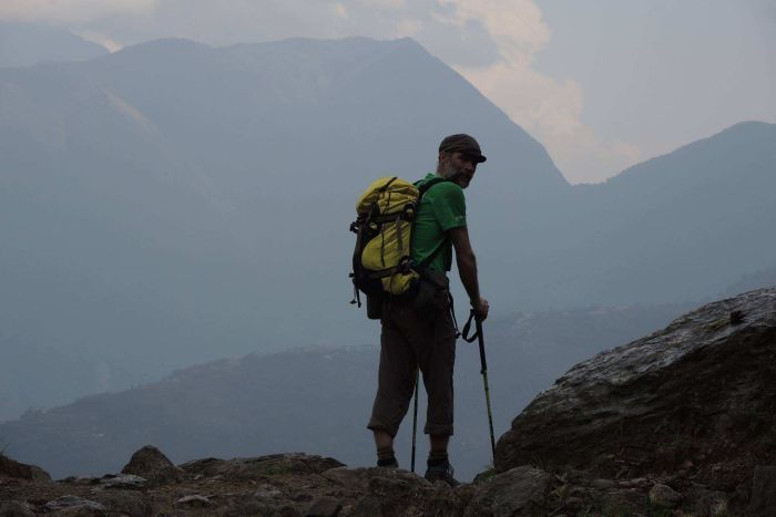
© Facebook: Adrian HayesHiker Adrian Hayes has been trekking to remote villages in Nepal and reporting back to aid agencies.
Poor weather and avalanches are continuing to prevent emergency workers from reaching remote villages, two weeks after a massive magnitude-7.8 earthquake devastated parts of Nepal. One man has been trekking in to remote villages and reporting his findings back to aid agencies since the earthquake struck on April 25.

"The highest village in Makalu region was around 4,000 metres and then down to around 2,000m," professional adventurer Adrian Hayes told ABC's PM via Skype from Nepal.

"[I was seeing] buildings with half their side gone, piles of rubble, some buildings ... some communities completely flattened."

He said that he was often the first person to get to some remote villages after the quake struck. The villagers told him of feeling helpless and said they did not expect to receive any help from their government for years, Mr Hayes said.

"Nepalese people are used to hardship. They live a hard life up there, so people were getting on and trying to rebuild," he said. "Things were getting going, but obviously nowhere near the amount of funding and sort of support that they need."

Mr Hayes has climbed Everest, K2 and many of Nepal's other mountains and spent eight years as a Gurkha officer. He was about 18 kilometres from the Everest Base Camp and due to climb the world's fourth and fifth highest mountains when the earthquake hit. He quickly changed his plans.

Comment: Good to see people of conscience stepping up when the universe places them in the right place at the right time.


Arrow Up

Hawaii rattled by two earthquakes; volcanic lake hits record level

Image
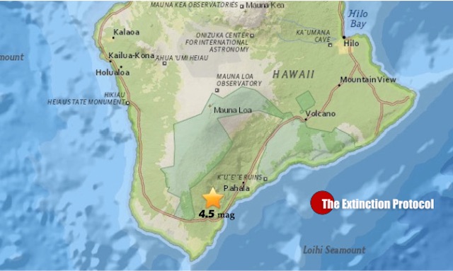
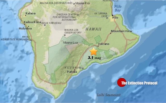
A pair of temblors rocked the Big Island early Saturday morning (May 9). At 2:17 a.m. a 3.1 magnitude quake struck the Hawaii Volcanoes National Park area while a second quake of 4.5 magnitude shook a minute later at 2:18 a.m. west of Pahala. The quakes were felt across the island.

Source: Hawaii 24/7

No changes were detected in Kilauea Volcano's ongoing eruptions or any of the other active volcanoes on the Big Island after a 4.5 magnitude earthquake was reported north of Naalehu Saturday morning, the Hawaiian Volcano Observatory said. The quake was reported at 2:18 a.m. and centered about five miles north of Naalehu in the Kau District and six miles deep, according to Wes Thelen, the observatory's Seismic Network Manager. Three aftershocks, magnitudes 1.6, 1.5, 1.4, were recorded at 3:30 a.m.

The depth, location, and recorded seismic waves of the earthquake suggest a source on the large fault plane between the old ocean floor and overlying volcanic crust, a common source for earthquakes in this area, scientists said.

Source: Star Advertiser
Image

Bizarro Earth

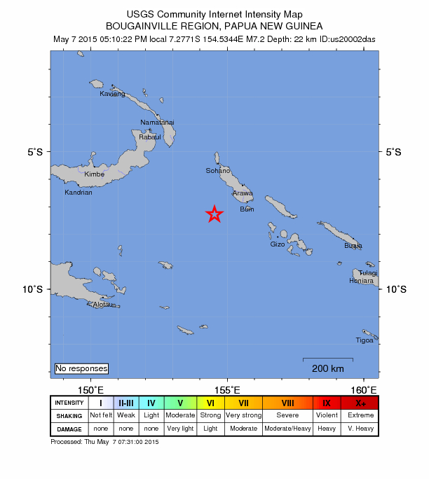
USGS: Earthquake Magnitude 7.1 - 149km SW of Panguna, Papua New Guinea

Panguna Quake_070515
© USGS
Time
  1. 2015-05-07 07:10:22 (UTC)
  2. Times in other timezones
Nearby Cities
  1. 149km (93mi) SW of Panguna, Papua New Guinea
  2. 161km (100mi) SW of Arawa, Papua New Guinea
  3. 409km (254mi) SE of Kokopo, Papua New Guinea
  4. 521km (324mi) ESE of Kimbe, Papua New Guinea
  5. 642km (399mi) WNW of Honiara, Solomon Islands
Scientific Data

Comment: Earth is 'opening up'. Other big earthquakes in just this one region over the last couple of months include:

March 16 2015 - 6,3 quake
March 30 2015 - 7,7 quake
April 30 2015 - 6.9 quake
May 1st 2015 - 7.1 quake
May 5th 2015 - 7.5 quake


Attention

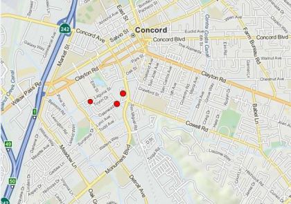
Three earthquakes in 30 minutes strike Concord Fault in California

concord earthquakes 06.05.15
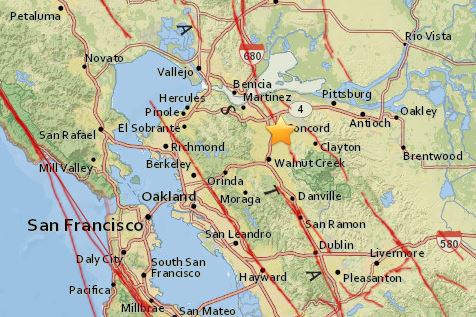
The U.S. Geological Survey is reporting three earthquakes, two with a 3-plus magnitude, have struck Concord Wednesday morning.

The USGS says the first quake, a magnitude 3.2, was centered east of Highway 242 in Concord and struck at about 7:01 a.m. PDT Wednesday. The second and largest, a 3.6-magnitude, struck at 7:32 a.m. It was later downgraded to a 3.5. The third, a 2.6-magnitude, hit shortly after at 7:35 a.m.

Over 100 people, mostly in Pleasant Hill, reported feeling the earthquakes, according to USGS' online "Did You Feel It" survey.

concord earthquakes
People chimed in over Twitter after some light shaking.


Comment: These latest earthquakes come only days after Michigan,Texas, Mississippi, California, Idaho and Washington were all jolted by significant earthquakes.

For more information about our increasingly extreme weather and overall planetary upheaval, see: SOTT Earth Changes Summary - April 2015