Earthquakes
S

Bizarro Earth

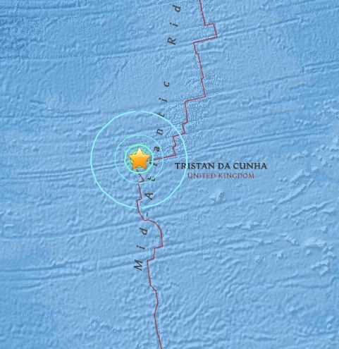
USGS: Earthquake Magnitude 7.0 - Southern Mid-Atlantic Ridge

Mid-Atlantic RidgeQuake_180615
© USGS
Time
  1. 2015-06-17 12:51:33 (UTC)
  2. Times in other timezones
Nearby Cities
  1. 494km (307mi) WNW of Edinburgh of the Seven Seas, Saint Helena
  2. 2750km (1709mi) SE of Arraial do Cabo, Brazil
  3. 2752km (1710mi) SE of Armacao de Buzios, Brazil
  4. 2755km (1712mi) SE of Cabo Frio, Brazil
  5. 3513km (2183mi) ESE of Montevideo, Uruguay
Scientific Data

Binoculars

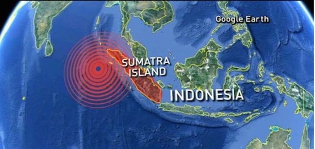
6.0 magnitude earthquake strikes off East Indonesia; no tsunami warning issued

Image
© theextinctionprotocol.wordpress.com
An earthquake measuring 6.0 on the Richter scale jolted North Sulawesi province in the eastern part of Indonesia earlier Tuesday, but it was not potential for tsunami and left no casualties, an official said in Jakarta.The quake struck at 04:04 a.m. Jakarta time Tuesday with epicenter at 71 km northeast Sangihe Island of the province and with the depth at 71 km under seabed, an official of the Meteorology and Geophysics Agency told Xinhua over phone.

"The shakes of the quake were felt moderate. It was not potential to trigger tsunami and did not cause damage. The condition of the people is normal," Sutopo Purwo Nugroho, spokesman of the national disaster management agency told Xinhua via phone after the quake.

Previously at 00:40 a.m. Jakarta time Tuesday another quake measuring 5.8 on the Richter scale struck off East Nusa Tenggara province in central part of Indonesia, the official of the meteorology and geophysics agency said.

The quake was centered at 64 km southeast of the province and with the depth at 65 km under seabed, he said.

Sutopo also confirmed that the quake did not cause any damage.

Indonesia is prone to quake as it lies on a vulnerable quake- hit zone called "the Pacific Ring of Fire."

Question

Alabama rattles with swarms of earthquakes; experts say reasons unclear

Image
© AP/Brynn AndersonThis Tuesday, June 9, 2016, photo shows an abandoned building near Eutaw, Ala., where there have been reported earthquakes. More than a dozen weak earthquakes have followed in the seven months since in west Alabama's rural Greene County, and geologists are trying to figure out what is causing the seismic swarm in an area of the South more prone to tornadoes than earthquakes.
Jim Sterling didn't know what had hit his 156-year-old antebellum home when an earthquake struck Alabama's old plantation region early one morning last November. Startled, he grabbed a gun and ran outdoors.

In the pre-dawn chill, Sterling said, he found an odd scene: horses were galloping, cows mooing and dogs barking.

"I heard a boom and felt the shaking," Sterling said. "It really upset me."

More than a dozen weak earthquakes have followed in the seven months since in west Alabama's rural Greene County, and geologists are trying to figure out what is causing the seismic swarm in an area of the South more prone to tornadoes than earthquakes.

"It is interesting that recently there has been more activity there than in the last four decades," said Sandy Ebersole, an earthquake expert with the Geological Survey of Alabama.

Records from the U.S. Geological Survey show the first of 14 earthquakes occurred on Nov. 20, when a magnitude 3.8 earthquake was recorded about 10 miles northwest of the community of Eutaw. The second occurred in mid-December, followed by another in January and three within a few hours of each other on Feb. 19.

The tremors have continued ever since, with the most recent occurring June 6, when a magnitude 3.0 quake rattled the area. All the tremors have been weaker than the initial jolt in November, and Ebersole said some have been too slight for residents to detect.

Comment: See:


Dominoes

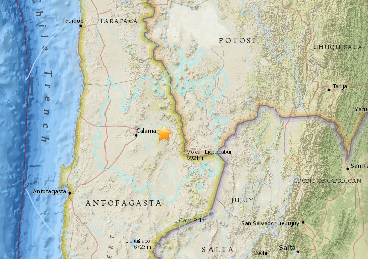
San Pedro de Atacama, Chile hit with magnitude 6.0 earthquake

Image
Time
  1. 2015-06-10 13:52:08 (UTC)
  2. 2015-06-10 09:52:08 (UTC-04:00) in your timezone
  3. Times in other timezones
Nearby Cities
  1. 57km (35mi) NNW of San Pedro de Atacama, Chile
  2. 62km (39mi) E of Calama, Chile
  3. 195km (121mi) E of Tocopilla, Chile
  4. 252km (157mi) ENE of Antofagasta, Chile
  5. 654km (406mi) S of La Paz, Bolivia
Tectonic Summary

Seismotectonics of South America (Nazca Plate Region)

The South American arc extends over 7,000 km, from the Chilean margin triple junction offshore of southern Chile to its intersection with the Panama fracture zone, offshore of the southern coast of Panama in Central America. It marks the plate boundary between the subducting Nazca plate and the South America plate, where the oceanic crust and lithosphere of the Nazca plate begin their descent into the mantle beneath South America. The convergence associated with this subduction process is responsible for the uplift of the Andes Mountains, and for the active volcanic chain present along much of this deformation front. Relative to a fixed South America plate, the Nazca plate moves slightly north of eastwards at a rate varying from approximately 80 mm/yr in the south to approximately 65 mm/yr in the north. Although the rate of subduction varies little along the entire arc, there are complex changes in the geologic processes along the subduction zone that dramatically influence volcanic activity, crustal deformation, earthquake generation and occurrence all along the western edge of South America.

Attention

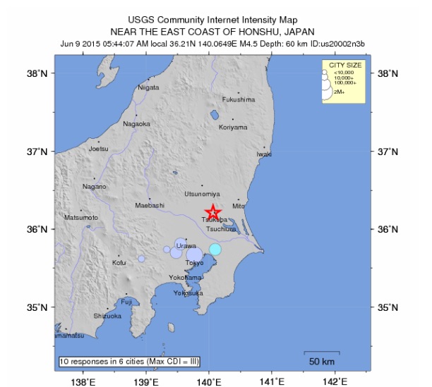
Magnitude 4.7 quake hits Tokyo, surrounding region; no tsunami alert

Image
© USGS
An earthquake with a preliminary magnitude of 4.7 struck Tokyo and its surrounding region on Tuesday morning, the Meteorological Agency said, No tsunami alert was issued.

The 5:44 a.m. temblor occurred in the southern part of Ibaraki Prefecture at a depth of about 50 kilometers, registering 4 on the Japanese seismic intensity scale to 7 in Moka, Tochigi Prefecture, and 2 in central Tokyo.

Comment: USGS: Earthquake Magnitude 6.2 - 64km ENE of Mutsu, Japan


Moon

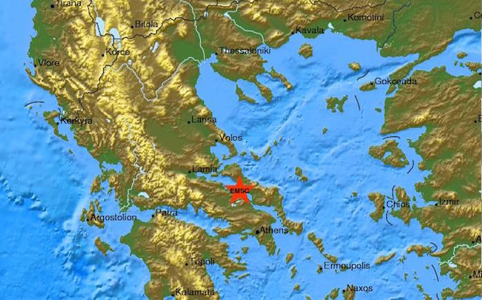
Strong 5.2 magnitude earthquake rattles Greece

earthquake near Athens, Greece
An earthquake with magnitude 5.2 occurred near Athens, Greece at 01:09:02.90 UTC on Jun 9, 2015. There have been no immediate reports of damage or injuries.

According to the Geodynamic Institute in Athens, the quake occurred early Tuesday morning in the Gulf of Northern Evia, about 80 kilometers (50 miles) north of Athens. Its epicentre was located 5 km deep near the city of Chalkida on Evia island. There have already been reported two smaller scale aftershocks.

"It was certainly felt, but so far we have not received any calls for assistance," a Greek fire brigade official in Athens said.

Earthquakes are common in Greece and have historically caused widespread damage across central and southern Greece, Cyprus, Sicily and other neighboring regions. Last year, a series of strong earthquakes on the island of Kefalonia damaged hundreds of homes and injured more than a dozen people.

Bizarro Earth

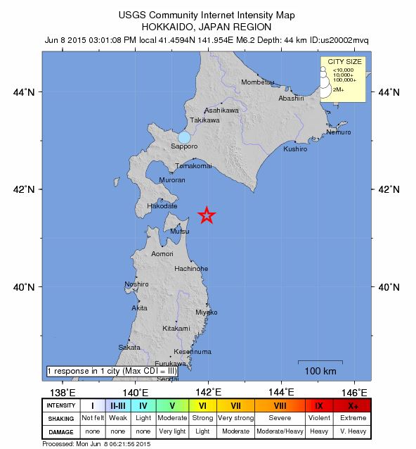
USGS: Earthquake Magnitude 6.2 - 64km ENE of Mutsu, Japan

Mutsu Quake_080615
© USGS
Time
  1. 2015-06-08 06:01:08 (UTC)
  2. Times in other timezones
Nearby Cities
  1. 64km (40mi) ENE of Mutsu, Japan
  2. 99km (62mi) NNE of Misawa, Japan
  3. 102km (63mi) SSW of Shizunai, Japan
  4. 107km (66mi) ESE of Hakodate, Japan
  5. 670km (416mi) NNE of Tokyo, Japan
Scientific Data

Bizarro Earth

Strong earthquake strikes Sabah

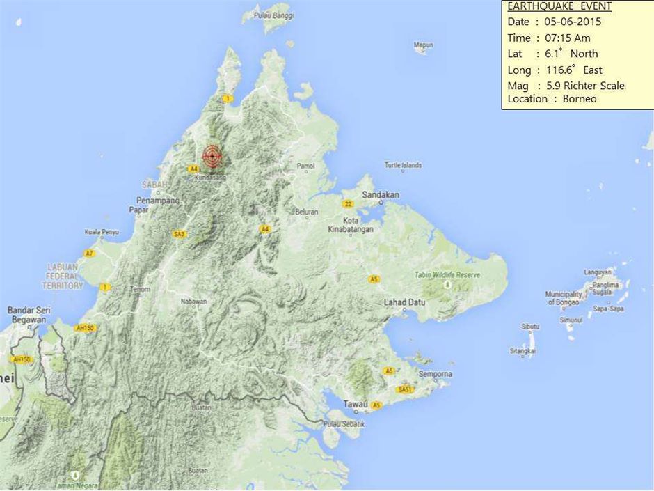
Kota Kinabalu: Tremors shook Kota Kinabalu and other parts of Sabah's west coast on Friday after a magnitude 5.9 earthquake hit near Ranau district. Initial reports from the Malaysian Meteorological Services Department said the quake struck 16km northwest of Ranau at 7.15am.

The US Geological Survey put the Richter scale at 6. No tsunami warning was issued.
Sabah Quake
© Courtesy of Malaysian Meteorological Department
It said that the strong quake struck at a depth of 10km, with its epicentre located 19km from the town of Ranau, and 54km from Kota Kinabalu. Apart from the state capital, the tremors were felt in the northern Kudat and Kota Marudu districts, and as far away Beaufort in the south.

The tremors shook buildings and rattled windows prompting people to run out from their houses, shops, and even at the Kota Kinabalu International Airport terminal.

The extent of damage cannot be immediately ascertained.

Bizarro Earth

Swarm of 7 earthquakes hit off Oregon coast

USGS monitoring station
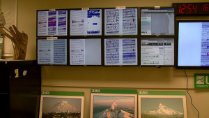
© KOINThe wall of earthquake monitors at the USGS monitoring station in Vancouver, June 1, 2015
A series of earthquakes struck off the Oregon coast early Monday, but scientists said they weren't strong enough to trigger tsunamis.

The first came at magnitude 5.8. It struck about midnight Sunday and was followed by three quakes early Monday. They were of magnitude 4.3, 5 and 4.4. A fifth struck around 1:13 p.m. and registered at a 5.9 magnitude.

At 7:50 p.m., a 3.9 magnitude earthquake was recorded off the Oregon coast. Then at 8:11 p.m., a 4.2 magnitude trembler was felt.

A ground motion sensor near Mt. Hood picked up all of the ocean quake activity, highlighted by red indicators on screens at the U.S. Geological Survey offices in Vancouver.

They struck at a fault nearly 300 miles west of Coos Bay, Oregon. They were relatively shallow, at 6 miles deep.

KOIN 6 News wanted to know if these quakes could mean we're closer to a big offshore quake, like the one that rattled the region more than 300 years ago.

"These earthquakes are happening in a totally different part of the system and aren't really relevant in a physical way," USGS seismologist Seth Moran said.

According to Moran, Monday's quakes are on a fault line farther out to sea than the much more dangerous fault line right off the Oregon coast. That closer fault line โ€” the Cascadia-Subduction Zone โ€” has caused huge quakes in the past and is currently building up pressure.
Bizarro Earth

Dunedin, New Zealand jolted by strongest quake in 41 years

Dunedin Quake
© ThinkstockThe quake was 7km deep.
The 4.7-magnitude earthquake that rocked parts of Otago last night was believed to be the strongest experienced in the region since 1974.

It struck at 11.17pm at a depth of 7km, centred 2km northeast of Lee Stream, some 30km west of Dunedin.

The quake was felt in various parts of Otago, but there were no immediate reports of injury or damage.

Adrian Bardrick, publican at the Clarks Junction Hotel, on State Highway 87, only about 12km from the epicentre, said they received a pretty good "sort of thump".

It rattled the bottles, he said.

"But there was no damage."

The hotel was cleaning up after a good evening.

"The Strath Taieri boys had beaten the West Taieri boys" in rugby and had called in on their way home.

They had left by the time of the quake.

The largest quake significantly affecting Dunedin in the past several decades was on April 9, 1974. It was magnitude 5 and dislodged grocery stock and damaged some chimneys.

The quake on October 16 last year was magnitude 4.1 at a depth of 4km and in almost the same place as last night's shake.

Police early this morning received several calls but no reports of damage.