Earthquakes
S

Bizarro Earth

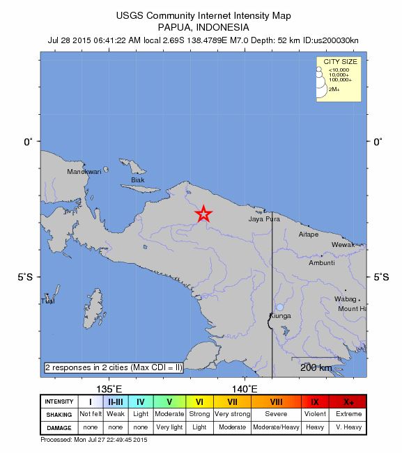
USGS: Earthquake Magnitude 7.0 - 234km W of Abepura, Indonesia

Papua Quake_270715
© USGS
Time
  1. 2015-07-27 21:41:22 (UTC)
  2. Times in other timezones
Nearby Cities
  1. 234km (145mi) W of Abepura, Indonesia
  2. 247km (153mi) W of Jayapura, Indonesia
  3. 314km (195mi) W of Vanimo, Papua New Guinea
  4. 341km (212mi) ENE of Nabire, Indonesia
  5. 1195km (743mi) SSE of Koror Town, Palau
Scientific Data

Bizarro Earth

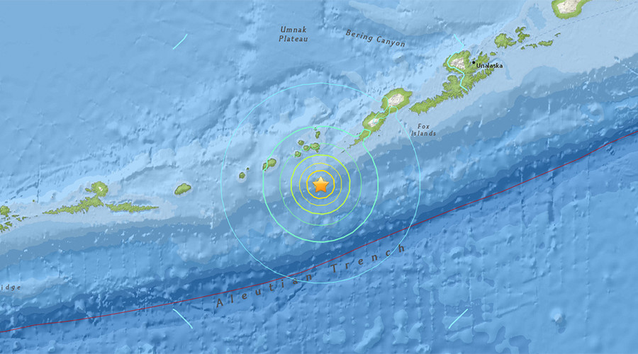
Magnitude 6.9 earthquake strikes off Alaska coast

earthquake off Alaska July 2015
© USGSM6.9 - 76km ESE of Yunaska Island, Alaska
A strong 6.9 magnitude quake hit off the coast of western Alaska near the Islands of Four Mountains, USGS reported.


The epicenter of the tremor on Monday was 76 km southeast of Yunaska Island, the largest island in a group in the chain of volcanic Aleutian Islands that stretch across the northern Pacific from the US to Russia, the report said.

The quake struck at a depth estimated to be 11.9 km. No tsunami alert was issued following the quake.

The Aleutian Islands run along the trench of the same name and comprise the northern part of the so-called Pacific Rim of Fire, an area of frequent seismic activity.

Comment: See also:

5 additional dead whales found in Alaska waters since June; total 14 dead
Active Week For Ring Of Fire As Earthquake Rattles Alaska
Why have 10 major volcanoes along the Ring of Fire suddenly roared to life?


Bizarro Earth

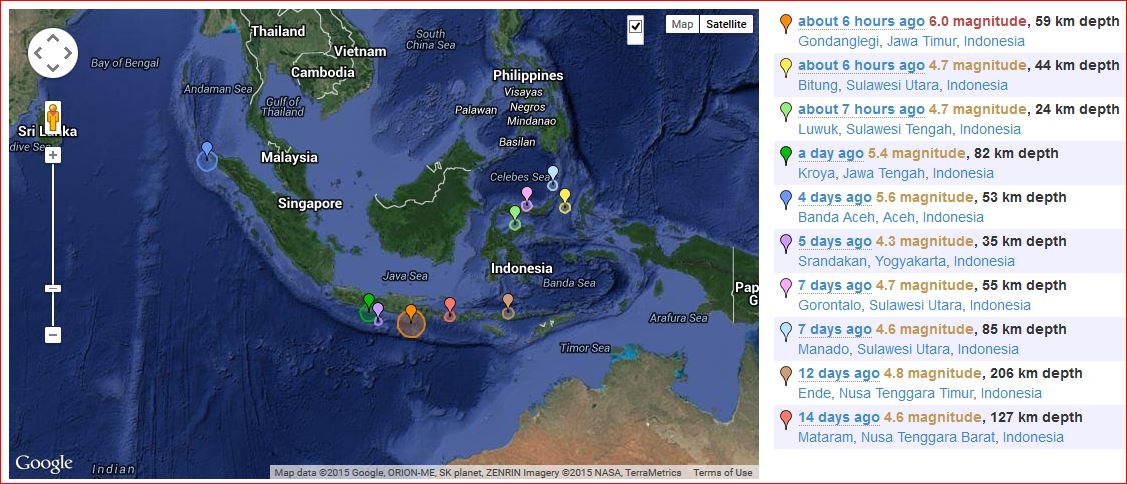
Magnitude 6.0 earthquake strikes off Indonesia, no tsunami threat

Indonesia earthquake 07_26_2015
© earthquaketracker.com
A strong 6.0-magnitude earthquake struck off the Indonesian island of Java today, the US Geological Survey reported, but local officials said there was no risk of a tsunami.

The quake struck at 2:05 pm local time (0705 GMT), 93 kilometres (57 miles) south of Krajan Tambakrejo village in east Java province at a depth of 59 kilometres, the USGS said.

Mochammad Riyadi, from the Indonesian meteorology, climatology and geophysics agency, said there were no reports of casualties or damages.

"The quake epicentre was in the sea, but there's no risk of a tsunami. It's quite a distance from nearby cities," he told AFP.

An AFP correspondent in Banyuwangi city in east Java said that mild shaking could be felt for about five seconds.

Indonesia sits on the Pacific "Ring of Fire" where tectonic plates collide, causing frequent seismic and volcanic activity.
Comment: See also:

Active Week For Ring Of Fire As Earthquake Rattles Alaska
Why have 10 major volcanoes along the Ring of Fire suddenly roared to life?


Bizarro Earth

Huge earthquake overdue Pacific North West

Ofunato
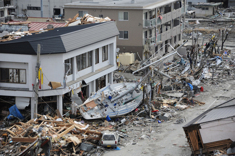
© U.S. Navy photo by Mass Communication Specialist 1st Class Matthew M. Bradley/ReleasedOfunato, Japan (March 15, 2011) A fishing boat is among debris in Ofunato, Japan, following a 9.0 magnitude earthquake and subsequent tsunami.
IceAgeNow - seismologist Chris Goldfinger has warned that a gigantic Earthquake, just of the coast of the Pacific Northwest, with the potential to kill over 10,000 American people, is many decades overdue.

According to The New Yorker;
San Andreas, which runs nearly the length of California and is perpetually rumored to be on the verge of unleashing "the big one." That rumor is misleading, no matter what the San Andreas ever does. Every fault line has an upper limit to its potency, determined by its length and width, and by how far it can slip. For the San Andreas, one of the most extensively studied and best understood fault lines in the world, that upper limit is roughly an 8.2โ€”a powerful earthquake, but, because the Richter scale is logarithmic, only six per cent as strong as the 2011 event in Japan.

Just north of the San Andreas, however, lies another fault line. Known as the Cascadia subduction zone, it runs for seven hundred miles off the coast of the Pacific Northwest, beginning near Cape Mendocino, California, continuing along Oregon and Washington, and terminating around Vancouver Island, Canada. The "Cascadia" part of its name comes from the Cascade Range, a chain of volcanic mountains that follow the same course a hundred or so miles inland. The "subduction zone" part refers to a region of the planet where one tectonic plate is sliding underneath (subducting) another. Tectonic plates are those slabs of mantle and crust that, in their epochs-long drift, rearrange the earth's continents and oceans. Most of the time, their movement is slow, harmless, and all but undetectable. Occasionally, at the borders where they meet, it is not.
Read the rest of the article

Comment: Its not often that we get accurate information from Fox News:


Fire

Best of the Web: Signs of Change: Extreme weather and environmental upheaval in June and July 2015 (VIDEO)

Image
© HawkkeyDavisChannel/YouTubeA first? Wildfire torches moving vehicles on highway near Los Angeles, California
Video compilation of extreme weather events (and general environmental chaos) from the past month or so.

Record high temperatures in Germany were immediately followed by unusually strong storms and hail. Record rainfall in China was followed by a record heatwave there. In the US, there's been a record heatwave in the West, and record rainfall in the South. There's been record cold in Australia, and record heat in Pakistan. Volcanoes erupted in Indonesia, Japan and Mexico, while there was a strong earthquake in China and an earthquake swarm in Iceland... And in between all that; powerful storms and record rainfall.

Things be intensifying!


Bizarro Earth

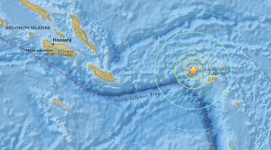
Tsunami warning in Pacific as 7.5 quake strikes near Solomon Islands

Solomon Island Quake
© earthquake.usgs.gov
The Pacific Tsunami Warning Center issued a 300-kilometer radius tsunami warning after a shallow 7.5-magnitude earthquake was registered some 80 kilometers off Lata, in the Solomon Islands.

The quake's epicenter centered at the depth of 12 km northwest of the provincial capital of Lata, according to US Geological Survey. While there are some 550 people living in the town near the epicenter, the preliminary warning issued by the PTWC has alerted a wide region including states from Solomon Islands and Papua New Guinea to Australia and even New Zealand.

"Hazardous tsunami waves from this earthquake are possible within 300 km (186 miles) of the epicenter along the coasts of the Solomon Islands," PTWC said.

Attention

6.4 magnitude earthquake in Atlantic Ocean near Barbados creates possibility of local tsunami

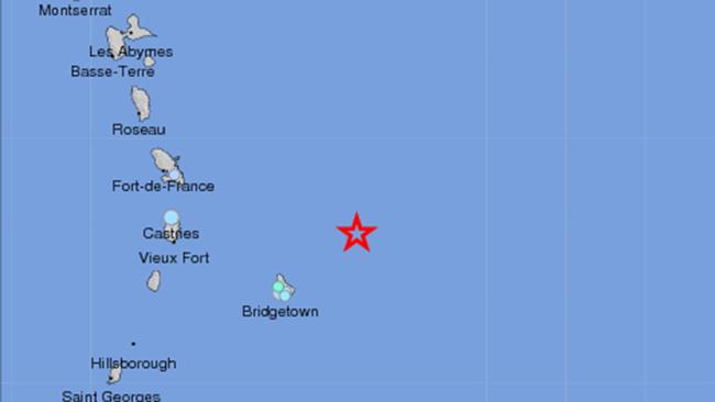
The epicenter of Thursday's earthquake off the coast of Barbados
© USGSThe epicenter of Thursday's earthquake off the coast of Barbados.
An earthquake in the Atlantic Ocean off the coast of Barbados Thursday shook tiny island chains, and also created the risk of a localized tsunami.

The magnitude-6.4 quake hit around 11:15 a.m. ET, and was centered 87 miles northeast of Barbados. The tremor was shallow, only about 3 miles deep.

The USGS estimates as many as 1 million people felt the jolt. People from Bridgetown, Barbados, well south into the Port of Spain report feeling weak to light shaking.

Attention

Over thirty earthquakes reported overnight near San Andreas fault in Southern California; 169 quakes in area this week

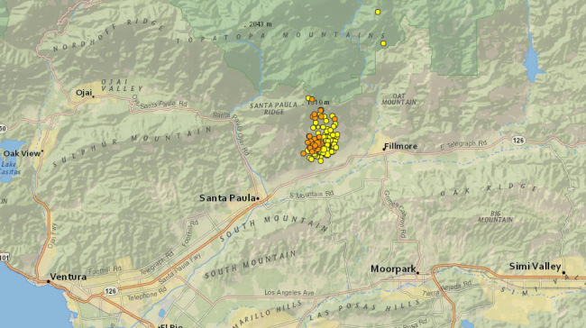
Over 30 earthquakes ranging in magnitude from 1.3 to 2.4 were reported between Sunday night and Monday morning, according to the U.S. Geological Survey.

Most of the seismic activity was recorded between the Topatopa Mountains and the Santa Suzanna Mountains.

The quakes occurred near, but not on the San Andreas fault line.

21 of the earthquakes occurred between the hours of 10 p.m. and 5 a.m.

There have been a recorded 169 earthquakes in the area this week, according to the USGS.
Image
© kron4.com

Bizarro Earth

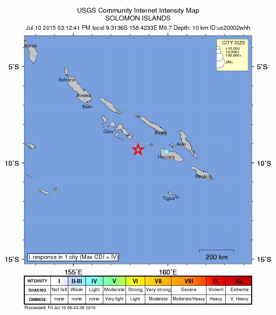
USGS: Earthquake Magnitude 6.7 - 155km SSW of Dadali, Solomon Islands

Solomon Quake_1000715
© USGS
Time
  1. 2015-07-10 04:12:41 (UTC)
  2. Times in other timezones
Nearby Cities
  1. 155km (96mi) SSW of Dadali, Solomon Islands
  2. 168km (104mi) W of Honiara, Solomon Islands
  3. 467km (290mi) SE of Arawa, Papua New Guinea
  4. 874km (543mi) SE of Kokopo, Papua New Guinea
  5. 885km (550mi) E of Alotau, Papua New Guinea
Scientific Data

Bizarro Earth

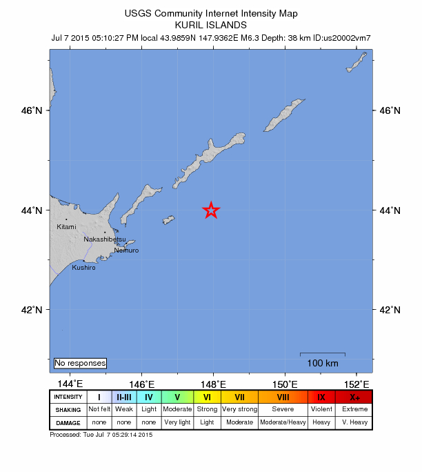
USGS: Earthquake Magnitude 6.3 - 99km ENE of Shikotan, Russia

Shikotan Quake_070715
© USGS
Time
  1. 2015-07-07 05:10:27 (UTC)
  2. Times in other timezones
Nearby Cities
  1. 99km (62mi) ENE of Shikotan, Russia
  2. 204km (127mi) ENE of Nemuro, Japan
  3. 228km (142mi) E of Shibetsu, Japan
  4. 294km (183mi) E of Abashiri, Japan
  5. 1159km (720mi) NE of Tokyo, Japan
Scientific Data