Volcanoes
S


Attention

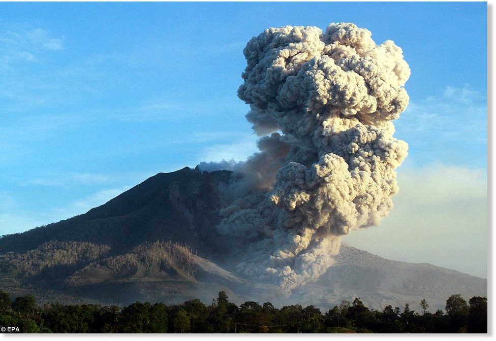
Sinabung volcano erupts seven times in less than 24 hours, Indonesia

Indonesian volcano Mount Sinabung
Indonesia's Mount Sinabung in North Sumatra province erupted seven times on Sunday, local media reported.

"The eruptions occurred from midnight until 4:50 pm (1700 GMT Saturday until 0950 GMT Sunday)," volcanology agency official Arif Cahyo was quoted by Viva.co.id news portal as saying.

The ash spewed from the volcano was carried by winds to Berastagi, a tourist town in the Karo highlands south-east of the volcano, Cahyo added.

Local officials in Berastagi told locals and tourists to wear masks and eye protectors to avoid being exposed directly to the volcanic ash.

Fire

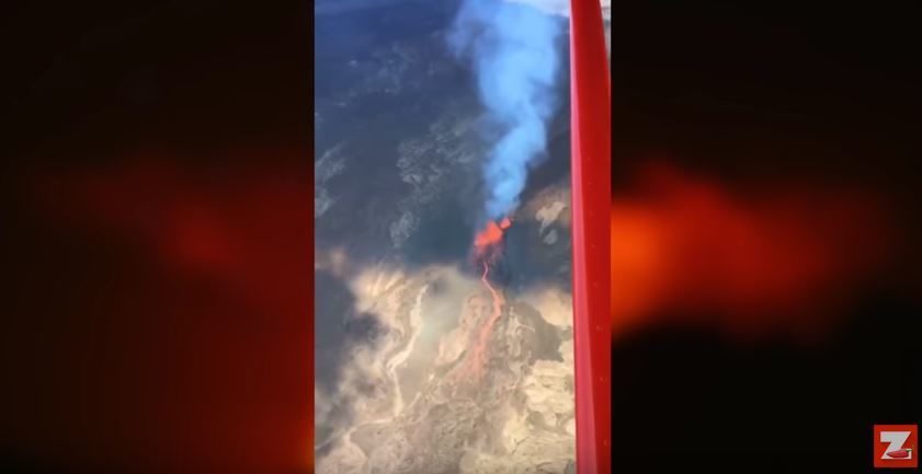
Piton De La Fournaise Volcano erupts on French island of Réunion

Reunion volcano eruption
© YouTube/Zinfos974 (screen capture)
The Piton de la Fournaise Volcano is on the French island of Reunion. The volcano erupted on January 31. This video shows lava sprays being thrown into the air during the eruption.

A fault was visible on the south-east end of the volcano, according to reports. The Piton de la Fournaise Volcanology Observatory said the eruption took place in the Chateau Fort area.


Snowflake Cold

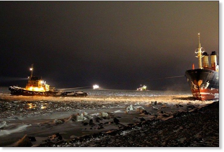
Russian ice breakers stuck in the Arctic, yachts over underwater volcanoes

Vessels Kapitan Dranitsyn and Admiral Makarov ‘marooned’ in east for the rest of winter after getting trapped off Chukotka.
Russian Ice Breakers stuck in unexpectedly and unusually thick sea ice, but they we were told the sea ice is disappearing. Private yacht sails through floating pumice and then after see an underwater volcano where they sailed over. New Zealand Herald, epic article as a case study into "Warm Weather Media Bias"


Sources

Fire

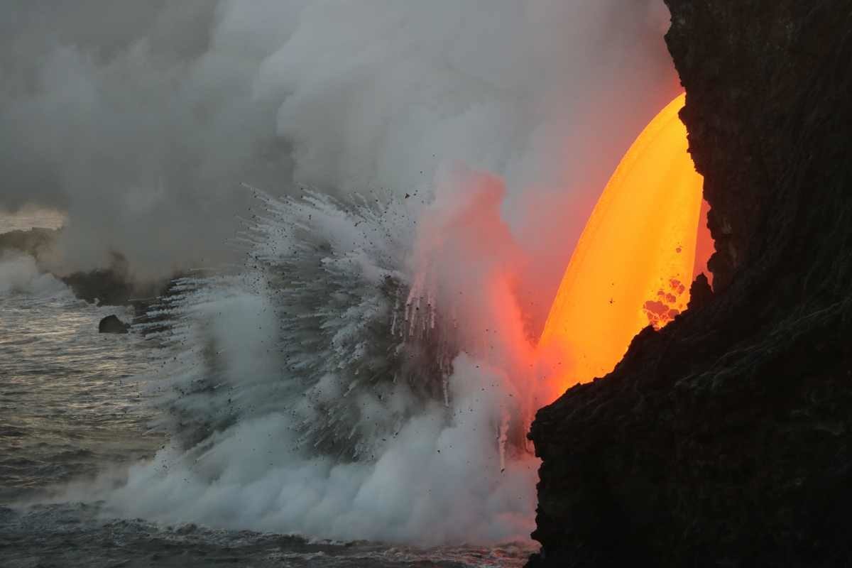
Hawaii's Kilauea volcano lava 'firehose': 'Never seen anything like it' says scientist (VIDEO)

Hawaii volcano lava firehose
© USGSWhen this USGS photo was taken over the weekend, scientists noted the lava stream “appeared wider… today compared to yesterday, and often had holes in the thin sheet.”
Scientists with the USGS Hawaiian Volcano Observatory have been studying the mesmerizing lava stream, pouring out of the lava tube on the sea cliff at the Kamokuna ocean entry, inside the boundary of Hawaii Volcanoes National Park.

In a Monday phone interview, geologist Matt Patrick said he hasn't seen anything like it in his 9 years monitoring Kilauea volcano on Hawaii Island.

The activity is part of the 61g lava flow, erupting miles away from the vent of Puʻu ʻŌʻō on the East Rift Zone of Kilauea. As the molten lava flows into the cool seawater, pulsating littoral explosions throw spatter, or fragments of molten lava, high into the air.

Patrick was out at the edge of the lava flow recently, taking the spectacular photos and video that have since been posted to the USGS website. The scientists carefully approached the site in protective gear on Jan. 28, and took a look at an ominous crack that has developed on the cliff.

The geologists determined that "the eastern end of the hot crack was about 30 cm (11.8 in) wide and deeply cut into recent lava atop the older sea cliff."


Comment: There has been increased activity at Kilauea volcano in recent times. See also:


Bizarro Earth

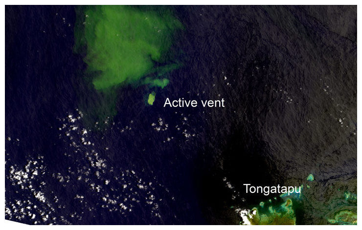
Underwater volcano eruption spotted near Tonga

A New Zealand scientist says satellite images show that an underwater volcano has erupted near the main island of Tonga.
Underwater volcano near Tonga
© Auckland UniversityThe underwater volcano has erupted near the main island of Tonga.
Auckland University's Murray Ford, who is monitoring a volcanic island in the area, discovered the eruption when he noticed a large plume of dirty water between Tongatapu and Hunga volcano.

Dr Ford said the satellite imagery definitely showed a vent releasing volcanic debris into the water.

"We got a spectacular satellite image from the Landsat 8 satellite, which was largely cloud free, which is quite rare in the tropics, so in terms of that, it was quite spectacular."

GNS Science vulcanologist Brad Scott said the images confirmed that a submarine volcanic eruption had been ongoing since 23 January.

Seismograph

Schoolchildren evacuated as more than 60 quakes shake Mount Etna, Sicily

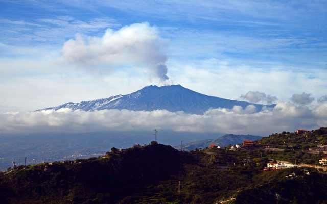
An eruption at Mount Etna
© Giovanni Isolino/AFPAn eruption at Mount Etna, one of the world's most active volcanoes, in 2015.
Schools in Sicily were evacuated on Monday after the island's active volcano, Mount Etna, experienced a flurry of quakes.

Seismic experts at Italy's National Institute of Geophysics and Vulcanology (Ingv) registered more than 60 tremors on Monday morning - the most significant measuring at least 3.5 magnitude, at 10:51am. The quakes began shortly after 6am, and five have measured over 3.0 in magnitude.

Local authorities have alerted residents to the series of tremors, which have had their epicentre between Ragalna and Monte San Leo, at around 14km deep.

Ingv said there was "nothing unusual" about the volcanic activity, and there have not been any reports of damage to buildings or any injuries caused by the quakes. In the towns of Ragalna, Nicolosi and Bronte on the south side of the volcano, schoolchildren were evacuated on Monday morning as a precaution.

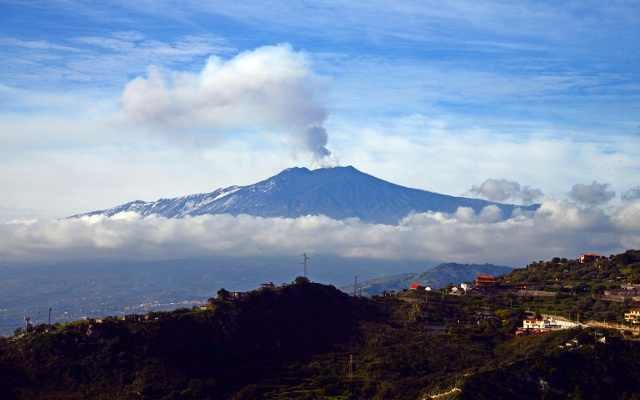
Etna, nestled between the cities of Messina and Catania, is Europe's most active and highest volcano and Italy's highest peak south of the Alps. Together with Mount Vesuvius near Naples, it is one of 16 volcanoes in the world designated as 'Decade Volcanoes' by the UN, which means that they are studied particularly closely due to the frequency of activity and density of nearby population.

It is in a near-constant state of activity, and striking video footage from the past week shows the snow-covered peak sending out clouds of smoke.

Bizarro Earth

Earth 'overdue' for magnetic pole reversal

Earth's Magnetic Field
© ShutterstockThe Earth's magnetic field, magnetic poles and geographic poles.
Earth's magnetic field may be about to reverse, which could have devastating consequences for humanity.

Scientists think that Earth is long "overdue" for a full magnetic reversal and have determined that the magnetic field's strength is already declining by 5 percent each century. This suggests that a fully reversal is highly probable within the next 2,000 years

Earth's magnetic field surrounds the planet and deflects charged particles from the sun away, protecting life from harmful radiation. There have been at least several hundred global magnetic reversals throughout Earth's history, during which the north and south magnetic poles swap. The most recent of these occurred 41,000 years ago.

During the reversal, the planet's magnetic field will weaken, allowing heightened levels of radiation on and above the Earth's surface.

The radiation spike would cause enormous problems for satellites, aviation, and the power grid. Such a reversal would be comparable to major geomagnetic storms from the sun.

The sun last produced such a storm that struck Earth during the summer of 1859, creating the largest geomagnetic storm on record. The storm was so powerful that it caused telegraph machines around the world to spark, shocking operators and setting papers ablaze. The event released the same amount of energy as 10 billion atomic bombs.

Researchers estimate that a similar event today would cause $600 billion to $2.6 trillion in damages to the U.S. alone. National Geographic found that a similar event today would destroy much of the internet, take down all satellite communications, and almost certainly knock out most of the global electrical grid. The Earth would only get about 20 hours of warning. Other estimates place the damage at roughly $40 billion a day.

A similar solar event occurred in 2012, but missed Earth.

Attention

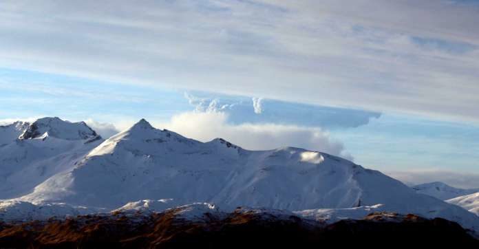
Alaska's Bogoslof volcano erupts again; more than 25 times since mid-December

Bogosloff volcano
© Lynda Lybeck Robinson, APThis photo taken Dec. 21, 2016 and provided by Lynda Lybeck Robinson shows the Bogoslof Volcano erupting in the Aleutian Islands, Alaska. A volcano in the Aleutian Islands erupted Friday.
The Alaska Volcano Observatory has raised the aviation warning level after a volcano in the Aleutian Islands erupted again.

Bogoslof Volcano erupted Friday morning, and the observatory says it generated an ash cloud that may be as high as 25,000 feet.

Volcanic ash above 20,000 feet is a threat to airliners flying between Asia and North America.

The volcano 850 miles southwest of Anchorage has erupted more than 25 times since mid-December and could continue periodic eruptions for months. It also erupted Thursday.

After Friday's event, the Aviation Color Code was raised from orange to red, the highest level. The observatory says the cloud could reach 30,000 feet.

The National Weather Service issues alerts to traffic controllers after significant eruptions.

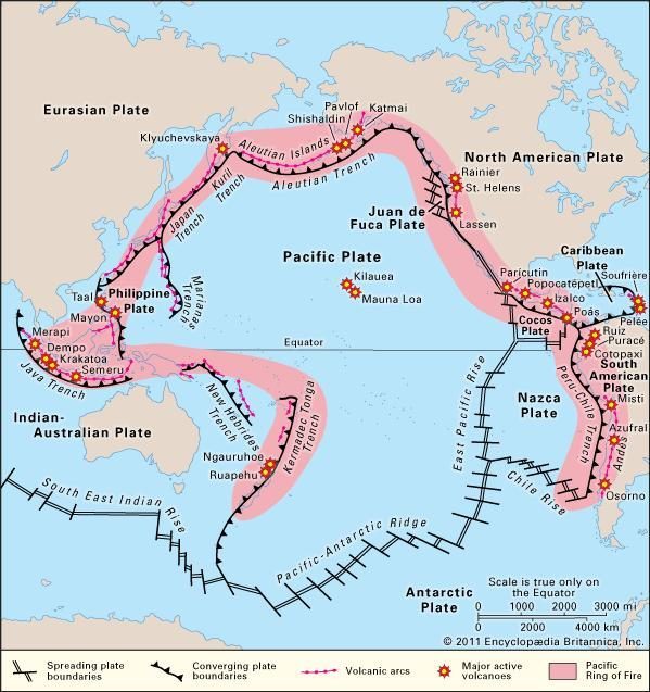
Comment: The Aleutian Islands volcanoes are part of the Pacific Ring of Fire, an area subject to frequent earthquakes and volcanic eruptions. The Bogoslof volcano has seen quite a bit activity recently:

January 18: Alaska's Bogoslof Volcano erupts again, sends ash cloud to 31,000 feet
January 12: Photographs show how recent eruptions at Alaska's Bogoslof volcano have changed island
January 5: Bogoslof Volcano in the Aleutians back at Red Alert
December 29: Increased seismic activity at Alaska's Bogoslof volcano
December 27: Bogoslof volcano alert raised to red by the Alaska Volcano Observatory
December 23: For second day running, Bogoslof volcano eruption sparks aviation alert in Alaska
December 21: Bogoslof volcano in Alaska erupts briefly, spews ash cloud 34,000 feet

Pacific Ring Of Fire
© Encyclopædia Britannica, Inc.Pacific Ring Of Fire


Attention

Ethiopia's Erta-Ale volcano: Lava flows from crater for first time in a decade

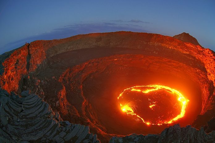
Erta Ale volcano
© Traveldudes.orgErta Ale - The world's only permanent lava lake
The world's famous active volcano and molten lava lake of the Afar Regional Sates of Ethiopia, Erta-Ale, is flowing out of its crater for the first time in a decade says Addis Ababa University.

The unusual happening was made public today by Professor Gezahegn Yirgu of the Addis Ababa University Department of Geology.

The molten lava crater is a famous destination for tourists and scientists both from home and abroad. It has been flowing in large amount over for a week now, said the professor.

According to the professor, the molten lava has filled another crater and flowing further south wards towards Afdera town. It the flowing continues, it disrupts life in the area. That needs a serious scrutiny in the area, he said.

The professor also noted that at the right side of the road to Erta-Ale, a new happening has been observed; lava is coming out of a new depression in the area.


Comment: The recent Erta'Ale eruption also produced the largest sulfur dioxide emission ever measured (by satellite) from the volcano.


Bizarro Earth

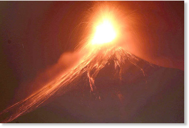
Guatemala's Volcano of Fire makes explosive eruption blasting a tsunami of deadly lava into the sky

The deadly Volcano of Fire blew tonnes of lava from its crater in a series of explosions in Guatemala. Stunning images show the moment of the forceful eruption, as red-orange rivers of molten rock trickle down the mountain side. Residents have been warned not to stray too near to the volcano, as the risk of pyroclastic flows of heated rock clouds is still possible.

A Column of hot grey ash was blown into the air 5,500 metres above sea level, but it was invisible in the darkness when the eruption occurred last night. The volcano sits firmly on the so-called Ring of Fire which is an area of constant volcanic and tectonic activity around the Pacific Ocean.

volcano of fire
© EPALava was blasted out of one of the world's most active volcanoes in its first eruption of the year.
Authorities in Alotenango, Sacatepequez, are on high alert in case any dangerous eruptions follow and force an evacuation. The deadly Volcano of Fire blew tonnes of lava from its crater in a series of explosions in Guatemala. Stunning images show the moment of the forceful eruption, as red-orange rivers of molten rock trickle down the mountain side.