Volcanoes
S


Fire

New Mount Merapi eruption in Indonesia: Increased rumblings at 21 other volcanoes in the region

Mount Merapi
Mount Merapi
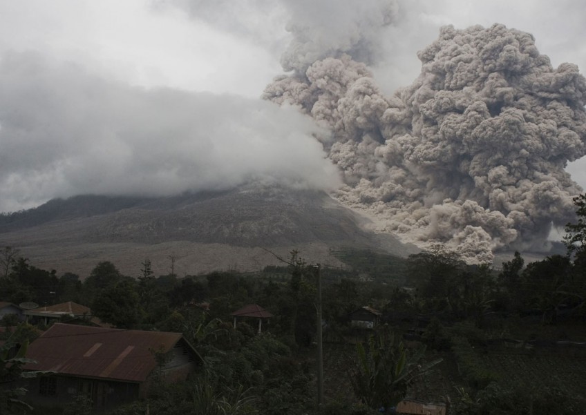
Deafening explosions of hot gas rattled evacuees miles from a volcano Tuesday, the latest eruption in a deadly week. Increased rumblings were reported at 21 other active volcanoes in Indonesia, raising questions about what's causing the uptick along some of the world's most volatile fault lines.

No casualties were reported in Mount Merapi's new blast, which came as Indonesia struggles to respond to an earthquake-generated tsunami that devastated a remote chain of islands. The two disasters unfolding on opposite ends of the country have killed nearly 500 people and strained the government's emergency response network. In both events, the military has been called in to help.

Merapi has killed 38 people since it started erupting a week ago. Monitoring officials have raised alert levels at some of the 129 active volcanoes in Indonesia, with two under watch for possible eruption within two weeks and 19 showing increased activity, an official said.

Source: AP

Fire

Carbon tax this! Momotombo Volcano in Nicaragua erupts for first time in over a century, forcing thousands to evacuate

Nicaraguan Momotombo
© AFPNo damages or victims have been reported after the Nicaraguan Momotombo volcano erupted Tuesday
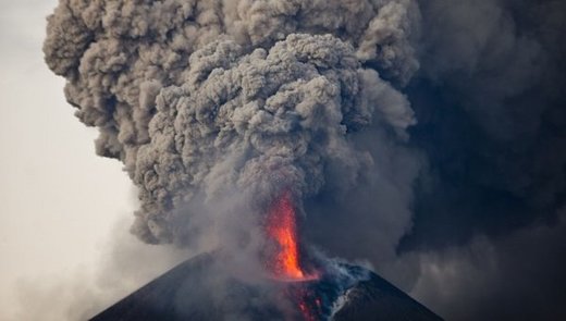
Thousands of people in Nicaragua have been asked to evacuate an area of about four miles surrounding the Momotombo volcano after it erupted for the first time in 110 years spewing lava, ashes and smoke.

"The seismic tremor is increasing and in the volcano's crater there are explosions every four seconds," said Wilfried Strauch, a scientific adviser for the Nicaraguan Institute of Territorial Studies or INETER.

Arrow Up

Nicaragua's Mombotombo volcano erupts for first time in 110 years; 4 explosions in an hour

Momotombo volcano
© Jaime Incer
Momotombo volcano in Nicaragua reported first eruptions in the last 110 years on the morning (local time) of December 1, 2015. The eruptions produced steam and ash plumes rising up to 1 km (3 281 feet).

Four small explosions occurred at the volcano at 07:49, 08:17, 08:42 and 08:55 am (local time), Volcano Discovery reported. The last of the eruptions was the largest and sent a plume of ash and steam high above the crater.

The communities of El Papalonal and in the vicinity of the Momotombo geothermal plant situated SW of the volcano summit reported light ash fall. A team of volcanologists from the Nicaraguan Institute of Territorial Studies (INETER) surveyed the area and took samples of ash and gasses.

This is the first time the volcano showed the signs of eruptive activity since 1905, and only 16 eruptions have been recorded since 1524, most of which have been small explosions of phreatic nature. The only two larger eruptions were observed in 1605 and 1609 when large bombs and blocks were expelled to the distances of approximately 6 km (19 685 feet), in the area of the nowadays abandoned town of León Viejo.

According to the scientists the volcano explosions has not been triggered by the increased activity of the nearby Telica volcano over the last few weeks.


Comment: Portions of the Pacific Ring of Fire have been active in the past 30 days:


Pacific Ring of Fire:

Ring of Fire
© Wikimedia Commons


Bizarro Earth

Powerful explosion of Guatemala's Santiaguita volcano prompts air traffic precautions

Santiaguito volcano
© Screenshot via YouTube/juanp756
Santiaguito, an active dome of the Santa Maria volcano in Guatemala produced a large explosion on the morning (local time) of December 1, 2015, following a period of heightened activity. An active volcano watch and the necessary precautions for air traffic in the area have been recommended.

A period of increased activity of Santiaguito volcano since November 29 resulted in a strong explosion in the early hours of December 1. The explosion produced a plume of ash between 2 and 3 km (6 562 and 9 843 feet) high most likely accompanied by a small pyroclastic flow, Volcano Discovery reported.

A powerful explosion occurred at 07:07 am (local time) and a pyroclastic flow traveled about 15 km (9.3 miles) west-southwest. The ashes have been reported to fall near the St. Marcos Palajunoj, Finca La Florida and other adjacent villages, according to INSIVUMEH.

Several explosions have been reported over the last few days from the Caliente lava dome, significantly stronger than average. A moderately strong explosion was observed on November 30 at 01:34, which ejected incandescent bombs up to 150 m (492 feet) above the volcano dome. A large incandescent avalanche has also been observed on the eastern side of the Caliente dome.


Attention

Alert level 1 for Kanlaon Volcano after steam explosion, Philippines

Image
© AFP Residents look towards the Kanlaon volcano from Kanlaon, central Philippines. File Photo
The Philippine Institute of Volcanology and Seismology (Phivolcs) has hoisted Alert Level 1 over Kanlaon volcano on Tuesday after it had a steam explosion.

The steam explosion, which occurred at 9:55 p.m. on Monday, lasted for eight minutes, Phivolcs reported.

The explosion produced a 1.0-1.5 kilometer high white plume above the summit before drifting towards the southwest," it said.

On Tuesday morning, Kanlaon continues to emit steam with minor ash.

Prior to Monday night's steam explosion, only four volcanic quakes were recorded in Kanlaon. However, a volcanic tremor which lasted five hours has since recorded after the explosion.

Camera

Continuing its rampant activity, Colima volcano erupts spectacularly in Mexico

Image
© Screenshot via webcams de Mexico
Mexico's Fire Volcano is continuing its rampant activity spitting out ash and instilling fear in both locals and visitors to breathtaking effect. Webcams de Mexico has captured the latest stunning Colima volcano activity.

A moderate explosion recorded Tuesday, shows the crater of one of the most deadly volcanoes in the world slowly steaming away when it suddenly erupts, sending debris into the air.

The heated material than falls on the slopes as flashes of volcanic lightning are seen before the ash is whipped up by the wind. After the blast, which happened early Tuesday, the plume from the eruption spread roughly one kilometer into the air. Further eruptions saw the plume reaching roughly 2.5 km into the air.

The volcano continues to remain restless, after being home to a powerful eruption on November 16. On this date, the plume of smoke and ash from the Fire Volcano reached some 3,000 meters into the air. Webcams de Mexico also offers footage of the spectacular explosion.


Blue Planet

UN Report: Major rise in weather disasters over last 2 decades

Image
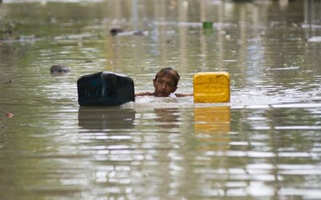
© AFPA flood-affected resident swims through floodwaters in Kalay, upper Myanmar’s Sagaing region on August 3, 2015. Relentless monsoon rains have triggered flash floods and landslides, destroying thousands of houses, farmland, bridges and roads with fast-flowing waters hampering relief efforts.
Since 1995, weather disasters have killed millions of people & left billions injured & homeless.

Weather-related disasters such as floods and heatwaves have occurred almost daily in the past decade, almost twice as often as two decades ago, with Asia being the hardest hit region, a UN report said on Monday.

While the report authors could not pin the increase wholly on climate change, they did say that the upward trend was likely to continue as extreme weather events increased.

Since 1995, weather disasters have killed millions of people, left billions injured, homeless or in need of aid, and accounted for 90 percent of all disasters, it said.

A recent peak year was 2002, when drought in India hit 200 million and a sandstorm in China affected 100 million.

But the standout mega-disaster was Cyclone Nargis, which killed 138,000 in Myanmar in 2008.

Arrow Up

Tungurahua volcano erupts in Ecuador covering houses, fields with ash and smoke

Image
© AP/Dolores OchoaTungurahua volcano spews ash and vapor, as seen seen Ojos del Volcan, Ecuador, Thursday, Nov. 19, 2015.
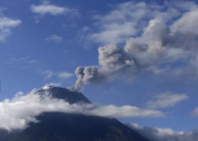
Residents from communities near Ecuador's Tungurahua volcano faced a massive cleaning operation on Thursday (19 November) after the volcano erupted, covering houses and fields with smoke and ash. Authorities issued an orange alert as emissions reached 2,500 metres above the crater.

In nearby Queros, one of the most affected communities, officials registered 10kg of ash per square metre.
As he swept the street near his house, resident Luis Vaca said the volcanic material was damaging crops. "Ash is falling everywhere; it's strong, especially in the countryside where it's falling more heavily. It's damaging the crops. It would be good if the president came to visit us," he said.
Image
© AP/Dolores Ochoa
Volcanologist Patricia Mothes confirmed that eruptions have been substantial. "These accumulations of ash that have been falling are the greatest masses of ash that we've registered in the past five years," she said.
Comment: Check out SOTT's latest Earth Changes Summary video of extreme weather and planetary upheaval.


SOTT Earth Changes Summary - October 2015: Extreme Weather, Planetary Upheaval, Meteor Fireballs


Arrow Up

Indonesia's Mount Sinabung erupts again emitting ash 2,000 meters

Image
© AFPA photo taken from Tiga Serangkai village in Karo, North Sumatra, shows Mount Sinabung spewing volcanic ash in the distance on September 23, 2015.
Mount Sinabung in Karo regency, North Sumatra, erupted forcefully once again on Wednesday and may threaten the opening of the Lake Toba Festival by Tourism Minister Arief Yahya in Berastagi, also in Karo, slated for Thursday.

No casualties were reported following the eruption, but pyroclastic flows drifting to the southeast affected a number of villages that have long been abandoned by residents. "The current wind direction is directed to the southwest, but if it blows to the east the Lake Toba Festival will be disrupted as the spread of ash would reach Berastagi," Mt. Sinabung Observation Station staff member Deri Hidayat told The Jakarta Post.

Deri said the volcano discharged the clouds at 1:47 a.m. and 9:28 a.m. He added the pyroclastic clouds, which drifted as far as 3.5 kilometers, affected Bekerah and Simacem villages. He said both villages had long been left empty as they were inside a designated danger zone. Deri added that Mt. Sinabung had also emitted volcanic ash to a height of 2,000 meters toward the southwest. He said the spread of ash could disrupt the Lake Toba Festival if the wind changed direction in coming days.

He said volcanic activity could increase within the week, adding that the volcano could discharge a bigger volume of pyroclastic flows and ash. "The biggest eruption took place on Tuesday, when the volcano discharged pyroclastic clouds 13 times, compared to only twice today," said Deri. According to him, the potential for pyroclastic flows remained great due to a lava dome buildup on the southeastern section of the peak. Deri said the lava dome could collapse anytime and trigger huge pyroclastic flows.

Attention

Magnitude 3.2 earthquake hits Bárðarbunga volcano, Iceland

Image
© AFP/Bernard MericHoluhraun in December 2014.
Eyes are back on Iceland's Bárðarbunga volcano following a magnitude 3.2 earthquake that hit the caldera of the volcano yesterday.

Monitoring by the Icelandic Met Office has recently revealed significantly greater seismic activity than any time since the 2014-15 eruption in the adjacent Holuhraun lava field.

Bárðarbunga is one of Iceland's most powerful volcanoes and is located under the country's famous Vatnajökull glacier.

The Met Office's Einar Hjörleifssonhas indicated that the situation is being monitored closely.