Volcanoes
S

Bizarro Earth

Update: Galeras Volcano in Colombia Erupts, Government Raises Alert

Galeras Volcano
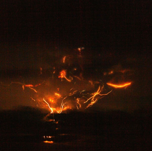
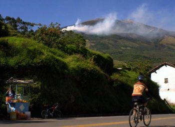
© Johana Gonzales/Getty ImagesThe Galeras volcano, Narino department, Colombia, on January 3, 2010. The Galeras volcano in southeastern Colombia erupted Saturday night, but there were no reports of deaths or injuries, authorities said.
The Galeras volcano, located 14,029 feet above sea level in southwestern Colombia, erupted at 4 a.m. local time on Wednesday.

A total of 278 people were evacuated according to an Associated Press report.

Hospitals close to the affected area were requested by the government to prepare medical resources and supplies to be ready to provide immediate help.

The eruption, which spewed gas and ash, has not caused significant damage in the surrounding area, said an official press release.

The government issued alerts to residents in surrounding towns recommending residents stay indoors, avoid panic, remove ash in residential areas, and avoid using bridges after the eruption.

Galeras is considered the one of the most active volcanoes in the country, according to the Global Volcanism Program.
Bizarro Earth

Authorities Fear Eruption of Galeras Volcano

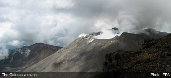
The Galeras Volcano
© EPAThe Galeras Volcano
Authorities and inhabitants in the south of Colombia fear an eruption of the Galeras volcano after four tremors shook the area on Sunday and Monday.

According to the volcanic observatory run by Colombia's Geology and Mining authority Ingeominas, the several tremors are related to the activity of the volcano and an eruption is likely within days or weeks.
The quakes took place in the area surrounding the active volcano just outside the city of Pasto.

Ingeominas says it continues to be alert to the volcanic phenomena and will report changes.

The Galeras volcano erupted last in January, after which 8,000 people were forced to evacuate.

Bizarro Earth

Activity At Sakurajima Volcano Intensifies

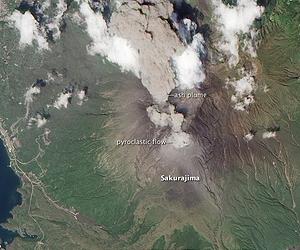
Sakurajima Volcano
© Space DailyRoughly 7,000 years ago Sakurajima erupted with a volcanic explosivity index (VEI) of 6, equivalent to the 1991 eruption of Mount Pinatubo.
By mid-August, Sakurajima Volcano-one of Japan's most active-had erupted ash at least once every week during 2010.

On August 19, 2010, an ash plume was sighted at 9,000 feet (2,700 meters), according to the Tokyo Volcanic Ash Advisory Center.

This natural-color satellite image shows the gray plume moving west (towards image top) from the volcano's summit. Simultaneously, a pyroclastic flow descended the eastern slopes.

Although Sakurajima's activity since 1955 has been characterized by frequent small eruptions, the volcano still poses a danger to the densely-populated surroundings.

Roughly 7,000 years ago Sakurajima erupted with a volcanic explosivity index (VEI) of 6, equivalent to the 1991 eruption of Mount Pinatubo.

The image was acquired by the Advanced Land Imager (ALI) aboard the Earth Observing-1 (EO-1) satellite.

Bizarro Earth

Quakes Due to Undersea Volcano, Expert Claims

Manila: Three major earthquakes that occurred in the south Philippines on July 24 were due to the eruption of Kawio Barat, a big underwater volcano rising 10,000 feet from 18,000 feet of water between Indonesia and the south Philippines, said an expert, whose analysis was challenged by a local scientist.

Three major undersea earthquakes with magnitudes of 6.8 and 7.1 on the Richter scale, occurred in the Moro Gulf off Mindanao on July 24, the Philippine Institute of Volcanology and Seismology (Phivolcs) confirmed, adding the undersea quakes did not damage land areas.

The quakes, tectonic in origin, had nothing to do with the eruption of a recently discovered undersea volcano, the Kawio Barat, Mahar Lagmay, associate professor at the University of the Philippines National Institute of Geological Sciences, told the Inquirer.

However, Jim Holden, chief scientist for the US-Indonesia deep-sea expedition of Kawio Barat, said in a press release quoted by the Inquirer that the major earthquakes off south Philippines last month were due to the eruption of Kawio Barat, which was recently found by scientists under the seabed of Sulawesi Islands in Indonesia.

Bizarro Earth

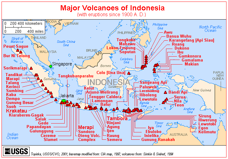
Indonesia's Mount Karangetang volcano spews lava, gas; 4 feared dead

Image
© USGS
One of Indonesia's most active volcanos erupted Friday, sending lava and a searing gas cloud tumbling down its slopes. At least four family members were swept away and feared dead, officials said, and several others were badly hurt.

"It happened so fast," said Surono, the director of the volcanology and mitigation agency. "There was no time for an evacuation."

Mount Karangetang, located on Siau, part of the Sulawesi island chain, burst just after midnight when heavy rains broke the volcano's hot lava dome, which spit out 1,110 degree Fahrenheit (600 Celsius) clouds of gas.

Ash and lava crashed down the mountain's western slope, destroying at least nine houses, a church and a school, said Priyadi Kardono, an official with the national disaster management agency. A road and a bridge also were badly damaged, leaving more than 2,000 people in the remote area completely isolated.

Kardono said four family members were missing and feared dead. Five others were hospitalized, one in critical condition.

Authorities were trying to evacuate residents living in at least one nearby village, said Tony Supit, a district chief.

Bizarro Earth

Scientists Discover and Image Explosive Deep-Ocean Volcano

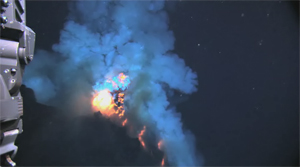
underwater volcano
© NOAA and NSFROV Jason gets a close view of magma explosions and lava flows on West Mata volcano (May 2009).
Scientists funded by NOAA and the National Science Foundation recorded the deepest erupting volcano yet discovered, describing high-definition video of the undersea eruption as "spectacular." Eruption of the West Mata volcano, discovered in May, occurred nearly 4,000 feet below the surface of the Pacific Ocean, in an area bounded by Fiji, Tonga and Samoa.

Imagery includes large molten lava bubbles approximately three feet across bursting into cold seawater, glowing red vents explosively ejecting lava into the sea, and the first-observed advance of lava flows across the deep-ocean seafloor. Sounds of the explosive eruption were recorded by a hydrophone and later matched to the video footage.

"We found a type of lava never before seen erupting from an active volcano, and for the first time observed molten lava flowing across the deep-ocean seafloor," said the mission's Chief Scientist Joseph Resing, a chemical oceanographer at the University of Washington who collaborates with NOAA through the Joint Institute for the Study of the Atmosphere and Ocean. "Though NOAA and partners discovered a much shallower eruption in 2004 in the Mariana Arc, the deeper we get, the closer the eruption is to those that formed most of the oceanic crust."

Meteor

Best of the Web: Eyjafjallokull: The terrible beauty that is a Sign of our Times

Image
© AP
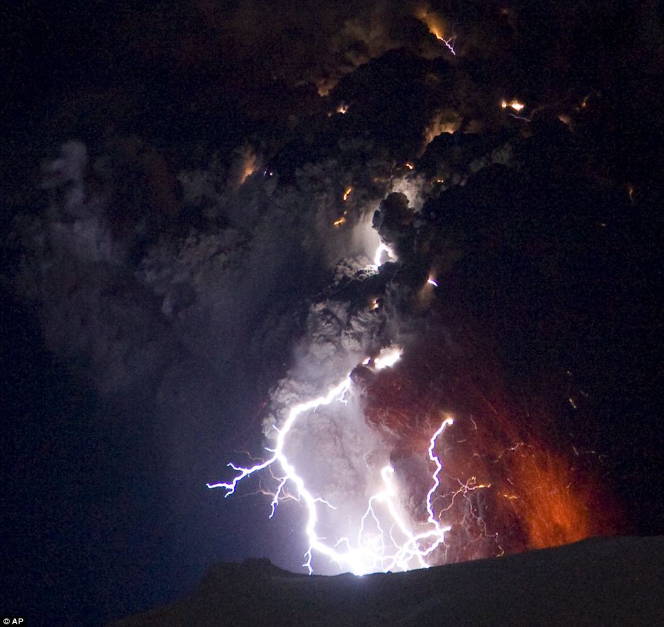
Iceland is known as the land of fire and ice and on the slopes of the Eyjafjallajokull glacier this has never been more true as these pictures show its volcano spewing molten ash into the sky at around 100 metres a second.

This is the dramatic crucible of lava and lightning which has grounded flights across the Atlantic and northern Europe, bring chaos to hundreds of thousands of passengers.

Ripping a half-mile fissure in a field of ice just over four weeks ago, the volcano ejected lava bombs and created forks of lightning, thought to be caused by charge-inducing collisions in volcanic dust. And, as these pictures taken late on Sunday show, it is still wreaking havoc.

As people in Britain and the rest of Europe are caught up with the unprecedented travel chaos caused by the eruption, those in Iceland are living with blankets of ash falling from the sky and fears of volcanic floods.

Almost completely blocking out an otherwise blue sky, the cloud released from the volcano resembles a tornado as it sweeps across the landscape.

On remote farms, animals, houses and nearby mountain ranges have been coated in grey as the wall of fog moves across the sky, creating the impression it is the middle of the night.

Comment: The jury's still out on whether the eruption of Eyjafjallokull merited shutting down European airspace for six days. While Sott.net leans towards this being an hysterical over-reaction from the point of view of air safety, the event itself is another significant marker as we approach catastrophic climate change brought on by the build-up of comet dust in the upper atmosphere. The marked increase in the number of strong earthquakes and volcanism strengthens our theory that the planet's rotation is slowing down, however slightly, weakening the magnetic field and thus literally "opening up" the planet.

Cosmic Climate Change
What we suspect has really been happening, based on our research thus far, is that the upper atmosphere is cooling because it is being loaded with comet dust, which shows up in the form of noctilucent clouds and other upper atmospheric formations. The comet dust is electrically charged which is causing the earth's rotation to slow marginally. The slowing of the rotation is reducing the magnetic field, opening earth to more dangerous cosmic radiation and stimulating more volcanism. The volcanism under the sea is heating the sea water which is heating the lower atmosphere and loading it with moisture. The moisture hits the cooler upper atmosphere and contributes to a deadly mix that inevitably leads to an ice age, preceded for a short period by a rapid increase of greenhouse gases and "hot pockets" in the lower atmosphere, heavy rains, hail, snow, and floods.

Expect this trend to continue but don't believe in "man-made global warming". Whatever warming there has been, it's really a prelude to the way ice ages begin. Let's hope that there aren't any catastrophically large chunks in that stream of comet dust cycling through our solar system.


Binoculars

Incredible Images of Iceland Volcano from Just a Few Kilometers Away

Image
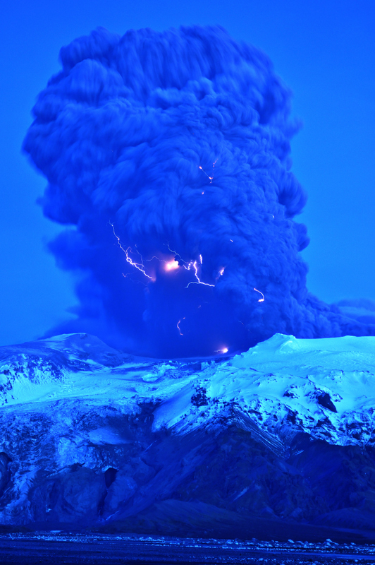
© Snaevarr GudmundssonLightning visible in the plume of the Eyjafjallajokull volcano in Iceland on April 17, 2010.
Astronomer Snaevarr Gudmundsson from Iceland was able to travel to within just a few kilometers from the Eyjafjallajokull volcano, and shared his incredible close-up images with Universe Today. "I stayed near the volcano from about 16:00 hours to 22:00 hours on Saturday and watched its impressive eruption," Gudmundsson said in an email to me. "Amazing event, awesome explosions of 1200 ยฐC hot magma reaching ice and water. I shot more than 550 images during these hours of continuous enjoyment. Sounds ridiculous but its ever changing appearance was never boring."

The massive plume put on an impressive display - from lightning forming within the plume to an incredible amount of spewing ash. On one of following pictures you can see helicopter for size comparison of the plume.

Gudmundsson said he and other photographers were a safe distance from the eruption, but were a few kilometers away. "Nearby was a small river and its prominent sound prevented us from hearing much in the eruption itself except a loud roar from thunders from time to time," he said. "During daylight we even glimpsed some lightning but at dusk (the photo is taken at about 22:00 in the evening) they were easily spotted especially during active periods of explosions."

Bizarro Earth

Volcanic lightning around Eyjafjallajokull eruption

Image
© Harald Edens
It is well known that volcanic eruptions produce strong lightning. Less well known is why? Ordinary lightning in thunderstorms is not fully understood; volcanic lightning is even more of a mystery.

To investigate, a team of researchers from New Mexico Tech has traveled to Iceland to monitor the Eyjafjallajokull volcano--and they have found it crackling with electricity.

"On the evening of April 16th, there were some small eruptions producing ash clouds up to about 6-7 km, with lightning," says photographer Harald Edens. "The sky was nice and clear, so I was able to photograph the bolts from the town of Hvolsvollur using my Nikon D700 and a 80-200/2.8 lens."

Bizarro Earth

A New Kind Of Lightning Discovered

Image
© Bretwood HigmanLightning in the ash cloud atop Mount Redoubt from the March 28 eruption.
When volcano seismologist Stephen McNutt at the University of Alaska Fairbanks's Geophysical Institute saw strange spikes in the seismic data from the Mount Spurr eruption in 1992, he had no idea that his research was about to take an electrifying turn.

"The seismometers were actually picking up lightning strikes," said McNutt. "I knew that I had to reach out to the physicists studying lightning."

With McNutt's curiosity about volcanic lightning sparked, he teamed up with physicist and electrical engineer Ronald Thomas and Sonja Behnke, a graduate student in atmospheric physics at the New Mexico Institute of Mining and Technology in Socorro, N.M. for a unique collaboration in order to learn more about volcanic lighting.

When the Mount Redoubt volcano started making seismic noise in January 2009, McNutt alerted Thomas and Behnke that this would be a great opportunity to capture some new volcanic lightning data. By the time the volcano erupted in March, the team had four Lightning Mapping Arrays set up to monitor the lightning from the eruption.