Volcanoes
S


Fire

Mount Etna in Sicily erupts spewing ash and smoke hundreds of metres into the skies

Mount Etna eruption May 2016
© INGVThe volcano's north-east crater at 13:42pm on Wednesday.
Sicily's Mount Etna is erupting again.

Europe's most active volcano has spent the last 24 hours sending huge plumes of ash and smoke hundreds of metres into the skies above Sicily.

The 3350-metre high volcano began to stir on Tuesday, with emissions from its north-east crater growing in intensity throughout the day.

"On May 17th we witnessed an increase in the amplitude of volcanic tremors and recorded intense degassing accompanied by occasional, weak emissions from the north-eastern crater," explained the Catania branch of Italy's National Vulcanology and Geophysics Institute (INGV).

Vulcanologists are classing the eruption as 'Strombolian' - a category characterized by explosive bursts of activity during which cinder, ash and smoke are ejected from the crater with great force.


Arrow Up

New volcanic eruptions at Turrialba (Costa Rica) and Sakurajima (Japan) on May 12, 2016

Turrialba volcano eruption
© New China TV/YouTube
Just to let you know that the Turrialba and the Sakurajima volcanoes erupted again on May 12, 2016. And the pictures and video below show you how explosive it was. Large blast at Turrialba volcano in Costa Rica.

A large blast was reported at Turrialba volcano, Costa Rica on May 12, 2016 at 07:19am (UTC) sending a column of gas and ash 3 kilometers over the top of the summit.

The eruption lasted between 8 and 11 minutes and ash fall was recorded across the Central Valley, closing the airport tobias bolaños, West of San Jose.

Roads and access to the volcano have been closed and evacuation has been started for villages in a radius of 1,6 km (1 mile) around the volcano.

This single blast was very strong meaning that there was a high pressure in the interior of the volcano. Some more to come?


Bizarro Earth

Mount Sourabaya erupts - first time in 60 years

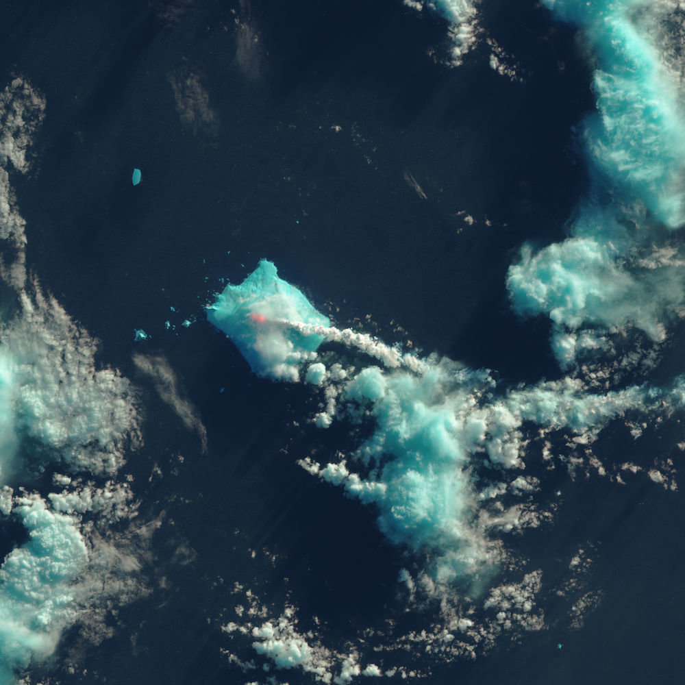
Mount Sourabaya
© NASA Earth Observatory image by Jesse Allen, using Landsat data from the U.S. Geological Survey
Nobody lives near Mount Sourabaya, but a NASA satellite captured its eruption in the South Atlantic in this false-color image.
For the first time in 60 years, Mount Sourabaya erupted with a spectacular show of fiery lava — in fact, it erupted twice. But there wasn't a single human soul who saw the eruptions live; nobody lives on the volcano's remote island in the South Atlantic Ocean, according to NASA Earth Observatory.

Instead, satellites captured images of the eruptions, which happened on April 24 and May 1, 2016, NASA reported.

Volcanic eruptions in far-flung places, such as the South Atlantic, used to go unnoticed. But the advent of satellites and seismic monitoring has given scientists new insight into volcanic events worldwide, NASA officials said.

"Today, scientists can pick up signatures of events occurring far from any human observers," NASA's Earth Observatory said in a statement.

That's exactly what happened when Mount Sourabaya erupted. The volcano sits on Bristol Island, one of the largest islands in the South Sandwich Islands chain. The archipelago is located about 1,725 miles (2,776 kilometers) southeast of Buenos Aires, Argentina, which is about the distance from Los Angeles to Chicago.

Bizarro Earth

North American tectonic plate peeling off

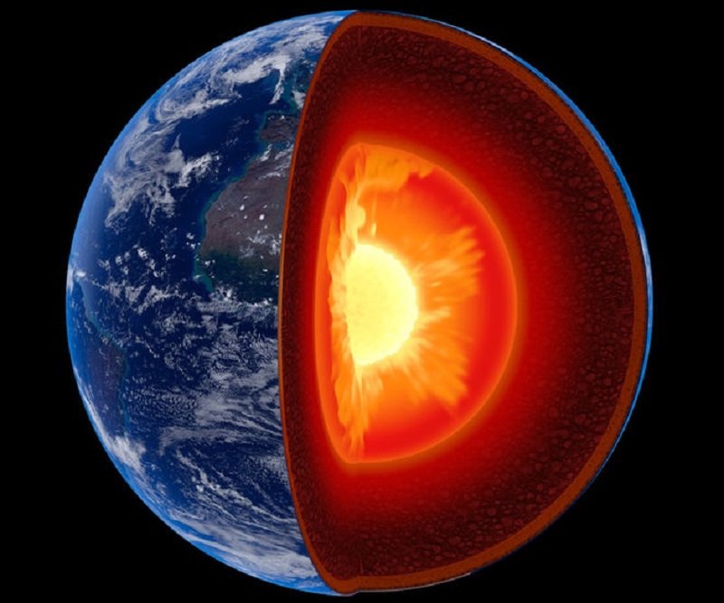
Earth's Mantle
© Johan Swanepoel/ShutterstockScientists suspect that chunks from the bottom of the North American tectonic plate, which is the upper portion of the mantle, are peeling off and sinking. Replacing the resulting void is gooey material from the asthenosphere.
An odd phenomenon may explain why the Southeastern United States has experienced recent earthquakes, even though the region sits snugly in the middle of a tectonic plate and not at the edges, where all the ground-shaking action usually happens.

This seismicity — or relatively frequent earthquakes — may be the result of areas along the bottom of the North American tectonic plate peeling off, the researchers said. And this peeling motion is likely to continue, leading to more earthquakes in the future, like the 2011 magnitude-5.8 temblor that shook the nation's capital.

To figure out the cause of these earthquakes, Berk Biryol, a seismologist at UNC Chapel Hill, and colleagues created 3D images of the uppermost part of Earth's mantle, which is just below the crust and comprises the bottom of a tectonic plate. These tectonic plates scoot around atop a layer of warm, viscous fluid called the asthenosphere.

The resulting X-ray images revealed that the plate's thickness in the southeast United States was uneven, with thick regions of dense, old rock combined with thinner areas composed of younger rocks that were also less dense.

Attention

Nevados de Chillán volcano erupts in Chile

Nevados de Chillán volcano
© SernageominNevados de Chillán volcano
The volcano Nevados de Chillán in Chile has erupted at 5:03 UTC on May 9, 2016.

The explosion sent ash and gas to an altitude 1700 meters above the main crater.


Bizarro Earth

Earthquake swarms a sign Mount St. Helens is recharging

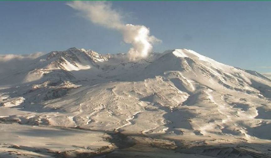
Mount St Helen Live Cam
© www.mountsthelens.comThis live image of Mount St. Helens is from the USFS HD Volcano Cam at Johnston Ridge Observatory on May 8, 2016.
Seattle - Washington state's Mount St. Helens is letting the USGS know it is waking up again. For the past eight weeks, there have been a swarm of over 130 low-magnitude earthquakes.

"At this point, there is absolutely no sign that it will erupt anytime soon, but the data we collect tells us that the volcano is still very much alive," the U.S. Geological Survey said.

The low-magnitude quakes have increased in frequency to about 40 a week, as recorded by the Pacific Northwest Seismic Network (PNSN). The PNSN has a network of 300 seismology stations in Washington and Oregon, working to monitor earthquake and volcanic activity across the Pacific Northwest.

There have been no signs indicating any change in gas emissions, and no signs of magma formation beneath the surface, says the USGS, and more importantly, no signs of an imminent eruption, reports CNN. The agency reminds us that a recharge can continue for many years beneath a volcano without an eruption.

Bizarro Earth

Mt. Ruapehu crater lake recording increased temperatures

Mt Ruapehu
© Getty The crater lake at the top of Mt Ruapehu.
Temperatures have risen to a 16-year high and surface activity has been reported at Mt Ruapehu's crater lake in the central North Island. A tourist flight over the lake on Saturday afternoon reported vigorous steaming of the surface, which was also disturbed by upwelling bubbles.

GNS duty volcanologist Brad Scott said although these signs hadn't been seen in recent years, the same sort of activity had been observed when temperatures rose over 40-42C. Crater lake temperatures have been rising since late 2015 and have now reached 44C, the hottest recorded since the new lake was established post 2000.

A swarm of volcanic earthquakes reported beneath the surface late last month has stopped, although volcanic tremor has increased slightly this week. Volcanic tremor is always present at Ruapehu, although the level varies and doesn't necessarily indicate an upcoming eruption.

GNS Science volcanologists regularly monitor Mt Ruapehu, an active volcano at the southern end of the Taupo Volcanic Zone.

Attention

Mysterious fish die-off at volcanic Lake Toba, Sumatra

Dead fish
© Tribun Medan/ Royandi Hutasoit
Lake Toba is the largest volcanic lake in the world occupying the caldera of a supervolcano on the Island of Sumatra in Indonesia.

Millions of fish were found dead by fishermen between May 3 and May 5, 2016. Officials are unable to find the source of the mass killing but think it is linked to the lack of dissolved oxygen in the water. Could the drop in oxygen content in the north-east of lake Toba be the result of volcanic activity of some kind?

It all started one month ago, when fishermen at Lake Toba started to find dead fish in their nets.

But the mysterious die-offs have suddenly increased beginning of this month, when professional fishermen caught more than 320 tones (May 3, 2016) and then 800 tons (May 5, 2016) of dead fish... In overall about 1500 tones in 3 days! So millions of fish!


Red Flag

Cleveland Volcano in Aleutian Islands under heightened alert after explosion

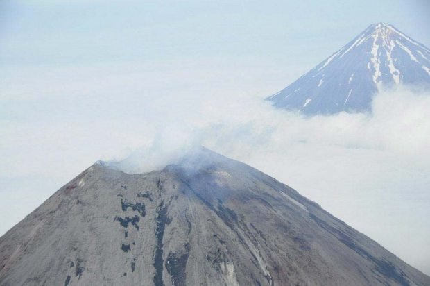
cleveland volcano
© NOAASmoke rises from Cleveland Volcano in the Aleutians on Aug. 8, 2011, in this aerial photo provided by the National Oceanic and Atmospheric Administration. Alaska Volcano Observatory staff raised the volcano's alert level after detecting an explosion Thursday evening.
The Cleveland Volcano in the Aleutian Islands is again under a heightened alert level from the Alaska Volcano Observatory, after researchers there recorded an explosion Thursday evening.

The observatory issued a statement raising the eastern Aleutians volcano's alert level to watch, and its aviation color code to orange, late Thursday.

Researchers said in the statement they detected an explosion at 6:44 p.m. Thursday using both air pressure and seismic data.

"There are no recent satellite views since the detected explosion. However, previous Cleveland explosions have typically produced ash emissions," observatory staff wrote.

Nearly a year ago, scientists recorded a restless period at the volcano on Chuginadak Island, including an explosion -- but no detected ash cloud -- in July.

In March, an eruption at Pavlof Volcano on the Alaska Peninsula sent an ash plume to an altitude of 20,000 feet, coating the nearby village of Nelson Lagoon and disrupting flights across Alaska as the material drifted northeast across Interior Alaska into Canada.

Bizarro Earth

The sabotage and destruction of Egypt's Ptolemaic Kingdom may have been influenced by volcanic eruptions

ptolemaic kingdom nile
© Fine Art Images/Heritage Images/Getty
You won't find it in history textbooks, but the Roman Empire's rise to dominance in Egypt and the Middle East may have been influenced by a series of volcanic eruptions that reduced rainfall.

These eruptions could have contributed to the sabotage and destruction of the Ptolemaic Kingdom on the Nile, paving the way for the rise of Cleopatra and the Roman Empire - and, ultimately, the modern Western world.

The Ptolemaic Kingdom ruled Egypt and North Africa in the final three centuries BC, known as the Hellenistic period. Now, teamwork between volcanologists and historians has revealed a close match in timing between volcanic eruptions and domestic unrest, revolts and uprisings that led to the kingdom's downfall.

"So far, Hellenistic history has never had any climate component," says Joseph Manning, a historian at Yale University. Bringing in the impact of climate shocks on the unfolding of history is important, he says.

"There were revolts and social unrest from 245 BC onwards, down to the mid-first century BC," Manning told the meeting of the European Geosciences Union in Vienna, Austria, last week. "One involved the entire river valley along the Nile for 20 years."

At the heart of the unrest were starvation and famine in the Ptolemaic Kingdom, where grain harvests were critically dependent on annual flooding of fertile plains by the East African monsoon.
Comment: For more in-depth information on how the rise and fall of civilizations are linked to catastrophic earth events and how the human mind and states of collective human experience can influence such cosmic and earthly phenomena, see: