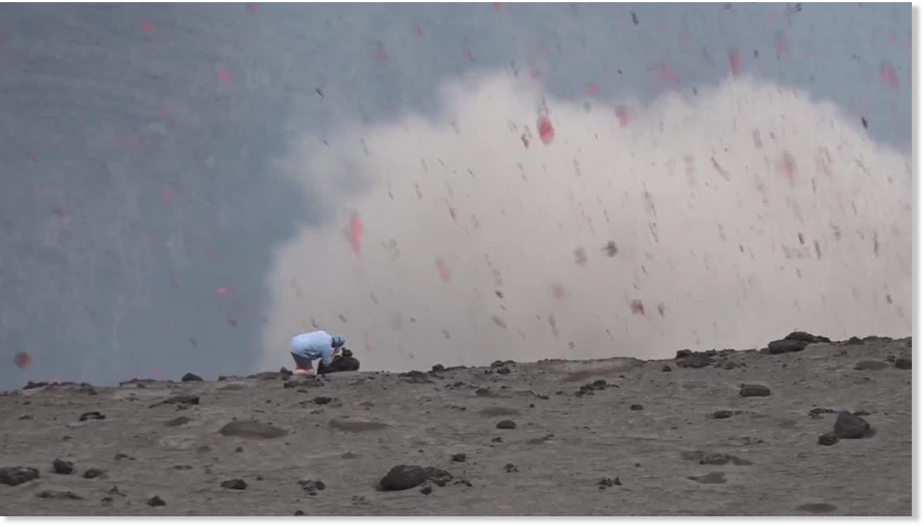
Incredible footage has emerged of a cameraman being nearly blown off the edge of an exploding volcano.
In the short video posted to newsflare.com, Kiwi film maker Geoff Mackley is setting up a camera on the edge of a volcanic crater in Vanuatu when it suddenly erupts.
"While placing a GoPro, ***t happened," Mackley posted on Facebook, along with a still shot of volcanic debris swirling around his hunched-over body.
The moment was captured by the Mackley's friend at Mt Yasur volcano, on Tanna Island, three days ago.
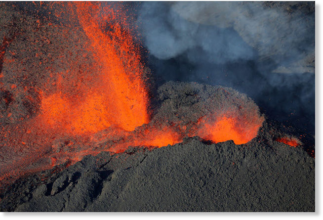
The volcano began erupting early this morning, making it the third eruption this year (after the ones in January and May).
Following an increase of earthquakes over the past days, an intense seismic crisis started 22:20 local time last night - sign of the magma moving towards the surface.
The eruption itself, when the magma reached the surface, began at around 00:50 this morning from a new fissure on the SSW slope of Dolomieu crater near the Chateau Fort cinder cone.
The East African peak looms over a modern city as well as three major sites featuring signs of early humans.
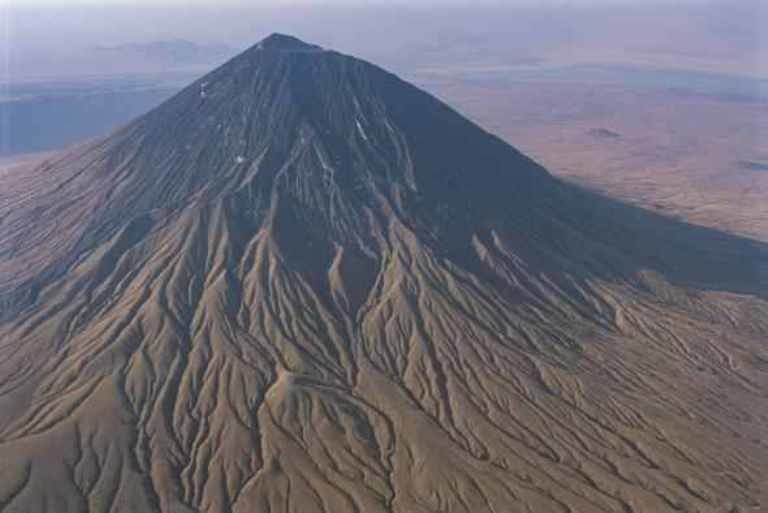
An active volcano in northeastern Tanzania known to the Maasai as the "Mountain of God" has been quietly rumbling—and it is showing signs that an eruption is imminent.
The volcano is some 70 miles from the city of Arusha and is known for its proximity to some of the world's most important paleoanthropological sites. Ol Doinyo Lengai is less than 70 miles from the famed Olduvai Gorge, a collection of 3.6-million-year-old hominin footprints at a site called Laetoli, and a "dance hall" of ancient Homo sapiens footprints at a site called Engare Sero.
Typically, the volcano's activity is confined to its summit. But occasionally, the Mountain of God can roar to life in more dramatic fashion: On September 4, 2007, the volcano belched out a plume of ash that extended at least 11 miles downwind. Lava running down the north and west flanks ignited burn scars that were visible from space.
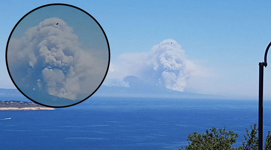
A photo of smoke billowing from Mount Vesuvius shows what appears to be a ghoulish face looming above southern Italy's famous volcano. The disturbing image was taken as wildfires force evacuations from surrounding areas.
"After millennia the monster of Vesuvius came out," Rosario Scotto Di Minico posted on Facebook along with the image, which shows a menacing face emerging from the pattern of smoke.
Speaking to RT.com he said the nightmarish image was captured on camera phone by Albarosa Scotto di Minico.
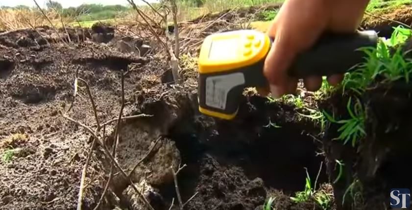
Residents in a sleepy Mexican town fear that a new volcano is bubbling under the ground after an eruption of gas and smoke emerged from a field, local media has reported.
According to reports, cracks have appeared on the ground in Pueblo Viejo in the southern state of Michoacan, with temperatures of some 250 deg C registered in the subsoil.
Local residents gathered at the site with preliminary investigations revealing that the cause of the eruption was geothermal activity from an underground swamp.
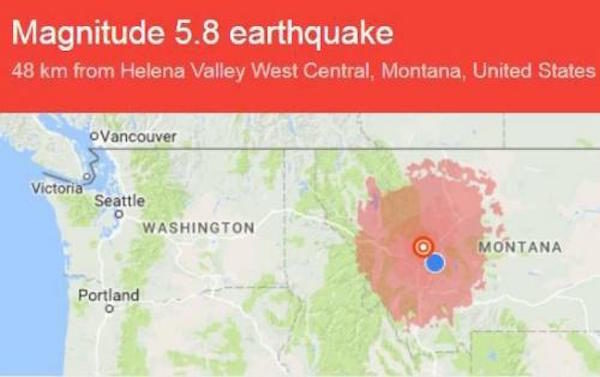
Following a swarm of over 1100 earthquakes recorded in the Yellowstone caldera over the past month, prompting scientists to voice concerns about a dormant Yellowstone "Supervolcano" slowly waking up, overnight these concerns escalated after a strong M5.8 earthquake hit western Montana early on Thursday morning - the strongest quake to hit the area in the past 20 years - the U.S. Geological Survey reported, with Reuters adding that the tremor was felt hundreds of miles away, from Missoula to Billings and some surrounding states.
The quake appears to be the largest to hit Montana since a slightly weaker M5.6 struck outside of Dillon a dozen years ago. By comparison, the state's largest quake which struck the West Yellowstone region 58-years ago was 7.2 magnitude.
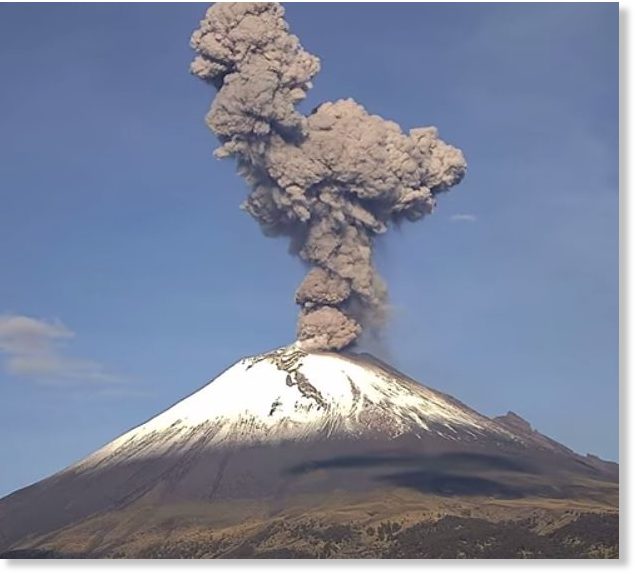
Mexico's Popocetepetl volcano erupted early Sunday (2 July) morning, sending a column of smoke and ash soaring into the sky, the National Disaster Prevention Center announced. Officials said there were 136 low-intensity exhalations from the volcano recorded.
Ash fallout was reported in several towns in Mexico State, including Ozumba, Amecameca, Tlalmanalco, Chalco, Ayapango, Tenango del Aire and San Pedro Nexapa, El Sol de Mexico reported. Luis Felipe Puente, the national coordinator of Civil Protection, said the eruption had sent a column 2 kilometres (1.2miles) into the sky.
The volcano's opening was glowing at night as it erupted, El Sol de Mexico reported.
During the day, the volcano continued to erupt, sending smoke and ash in a northeastern direction. Three eruptions were recorded with a moderate amount of ash pushed northeast of the volcano. According to El Universal, Puente also shared recommendations in light of ash fallout from the eruption.
A rescue helicopter has crashed as it went to help evacuate residents near an active volcano in Indonesia.
All eight people on board were killed and at least 10 on the ground were injured when the Sileri Crater at Dieng Plateau spewed cold lava, mud and ash as high as 164 feet into the sky when it erupted on Sunday.
The aircraft went down about three minutes before arriving at the popular tourist area.
It reportedly hit a cliff on Butak Mountain in the Temanggung district of Central Java province.
Brigadier General Ivan Tito, director of operation and training at the search agency, said the victims were four navy officers and four rescuers.
He said the Indonesian-made Dauphin AS365 helicopter was airworthy.
The sudden eruption occurred while about 17 visitors were around the crater.
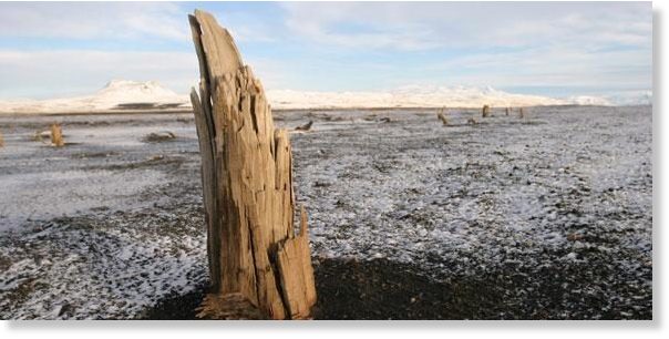
An international group of researchers has dated a large volcanic eruption in Iceland to within a few months. The eruption, which is the oldest volcanic eruption to be precisely dated at high northern latitudes, occurred shortly before the first permanent human settlements were established, when parts of the now mostly treeless island were still covered with forest.
The team, which included volcanologists, climatologists, geographers and historians among others, used a combination of scientific and historical evidence to pinpoint the eruption date of the Katla volcano between late 822 CE and early 823 CE, decades before the earliest settlers arrived. Their results are reported in the journal Geology.
In a similar way to how fossils can be used to understand the development and evolution of life on Earth, different types of environmental evidence can be used to understand what the Earth's climate was like in the past and why. The 'fingerprints' contained in tree rings and ice cores help scientists to estimate past climatic conditions and extend our understanding of the interaction between humans and the environment hundreds and thousands of years back in time.
Sadie Whitelocks Daily Mail Thu, 29 Jun 2017 17:48 UTC
For more than a month an underwater volcano in the Pacific Ocean spewed ash and magma to the surface, and high into the air. This build-up created a new island, just off the coast of Tonga, in a region known as the Ring of Fire
These newly-formed islands emerging from plumes of smoke and bubbling magma reveal how the earth's surface is constantly changing.
Over the past decade, several significant land masses have been confirmed, most recently a sandbar off the coast of North Carolina nicknamed Shelly Island.
Scroll down for some of the newest places making their marks on the map, with many more set to be discovered...
Comment: See also: Mount Vesuvius volcano engulfed in smoke as wildfires rage along its slopes in southern Italy