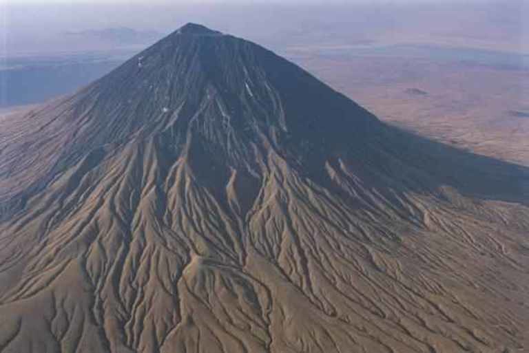
An active volcano in northeastern Tanzania known to the Maasai as the "Mountain of God" has been quietly rumbling—and it is showing signs that an eruption is imminent.
Known as Ol Doinyo Lengai, the 7,650-foot-tall peak is the only known active volcano that belches out lava rich with a type of rock called carbonatite. This thin, silvery lava can flow faster than a person can run. (Read more about the volcano from our January 2003 issue.)
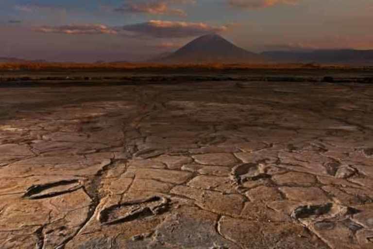
The volcano is some 70 miles from the city of Arusha and is known for its proximity to some of the world's most important paleoanthropological sites. Ol Doinyo Lengai is less than 70 miles from the famed Olduvai Gorge, a collection of 3.6-million-year-old hominin footprints at a site called Laetoli, and a "dance hall" of ancient Homo sapiens footprints at a site called Engare Sero.
Typically, the volcano's activity is confined to its summit. But occasionally, the Mountain of God can roar to life in more dramatic fashion: On September 4, 2007, the volcano belched out a plume of ash that extended at least 11 miles downwind. Lava running down the north and west flanks ignited burn scars that were visible from space.
D. Sarah Stamps, a geophysicist at Virginia Tech, has been partnering with local academics to try and predict the next major eruption. In June 2016, she and her colleagues installed five positioning sensors around Ol Doinyo Lengai in the hopes of tracking how magma's underground churn is deforming the volcano's surface.
In concert with Tanzania's Ardhi University and South Korea's KIGAM, Stamps has set up a monitoring system that collects data on the volcano's activity in real time.
On January 17, 2017, Stamps saw a shudder in the data streaming from one monitoring station—a sign that, far from merely rumbling, parts of the volcano were lifting upward.
"Several subsequent signals were also seen in real-time with additional on-the-ground observations by our local technician," Stamps says. "These signals prompted rapid responses by our team to install three new real-time stations"—a project funded by the National Geographic Society. (Since 2012, the National Geographic Society has committed more than $400,000 to researching volcanoes. Find out more.)
Based on the data they are seeing, Stamps and her colleagues warn that an eruption seems to be on the horizon.
"Imminent in our case means in one second, in a few weeks, a couple of months, or a year or more," she says in an email.
"There are increased ash emissions, earthquakes, uplift at small volcanic cones, and an ever widening crack at the top of the volcano on the west side," she adds. "These are all signs of volcanic deformation that will likely lead to an eruption sooner rather than later."
Debris Dangers
Stamps notes that an eruption alone likely would not affect many of the nearby paleoanthropological sites, an opinion shared by Cynthia Liutkus-Pierce, an Appalachian State University geologist and National Geographic grantee who recently led an analysis of the Engare Sero footprints.

However, if a large eruption and a heavy rainy season were to coincide, the resulting debris flows could potentially harm Engare Sero and nearby sites, Liutkus-Pierce says.
"Historically, Lengai is capable of large debris flows and debris avalanches that reach the shore of Lake Natron, and these could potentially pose a significant threat to the site and to all of the camps that are here along the lake edge," she says.
"I think that would be my biggest concern for this area—the potential for a debris flow or debris avalanche."
As it happens, the Engare Sero footprints exist only because a similar scenario occurred between 5,000 and 19,000 years ago.
At that time, an influx of volcanic mud—washed off of Ol Doinyo Lengai's flanks by rainfall—created vast mudflats on the shoreline of Lake Natron that ancient humans trod across within hours to days of the event. A second surge of material then filled in the dried footprints, preserving them.
Liutkus-Pierce notes that even in a worst-case scenario, Engare Sero's "dance hall" is staying alive. Her research team has photographed the footprints in high resolution and could re-create them—and even print them out—in 3D as needed.
"In that way," she says, "we have essentially preserved the site in case of a natural disaster."


Reader Comments
to our Newsletter