Volcanoes
S


Attention

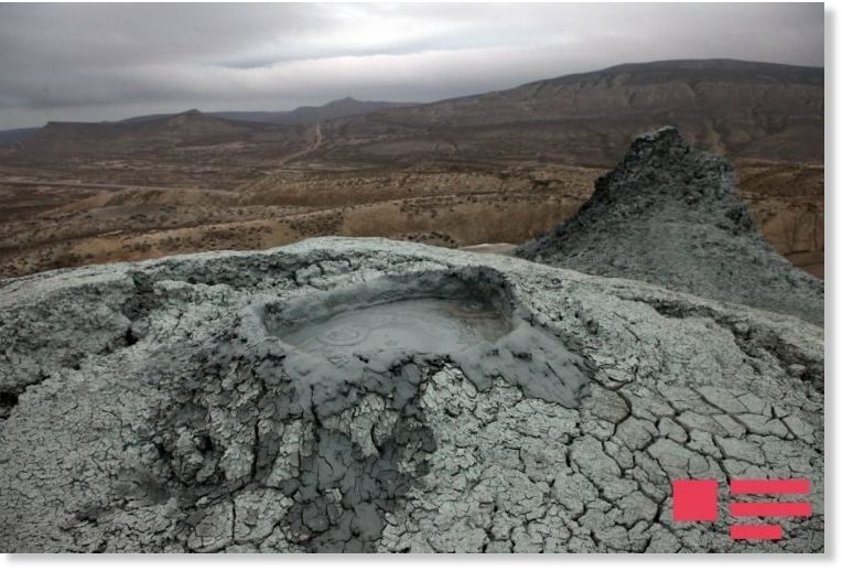
Keyraki mud volcano erupts in Azerbaijan

The Keyraki mud volcano
The Keyraki mud volcano erupted around 07:00am local time.

According to the press service of the Ministry of Ecology and Natural Resources, the eruption lasted for 15 minutes and the mud covered an area of 3.5ha.

The depth of the erupted mud layer reached 3 meters within the crater and 0.2 to 0.3 meter around the crater.

The Keyraki mud volcano is situated 12km north of Baku. The eruption caused no damage to the nearby residential areas. However, there are several active mud volcanoes in the area and thus further eruptions cannot be ruled out.

Experts of the Ministry of Ecology and Natural Resources are studying the consequences of the eruption.

The Keyraki mud volcano has erupted 18 times so far. Last time it had erupted in 2014.

Attention

Three volcanoes are restless on the Alaska Peninsula

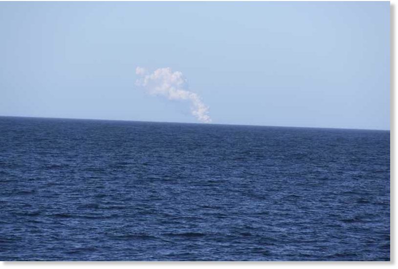
A volcanic plume from Bogoslof on June 5, 2017
© US Fish & Wildlife ServiceA volcanic plume from Bogoslof on June 5, 2017
Bogoslof volcano has a new lava dome. Cleveland volcano continues to put up ash and extrude lava, and the alert level for Pavlof volcano was raised to "advisory."

Over the last week there has been quite a bit of volcanic activity along the Alaska Peninsula. The Bogoslof, Cleveland, and Pavlof volcanoes are all showing signs of unrest. Most recently, the Bogoslof volcano erupted briefly Wednesday around 9:30 p.m.

"Bogoslof has been continuing its eruptive activity that started in December 2016 with a series of small activities," says Jessica Larsen, a geologist with the Alaska Volcano Observatory. "Now we have new evidence that there's a lava dome growing at the Bogoslof Island."

A lava dome is a mound of lava that has been extruded from the volcano. This is characteristic of previous Bogoslof explosive periods.

Attention

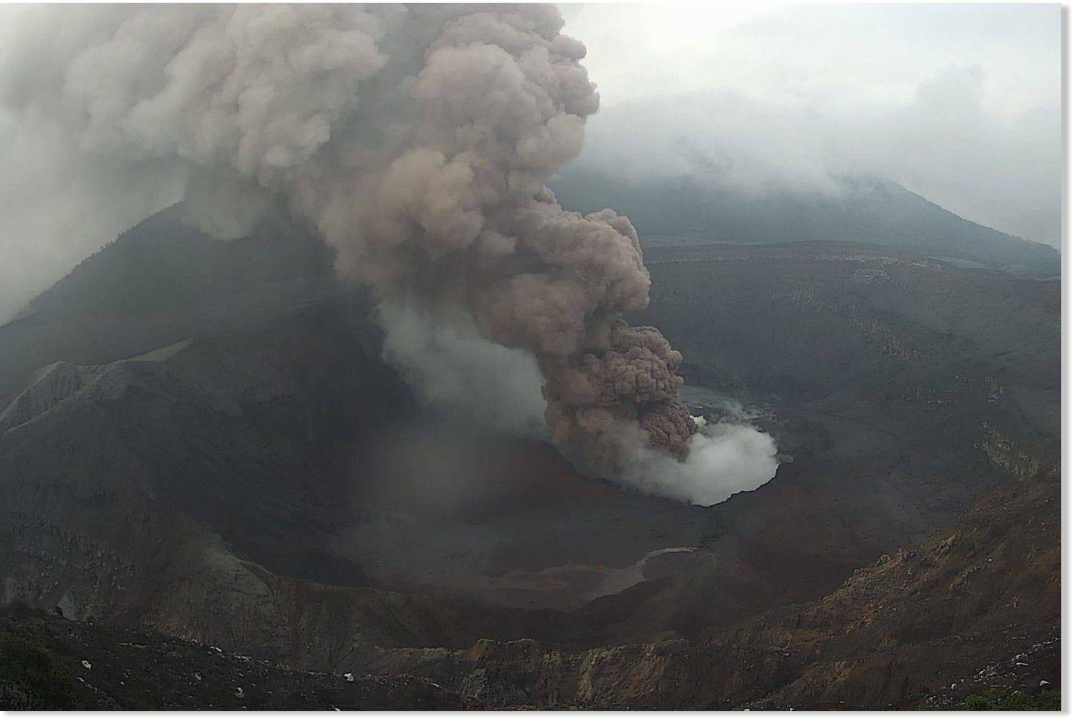
New eruption at Poas Volcano in Costa Rica

June 2 Poas Volcano activity.
© National Seismology networkJune 2 Poas Volcano activity.
The National University's Volcanology and Seismology Research Institute (OVSICORI) reported an eruption that reached 1,000 meters above the crater, 3,708 meters above sea level (12.162,24 ft.), began at 8:50 a.m. local time this Tuesday and was still in progress at 10:05 a.m.

This past Friday, June 2 the Poás Volcano registered constant activity with small size eruptions and redcolumns of gases and ash, on Saturday some activity continued but Sunday and Monday there were no new eruptions although there was an intense column of steam and gases emanating from the crater.

Attention

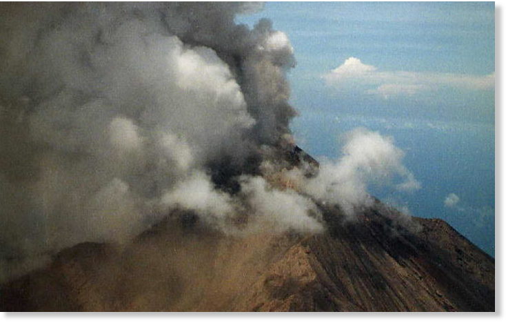
Marapi volcano erupts in West Sumatra, Indonesia

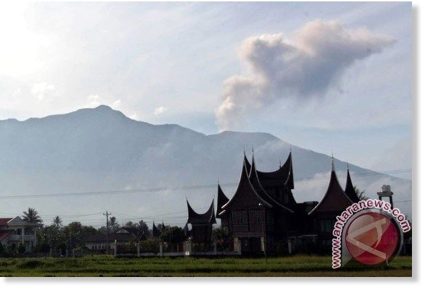
Marapi volcano in West Sumatra
Marapi volcano in West Sumatra, Indonesia erupted on June 4, spewing clouds of volcanic ash over the region of Tanah Datar in Sumatran province.

According to the Volcanology and Geological Disaster Mitigation Centre (PVMBG), Marapi volcano erupted twice at 10:01 am and 10:22 am (local time).

The first eruption generated a 300-metre high plume of smoke from the peak, while the second one spewed ash much higher at around 700 metres from the mountain top.


The PVMBG set up an exclusion zone with the three-kilometer radius from the mountain summit, and called local residents to abide by instructions as well as notices of the centre.

Attention

Mount Bulusan in the Philippines spews ash

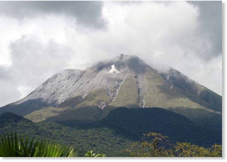
Mt. Bulusan
Mt. Bulusan
Restive Mt. Bulusan in Sorsogon spewed ash last Monday evening, generating sulfuric odor and rumbling sound, according to the Philippine Institute of Volcanology and Seismology (Phivolcs).

Based on Phivolcs' seismic record, the minor phreatic eruption, which was observed at 10:29 p.m., lasted for approximately 12 minutes.

Phivolcs explained that phreatic eruption is driven by steam produced by heat and expansion of ground water due to an underlying hot source.

The eruption last Monday could not be observed visually due to thick clouds covering the summit, but traces of ash, sulfuric odor and rumbling sound were reported in Barangays Monbon and Cogon in Irosin.

Meanwhile, sulfuric odor was observed at Barangay Bolos, also in Irosin.

In the past 24 hours, Mt. Bulusan generated three volcanic earthquakes.

Attention

Sakurajima volcano erupts in southwestern Japan

Sakurajima volcano erupting
© James ReynoldsSakurajima volcano erupting
Mount Sakurajima, a volcano in Kagoshima Prefecture in southwestern Japan, erupted on Tuesday morning, the weather agency in Tokyo said.

According to the agency, the eruption occurred at 7:56 a.m. local time and marked the second significant event there in recent weeks.

Ash and smoke was recorded as billowing as high as 3,200 meters into the sky
, the weather agency said, and was ejected from the 1,117-meter volcano's Showa crater.

The agency warned that similar eruptions could occur, although there have been no immediate reports of injury or damage as a result of the latest eruption.


Attention

Mt. Marapi erupts 3 times within an hour in West Sumatra, Indonesia

Marapi Mountain in West Sumatra
© ANTARA/Arif PribadiMarapi Mountain in West Sumatra
Marapi Mount in West Sumatra erupted again today (4/6). Until this afternoon, the mountain situated in Agam Regency has erupted three times.

Bukittinggi Volcanology and Geological Disaster Mitigation Agency (PVMBG) observer Bujang said that the first eruption occurred at 10:10 in the morning by spewing 300-400 meters high of volcanic ashes. "It was followed by the next eruption at 10:22 in the morning with 600 to 700 meters high of volcanic ashes," Bujang added on Sunday (4/6).

The third eruption took place at 10.46 with volcanic ashes up to 400 meters. Bujang explained that the biggest eruption was the second taking place at 10:22 AM. He added that seismic reading was detected during the eruption. The amplitude of the seismic waves was 6 milimiters with 22 to 35 seconds of earthquake duration.

The status of hazard of Marapi was issued from Agustus 2011 through PVMBG recommendation letter number 1385/45/BGL.V/2011 on 3 August 2011 on the increase of Gunung Marapi status from (level I) to alert (level II). Until now, the status has not been revoked.

Bizarro Earth

Evacuated Manam Islanders facing food shortages after April eruption

manam volcano eruption
Manam Volcano
Over 800 people evacuated from the volcanic island of Manam are facing food shortages on Papua New Guinea's mainland. The islanders were evacuated after the eruption alert level for the Manam volcano was raised to stage three in late April.

According to the newspaper The National, the islanders have been at the Potsdam Care Centre in Madang for almost a month. Manam leader Paul Maburau said the Madang provincial disaster office gave each family a bail of rice, 5kg of flour and two litres of oil when they first arrived.

He said they had now run out of food and couldn't find any way of obtaining more. Mr Maburau said people at the care centre were also getting sick and the nearest health centre did not have any medical supplies. Citing a lack of communication with the Madang government, he said the islanders were confused about whether they would be going back to the island or not.

Bizarro Earth

An earthquake in the Arctic Circle?

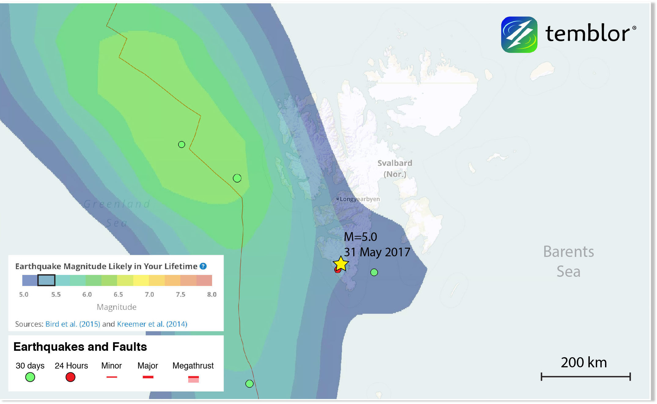
Global Earthquake Activity Rate (GEAR) model for Svalbard
This Temblor map shows the Global Earthquake Activity Rate (GEAR) model for Svalbard in the Arctic Circle. This map shows that today’s M=5.0 earthquake (magnitude from the USGS) should not be considered surprising and that the region could experience larger quakes.
At 3:59 p.m. local time, a M=5.0 earthquake shook the island of Spitsbergen, the largest island in the Svalbard archipelago in the Arctic Circle. According to the USGS, the quake occurred at a depth of 7.7 km, and was centered 133 km from Longyearbyen, the archipelago's largest settlement, which is home to a little over 2,000 people. This M=5.0 quake was preceded several hours earlier by a M=3.0. While very few people likely felt this earthquake, it highlights a lesser-known area, and the idea that seemingly inactive faults can rupture in earthquakes.

The Svalbard archipelago represents an uplifted portion of the Barents Sea, which separates Svalbard from Northern Europe. To the west of the archipelago is the Mid-Atlantic Ridge, and the Spitsbergen Fracture Zone, a divergent plate boundary between the North American and Eurasian plates. Much of the seismicity in this part of the Arctic Ocean occurs on or near the Mid-Atlantic Ridge, which has a spreading rate of approximately 2.5 cm/yr (1 inch). However, by examining the historical seismicity of the island of Spitsbergen and the rest of Svalbard, it is clear that this remote archipelago is no stranger to earthquakes.

Attention

Volcanism in the Mini Ice Age, which next eruption will drop Earth's temperate?

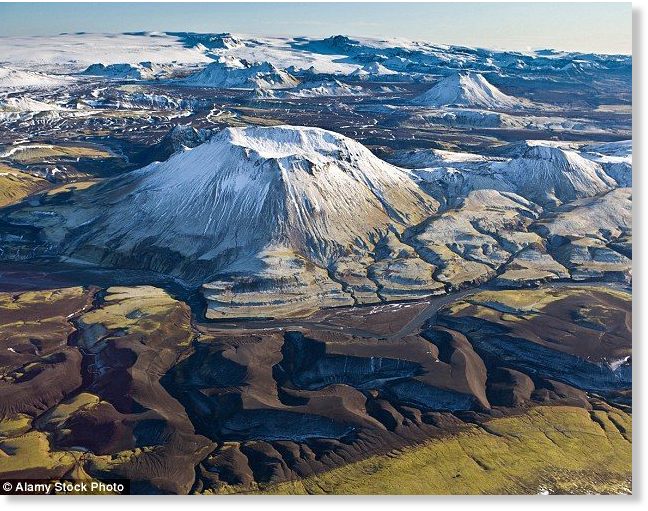
 Katla volcano
Katla volcano, Iceland
All of Iceland's major volcanoes showing unusually high levels of activity which is to be expected as in each mini ice age / grand solar minimum there is one major eruption that cools Earth's climate. We are entering another GSM as we speak so I ask you which of these nine explosive volcanoes will erupt during the 2017-2035 Mini Ice Age?


Sources

Comment: See also this more recent report: Another earthquake registered around Bardarbunga volcano in Iceland