Volcanoes
S


Cloud Lightning

SOTT Focus: SOTT Earth Changes Summary - April 2017: Extreme Weather, Planetary Upheaval, Meteor Fireballs

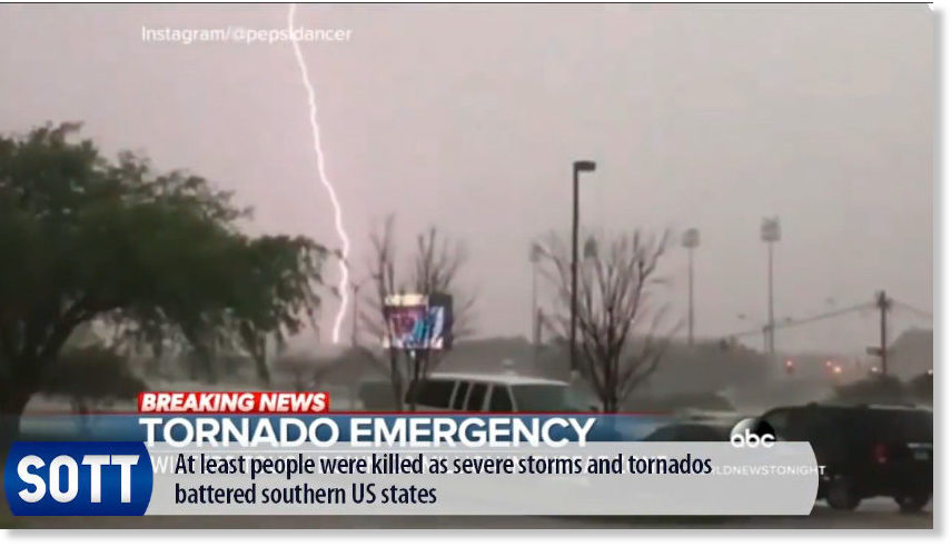
lightning hits Texas tornado
Planetary environmental chaos continued unabated this April.

After Peru was inundated in March, Columbia was next in line for massive rainfall and flooding which provoked deadly landslides in the city of Mocoa. Major flooding and landslides also hit India, Indonesia, the USA and China, while

Wildfires once again struck the US state of Florida while very late snow saw many European nations blanketed, with many crops destroyed.

Meteor/fireballs were also spotted from one end of the planet to the other and a comet made a special appearance.


Or watch on Sott.net's Vimeo Channel


Bizarro Earth

Strong 6.4 magnitude earthquake strikes near Tanaga Volcano, Alaska

Tanaga Earthquake
© USGS
The United States Geological Survey reports a preliminary magnitude 6.4 earthquake struck near Tanaga Volcano, Alaska on Monday.

The quake hit at 7:00 AM local time at a depth of 10 kilometers.

There was no initial word on damage or injury resulting from the quake. More information on this earthquake is available on the USGS event page.

See the latest USGS quake alerts, report feeling earthquake activity and tour interactive fault maps in the earthquake section.

Arrow Up

Guatemala's Fuego volcano erupts belching ash up to 37,000 feet

Fuego volcano eruption
© AFP PHOTO / JOHAN ORDONEZ / MANILA BULLETINThe Fuego volcano is seen from Alotenango municipality, Sacatepequez department, about 30 km southwest of Guatemala City, as it erupts on May 5, 2017.
Guatemala's Fuego volcano belched black ash high into the sky at dawn on Friday, May 5th, with authorities placing local authorities from nearby villages on high alert.

Guatemala's volcanic monitor, Insivumeh, said in a statement that thick columns of ash reached between 34,000 feet and 37,000 feet above sea level, amid loud explosions and extended new lava flows.

According to Insivumeh's statement, ash was swept more than 12 miles towards the south, southwest and west and fell in the areas of San Pedro Yepocapa, Sangre de Cristo, Panimache I and II.

Local media reported that the National Coordinator for Disaster Reduction (Conred) has not yet reported damages after the explosion, which is the fourth so far this year.

The volcano is located about 30 miles southwest of the Guatemalan capital.

Attention

Alert raised after Kick 'em Jenny volcano erupts: More than 40 tremors recorded

Kick ’em Jenny
Underwater volcano Kick ’em Jenny
The University of the West Indies (UWI) Seismic Research Centre (SRC) is monitoring increased activity at underwater volcano Kick 'em Jenny following scores of eruption over the past few days, but it says there's no tsunami threat so far.

The Trinidad-based SRC said the first eruption at the region's only submarine volcano - which is located about five miles north of Grenada - occurred on Saturday around 5:45 pm, with reports of it being felt in St Patrick's, Grenada.

In its update yesterday, Grenada's National Disaster Management Agency (NaDMA) said at least 43 "mostly low magnitudes volcanic earthquakes" - in the magnitude range of 1.5 to 2.3 - had occurred between that first tremor and 10:41 a.m. yesterday. There were a few larger events with the largest at magnitude 3.0.

Info

Mythical sounding stories aren't always just flights of fancy - True story of volcanic eruption told by Aboriginals for 7,000 years

Volcano Eruption
© RossiroBinnice/Shutterstock
We're all storytellers at heart, but we often prefer the more mythical and legendary tales of times long gone than ones of real scientific discovery. However, on occasion, some ancient stories turn out to be grounded almost entirely in fact, not fiction.

Take this story that's been passed down through more than 230 generations of Gugu Badhun Aboriginal people, for example.

Once upon a time, a huge explosion rocked the land and a massive crater appeared in the ground. A malicious dust filled the air, and when people wandered into it, they disappeared forever. The air was so hot that along the waterfronts, the ground appeared to be on fire.

This story was first definitively documented in the 1970s, when a recording was made of an Aboriginal elder talking about it. At the time, it was considered to be nothing more than a work of someone's imagination.

As it so happens, a brand new study has just confirmed that this 7,000-year-old epic has likely been true all along, and it probably won't surprise you that it was based on a volcanic eruption.

Comment:

Indigenous peoples around the world tell myths which contain warning signs for natural disasters - Scientists are now listening


Bizarro Earth

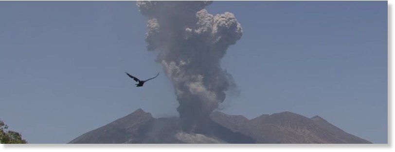
Strong eruption at Sakurajima volcano, ash to 4.3 km (14,000 feet)

sakurajima
© Kyodo News AgencySakurajima eruption on April 28, 2017.
A powerful explosive eruption occurred at the Showa crater of Sakurajima volcano in Kagoshima Prefecture, southwestern Japan at 02:01 UTC on April 28, 2017 (11:01 JST). Several smaller eruptions followed.

The Japan Meteorological Agency said it is the first such eruption this year and the first of such strength since July 2016.

According to the Tokyo VAAC, the volcanic ash cloud produced by the eruption at 02:01 UTC reached an altitude of 4.3 km (14 000 feet) above sea level and drifted southeast. JMA warned similar explosive eruptions might occur in the future.

JMA maintains Level 3 (orange alert), signifying the volcano is active and should not be approached.

Better Earth

New map shows the world hidden beneath your feet

Mount Saint Helens
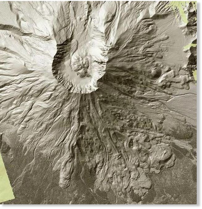
© Sailor, Craig - Tacoma Department of Natural ResourcesMount Saint Helens can be seen in this screen grab from the Washington State Department of Natural Resources’ Lidar map. The 1980 eruption blew out the northern side, top, of the volcano, while the southern side shows volcanic flows from ancient eruptions.
Puget Sound is grooved like an old record. That's one of the Earth's secrets that can be found on a new interactive map produced by the state.

Using Lidar technology, the Washington State Department of Natural Resources has mapped a good third of the state revealing the smallest of details hidden beneath trees, buildings and other obstructions.

The grooves, carved by ancient glaciers, can be seen from Whidbey Island to south of Olympia. Tacoma is etched with a series of subtle pattern of north-south lines. The grooves become most prominent around Lake Tapps.

Toggling between "Bare Earth" and "Top Surface" is the best way to view the map.

Ice Cube

A new glacier grows at Mount St. Helens

mt st helens crater
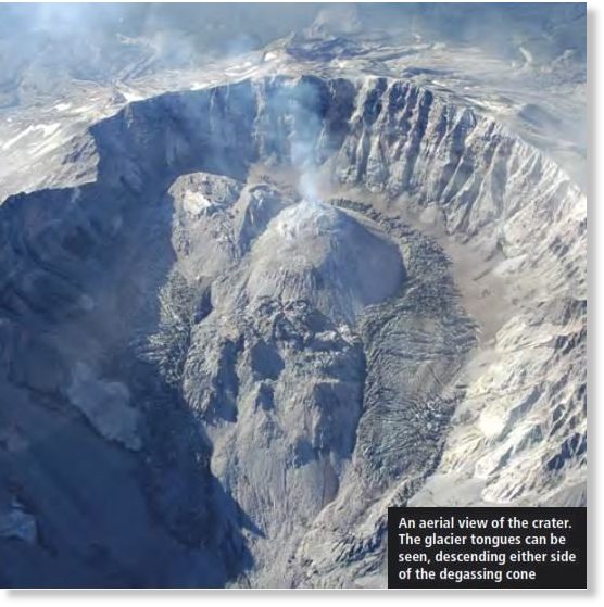
© Geography ReviewAn aerial view of the crater
"I grew up in the Yakima Valley (near Mount St. Helens). I was out fishing when I saw the lightning and dark cloud," Flickr user vmf-214, who captured the eruption of Mount St. Helens in 1980, told GlacierHub. "It looked like a storm. I saw it as I pulled into the yard. Mom came out and said the mountain had blown."

He was describing the volcanic eruption that occurred at Mount St. Helens 37 years ago in May 1980. During that event, an eruption column rose into the sky, ultimately impacting 11 states in the U.S. But it wasn't just the people who live in the area that were affected by the eruption: the glaciers of Mount St. Helens melted into nearby rivers, causing several mudslides.

Cascades Volcano Observatory indicates that before the 1980 eruption, extensive glaciers had covered Mount St. Helens for several hundred thousand years. About 3,900 years ago, Mount St. Helens began to grow to its pre-eruption elevation and a high cone developed, allowing for substantial glacial formation. There were 11 major glaciers and several unnamed glaciers by May 18, 1980, according to the United States Geological Survey. But after the eruption and resultant landslide, about 70 percent of the glacier mass was removed from the mountainside. It was during the winter of 1980 to 1981, following the catastrophic eruption, that a new glacier, Crater Glacier, first emerged.

Additional images

Arrow Down

The 'March to Silence' - Shots fired at building housing leading climate skeptic scientists

NSSTC
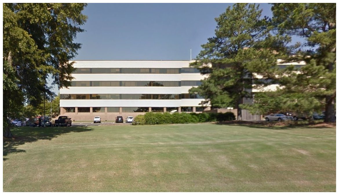
© Image via Google Maps Street ViewNational Space Science and Technology Center (NSSTC) building.
A total of seven shots were fired into our National Space Science and Technology Center (NSSTC) building here at UAH over the weekend.

All bullets hit the 4th floor, which is where John Christy's office is (my office is in another part of the building).

Given that this was Earth Day weekend, with a March for Science passing right past our building on Saturday afternoon, I think this is more than coincidence. When some people cannot argue facts, they resort to violence to get their way. It doesn't matter that we don't "deny global warming"; the fact we disagree with its seriousness and the level of human involvement in warming is enough to send some radicals into a tizzy.

Our street is fairly quiet, so I doubt the shots were fired during Saturday's march here. It was probably late night Saturday or Sunday for the shooter to have a chance of being unnoticed.

Maybe the "March For Science" should have been called the "March To Silence".

Campus and city police say they believe the shots were fired from a passing car, based upon the angle of entry into one of the offices. Shell casings were recovered outside. The closest distance a passing car would have been is 70 yards away.

This is a developing story. I have no other details.

Attention

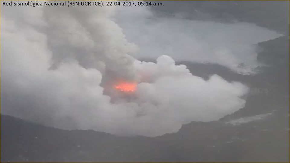
Eruptions continues at Poas volcano in Costa Rica, 48 hours of continuous activity

April eruption at Poas
Poás Volcano, Costa Rica, photo from April 21.
48 hours of continuous eruptive activity at Poás Volcano were marked this Saturday at 10:12 p.m. with a strong explosion that was captured by the cameras of the National Seismology Network, this explosion only lasted one minute and threw rocks at high temperatures in the areas close to the crater: