Volcanoes
S


Attention

Kilauea Volcano's lava lake rises 54 feet to near crater rim in Hawaii

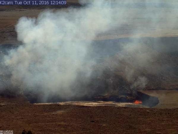
An image from the rim of Halema‘uma‘u Crater on Tuesday.
© USGS Hawaiian Volcano ObservatoryAn image from the rim of Halema‘uma‘u Crater on Tuesday.
Kilauea Volcano's summit lava lake rose to within 54 feet of the crater rim Tuesday under the watchful eyes of the USGS Hawaiian Volcano Observatory.

The lake level is reminiscent of spring 2015, when the lake eventually overflowed onto the floor of Halema'uma'u Crater, covering 28 acres in fresh lava.

"We haven't had an overflow since then," said HVO Scientist in Charge Tina Neal.

If there's a big rockfall from the side of the crater into the lake, and if winds happen to be coming from the south at that time, some ash could fall on visitors. But that shouldn't be terribly troubling, except to those with significant pre-existing respiratory problems, Neal said.

Why is this happening?

It's unclear why the lake is rising so much, Neal said.

"Over the long-term history of the lake, it's unusual — the only other time it got this high, it overflowed," she said.

What will happen at Pu'u 'O'o?

"If the lake is high, typically we've seen a variety of behaviors down at Pu'u 'O'o," Neal said.
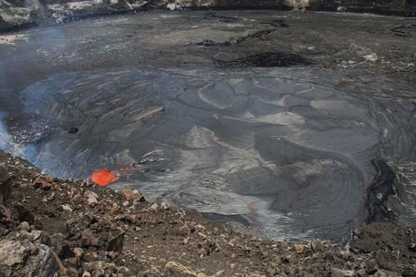
This photo captured from the rim of Halemaʻumaʻu Crater at the end of April 2015 shows the lava lake in the completely filled Overlook crater atop Kilauea Volcano. The lava lake is rising again.
© USGS Hawaiian Volcano ObservatoryThis photo captured from the rim of Halemaʻumaʻu Crater at the end of April 2015 shows the lava lake in the completely filled Overlook crater atop Kilauea Volcano. The lava lake is rising again.

Cloud Grey

Japanese volcano dramatically erupts, spewing ash on surrounding countryside

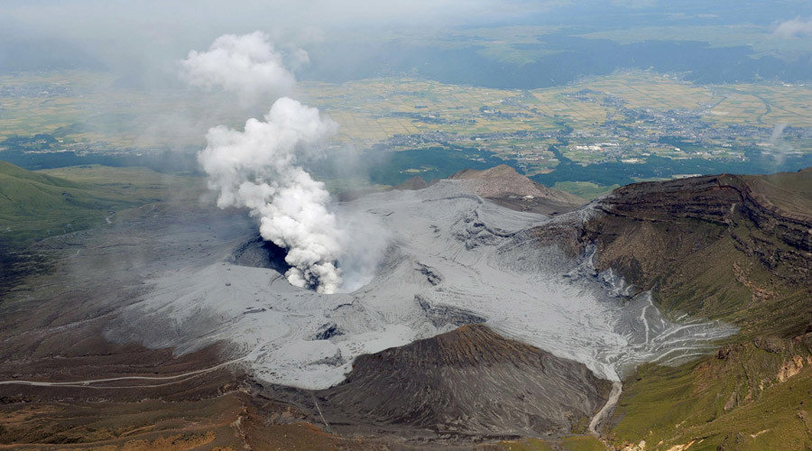
An aerial view shows volcanic ash around the eruptive crater of Mount Aso in Aso, Kumamoto prefecture, southwestern Japan
© Kyodo / ReutersAn aerial view shows volcanic ash around the eruptive crater of Mount Aso in Aso, Kumamoto prefecture, southwestern Japan
People on the foothills of Mount Aso in Japan are cleaning up after a volcanic eruption rained tons of ash down on their homes and streets.

In the aftermath of the eruption, the Japanese Meteorological Agency warned that a second one could follow. No one has reportedly been injured however the volcanic alert has been raised to Level 3, which cautions against approaching the volcano.

Footage showed flames bursting from several sources on the mountaintop as the volcano belched thick ash into the sky.


Bizarro Earth

Mount Aso erupts in Southern Japan

Moutn Aso
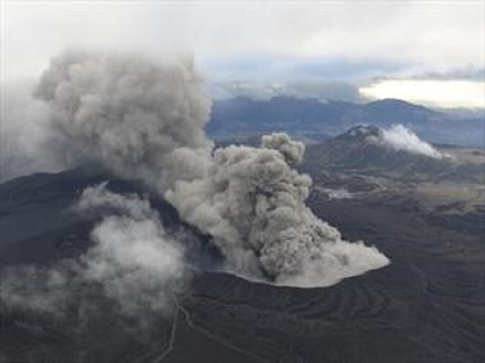
© Perth NowJapan's meteorological agency has warned Kyushu residents to stay away after Mount Aso erupted.
Mount Aso in Kumamoto Prefecture erupted early Saturday, belching a column of ash 11,000 meters into the air in the latest eruption in one of the world's most volcanically active countries.

The explosive eruption occurred around 1:46 a.m. on one of the peaks of the 1,592-meter mountain, the Meteorological Agency said. There were no immediate reports of injuries.

It was the first explosive eruption at that particular peak since January 1980.

The agency raised the alert level for the volcano to level 3 on a scale of 5 and urged people not to approach the mountain.

Footage on NHK public television showed orange flames billowing from several locations on the mountaintop as the volcano emitted thick gray smoke into the sky.

There are no houses within the off-limit area and no injuries or major damage have been reported in nearby towns, though buildings and cars were covered with thick ash. No flights were affected.

A window at a youth center just a few kilometers away from the mountain suffered a crack apparently from volcanic rocks.

Masaaki Yamamoto, a manager at the center, told NHK that he heard small volcanic rocks hitting the exterior of the building, and found a crack in the window along with nearby chunks of volcanic debris about the size of golf balls.


Camcorder

USGS releases video of volcano lava lake at Kilauea, Hawaii

Hawaii volcano lava lake
© YouTube/Associated Press (screen capture)
The US Geological Survey has produced new, high definition images of the Hawaii volcano Kilauea summit eruption and the active lava lake formed in the crater at the top of the volcano.


Comment: There has been increased activity at Kilauea volcano this year. See also:


Arrow Up

Dormant volcano in British Columbia, Canada sparks with activity

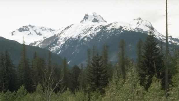
Mount Meager
© Global Volcanism Program/Smithsonian InstituteVolcanologist Melanie Kelman with Natural Resources Canada is taking a closer look at Mount Meager, north of Pemberton, after a discovery this summer showed the long-dormant volcano is a little more active than originally thought.

Expert says activity on Mount Meager presents no danger to the public, but scientists monitoring


Experts are taking a closer look at Mount Meager, a dormant volcano north of Pemberton, after they discovered activity on the peak earlier this summer.

Volcanologist Melanie Kelman with Natural Resources Canada said sulphur smells and volcanic openings known as fumaroles were spotted on the the long-dormant volcano.

She said it is not uncommon to find fumaroles on the peak, and it could have been thinning ice that exposed the vents.

While fumaroles pose no risk to the public, she said it would be unsafe to approach or enter them as they are letting off hydrogen sulfide — a poisonous gas — and the ice around them is crevassed and potentially unstable.

Her team is now monitoring the area for increased seismic activity — the key sign of an upcoming eruption.

"The main thing we would expect if the volcano was becoming more active is lots and lots of small earthquakes," she explained.

"We're not seeing a lot of that right now, but this is what we would expect, and that's why we're watching it closely."

Attention

Volcano triplets spotted erupting on the South Sandwich Islands

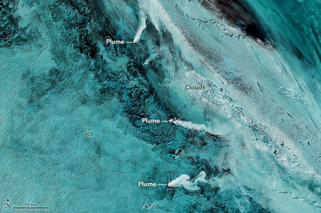
On Sept. 29, 2016, the Moderate Resolution Imaging Spectroradiometer on NASA’s Aqua satellite captured this false-color image showing volcanic activity in the South Sandwich Islands.
© NASAOn Sept. 29, 2016, the Moderate Resolution Imaging Spectroradiometer on NASA’s Aqua satellite captured this false-color image showing volcanic activity in the South Sandwich Islands.
Three active volcanoes simultaneously erupting and unleashing giant plumes of smoke were spotted by a NASA satellite as it passed over a remote archipelago in the South Atlantic Ocean.

The three stratovolcanoes — a type of composite volcano built of layers of lava, ash and stone — are located on the South Sandwich Islands, which are about 1,700 miles (2,800 kilometers) southeast of Buenos Aires, Argentina. Volcanoes in the region are some of the least studied in the world, because of the remote location and inhospitable environment of the islands.

On Sept. 29, NASA's Aqua satellite captured the plumes from these volcano triplets in a false-color image. Clouds and ice in the region make it difficult for satellites to see volcanic activity in natural-color imagery, NASA said. False-color images use portions of the electromagnetic spectrum typically invisible to humans — such as infrared — to distinguish ice from ash and clouds, according to the agency.

Arrow Up

Peru's Ubinas volcano resumes eruptions after 9-month hiatus

Ubinas eruption
© Melquades Alvarez
A series of events beginning with one exhalation and followed by three explosions took place the evening of Sunday, October 2, into Monday morning.

The most energetic of the three explosions happened on Sunday evening at 10:50 p.m., measuring at 19 megajoules, just three hours after the first exhalation happened at 7:21 p.m. But this measured 0.6 megajoules. It was the late night explosion that caused ash coverage in the villages of Santa Rosa de Phara and Yanapuqui northeast of the volcano.

The explosions Monday morning at 4:24 a.m. and 5:52 a.m. led to ash within the town of Ubinas, which is southeast of the volcano with the wind carrying it southwest of the volcano also.

Due to fluctuations with rise of magma, the Scientific Committee of Permanent Monitoring of Volcano Ubinas, composed of the Volcano Observatory of the South (OVS) and the Volcanological Observatory of the INGEMMET (OVI), warned of possible reoccurrences and to take proper measures.


Comment: The last eruption was reported in January of this year.

Peru's Ubinas volcano erupts: 3km smoke ash cloud


Seismograph

Fears of Teide volcano eruption after 'abnormal' earthquake swarm hits Tenerife

Tenerife earthquake swarm
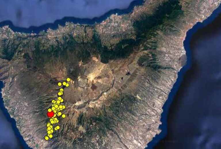
© INVOLCAN92 microquakes were recorded in Adeje and Vilaflor in the space of four hours on Sunday October 2

FEARS are mounting that a huge volcano on the island of Tenerife could erupt after nearly 100 mini earthquakes were reported in FOUR HOURS in the region


The Volcanology Institute of the Canary Islands (Involcan) reported a significant spike in seismic activity on Sunday afternoon.

Some 92 microquakes were recorded in Adeje and Vilaflor in the space of four hours, with one measuring more than 1.5 on the Richter scale.

The majority of the quakes took place between 7 and 13km below ground sparking fears Mount Teide could be about to blow.

Involcan has sent teams to the area to measure the amount of carbon dioxide in the atmosphere following the quakes, which they described as a "seismic swarm" which is "abnormal" for the region.

An increase in carbon dioxide is said to be an early indicator of volcanic earthquake activity that can precede an eruption.

Involcan said in a statement: "We are registering an important seismic rally on the island of Tenerife.

"In principle, these earthquakes are very low magnitude, consistent with those that occur in active volcanoes.

"The number of earthquakes is provisional pending the analysis of the signals more closely, but we can qualify this activity as a seismic swarm whose pattern is an alignment with prevailing direction northeast to southwest ".

Attention

Six previously undiscovered volcanoes found near Italy's deadly Mt Vesuvius

volcanoes submerged near Naples
© GettyThe volcanoes are submerged near the coast of Naples

SIX previously undiscovered volcanoes have been found off of the coast of Naples, all of which are situated close to the deadly Mt Vesuvius.


The newly found submerged volcanoes lie just three kilometres from the Gulf of Naples - home to Mt Vesuvius.

Mt Vesuvius is responsible for one of the most deadly eruptions in human history when, in 79 AD, the huge volcano erupted over the city of Pompeii, killing all 11,000 inhabitants of the ancient Roman-ruled area.

Researchers from the National Institute of Geophysics and Volcanology (INGV), the University of Naples Federico II and the National Research Council discovered the new volcanoes during a campaign in 2014 to garner more information on Vesuvius, which is overdue an eruption, but information has only just been released.

INGV's Guido Ventura said: "We detected new points of carbon dioxide emissions in the Gulf of Naples, which is quite common in geothermal and volcanic areas such as Naples.

"And here we have discovered six volcanic structures (cones and domes) with a diameter of 800 meters, unknown until now."

Comment: There has been a sharp rise in observable volcanic activity on our planet's surface in recent times. However, the vast majority of the planet's volcanoes are located underwater (up to one million is estimated).

Unprecedented marine heatwaves could be attributed to increased quantities of CO2, methane outgassing and heat coming up from below, i.e. passing up through the oceans from within the planet, heating and acidifying the planet's oceans.

Such activity may be a significant contributory factor to the increasing number of bizarre, odd (perhaps even mutated species), previously unknown and mysterious creatures being discovered recently, together with increases in abnormal animal and marine behavior. All over the world such 'strange' and 'unusual' incidents are quickly becoming the norm, as are mass fish die offs.


Seismograph

Katla volcano continues to tremble in Iceland with over 200 tremors in 24 hours

Katla volcano.
© Páll Stefánsson.Katla volcano.
Seismic activity in Katla volcano, South Iceland, continues. No less than 200 tremors have registered there in the past 24 hours, Vísir reports. Three quakes in excess of magnitude 3 hit the volcano overnight, the largest one at 4:41 am, of magnitude 3.7. It was preceded by another one of magnitude 3.1 a minute earlier. The third one measured 3.2 at 2:43 am. All three were shallow. Sigurdís Björg Jónasdóttir, natural hazard specialist at the Icelandic Met Office, reported that the seismic activity was constant all night long.

"It's been very lively in Katla overnight, but the tremors are all shallow, and there hasn't been any eruption activity or glacial outburst flood activity, so those of us who are on call are relatively calm, since the situation effectively hasn't changed since yesterday," Sigurdís stated.

Katla volcano is located under the icecap of Mýrdalsjökull glacier. It last erupted in 1918, but has, on average, erupted twice a century.