Volcanoes
S


Blue Planet

Adapt 2030 Ice Age Report: Civilization timelines are off

Civilization time lines are off
© YouTube/Adapt 2030 (screen capture)
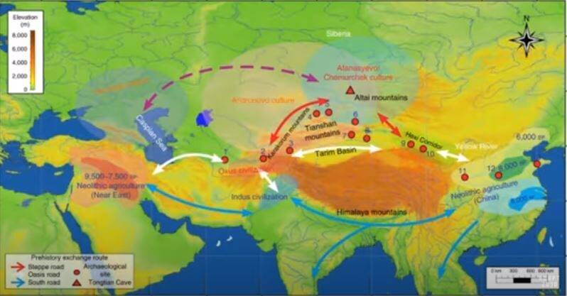
New finds that tons of grain were transported between the Fertile Crescent (Middle East) and Eastern China 5000+ years ago before trade routes were established is making academia question the official time line of history. Additionally the mega city of Nebelivka, Ukraine which was over a mile wide, housed 15,000 people and had roads 5200 years ago with industrial agriculture before animals were used to plow fields. These civilizations were Sun worshipers. Greenland melt season stops a month early in 2020.


Comment: See also:


Attention

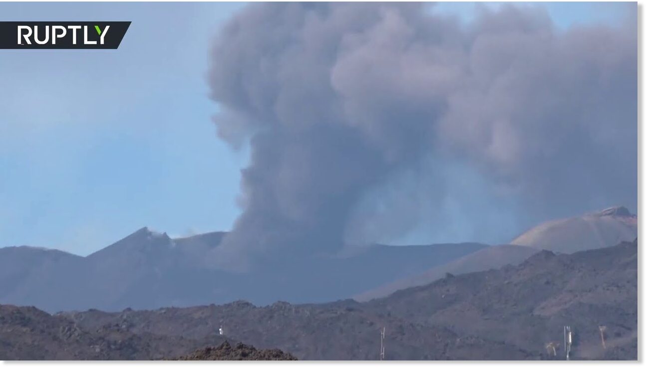
Italy's Mount Etna erupts spewing ash and smoke

etna
The New Southeast Crater of Mount Etna, the largest active volcano in Europe, has been seen spewing ash and smoke as volcano's activity increased recently.


Attention

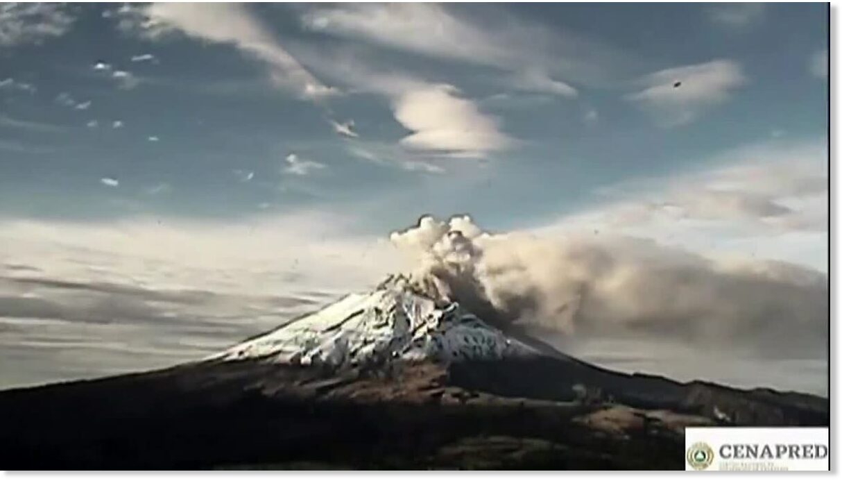
Mexico's El Popo volcano blasts plumes of smoke, ash high into sky

Popocatepetl volcano
Mexico's majestic Popocatepetl volcano rumbled to life on Friday (August 14), spewing smoke and ash columns some 600 meters (1968 feet) out from its crater.

The eruption occurred at 0727 local time (1227 GMT). The massive plume of gas and ash then dispersed towards the southeast, according to reports.

Mexico's National Center for Disaster Prevention has warned people to stay away from Popocatepetl, reporting that in the previous 24 hours it had observed more than 36 discharges from the volcano.

Popocatepetl is 5,426 meters (17,802 feet) tall and is the second-highest mountain in Mexico and the fifth-highest in North America.


Source: Reuters

Attention

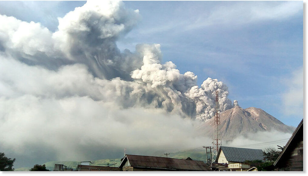
Mt. Sinabung in Indonesia erupts yet again, spewing ash 2,000 meters high

Thick smoke billows up from Mount Sinabung
© Antara/Sastrawan GintingThick smoke billows up from Mount Sinabung in Karo, North Sumatra. The volcano erupted on Thursday with a column of ash going up 2,000 meters into the sky.
Mount Sinabung in Karo regency, North Sumatra, erupted again several times on Thursday, spewing out a 2,000-meter-high column of ash and smoke into the air.

The first eruption was recorded at 6:07 a.m. and continued for around 11 minutes, with a 1,000-m-high column of ash moving toward the east, the southeast and the south, the National Disaster Mitigation Agency (BNPB) reported.

The second eruption lasted for around 20 minutes starting at 1:08 p.m. as the volcano spewed a 2,000-m-high column of ash, which blew toward the east and the southeast, the Volcanology and Geological Hazard Mitigation Center (PVMBG) said.


Seismograph

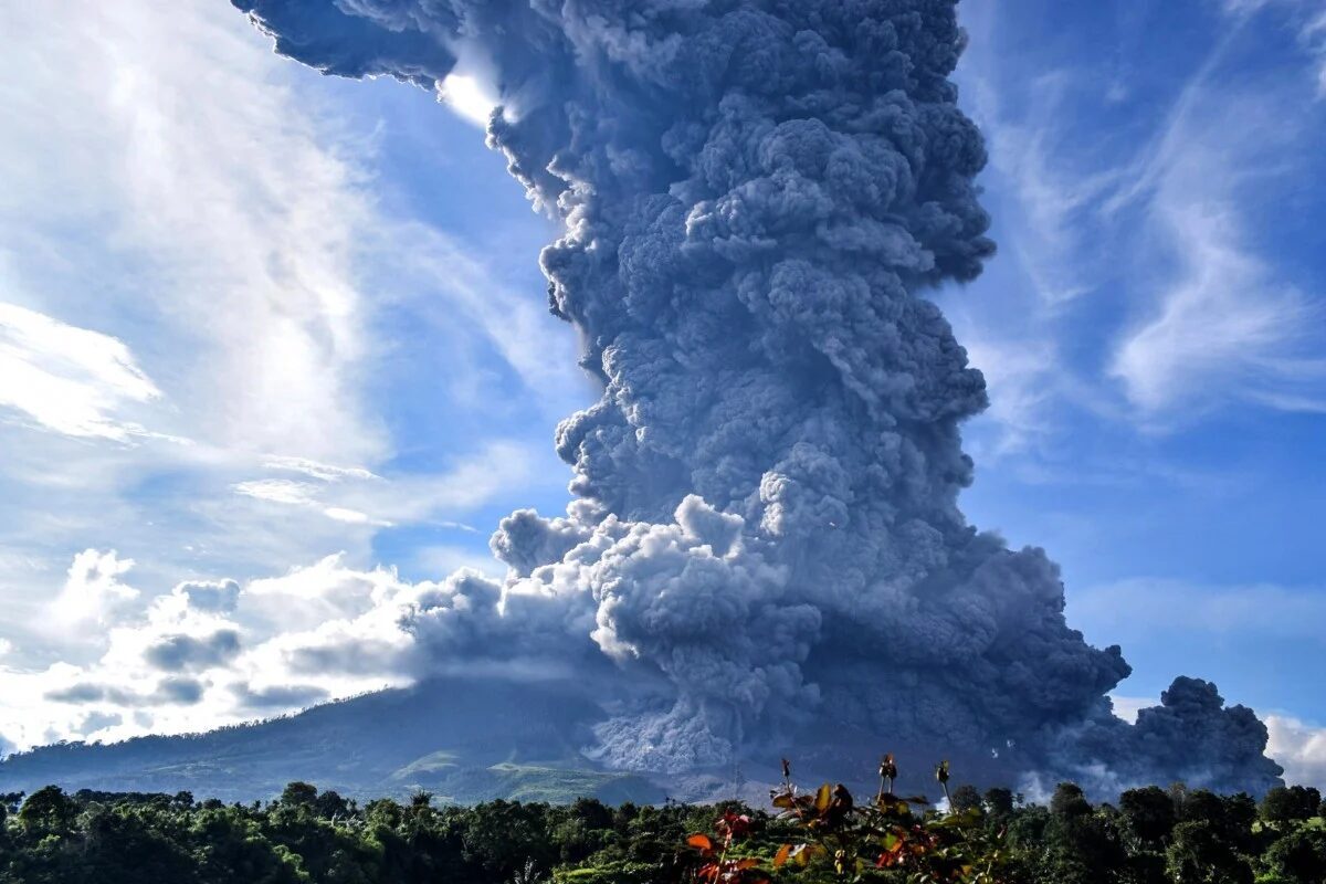
Another major eruption forces evacuations from around Mount Sinabung in Indonesia

Mount Sinabung seen spewing volcanic smoke
© EPAMount Sinabung seen spewing volcanic smoke from Tiga Pancur Village in Karo, North Sumatra.
Rumbling Mount Sinabung on Indonesia's Sumatra island erupted Monday, sending a column of volcanic materials as high as 5,000 meters (16,400 feet) into the sky.

There were no fatalities or injuries from the morning eruption, Indonesia's Volcanology and Geological Hazard Mitigation Center said.

Villagers are advised to stay 5 kilometers (3.1 miles) from the crater's mouth and should be aware of the peril of lava, the agency said.

Some 30,000 people have been forced to leave homes around the mountain in the past few years.

A thick layer of ash covered several villages up to 20 kilometers (12.4 miles) from the crater, said Armen Putra, an official at the Mount Sinabung observation post.


Info

Volcanic or cosmic impact origin for the Younger Dryas mini ice-age?

On July 31st 2020, Sun et al. published a paper in Science Advances [1] that suggests the Younger Dryas cooling event nearly 13000 years ago was triggered by the Laacher See volcanic eruption rather than a cosmic impact, the usual explanation. Until now, over 60 primary peer-reviewed journal papers together with dozens of supporting responses all agree the Younger Dryas event was caused by Earth's collision with debris from a disintegrating comet. Only one paper has previously suggested it was caused by the Laacher See volcanic explosion - and that paper was thoroughly refuted only a year later.

In their new paper, Sun et al. focus on platinum group elemental abundances, and especially osmium isotope abundances and ratios, found in the sediment of Hall's Cave, Texas. The sediment in this cave, many meters deep, has accumulated over tens of thousands of years, providing a convenient record of environmental conditions near the cave over this time (see photo below). An easily visible transition in the colour of the sediment at a depth around 1.51 m signifies a dramatic change in climate, and has been suggested to indicate the onset of the Younger Dryas climate anomaly when the Northern Hemisphere experienced a sudden return to near ice-age conditions for over 1000 years. This view is supported by the discovery in this boundary layer of the same kinds of microscopic impact debris found at many other Younger Dryas boundary sites across four continents [2]. So, it appears that Hall's Cave is yet another record of this most dramatic and important cosmic impact event, thought to have reset human Cultures and extinguished many species of large animal across the globe. An event that is probably remembered by numerous extant religions, and might even have helped trigger the rise of our own civilisation [3].
Hall's Cave, Texas
© Nan Sun, University
However, the platinum group metal abundances in the sediment around the Younger Dryas boundary layer at Hall's Cave have not previously been investigated. If the prevailing view is correct, we should find anomalies in them very close to this layer, since cosmic impacts generally produce enhancements in several of these elements. For example, the dinosaur-killing Chicxulub impactor was particularly rich in iridium, and coated Earth in an iridium-rich layer of dust and debris. However, we know from analysis of the GISP2 ice core in Greenland, that the Younger Dryas impactor was instead rich in platinum.[4] Since that discovery peaks in platinum concentration within sediments have been used to locate the Younger Dryas boundary accurately at many other sites [5].

Arrow Up

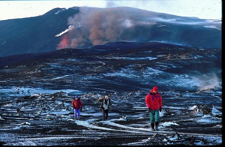
Iceland's Mount Hekla shows signs of high magma pressure

From the 1991 Hekla eruption, when lava covered an area of 23 square kilometers
© Árni SæbergFrom the 1991 Hekla eruption, when lava covered an area of 23 square kilometers.
Measurements made near stratovolcano Hekla indicate a build-up of magma pressure that has become considerably greater than when the volcano last erupted in 1991 and 2000.

The Institute of Earth Sciences at the University of Iceland, which performed the measurements, warns that eruptions in Hekla usually happen suddenly and that hikers in the vicinity of the volcano might be in danger in case of volcanic activity.

"It is not possible to guarantee that people visiting the area could be warned in time to seek shelter before an eruption would start. It is also worth noting that eruptions in Hekla often start with a powerful phreatomagmatic eruption," says the Institute. "Should a group of unprepared hikers find themselves near the eruption they would have few means of escaping."

In a phreatomagmatic eruption water and magma interact to produce tephra. There is a chance of pyroclastic flow where the tephra flows quickly down the hills of the volcano, similar to the flow of tephra that covered Pompeii in 79 AD.

The measurements were done near the farm of Næfurholt at the foot of Hekla where geologists discovered that the earth would rise during magma build-up underneath the volcano and then fall post eruption.

Seismograph

Deep repeating earthquakes beneath Hawaii's Maunakea volcano surprise scientists

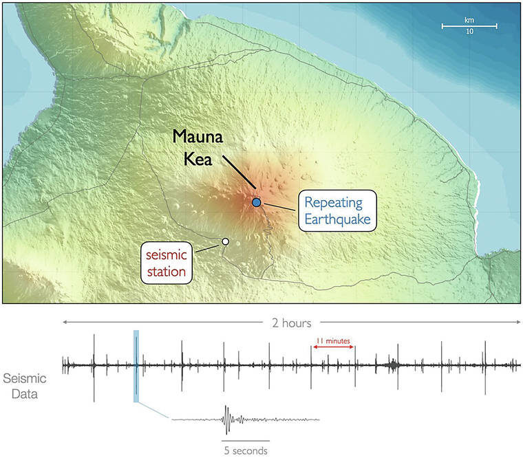
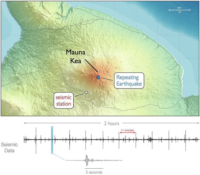
Seismic data from the station near Maunakea volcano
Example of 2 hours of seismic data from the station near Maunakea on April 14. The large spikes are earthquakes under Maunakea repeating every 11 minutes. The bottom waveform zooms in on 15 seconds of an individual event.
Maunakea volcano hasn't erupted in over 4,500 years, but that doesn't mean it's quiet. In fact, for decades it has been hiding one of the most unique seismic signals seen at any volcano.

Some discoveries are just serendipity. Several years ago, U.S. Geological Survey seismologists at the Hawaiian Volcano Observatory and Alaska Volcano Observatory were trying out a new method to track seismicity at Kilauea Volcano. The method scans 24-hour sections of seismometer data looking for signal similarity on many instruments. Out of curiosity, they decided to look at the rest of the Island of Hawaii to see what else they might find.

What they found came as a surprise. A study published in the journal Science in May, 2020 describes how they detected deep earthquakes beneath Maunakea that repeat every 7-12 minutes. Noise in the seismic records from wind and nearby cars, together with the small size of the individual earthquakes (magnitude 1.5), had prevented these earthquakes from being detected with the regular earthquake detection system.

The small, repeating earthquakes occur at depths of about 20-25 km (12-15 mi) directly beneath Maunakea's summit and happen every 7-12 minutes with surprising regularity. Furthermore, the repeating events can be detected going back to at least 1999. This was when a particularly quiet seismic station was installed in the saddle between Maunakea and Mauna Loa. It is very likely that the repeating earthquakes were occurring even further back in time.

Comment: See also:


Snowflake Cold

Adapt 2030 Ice Age Report: Summer snow, 500-year storms & volcanoes - natures alert

volcano

Summer snow India, 500 year storm New Zealand along with new data showing no warming in the country for the last 130 years. Brazil record cold in 23 municipalities and multiple volcanic eruptions across Japan. Is it a sign from nature that the changes begin ?


Fire

Italy's deadly Stromboli volcano suddenly explodes again without warning

Stromboli volcano eruption
The National Institute of Geophysics and Volcanology spotted some debris and lava travelling down the slope of the volcano which could have been dangerous for potential hikers
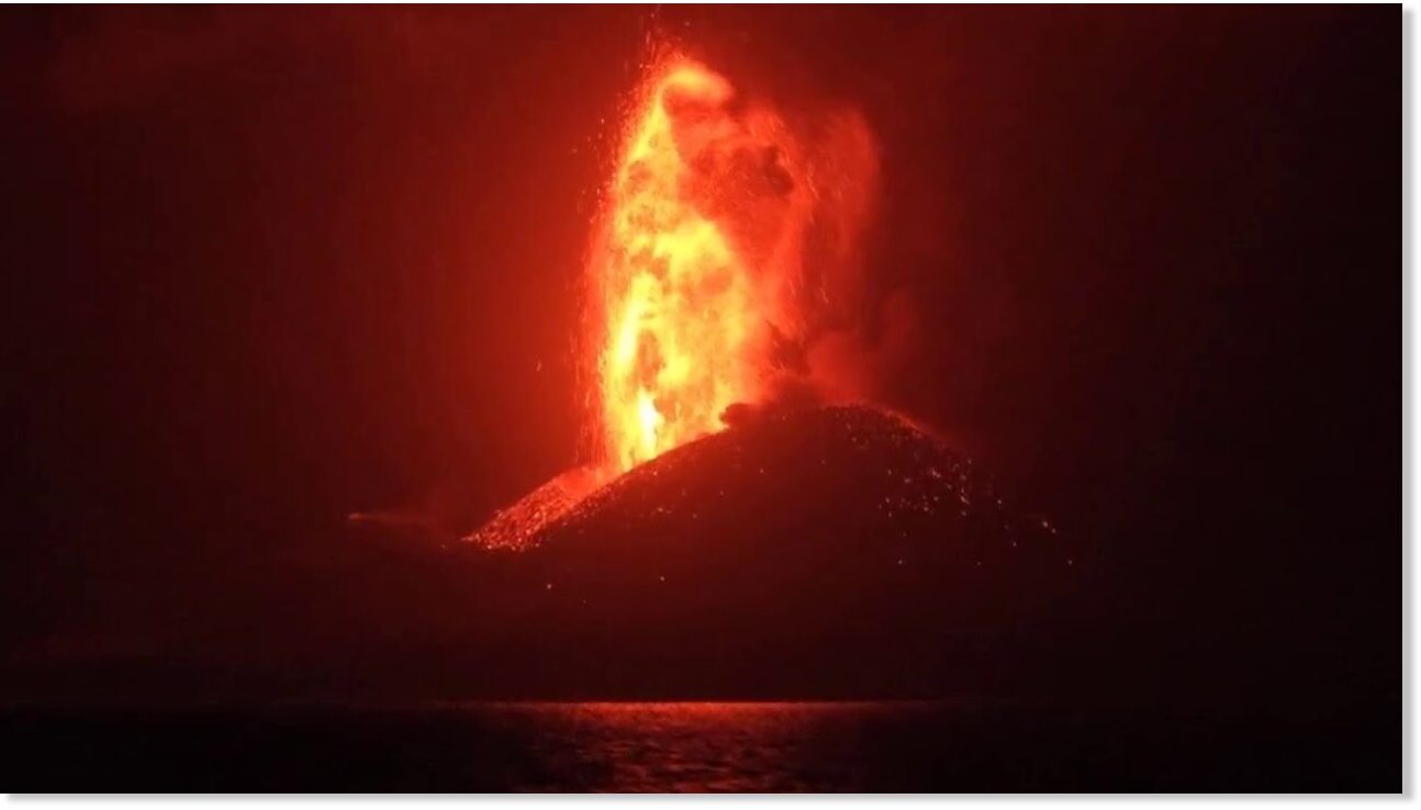
A violent eruption jolted residents of the Italian volcanic island of Stromboli awake at 3 a.m. Sunday.

The National Institute of Geophysics and Volcanology's observatory at Etna reports that its network recorded a loud explosion and eruption, sending lava and debris falling around the crater of the volcano and slope known as the Sciara del Fuoco, which is sometimes visited by hikers.

Webcam video shows "lava bombs" raining down on the area.

Data from the Laboratory of Experimental Geophysics at the University of Florence indicate that the eruption lasted for about four minutes before conditions on the island returned to relative normal