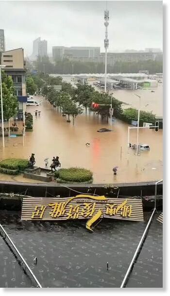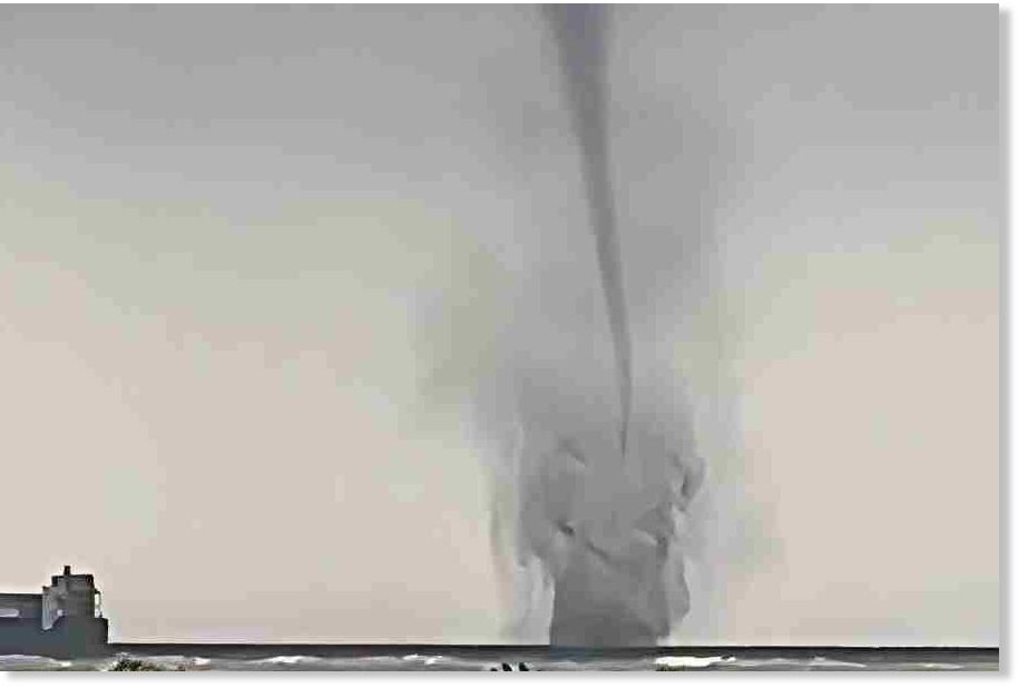
Twin waterspouts that erupted over the Hooghly river near Sagar Island on Friday morning sent waves of panic at Mahishamari in South 24-Parganas, forcing fishermen to abandon their nets and race back to shore.
Two towering columns of swirling water rose dramatically towards the sky — the spectacular yet frightening phenomenon, believed to have been triggered by severe atmospheric instability over the estuarine region where the Hooghly meets the Bay of Bengal — was witnessed around 11.30am.
Residents, fishermen and boat operators watched in astonishment as two tornado-like waterspouts developed almost simultaneously over the river.
As the giant columns of rotating water gathered strength, fear quickly spread among people navigating the river. Small fishing boats and trawlers hurriedly changed course and returned to nearby ghats, anticipating the onset of violent weather.
Sometimes the greatest scientific discoveries start with the simplest things.
Today, meteorologists are worried about a severe global event. It's part of an atmospheric pattern that wasn't recognized until the late 1960's. But it has had major economic impact over the decades. And it will have an impact this year if it's as bad as predicted.
But the story starts with marine mud and frustrated fishermen.
Geologists saw something odd in sediment cores taken off the West coast of South America. The cores looked like layer cakes. One layer of mud, another of fish scales...repeated through the core.
The layers reflect massive shifts in weather patterns. But it wasn't understood until the late 1960's. That's when Jacob Bjerknes, a Norwegian American meteorologist, linked the marine sediment record with atmospheric observations. He recognized that the ocean and atmosphere acted in a feedback loop that had dramatic impacts on the land.
The formal term is the El Niño,Southern Oscillation, or ENSO. It gets its name from Peruvian fishermen. They called the warm currents that sometimes occurred around Christmas "El Niño".
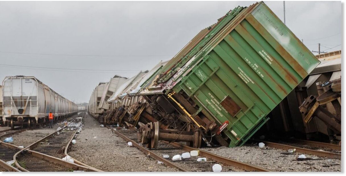
The remnants of Tropical Storm Arthur battered parts of the southeastern United States with drenching rains and strong wind on Thursday, tearing through buildings, flooding homes and launching water rescues along the Gulf Coast.
Severe weather also pummeled parts of the Midwest, where a separate line of strong storms knocked down structures and left tens of thousands of residents without power.
Arthur was the first tropical storm of the season in the Atlantic basin, and although it quickly downgraded within a day of forming, the lingering system created dangerous conditions in Louisiana and Mississippi. In one rural Louisiana parish, more than 2 feet of rain fell in 48 hours and most of that soaking came Thursday, said Donald Jones, a meteorologist with the National Weather Service in Lake Charles.
It flooded at least 200 homes in Avoyelles Parish, about 70 miles (113 kilometers) northwest of the state capital, Louisiana state Rep. Daryl Deshotel said.
"Even by this region's standards, that's catastrophic rain," Jones said.
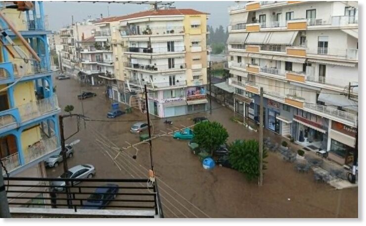
Serres was faced with a very heavy downpour on Wednesday afternoon (17/6), with flooding recorded in the Nigrita area, while there were problems in several parts of the road network of the Serres regional unit.
According to information from lionnews.gr , almost the entire city of Nigrita was flooded. The waters covered central streets and alleys, creating an extremely difficult situation for residents and drivers, while fears are being expressed for damage to underground and ground-floor buildings.
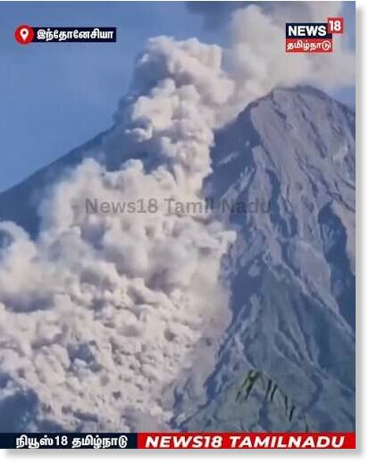
At 7:22 AM local time on June 19, 2026, an explosive eruption from Mount Semeru generated a powerful pyroclastic flow that descended nearly to the base of the volcano.
The eruption sent a towering column of ash and volcanic gases high above the summit before part of the eruptive material collapsed, producing a fast-moving pyroclastic flow that raced down Semeru's flanks through established drainage channels.
Pyroclastic flows are among the most dangerous volcanic hazards on Earth. They consist of a dense mixture of superheated gas, volcanic ash, and rock fragments that can travel at speeds exceeding 100 km/h (60 mph) while reaching temperatures of several hundred degrees Celsius.
Located in East Java, Indonesia, Semeru is the highest volcano on the island of Java and one of Indonesia's most active volcanoes. The volcano frequently produces explosive eruptions, ash plumes, lava flows, and pyroclastic density currents, making continuous monitoring essential for communities living nearby.
The distance reached by this pyroclastic flow underscores the ongoing hazards associated with Semeru's persistent activity and the importance of respecting exclusion zones established by Indonesian authorities.
Jesse Ferrell AccuWeather Thu, 18 Jun 2026 12:13 UTC
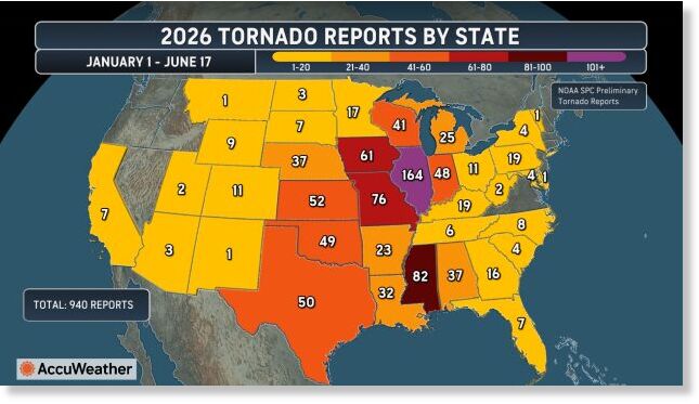
Illinois has led the nation in preliminary tornado reports for most of 2026, and after five were tallied during a severe weather outbreak on Wednesday, the state has surpassed its record for the most in a year. And it's only June.
There have been 164 tornado reports in Illinois as of June 18, according to data from NOAA's Storm Prediction Center (SPC). The large number is mostly due to tornado outbreaks in March, April and June. Illinois had only one tornado report in May.
Mississippi has the second-highest tornado count so far in 2026, with 82 tornadoes, exactly half of Illinois' total.
China's high country is still flirting with freezing.
On June 19, CMA's live observation ranking listed Gande at 0.5C (32.9F), Haiyan at 0.8C (33.4F), Shuanghu at 0.9C (33.6F), and Zeku at 0.9C (33.6F). Zhongba managed just 1.1C (34F). Henan saw 1.2C (34.2F). Dari reached 1.8C (35.2F). Maqen 1.9C (35.4F). Seda 2.2C (36F). And Jiuzhi 2.4C (36.3F). All are deeply anomalous late-June readings.
This has not come out of nowhere.
June has already delivered a series of sharp cold shots across China.
On June 7, a total of 12 national meteorological stations set or tied their lowest temperature records for June. The on June 8, China set another 16 June cold records, split between seven low-minimum records and nine low-maximum records.
Northern China is not enjoying a simmering summer. The theme is repeated cold intrusions and a plateau barely above freezing.
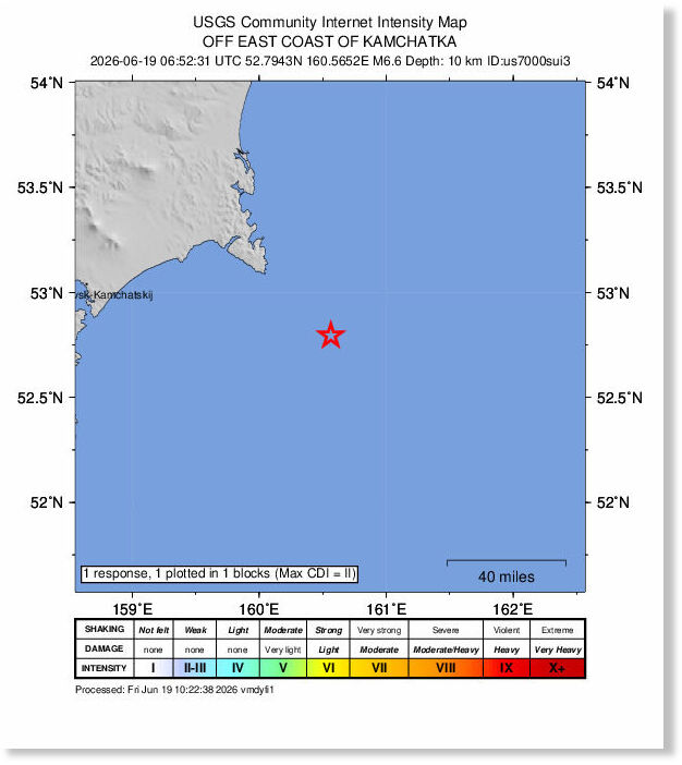
A strong and shallow earthquake registered by the USGS as M6.6 struck near the east coast of Kamchatka, Russia, at 06:52 UTC (18:52 LT) on June 19, 2026. The agency is reporting a depth of 10 km (6.2 miles). EMSC is reporting the same magnitude and depth. The event followed a nearby M6.0 earthquake reported by USGS at 06:51 UTC at a depth of 28.4 km (17.6 miles). The affected area lies within the same tectonic region that produced the major M8.8 Kamchatka earthquake and Pacific-wide tsunami in July 2025. PTWC said there is no tsunami threat from today's earthquake.
The M6.6 earthquake was preceded by an M6.0 event approximately one minute earlier and followed by an M4.9 earthquake about 13 minutes later.
The epicenter was located 136 km (85 miles) E of Petropavlovsk-Kamchatsky (population 181 216), and 151 km (94 miles) E of Yelizovo (population 40 692), and the preceding M6.0 was about 156 km (97 miles) ESE of Petropavlovsk-Kamchatsky, according to USGS.
Just look at us. Everything is backwards. Everything is upside-down. Doctors destroy health, lawyers destroy justice, universities destroy knowledge, governments destroy freedom, the major media destroy information, and religion destroys spirituality.
- Michael Ellner
”
Recent Comments
Oh well. What's another trillion or two as a gift to the Jizzraelis.. The USA has gone down the gurgler this far, it still sadly has a bit further...
Comment: Related: Illinois has already surpassed its record year for tornadoes with 164 reported