Extreme Temperatures
S


Snowflake

Strongest snowstorm for many years sweeping the Middle East

Image
Damascus, Syria
The snowstorm starting Tuesday - the strongest for many years - is forecast to hit all of Palestine, Lebanon and Jordan, and will have consequences for Saudi Arabia, Iraq and other countries. The snowstorm is expected to continue until the end of the week.


--------------------------------------------------------------------------------------------------------------

Snowflake

Heavy snowfall disrupts life in Nepal

Image
The continuous snowfall occurring here for two days has badly affected the life.The electricity supply is disrupted and air flights postponed. The 76-km long Beni-Jomsom roadway linking the district to the national highway has been fully blocked.

Although the snowfall decreased on Friday night, it is yet to be melted.

People are not able to go out of their homes. Similarly, the shops in the district headquarters are closed.

A local Kul Bahadur Thakali said, "The life is thrown out of gear here. All are dormant. Here is no light, no drinking water."

Technician at Nepal Electricity Authority in Mustang, Baburam Thapa, informed that more than half dozen electricity poles were crumbled thereby disrupting electricity supply.

Even the telephone wires are snapped. With the electricity cut off, mobile phone and internet are fully disturbed.

Snowflake

Rohtang Pass in India closed due to 5 foot of snowfall

Image
© News24 Bureau
The Rohtang Pass at 13,050 ft in Himachal Pradesh, which acts as a key road link between Manali and Keylong, has been closed due to heavy snowfall in the area.

The pass has 5 foot snow due to heavy snowfall for the last two days due to which traffic has been closed on the Rohtang Pass, government officials informed.

Rohtang Pass is also used to transport supplies to the Indian Army posted along the China and Pakistan borders in the Ladakh region of Jammu and Kashmir.

GREF (General Reserve Engineering Force), a Border Roads Organisation (BRO) wing has removed its posts from the Pass.

The Pass will now open around May at the onset of summer.

Snowflake Cold

Hawaii breaks 122-year old cold weather record

Image
© W.M. Keck Observatory WebcameraIcicles covered part of the lens of a webcamear at the W.M. Keck Observatory at Mauna Kea Monday morning as snow remained on the ground from a storm over the weekend.
The unusually cold weather over the last two days continued to break records in Hawaii, including a record for this date that goes back over 122 years in Honolulu.

The National Weather Service said Monday morning's low temperature of 57 degrees beat the low temperature for this date of 60 degrees of temperatures recorded at the Honolulu Airport.

It also beat a older low temperature record for Honolulu set in 1893 of 58 degrees.

On Kauai, the low of 57 degrees at the Lihue Airport beat tied a record of 57 degrees last seen in 1993.

It's the second day of record low temperatures.

Four low temperatures records were tied or broken Sunday morning.

The low of 54 degrees in Lihue and Kahului Sunday broke records for Kauai and Maui. The previous record of 59 degrees in Lihue was set in 2005. The low in Kahului broke a record of 55 set for this date in 1971.

In Hilo, the low temperature of 59 degrees broke the previous record of 60 set in 1999 on Sunday's date.

Honolulu tied a record low of 58 degrees set in 1979.

Temperatures should be a little warmer Monday night, ironically because of a weak cold front moving through the islands.

Comment: Cold records have been breaking all over the world. Reputable scientists have been predicting a coming ice age while the junk science of 'global warming' is spewed from every media outlet out there. Get prepared; it's going to get cold!

New Ice Age 'to begin in 2014'

The Little Ice Age predicted to start in 2014

Russian Scientist: New Ice Age to Begin in 2014


Snowflake

Travel chaos as heavy snowfall strikes Turkey

Image
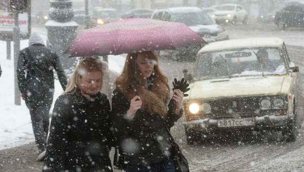
© Adem Altan/AFP A person walks with an umbrella on a snow-covered road in Ankara, on January 6, 2015.
Heavy snowfall descended on large parts of Turkey on Tuesday, January 6, snarling road and air traffic and leading to closures of schools, reports said.

In the northern province of Karabuk, a school bus went off the road and turned over on to its side in slick conditions caused by snow, leaving a student dead and 18 others injured, the Dogan news agency reported.

The snowfall also seriously disrupted road traffic across Turkey and caused trouble with the electricity network causing some power cuts, particularly in the northern parts of the country.

Turkey's national flag-carrier Turkish Airlines cancelled 44 international and domestic flights in and out of Istanbul and some other cities including the capital Ankara.


In mega-city Istanbul, the authorities appeared to take every precaution including closing down schools. But the snow has so far failed to appear in the city in the quantities predicted.


Snowflake

Sub-zero cold wave set to lash Saudi Arabia with snow and wind

Image
© ReutersIn this photo taken on Jan. 9, 2013, residents of Tabuk enjoy the snow after a heavy snowstorm in the desert. A snowstorm is forecast to hit parts of the Kingdom, including Tabuk, on Wednesday.
A wave of bitterly cold weather accompanied by wind, sub-zero temperatures and snow is expected to hit the Kingdom on Wednesday and last until Sunday, the Presidency of Meteorology and Environmental Protection (PME) said on Monday.

The extreme cold is forecast strike the north and northwest areas of the Kingdom as a result of storms coming from Europe and America. The inclement weather is expected to move across the entire country.

Hussain Al-Qahtani, spokesperson of the PME, said this would be the coldest weather for the year. The northern areas would be struck first, including Tabuk, Turaif and Al-Jouf, where sub-zero temperatures and light snow is expected. The PME also expects wind that would limit visibility.

The temperatures would likely drop in Madinah, Jeddah and Makkah, accompanied by strong winds. The cold wave would reach its peak on Thursday in Hail, Qassim, the Eastern Province and Riyadh.

Igloo

Snow forecast across 2,000 miles of U.S.

Image
© CBS News
In addition to some snow and heavy rain, bitterly cold temperatures have begun moving into parts of the U.S. and will be staying put for at least part of this week.

Snow is possible across a 2,000-mile stretch of the U.S. and meteorologist Megan Glaros of CBS station WBBM says that millions of people will deal with brutally cold weather - with wind chills as low as 50 degrees below zero for part of the northern Plains.

Here are some questions and answers about the weather:

Q: What's The Forecast?

A: The Midwest will see the tail end of a storm that could leave as many as 6 inches of snow in Chicago by early Tuesday. The National Weather Service has issued a wind chill advisory until noon Monday for the Chicago area, due to wind chills of 15 to 30 below overnight, CBS Chicago reported.

After that, Arctic temperatures like those seen in North Dakota and Minnesota will rush in. Parts of those states were expecting wind chills of between 25-50 degrees below zero through Monday morning.

It'll be a similar story in New York, where rain showers will give way to cold air. By Thursday, "New York City will be lucky if it hits 20″ for a high and could see lows near 10 degrees, according to Michael Musher with the National Weather Service's Weather Prediction Center.

In Boston, strong wind is ushering in the cold - and gusts will top out between 40-50 mph this afternoon resulting in some isolated pockets of tree/powerline damage in the region, WBZ-TV meterologist Danielle Niles reports.

Atlanta will see temperatures dip to about 15 degrees Monday and Tuesday.

Comment: Ice ages can start at any time and quickly. See:Fire and Ice: The Day After Tomorrow


Snowflake Cold

150,000 customers without electricity in the Montreal area

Image
© CBCA Hydro-Québec pole teeters as freezing rain casts the province in ice.
As of 4 p.m. ET on Sunday, more than 150,000 Hydro-Québec customers were without electricity on and around the island of Montreal after freezing rain encased southern Quebec in ice.

The power failures began on Sunday afternoon and affected small pockets around the greater Montreal region.

However, by late afternoon the blackouts were widespread across Montreal, the Montérégie (South Shore and areas west of the island of Montreal), the Richelieu Valley and elsewhere in southern Quebec.

Hydro-Québec spokeswoman Elaine Beaulieu said many of the power failures are due to fallen branches.

"Our crews are presently patrolling to find out where the power outages are and trying to restore the power as soon as possible. It's mainly due to the weather conditions," Beaulieu said.

Some Hydro poles and wires seemed to bow to the weight of the ice. Tree branches snapped and fell to the sidewalks and roads below in the Montreal region as the day wore on.


Snowflake

Indo-Tibetan Border Police sound high alert after early heavy snowfall on Himalayan border

Image
© Sanju PantHeavy snowfall at an ITBP camp on the China border in Pithoragarh.
The ITBP, which guards the high-altitude Himalayan border posts with China, has sounded a high alert as moderate to heavy snowfall has been reported in the region in the last 24 hours.

The snowfall continued in the higher reaches of this part of the Himalayas today, ITBP sources said here. "The snowfall has broken records of recent years. After 2005, dense snowfall used to occur in this part of the Himalayas after January 15, but this year it has started early," said Kedar Singh Rawat, an ITBP officer.

According to ITBP sources, while 120 cm snowfall was recorded at Joligkong Ridge, near the China border in the Vyans valley of Dharchula subdivision, the last border post at China border at Nabhidhang received 90 cm snowfall in the last 24 hours. "The snowfall, which started ahead of the Garbiyang post of the ITBP, witnessed 40 cm to 80 cm snowfall in the last 24 hours," said Rawat.

In Munsiyari, the peaks of Panchachuli, Rajrambha, Chiplakedar and Hansling received heavy snowfall in the last 24 hours. Weather Department sources said snowfall in higher reaches and rainfall in lower valleys would continue for the next 24 hours.

Arrow Down

Pope embraces false prophets of doom - Why I'm disassociating myself from the Vatican and church

Vatican
© NoTricksZone
I'm Catholic and this Sunday I'm announcing that I'm disassociating myself from the Vatican and its pope. I urge other skeptic Catholics to consider doing the same. This is not a step I've taken lightly.

I'll be opting out of Germany's Kirchensteuer (Church Tax) and will not attend any services in the future. With their latest planned encyclical they are indicating that they have shifted back to the Dark Ages of bad-weather witches, superstitions and Medieval indulgences. Worse, they are openly subscribing to nutty end-of-times theories.

This comes on the heels of a recent announcement that Pope Francis intends to issue an encyclical on climate change. I am not renouncing Catholicism, rather I am solely renouncing my recognition that the Vatican and Pope are the faith's administrator and moral compass. It's the last straw in an unending string of corruption, child sexual abuse and scandals that have raged within the Catholic Church in recent times.