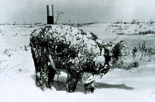
© NOAAA snow-covered steer in South Dakota after a blizzard in 1966.
While Ireland battles with widespread flooding, snow and wind in the US has caused havoc on dairy farms.
Storm Goliath tore through Clovis, New Mexico, where Glanbia are involved in cheese manufacture, and Lubbock, Texas last weekend. The storm dumped 22 inches of snow driven by wind speeds of 100km/h, causing havoc on dairy farms where it left over 40,000 dairy cattle dead and closed down most dairies.
News of the disaster took some time to come from the region as producers started clearing the snow on feed passages and dealing with power cuts throughout the area.
Texas Association of Dairymen is contacting state and federal leaders seeking assistance. In addition to the 40,000 dairy cattle lost during the storm, beef cattle feedlots are also affected. The huge loss will make any indemnity program trying to make a real impact to the affected farmers hard to achieve as most of the dairy cattle losses in Texas comes from just three counties. One farmer lost 350 cows and there are 30 other farmers in a similar situation.
The
Clovis News Journal reported that the Glanbia-run Southwest Cheese of Clovis operated at just 10% of normal delivery on Monday; it had recovered to 90% on Wednesday.

Comment: Yet another case of record snowfall. Does the Ice Age cometh? For more information regarding the speed in which ice ages may develop and sudden glacial rebound, read: