Volcanoes
S


Volcano

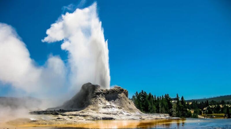
Yellowstone's supervolcano is creating a 19-mile bulge

Yellowstone Caldera
© Deposit PhotosYellowstone averages between 1500 and 2500 earthquakes per year.
In Yellowstone National Park, a bulge the size of 279 football fields has risen by an inch since last July. With no signs of slowing down, the bump that's roughly 19 miles across may cause some worry that the iconic locale's hibernating supervolcano is readying for an apocalyptic reawakening. Although impressed by the situation, the Yellowstone Volcano Observatory's scientist-in-charge doesn't sound particularly worried.

"I think it's pretty stunning even if it's not particularly unusual," Mike Poland recently explained to Cowboy State Daily.

This particular example of uplift or deformation is occurring at the northern rim of Yellowstone Caldera in northwest Wyoming. However, it's far from the first time researchers documented the geological occurrence. The most recent instance spanned around 16 years before wrapping up in 2020. In 1996, yet another deformation took place over four years. These events aren't visible to the average park visitor, but they can be dramatic when viewed by highly sensitive seismological equipment and other observational tools.

"We can see things that are moving up and away from this area of uplift on radar maps and satellites we use to measure this sort of thing," said Poland, adding that his team monitors the park with 17 GPS stations that help determine where the uplift started.

Comment:
Key Facts from USGS and Recent Monitoring (as of early 2026):
  • Yellowstone is not "overdue" for a major eruption. The last three large caldera-forming eruptions occurred approximately 2.08 million, 1.3 million, and 631,000 years ago. The average interval is roughly 725,000-735,000 years, but volcanoes don't follow strict schedules — this average is based on only two intervals and isn't predictive. Even by that rough math, another ~90,000-100,000 years would pass before it might be considered "due," but that's not how volcanology works.
  • The most recent volcanic activity (lava flows) was about 70,000 years ago. Smaller hydrothermal explosions occur occasionally, but nothing points to anything larger soon.
  • Current status (from the latest USGS Yellowstone Volcano Observatory update in February 2026): Activity is at background levels. There's ongoing subtle ground deformation (e.g., minor uplift near the north caldera rim starting in 2025, similar to past episodes like 1996-2004), low-level seismicity (normal for the area), and the alert level is NORMAL/GREEN. No magma-driven warning signs like rapid uplift, intense earthquake swarms, or unusual gas releases are present.
  • The magma chamber is only partially molten (5-15% in key areas), and recent studies (including 2025 analyses) show the magma isn't sufficiently connected or mobilized for a major eruption anytime soon. Odds of a super-eruption (VEI 8 scale) in any given year are extremely low — far lower than many other natural risks.
  • If a large eruption ever happens again (possible but not guaranteed), scientists expect detectable precursors (earthquakes, deformation, gas changes) for weeks to years in advance, thanks to constant monitoring.


Volcano

Seismic activity triggers new eruption at Réunion's active volcano

mmmmm
© OVPF-IPGPEruption on February 13, 2026 at the Piton de la Fournaise
A powerful eruption of the Piton de la Fournaise volcano occurred on Friday, February 13, on Réunion Island, with lava activity observed south of the Dolomieu crater.

According to the French agency Orange, the eruption was confirmed by the Piton de la Fournaise Volcanological Observatory (OVPF) and a scientific research institute involved in monitoring the volcano.

Seismic activity intensified at approximately 9:25 a.m., marking the start of a seismic crisis, while volcanic tremors — indicating the upward movement of magma — were detected beginning at 10:00 a.m. Observatory director Aline Peltier said the eruption had been anticipated, noting that strong seismic activity and inflation of the volcano had been observed following a previous eruption a week earlier. "For us, this was not unexpected: following the last eruption a week ago, strong seismic activity and inflation of the volcano had been observed," she explained.


Volcano

Indonesia's most active volcano 'Mount Semeru' erupts

mmmmm
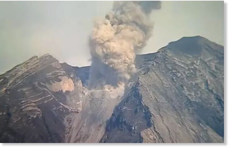
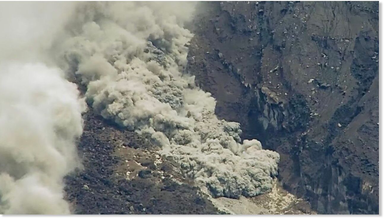
Indonesia's most active volcano on Java Island roared back to life early Saturday, as multiple eruptions from Mount Semeru sent clouds of superheated ash and gas as high as nearly 6 kilometers, authorities said.

The first significant eruption was recorded at 5:54 am local time, when intense and fast-moving mixtures of hot gas, volcanic ash and debris surged southeast toward the Besuk Kobokan river valley in East Java's Lumajang and Malang regencies.

A dense grey ash column rose roughly 2,000 meters (6,561 feet) above the summit, according to volcanologists at the Mount Semeru observation post.

A second eruption at 7:25 am produced another towering plume, this time reaching about 1,500 meters above the peak. Seismic sensors recorded significant ground tremors during both explosions.


Volcano

Indonesia's Mount Semeru records multiple eruptions

mmmmm
Indonesia's Mount Semeru in East Java erupted five times on Wednesday, sending volcanic ash up to 1,000 meters (3,280 feet) above its summit.

The first eruption occurred at 12:28 a.m. local time (1728 GMT Tuesday), producing an ash column that rose about 600 meters above the peak. The white-to-gray plume was of moderate intensity and drifted northward, News.Az reports, citing foreign media.

The most powerful eruption was recorded at 5:36 a.m. local time, when ash reached 1,000 meters above the summit and moved toward the northeast, according to Liswanto, an officer at the Mount Semeru Observation Post.


Volcano

Indonesia's Mount Semeru volcano erupts 7 times in 3 hours

nnnnnn
Indonesia's Mount Semeru volcano in East Java erupted seven times in three hours early Wednesday, sending volcanic ash up to 800 meters (2,624 feet) above its peak, state-run media reported.

The first eruption occurred at 4.58 am (2158GMT Tuesday), producing a thick gray ash plume drifting northeast, according to Antara news agency.

Seismic activity recorded a maximum amplitude of 22 mm and lasted 138 seconds.

Subsequent eruptions followed at 6.10 am and 6.56 am, with ash rising between 300 and 700 meters, while another eruption at 7.05 am sent a 600-meter-high column northward.


Volcano

Guatemala: Volcan de Fuego eruption sends ash up to 15,000 feet in the air on January 31

mmmmm
A screengrab of the volcano in Guatemala erupting.
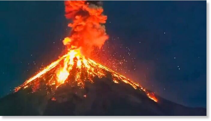
Guatemala's Volcan de Fuego, one of Central America's most persistently active volcanoes, produced a striking explosive eruption.

Videos shared widely on social media captured incandescent lava fragments lighting up the sky.

The Instituto Nacional de Sismologia, Vulcanologia, Meteorologia e Hidrologia (INSIVUMEH) confirmed ongoing eruptive behaviour throughout late January, with a notable increase in intensity around the transition to February.

Explosions generated ash plumes rising to altitudes of 14,000 to 16,000 feet, prompting multiple Volcanic Ash Advisories from Volcanic Asch Advisories Center in Washington.


Volcano

Mud volcano erupts with flames in Azerbaijan

nnnnnnn
A mud volcano erupted in the Hajigabul district on January 30 at 16:53 local time.

The eruption occurred at 16:53 local time and was recorded by seismic stations near the volcano, operated by the Azerbaijan National Academy of Sciences. Data from the center's Dynamics of Earthquake Foci department indicate that the eruption lasted about 13 minutes and occurred in a single phase, News.Az reports, citing the Republican Seismic Service Center (RSSC).

Seismologists said the eruption originated at a depth of around three kilometers, releasing an estimated 3.38 × 10⁶ joules of energy.

Earlier, local media reported a brief eruption at Mount Harami, located in the same district, on January 30. The eruption, which lasted only a few seconds, was accompanied by flames rising into the air.

The event was visible from the Baku - Ganja (Baku - Gazakh) highway and several nearby villages in Hajigabul. No injuries or damage were reported.


Volcano

Russia's Shiveluch volcano erupts, sending ash plume 7 km high

Shiveluch volcano in Russia erupts spectacularly
The Shiveluch volcano in the far east Russian region of Kamchatka became more active on Wednesday, spewing a column of ash more than 7 kilometers (4.34 miles) above sea level.

The volcano continues to develop into a lava dome, and the ash plume has spread 110 kilometers (68.4 miles) west of it, according to a regional response group for volcanic eruptions at the Institute of Volcanology and Seismology of the Far Eastern Branch of the Russian Academy of Sciences.

As a result, the volcano's summit was assigned an orange aviation danger code, the institute said in a statement on Telegram.

Danila Chebrov, the institute's director, described the eruption as "small" and not cause for concern.


Volcano

Indian Ocean: Piton de la Fournaise, an active volcano on Réunion Island, erupts for the first time since 2023

mmmm
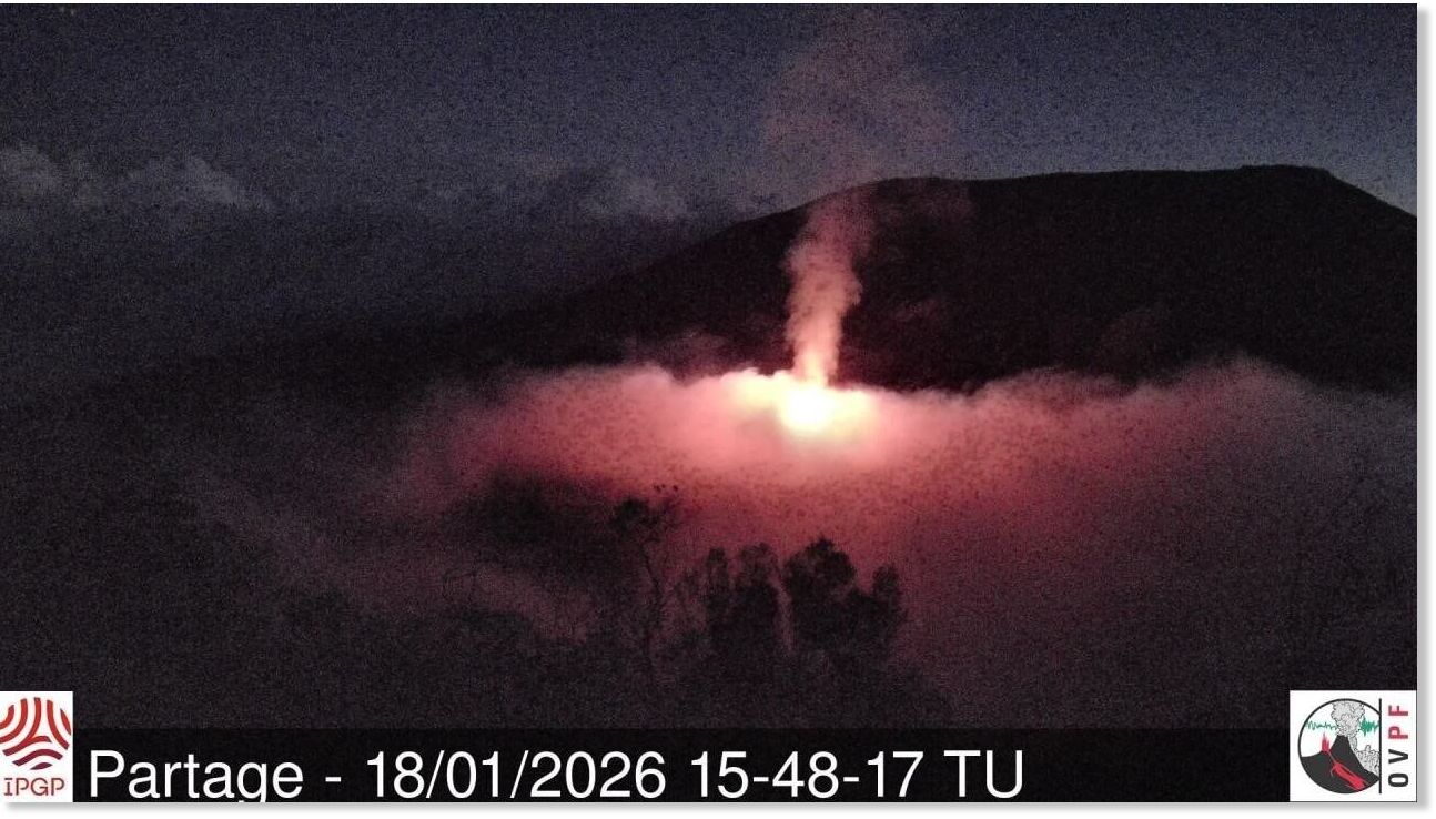
Piton de la Fournaise, an active volcano on Réunion Island, erupted on Sunday, January 18, at 7:42 p.m. local time (4:42 p.m. in Paris), without any particular threat to safety, the Piton de la Fournaise Volcanological Observatory (OVPF) specified.

According to the OVPF, "the eruptive fissure(s) opened on the northern flank of the volcano ." The eruption is located in a completely uninhabited area, posing no particular threat to the safety of people, property, or the environment.

The Piton de la Fournaise volcano had been showing signs of activity for several weeks . Significant seismic activity was recorded by the instruments of the volcanological observatory.


Volcano

Mount Merapi volcano erupts in Indonesia, sending ash up to 1,600 meters high

mmmmm
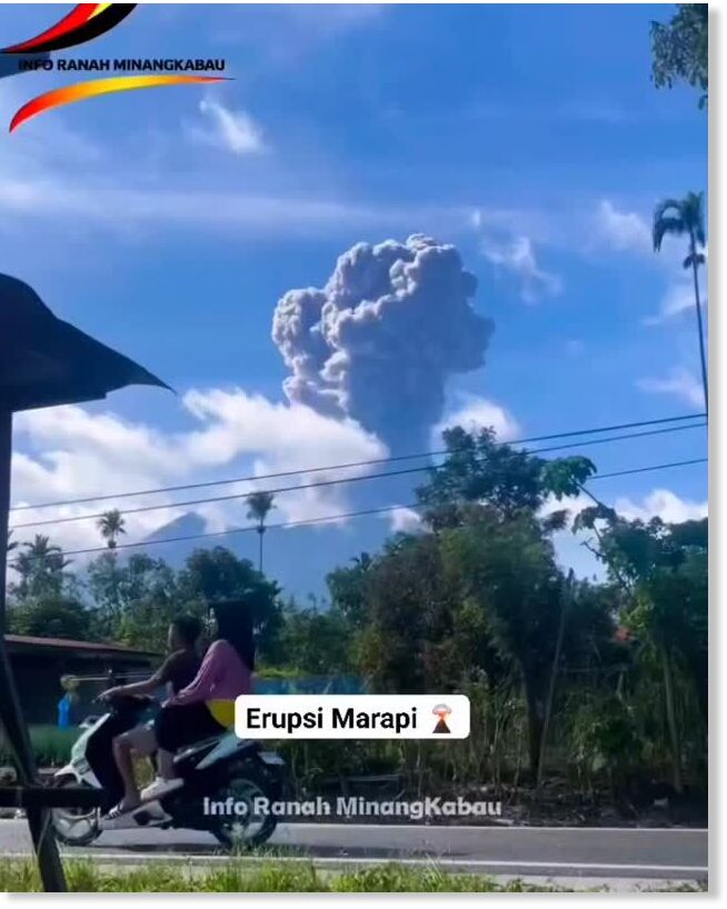
Indonesia's most active volcano erupted on Wednesday morning, sending a column of volcanic ash up to 1.600 meters above the mountain's summit.

The early morning eruption of Marapi, located in West Sumatra province, was recorded on a seismogram with a maximum amplitude of 28,6 millimeters and a duration of about 31 seconds, state-run Antara News agency reported, citing PGA officer Ahmad Rifandi in Padang.

"The explosion was still ongoing when the report was made," Rifandi said.

Meanwhile, it is reported that there have been no reports of casualties or damage to infrastructure.