Volcanoes
S


Bizarro Earth

Nearly 3 dozen small quakes in 24 hours - Volcanic unrest at Mammoth Lakes?

Image
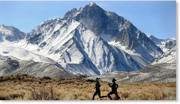
© Wally Skalij / Los Angeles TimesIn this 2012 photo, runners take to a trail in the Mammoth Lakes region in California's Eastern Sierra.
Nearly three dozen earthquakes have rattled the Mammoth Lakes region in less than 24 hours as the area continues to experience ripple effects of "volcanic unrest," according to the U.S. Geological Survey. The temblors -- all between magnitude 2.5 and 3.8 -- have struck since 9 a.m. Thursday, with the latest recorded at 1:49 a.m. Friday, according to the USGS. The 3.8-quake occurred at 9:21 p.m. with an epicenter six miles from Mammoth Lakes.

Heightened earthquake and ground uplift activity have been measured at Mammoth Mountain and the Long Valley Caldera over the last few decades. At 11,053 feet, Mammoth Mountain in California's Eastern Sierra is a lava dome complex on the southwest rim of Long Valley Caldera, although eruptions haven't occurred for some 57,000 years. The recent swarm of quakes in and around the mountain is being tied to recent "volcanic unrest" marked by gas emissions, tree die-offs and intrusions of upward-moving sheets of rock, according to the USGS.

USGS data for recent quakes

Bizarro Earth

U.S. Geological Survey decides to keep a closer eye on the slumbering giant Glacier Peak volcano

Image
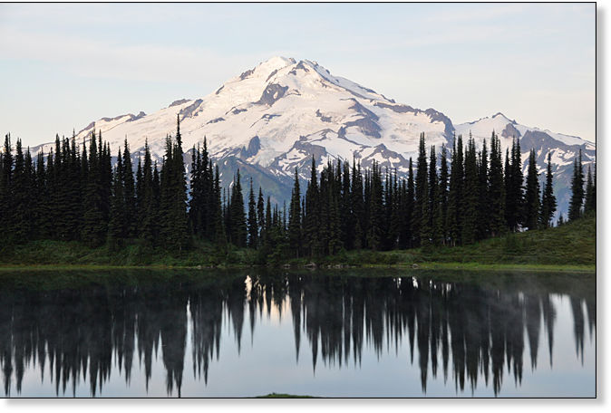
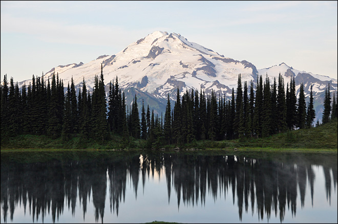
Glacier Peak, elevation 10,541 feet, behind Image Lake in Washington state's Glacier Peak Wilderness
The U.S. Geological Survey has decided to keep a closer eye on the slumbering giant in Snohomish County's wild, scenic back yard. A new study is under way for Glacier Peak, one of the most dangerous but least monitored volcanoes in the country.

Scientists are working to map Glacier Peak and the valleys and peaks to the west - about 482 square miles total - using Light Detection and Ranging, or LiDAR. The technology allows them to get an accurate lay of the land even in remote, heavily forested areas, said Jim Vallance, a research geologist with the Cascades Volcano Observatory.

This helps researchers examine past eruptions, prepare for future volcanic activity and determine the best locations for installing real-time monitoring systems.

The USGS National Volcano Early Warning System classifies Glacier Peak as a "very high threat" volcano, on par with Mount St. Helens or Mount Rainier. The St. Helens eruption in 1980 killed 57 people, destroyed hundreds of homes and wiped out at least 47 bridges and 185 miles of highway.

A large eruption of Glacier Peak could send a deadly wall of mud, rock and glacial melt barrelling through parts of the Stillaguamish and Skagit valleys. These catastrophic flows, called lahars, form the land on which Darrington, a town of about 1,400, sits today. Parts of Arlington and Stanwood might lie in the path of a lahar. Scientists also suspect that Burlington, Sedro-Woolley and Lyman in Skagit County are built on top of debris laid down by Glacier Peak's mudflows tens of thousands of years ago.

Attention

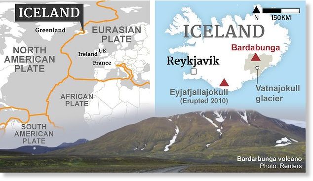
Bardarbunga volcano update: Eruption continues with steady and large lava output rate

Image

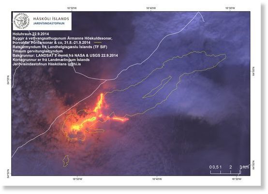
The fissure eruption in Holuhraun continues with similar intensity as during the past days and shows no sign of stopping soon. The latest satellite images indicate that the lava now flows into two main branches, one (the older one) to the north and a new one to the east.

Bizarro Earth

Researchers: 'Biggest volcanic eruption in last 500 years' devastated Europe's climate

Man and frozen crops
© checkinwithcharlie.bangordailynews.comThe Cold Summer of 1816
Scientists have long believed that the 1815 Tambora volcanic eruption could not, alone, have been responsible for the drastic climate change in 1816, nicknamed "Year Without a Summer" and "Eighteen-Hundred-and-Frozen-to-Death." Now, joint research by scientists and historians at the Cabot Institute believe they have pinpointed the date of what is called, in the scientific literature, the "Unknown eruption."

The global climate changes that accompanied these two eruptions created an unseasonably cold winter, which led to massive crop failure and a famine across both Europe and North America. These extreme conditions are also thought by scholars to have inspired literary works like Lord Byron's "Darkness," as well as the ice-framed narrative of Mary Shelley's novel Frankenstein.

According to Caroline Williams, of the Department of Hispanic, Portuguese and Latin American Studies, and Alvaro Guevara-Murua, a doctoral student in the School of Earth Sciences, and Erica Hendry, a professor in the same, the "Unknown eruption" likely occurred in South America sometime between mid-December 1808 and mid-February 1809.
Cold Europe
© scied.ucar.edu

Comment: The large amount of volcanic debris swirling around in the air during the year 1816 resulted in extensive agricultural failure and mass migrations, giving insight as to what might happen when humanity is faced with an atmosphere shielding event such as an asteroid collision, a chain of strong volcanic eruptions, comet debris or a nuclear winter in the near future.

An estimated 80,000 people died. Prices for staple foods like corn and grain skyrocketed and oats escalated to eight times their normal price, leading to a sell-off of livestock and bread made from straw and sawdust. Should similar circumstances repeat themselves, today's sun gazers may not be as prepared to adapt as those who lived in 1816...nor may we be as lucky.

Did you catch the references to the human activity during this period of extreme weather...wars and independence, diverted attention...Human-Cosmic connection?

To fully understand the various additional factors that are influencing our climate, read Earth Changes and the Human-Cosmic Connection.


Igloo

Eruption of Iceland's Bardarbunga volcano could trigger decades long climate disruptions

bardarbunga
Eric Worrall writes: The British and Icelandic MET offices are expressing concern about the possible effect on the climate, of a potentially enormous volcanic eruption in Iceland.

According to The Express, a UK daily newspaper;
"BRITAIN could freeze in YEARS of super-cold winters and miserable summers if the erupts, experts have warned.

Britain could face a freezing winter if the Icelandic volcano erupts.
Depending on the force of the explosion, minute particles thrust beyond the earth's atmosphere can trigger DECADES of chaotic weather patterns.
...
The first effect could be a bitterly cold winter to arrive in weeks with thermometers plunging into minus figures and not rising long before next summer.

The Icelandic Met Office has this week warned of "strong indications of ongoing magma movement" around the volcano prompting them to raise the aviation warning to orange, the second highest and sparking fears the crater could blow at any moment."
The Bardarbunga eruption could yet be a fizzle - the climatic damage caused by the eruption very much depends on the scale of the eruption, the amount of sulphates and ash hurled into the atmosphere, and even the direction of upper atmospheric wind patterns.

Comment: With the continuing volcanic eruptions around the Ring of Fire, coupled with the huge increase in meteors falling worldwide, the earth's atmosphere is already experiencing increases in particulate matter. These, in addition to the decrease in solar activity have been contributing to the cooling of the earth over the past 17 years. It is looking increasingly likely that we are headed into an ice age.

To fully understand the various additional factors that are influencing our climate, read Earth Changes and the Human-Cosmic Connection.


Blue Planet

Rushed evacuations as Philippine Mayon volcano spews lava

Image
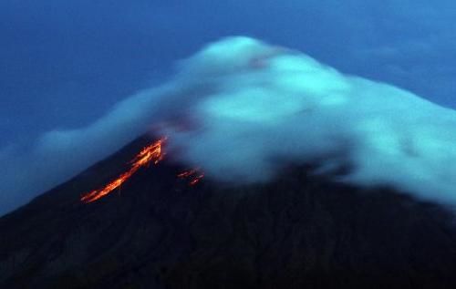
Lava flows from the crater of Mayon volcano, as seen from Legazpi City, Albay province, southeast of Manila, on September 17, 2014
Lava cascaded down the Philippines' most active volcano on Wednesday as authorities rushed to evacuate thousands ahead of a possible deadly eruption.

Mostly women, children and the elderly carrying bags of clothes were hauled out of farming villages near Mayon volcano's slopes on board army trucks and minibuses.

Soldiers went from house to house asking residents to evacuate, after authorities on Monday raised the third highest alert in a five-step scale, meaning a full-scale eruption is possible "within weeks".

Before dawn Wednesday, Mayon's crater glowed red as molten rocks flowed as far as halfway down its slopes.

The volcano's world-renowned perfect cone appeared to have been deformed, swollen with lava that had risen from the Earth's core.

At least 8,000 of the target 50,000 people had been moved to temporary shelters, with the operation expected to run for three days, regional civil defence director Bernardo Alejandro told AFP.

Bizarro Earth

Is Hawaii's Mauna Loa poised to erupt?

Image
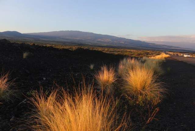
© Hollyn Johnson/Tribune-HeraldMauna Loa is seen Saturday morning from West Hawaii. -
As Kilauea continues to threaten lower Puna, geologists are also keeping their eyes on the volcano's much larger cousin - Mauna Loa. According to the U.S. Geological Survey Hawaiian Volcano Observatory, Mauna Loa, the largest active volcano on the planet, has been rumbling and showing signs of awakening for more than a year.

An eruption isn't imminent, and no warnings are being issued, but the towering 13,678-foot mountain is going through the same motions that it did before its 1984 and 1975 eruptions, said Wes Thelen, HVO seismologist. The activity includes faint, shallow earthquakes to the west of the summit and "deep long period" temblors 28 to 31 miles below the surface, both of which point to the intrusion of magma.

"All the signs are there that tells us that magma is moving into the shallow system," Thelen said. He said monitoring equipment, much more sophisticated than what was in place in the 1980s, is continually detecting magnitude 0.5 quakes about 4 miles below the surface in the same areas where activity was detected in the years leading up to the last eruptions. Thelen noted he is confident the small earthquakes are a recent development.

Bizarro Earth

It's not just the magma that could be a problem if Iceland's rumbling Bardarbunga erupts

The red-hot fountains of molten lava, glowing like wildfire, are nothing short of spectacular. Yet they could be ominous portents of things to come. For the second time in four nail-biting years, seismologists in the land of fire and ice, Iceland, are bracing for a monumental volcanic eruption that, once again, threatens to disrupt European air traffic.


Back in 2010, the Eyjafjallajokull volcano, which melted through 200 metres of glacier, sent more than 200 million cubic metres of fine ash billowing almost 10 kilometres into the sky. As a result, several European countries were forced to ground or re-route thousands of flights for several days.
Image

Bizarro Earth

Lava on Hawaii's Big Island creeping up on vacant lots in rural subdivision

Image
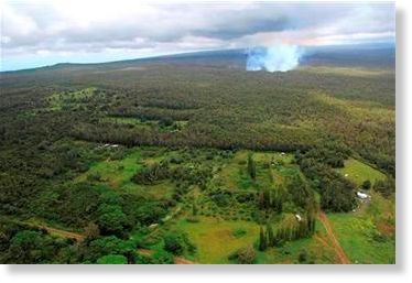
© AP Photo/U.S. Geological Survey, Tim OrrThis Monday Sept. 8, 2014, aerial photo provided by the USGS
Lava from one of the world's most active volcanos soon could reach three vacant lots in a rural subdivision on Hawaii's Big Island, but officials are hopeful homes will be spared. Based on the lava's movement of about 200 to 300 yards a day, the flow from Kilauea volcano was expected to reach the lots in Kaohe Homesteads in coming days, Hawaii County spokesman Kevin Dayton said.

The large lot closest to the flow is owned by the state, while the other two are privately owned, he said. "The fact that it's veering somewhat to the north as opposed to the east is a hopeful sign," Dayton said.

While no evacuations have been ordered, residents were asked to remain on alert and be prepared for possible changes in the lava's course. The slow-moving molten rock could spread and slow even further in coming days as it moves from a steeper grade to more level land, Dayton said.

The lava was about 3 miles from Pahoa Village Road and 3.5 miles from Highway 130, Dayton said. Highway 130 is a lifeline for the mostly rural Puna district, which would be cut off from the rest of the island if lava crosses the busy two-lane highway.

Bizarro Earth

Indonesia's Mount Lokon and Mount Slamet volcanoes exhibit multiple eruptions causing evacuations

Mount Slamet
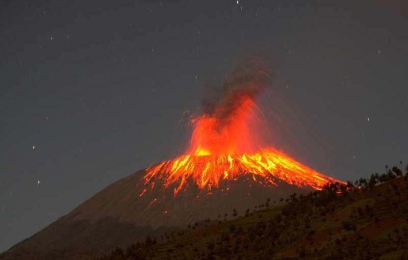
Mount Slamet erupts as viewed from Dawuhan village, Brebes, Central Java, Indonesia, on Sept. 11, 2014.
Jakarta, Indonesia: Mount Slamet volcano in Central Java province erupted again on Friday, spewing a column of ash by up to one km high, prompting more than 20,000 villagers living on the slope of the volcano to prepare for evacuation, officials said. Indonesian authorities have put the Mount Slamet volcano on the second-highest alert level after it erupted 38 times on September 11, spewing lava some 1,500 meters (5,000 feet) into the air.
Image