Volcanoes
S


Volcano

Mount Lewotobi Laki-laki volcano erupts in Indonesia - sending ash up to four miles high

mmmmmmm
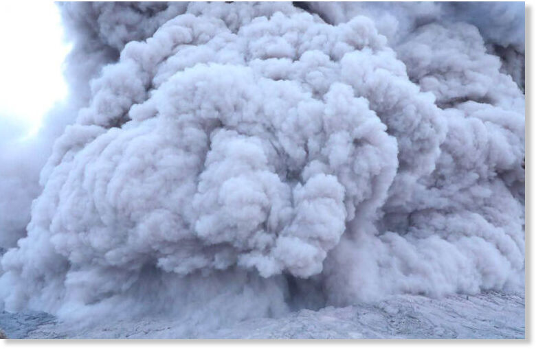
Residents watched as the Mount Lewotobi Laki-laki volcano erupted in Indonesia this afternoon - sending ash up to four miles high.

The crater in East Flores Regency, East Nusa Tenggara (NTT) Province, began shaking before spewing the cloud on Monday afternoon, August 18.

Head of the Lewotobi Laki-laki Volcano Observation Post, Herman Yosef Mboro, recorded the eruption at 5:12 PM local time. Seismograph data show the eruption lasted four minutes and five seconds with a maximum amplitude of 47.3 mm.

The ash cloud reached 6km (3.7 miles) above the summit. Residents were ordered to evacuate and stay away from the danger zone around the base of the volcano, which has shown renewed activity since early July.

Volcano

Indonesia's Mount Marapi erupts again, ash reaches 1.6 km

bbbbbb
Mount Marapi, located between the Agam and Tanah Datar districts in Indonesia's West Sumatra province, erupted Tuesday morning.

Volcanology officials reported that volcanic ash rose approximately 1,600 meters above the summit, News.Az reports, citing Indonesian media.

"An eruption occurred at Mount Marapi in West Sumatra at 8:39 a.m. local time, with the ash column observed at approximately 1,600 meters above the summit," an officer from the Mount Marapi Volcanology and Geological Hazard Mitigation (PGA), Ahmad Rifandi, informed on Tuesday.

The PGA reported that the ash column was white-gray, thick in intensity, and drifting northeast. Seismograph readings recorded a maximum amplitude of 30.4 millimeters, with the eruption lasting around 34 seconds.


Volcano

Japan's Shinmoedake volcano erupts, sending ash 3,000 metres into sky

mmmmmm
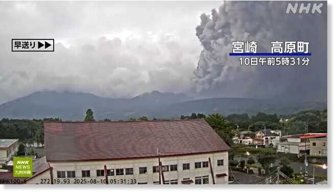
A powerful eruption at Japan's Shinmoedake volcano sent an ash plume more than 3,000 metres high on Sunday morning, prompting safety warnings from authorities.

The eruption occurred at around 5:23 a.m. local time in the Kirishima mountain range, on the border between Kagoshima and Miyazaki prefectures, according to local media. The volcano has been erupting intermittently since 27 June.

Japan's national broadcaster NHK said ash from Sunday's eruption is drifting northeast and could reach as far as Takanabe in Miyazaki Prefecture. The Japan Meteorological Agency (JMA) warned that moderate ashfall is expected in Kobayashi and Takaharu in Miyazaki Prefecture, as well as in Kirishima, Kagoshima Prefecture.

The JMA also cautioned that small volcanic rocks could fall within about 14 kilometres northeast of the crater. The eruption alert level remains at 3, with residents advised to watch for large volcanic rocks within 3 kilometres and pyroclastic flows within 2 kilometres of the crater.

Shinmoedake is part of the Kirishima volcanic group and has a history of periodic eruptions, with the last significant activity recorded in 2018. Authorities are monitoring conditions closely and urging residents and visitors to remain vigilant.


Volcano

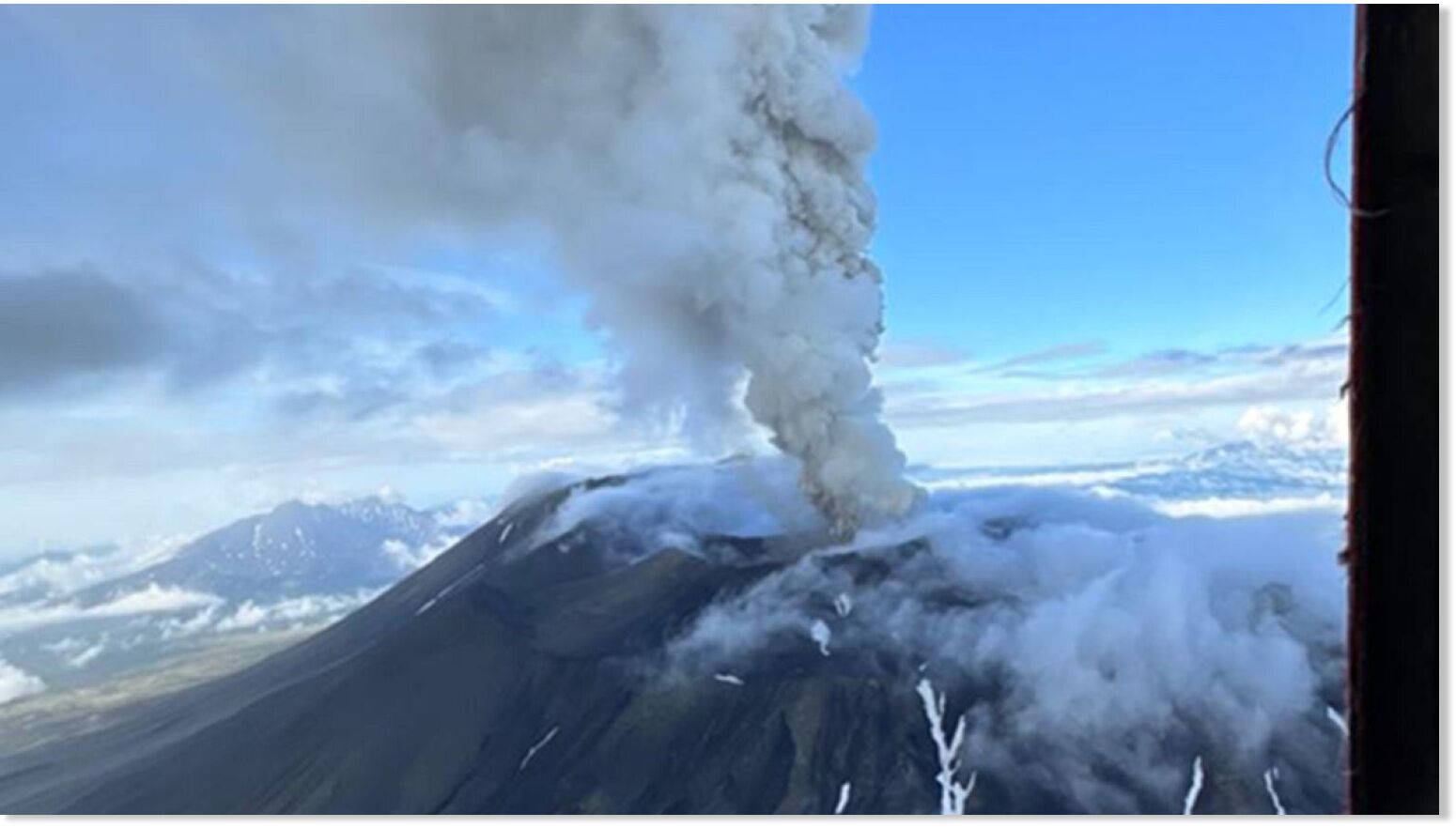
Klyuchevskaya Sopka volcano in Russia's Far East sends another ash plume 7-km high

mmmmmm
© Yuri Demyanchuk
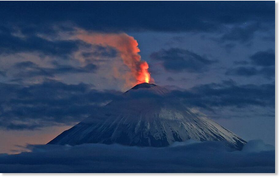
The Klyuchevskaya Sopka volcano has spewed another high column of ash into the air over the past day, the Institute of Volcanology and Seismology of the Far Eastern Branch of the Russian Academy of Sciences said in a statement on Telegram, TASS reports.

There are about 80 side blast craters and cinder cones on the volcano's slopes. Klyuchevskaya Sopka is located 30 km from the village of Klyuchi in the Ust-Kamchatsky district, which is home to about 4,500 people.

Nearby, the Bezymyanny volcano is also erupting.

Earlier it was reported that the Klyuchevskaya Sopka volcano erupted in Kamchatka as a result of July 30 earthquake.


Comment: Related: Russia: Kamchatka's Krasheninnikov volcano erupts for the first time in 600 years


Volcano

Best of the Web: Russia: Kamchatka's Krasheninnikov volcano erupts for the first time in 600 years

mmmm
The Kamchatka branch of Russia's ministry for emergency services said an ash plume was recorded rising up 5-6 kilometres following the volcano's eruption, and drifted 75 kilometres eastward.

The Krasheninnikov volcano in Russia's Kamchatka has begun erupting for the first time in nearly 600 years, according to the Kamchatka Volcanic Eruption Response Team (KVERT).

On the Telegram channel of the Institute of Volcanology and Seismology, KVERT said that the last eruption took place in 1463, and none has been known to have occurred since.

It comes after the Ministry of Emergency Services in the Kamchatka region reported that a magnitude 6.8 earthquake struck off the coast of Kamchatka.

The ministry issued a tsunami warning for the Kamchatka peninsula, which has since been lifted.


Comment: Related: Magnitude 6.8 earthquake strikes near Kuril Islands, Russia


Volcano

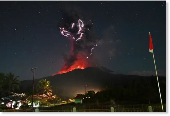
Indonesia volcano Mount Lewotobi erupts in electrifying fashion

eruption in East Flores, Indonesia, Friday, August. 1, 2025
© Badan GeologiIn this photo released by Geological Agency (Badan Geologi) of the Indonesia's Ministry of Energy and Mineral Resources, lightning strikes as Mount Lewotobi Laki-Laki spews volcanic material during an eruption in East Flores, Indonesia, Friday, August. 1, 2025
Mount Lewotobi Laki-Laki lit up the night sky with glowing lava and bolts of lightning when the volcano erupted on Aug. 1, 2025.

August began with a burst of volcanic activity in Indonesia as Mount Lewotobi Laki-Laki erupted, sending ash miles into the sky.

Part of the eruption unfolded at night, illuminating the darkness with the fiery glow of lava and flashes of lightning.

Violent volcano eruptions are often accompanied by lightning as the rapidly growing plume of ash generates a tremendous amount of static electricity in the atmosphere. Once enough charge builds up, it is released all at once in a bolt of lightning.


Bizarro Earth

Canada is breaking apart: Geologists reveal hidden fault line that could unleash devastating quakes

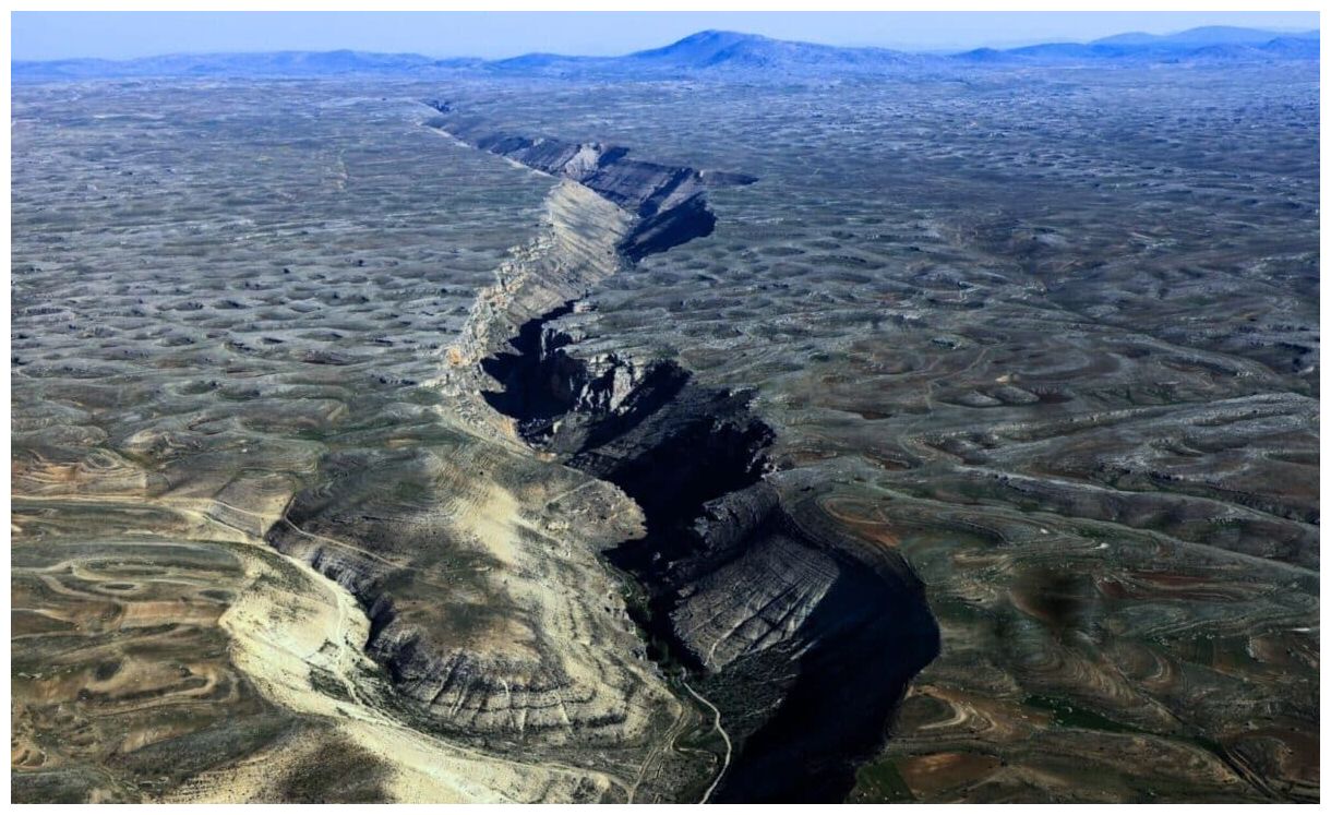
A hidden seismic threat is awakening beneath Canada's Yukon Territory. The Tintina fault, long thought to be inactive, now shows signs of significant movement, suggesting it could unleash massive earthquakes.
Aerial Photograph of Geological Landform, Mersin – Turkey.
© iStockAerial Photograph of Geological Landform, Mersin – Turkey.
What Is the Tintina Fault, and Why Does It Matter?

Stretching over 1,000 kilometers (621 miles) from the Yukon into Alaska, the Tintina fault is one of the major geological features in western North America. It runs parallel to the Yukon River, marking a significant divide in the Earth's crust where two tectonic plates meet. Over its history, the fault has shifted laterally by a remarkable 450 kilometers (280 miles), making it an essential player in understanding the region's seismic landscape.

For a long time, scientists believed the fault had been inactive for at least 40 million years, largely because there had been no significant seismic events associated with it during recorded history. This view began to shift when recent research uncovered new evidence that the fault may still be capable of large ruptures, potentially putting the area at risk for powerful earthquakes in the future.
Yukon Territory Fault Line
© Geophysical Research LettersPhysiography and seismotectonics of the Yukon Territory. Quaternary scarps along the Tintina fault in this study are highlighted with a red line.

Volcano

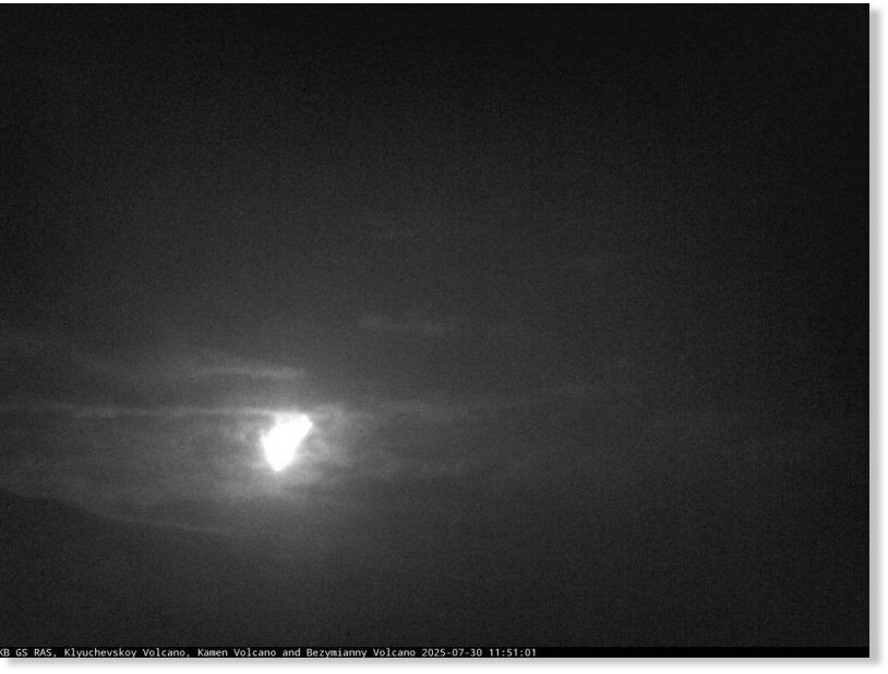
Russia mega earthquake triggers eruption at Klyuchevskoy volcano

mmmmm
Russia's Klyuchevskoy volcano on the Kamchatka Peninsula began erupting following a powerful earthquake in the Pacific on Wednesday, according to the country's geological monitoring agency.

According to reports from the Institute of Volcanology and Seismology of the Far Eastern Branch of the Russian Academy of Sciences, the volcano emitted a column of ash reaching 3 kilometers above sea level.

"Right now, Klyuchevsky volcano is erupting," it said.

Ash clouds have extended eastward, covering distances of up to 58 kilometers.

In a statement posted on Telegram, the Russian Academy of Sciences' United Geophysical Service said: "A descent of burning hot lava is observed on the western slope. Powerful glow above the volcano, explosions."


Comment: Related: 'Strongest in decades' 8-8 magnitude earthquake triggers tsunami alert


Volcano

Multiple volcanic eruptions reported near Erta Ale crater in Ethiopia - North crater collapses massively, 40 kms long rift formed (UPDATE)

Ethiopia's Erta Ale shield volcano.
© ENAEthiopia's Erta Ale shield volcano.

Volcanic eruptions have been reported in Ethiopia's Afar region, with activity recorded in four separate locations near the Erta Ale crater since Tuesday, local media have confirmed.

According to the Ethiopian News Agency (ENA), the eruptions occurred within a 15-kilometre radius of the main Erta Ale crater, one of the country's most active volcanic sites.

Visible ash plumes have been reported in the area, which, according to regional officials, began on Tuesday and has continued into the week, prompting close monitoring of the sites.

The Afar Regional Tourism Bureau has confirmed the eruptions, stating that no casualties or damage to nearby communities have been reported.

"Erta Ale volcano erupted again yesterday, July 15 and today, July 16, 2025. The eruptions that occurred in four places are producing thick smoke and are sinking to the ground," said the Bureau in a Facebook statement.


Comment: Update July 25

Vulkane.net reports:
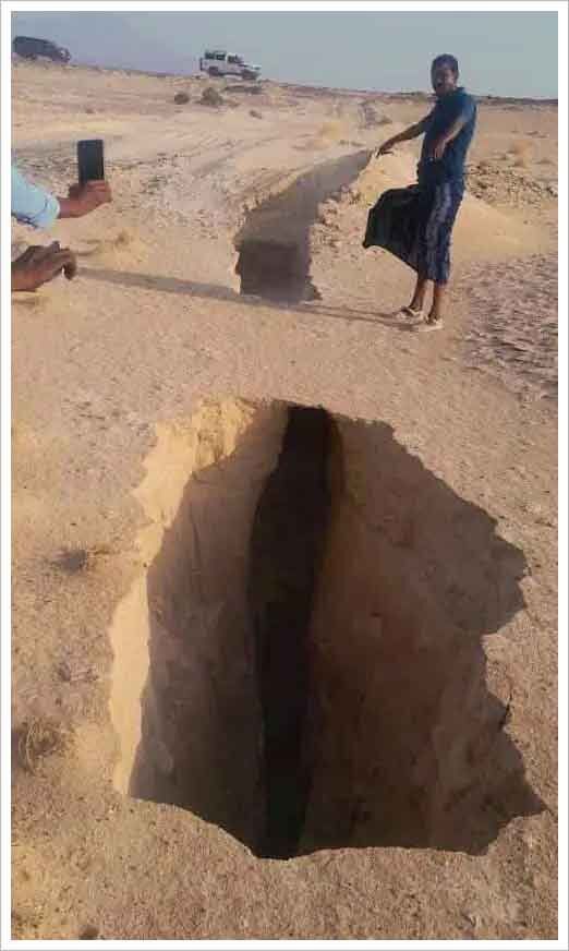
The true extent of the events taking place at the remote Erta Alé volcano since mid-July is gradually becoming clear. New images from the northern end of the caldera show that a massive pit crater several hundred meters deep has formed. The crater was formed as a result of collapse events as the magma reservoir beneath the volcano drained southward. This likely created a magmatic vein and rift approximately 40 kilometers long.

mmmmm
I know the north crater in the Erta Alé caldera as a slight depression, the edge of which dropped steeply by about 15 m in 2002. Over the past few years, the depression has filled with repeated lava flow eruptions until it even formed a dome. The resulting crater has likely returned to the dimensions it had at the beginning of the volcano's last cycle. As the volcano guides who took the photographs moved away from the volcano, they saw clouds of ash rising again, indicating further collapse events. This is a sign that crater formation, and thus the underground drainage of magma, may not yet be over. It cannot be ruled out that a lava flow could emerge at the end of the passage near the Afdera salt lake, where there is also a settlement.


The South Crater has also collapsed in recent days. Judging by satellite photos, it has returned to the size it was during my first visit. It's quite possible that a lava lake will form again in one or both of the pit craters. For tourists, direct contact with the lava has thus receded into the distance: Recently, several hornitos were seen, which had formed on the crater fillings or lids and were bursting with lava.

If the collapse events continue, the two closely located craters could merge into one. In this case, one could speak of caldera formation. But even so, this is an unusual occurrence.
(Translated by Google)


Volcano

Mount Marapi in Indonesia erupts with ash 1.6 km high, accompanied by booms and tremors

mmmm
Mount Marapi, located in Agam and Tanah Datar Regencies, West Sumatra, has erupted again, producing an ash column reaching a height of 1.6 kilometers on Wednesday (23/7/2025) morning. This eruption was also accompanied by loud explosions and vibrations that startled the residents.

The Center for Volcanology and Geological Hazard Mitigation (PVMBG) through the Marapi Volcano Observation Post (PGA) reported that the eruption of Marapi occurred on Wednesday at 07:32. The height of the ash column from the eruption was approximately 1,600 meters or 1.6 kilometers above the peak, or about 4,491 meters above sea level.

"The observed ash column is white to gray in color with a thick intensity leaning towards the southeast," said PGA Marapi Post Officer, Teguh Purnomo, in a written statement on Wednesday.

According to Teguh, the eruption of the volcano, which is currently at Level II or Alert status, is recorded on the seismogram with a maximum amplitude of 30.5 millimeters and a duration of approximately 1 minute and 18 seconds.