Earthquakes
S


Fireball 3

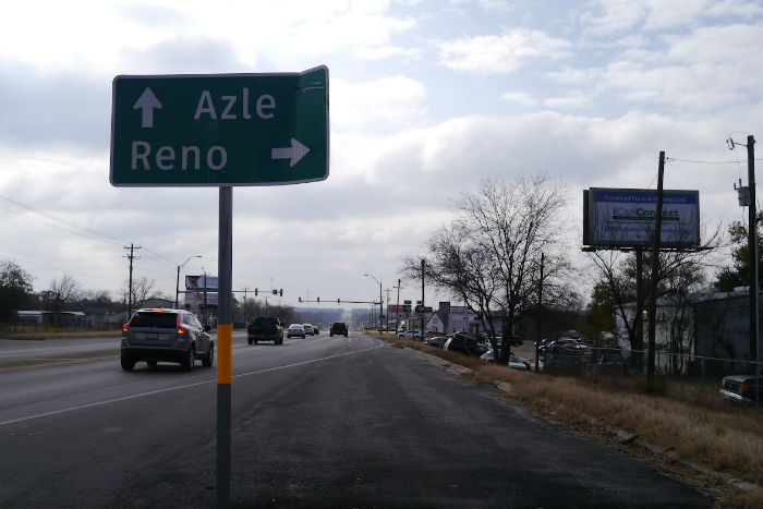
Frequent earthquakes, loud booms in North Texas rattle Azle residents

Image
On Nov. 26, another earthquake jolted the small town in northwest Tarrant County. And on Friday, yet another one hit nearby. About 20 quakes rattled North Texas in November -- five of them in or near Azle.

The minor earthquakes haven't caused significant damage, but residents in Azle are getting nervous and seismologists are trying to get to the bottom of what's going on.

Some point to natural gas drilling that's happening in the Barnett Shale, a massive geological formation that covers about 20 North Texas counties. But a geophysicist with the National Earthquake Information Center says more testing is needed to make such a connection.

Stop

Massachusetts seeks 10 year ban on gas fracking after series of Texas earthquakes

fracking
© Reuters / Shannon Stapleton
An environmental committee at Massachusetts Statehouse has approved a bill, imposing a 10-year ban on fracking for natural gas. The move comes as a wave of earthquakes in Texas has raised new concerns over the controversial drilling technique.

The Massachusetts fracking moratorium bill is designed to protect the state's drinking water from possible contamination and thus "ensure that the health and prosperity of our communities is maintained," according to one of the legislation's sponsors, Northampton Democratic state Rep. Peter Kocot, cited by AP.

To become law, the temporary ban on fracking has yet to be approved by the lawmakers and signed by the Democratic Governor, Deval Patrick.

The Massachusetts legislative move was taken on Friday, the day after Texas was stuck by a 3.6 magnitude earthquake, one in a row of similar episodes during the last three weeks. The finger of blame is being pointed at fracking. The series of small earthquakes caused no casualties, but left local Texas residents fearing worse could be in store.

Info

USGS: Magnitude 6.0 - 69km SE of Sinabang, Indonesia

Earthquake in Indonesia
© USGS
Event Time
2013-12-01 06:29:57 UTC
2013-12-01 12:29:57 UTC+06:00 at epicenter
2013-12-01 07:29:57 UTC+01:00 system time

Location
2.063°N 96.851°E depth=11.2km (7.0mi)

Nearby Cities
69km (43mi) SE of Sinabang, Indonesia
215km (134mi) WSW of Kabanjahe, Indonesia
217km (135mi) W of Sibolga, Indonesia
242km (150mi) SSE of Meulaboh, Indonesia
550km (342mi) WSW of Kuala Lumpur, Malaysia

Technical Details

Bizarro Earth

Over a dozen 'earthquakes' hit north Texas in November, and nobody has a clue what caused them

Image
© Doualy Xaykaothao / KERA NewsOn Tuesday morning, yet another earthquake rocked the small Tarrant County town of Azle.
On Tuesday morning, yet another earthquake rocked the small Tarrant County town of Azle. It was the sixth within a week in Tarrant and Parker counties. More than a dozen quakes have rattled North Texas in November.

Azle residents are getting nervous and seismologists are trying to get to the bottom of what's going on. Some point to natural gas drilling that's happening in the Barnett Shale, a massive geological formation that covers about 20 North Texas counties. But a geophysicist with the National Earthquake Information Center says more testing is needed to make such a connection.

Azle isn't the kind of place with a Starbucks or a quaint coffee shop. But at the popular gas station, Centerpoint Kwik Stop, the morning coffee crowd could only talk about one thing:

"Bam. It was like something hit the side of my house -- and it wasn't nothing but the earthquake," Janice Hammond said.

Bizarro Earth

USGS: Earthquake Magnitude 6.3 - Kepulauan Barat Daya, Indonesia

Indonesia Quake_011213
© USGS
Event Time
2013-12-01 01:24:14 UTC
2013-12-01 10:24:14 UTC+09:00 at epicenter

Location
7.006°S 128.351°E depth=10.0km (6.2mi)

Nearby Cities
343km (213mi) WNW of Saumlaki, Indonesia
351km (218mi) ENE of Dili, East Timor
366km (227mi) S of Ambon, Indonesia
410km (255mi) S of Amahai, Indonesia
446km (277mi) ENE of Atambua, Indonesia

Technical Details

Wreath

7 dead, 45 injured as 5.6 earthquake hits 60km from Iran's Bushehr nuclear plant

Bushehr main nuclear reactor
© Reuters / Raheb HomavandiBushehr main nuclear reactor
A powerful earthquake has hit Iran, killing seven and injuring a further 45, IRNA state news agency reported. The disaster's epicenter was in an area 62km north east of Bushehr, according to the USGS, where Iran has its only nuclear power plant.

The head of Iran's Crisis Management organization, Hassan Qadami, confirmed the initial 30 casualties to IRNA. However, Bushehr's Governor, Fereydoon Hasanvand, updated the figure to 45 on Thursday night. He added that 'total calm' had settled in the area.

Fars news agency placed the death toll higher, at eight, adding that helicopters would be posted to the area on Friday to assess the extent of the damage.

"There were some houses and electricity poles damaged. Rescue teams have been dispatched," local governor Alireza Khorani told Fars before full news of the wounded emerged.

Tremors were registered at a depth of 16.4 kilometers and some 14 kilometers from the nearest city of Borazjan in Bushehr Province.

While USGS measured the quake at 5.6, the local Seismological Center of Tehran University's Geophysics Institute has said that the earthquake measured 5.7 on the Richter scale.

Cloud Lightning

Best of the Web: Signs of Change in November, 2013

Image
The Philippines looked like it had been hit by a tsunami once Super-typhoon Haiyan roared through
Major flooding and landslides in India, a massive earthquake off Japan, a ferocious storm thrashing northern Europe, more mass animal die-offs, flash-flooding in Texas taking rivers to their highest levels in 100 years, canals turning red in The Netherlands, meteor fireballs seen the world over, a devastating super-typhoon wiping out parts of the Philippines, a deadly cyclone in Somalia, sinkholes swallowing more homes in Florida, a "second-season outbreak" of deadly tornadoes in the U.S. Midwest... just another month of strange and extreme weather and celestial events on a planet that's rockin' and rollin'.


Cow Skull

Staggering concessions by Austria's national weather service: "Natural factors substantial... models inadequate"!

A November 11, 2013 press release by Austria's national weather service, the Zentralanstalt für Meteorologie und Geodynamik (ZAMG), somehow got by me. And not surprisingly it was completely ignored by the German-language mainstream media. It's titled: "Slower temperature increase: climate models under scrutiny".

In the introduction the ZAMG writes:
If one compares the temperature development of the last 15 years to the simulations from the new climate model generation, then one sees a substantial deviation between reality and model: the so-called temperature hiatus."
Air temperature is the preferred parameter that experts use to gauge climate change. On the hiatus the ZAMG writes, "In the last 15 years there has been a clear weakening in the global temperature rise; only 3 of 114 climate model simulations account for it (Figure 1)."

Global temperature 1986-2010
© IPCC 2013Figure 1: Change in global near-surface temperature relative to the 1986–2005 period from observation data (black) and model simulations (coloured)

Bizarro Earth

Earthquake magnitude 7.0 strikes near Falkland Islands

Earthquake South Atlantic Ocean
© USGS
A magnitude-7.0 earthquake has struck in the South Atlantic, southeast of the disputed Falkland Islands, according to the U.S. Geological Survey (USGS).

It says the quake struck at 2-27 a.m. on Monday (0627 GMT), about 195 miles southeast of the Falklands' capital, Stanley, and 545 miles east of Ushuaia, Argentina. The depth was a shallow 6.2 miles.

The Falklands are a British territory that is claimed by Argentina.

The USGS says the quake followed four others that all measured more than 5.0, over a two-hour period leading up to the big quake. It says such quakes are uncommon in the region. Only 15 quakes of more than magnitude 5.0 had been measured in the region in the previous 40 years.

Bizarro Earth

USGS: Magnitude 7.0 - South Atlantic Ocean

Earthquake South Atlantic Ocean
© USGS
Event Time
2013-11-25 06:27:33 UTC
2013-11-25 02:27:33 UTC-04:00 at epicenter

Location
53.881°S 54.882°W depth=10.0km (6.2mi)

Nearby Cities
314km (195mi) SE of Stanley, Falkland Islands
877km (545mi) E of Ushuaia, Argentina
998km (620mi) ESE of Rio Gallegos, Argentina
1031km (641mi) SE of Puerto Deseado, Argentina
314km (195mi) SE of Stanley, Falkland Islands

Technical details

Additional commentary

The November 25, 2013 M7.0 earthquake (06:27:33 UTC) southwest of the Falkland Islands in the South Atlantic Ocean occurred as the result of strike slip faulting, on either a left-lateral fault striking ENE-WSW, or a right-lateral structure striking NNW-SSE. The location of the earthquake, near the ENE-WSW trending plate boundary between the South America and Scotia tectonic plates, suggests it is likely associated with left-lateral faulting along this margin. At the location of this earthquake, the Scotia plate moves ENE with respect to South America at a rate of approximately 9.5 mm/yr.

The November 25, 06:27:33 earthquake was the largest of 5 M5+ events that occurred in a similar area over an approximate 2-hour period, including a M5.6 earthquake 24 seconds prior to the M7.0 mainshock. Though this region experiences moderate-sized earthquakes relatively frequently - 15 M5+ events have occurred within 250 km of the November 25 earthquake over the past 40 years - large events are fairly uncommon. The largest nearby earthquake over the same time period was a M6.6 event in September 1993, 210 km to the east of the November 25 earthquake.