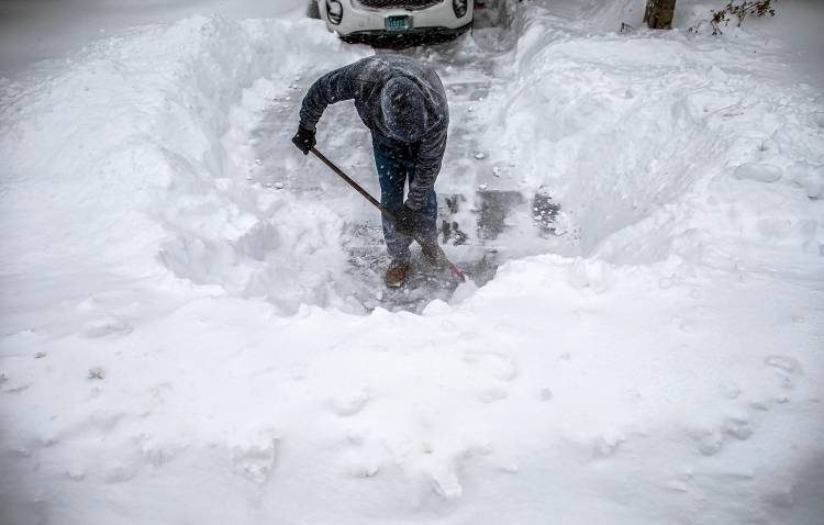
Record-busting snow buried the Northeast United States Wednesday and Thursday this week as a mass of brutal Arctic air rode south on the back of a weak and wavy "meridional" jet stream flow.
Centre County, Pennsylvania was overwhelmed Wednesday by more than a foot of unprecedented pow-pow.
State College was hit by 15 inches of global warming goodness, which broke the 24-hour December snowfall record by 2.5 inches in weather books dating back to 1893 (the previous record being the 12.5 inches set Dec. 11, 1992). In fact, more snow fell Wednesday than during the entire 2019-20 winter season.
The nor'easter dumped about 2 inches per hour at its peak, a rate that National Weather Service State College lead meteorologist Greg DeVoir called "outrageous."
At least four people are known to have died.
DeVoir continued: "This was a potent storm. We kept alluding to the snowfall rates as being critical both for snow removal and travel because it doesn't take long with those rate to completely halt safe transportation."
"Storms of this magnitude are pretty rare for State College and central Pennsylvania," Penn State assistant teaching professor of meteorology and atmospheric science Steve Seman said.
Seman's climate huckster colleague, Michael Mann, director of the Earth System Science Center at Penn State, has yet to comment (perhaps he was snowed-in?) but we can probably assume Mann's illogical position: "heatwaves are a sign of 'climate change' whereas record-smashing snowstorms are merely 'weather'"-or something like that...
Several nearby locations had logged more than 40 inches.
Litchfield, in the very northern part of the state, reported 43 inches, which exceeded the Pennsylvania 24-hour snowfall record of 38 inches set back in March 1958.
Southern Vermont proved to be another jackpot zone for snowfall where several locations topped 40 inches, including a 44-inch total in Ludlow.
In New Hampshire, snowfall rates were as high as seven inches per hour.
Shifting attention to New York State, forecasters had said that around a foot of snow could fall on the Binghamton area and other parts of the Southern Tier, but in reality more than 3.5 feet buried much of Broome County, obliterating the previous December snowfall record.
Broome County Executive Jason Garnar declared a state of emergency and travel ban even before the worst of the storm hit, and Thursday morning Garnar said it could take days before the mountain of snow is removed-it could-well last until Christmas.
"This is the fastest rate of snowfall I've ever encountered, even worse than March 2017, when three feet of snow fell in less than 12 hours," Garnar said.
"We had bands of snow that hovered over our county and were dumping 4 to 5 inches an hour. Snowplows can't keep up with it. In several municipalities, they aren't even able to get to their trucks."
Lily Chapman, a meteorologist with the NWS in Binghamton was quick to get in her excuses re the failed predictions, saying it's often difficult to predict in advance how much snow a major winter storm will dump on a particular area. "It was record-breaking," admitted Chapman. "As far as December goes, it was the highest one-day total. The previous record was 14 inches, so we smashed that one. It's also the greatest ever two-day total for our office."
The New York State capital of Albany finished-up with more than 30 inches:
New York City was left with over 10 inches, more than all of last year's winter storms combined — Central Park posted 10.5 inches.
Boston registered over a foot — Thursday afternoon's measurement of 12.5 inches at Boston Logan International Airport almost doubled the previous Dec. 17 record of 6.4 inches set back in 2013.
Hundreds of cold records tumbled across the Mid-Atlantic and Northeast this week — I'll bring you the exact numbers as soon as they've been confirmed.
Stay tuned for updates.
The COLD TIMES are returning, the mid-latitudes are REFREEZING in line with historically low solar activity, cloud-nucleating Cosmic Rays, and a meridional jet stream flow.
Both NOAA and NASA appear to agree, if you read between the lines, with NOAA saying we're entering a 'full-blown' Grand Solar Minimum in the late-2020s, and NASA seeing this upcoming solar cycle (25) as "the weakest of the past 200 years", with the agency correlating previous solar shutdowns to prolonged periods of global cooling here.
Furthermore, we can't ignore the slew of new scientific papers stating the immense impact The Beaufort Gyre could have on the Gulf Stream, and therefore the climate overall.


R.C.