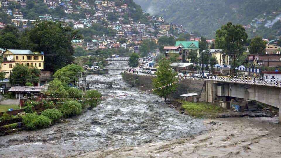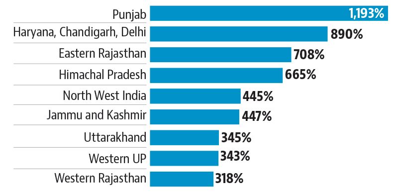
Since Friday, north-west India received 454% more rainfall than the normal for this period.
The departure was highest for Punjab, which received 1,193% more rainfall than usual, and lowest for western Rajasthan, which also got 317% more rain than normal.
Weather experts said that rainfall in this part of the country normally occurs when localised depressions caused by summer heat attract moisture laden winds, mostly from the Bay of Bengal. But the rainfall being experienced by the region at the moment is a result of moisture from both the Bay of Bengal to the east and the Arabian Sea to the west.
"The large low pressure area caused by Cyclone Daye, extending to the coast of Gujarat, got 'hooked' with the westerly winds coming from Arabian sea, taking the moisture upwards towards north," said India Meteorological Department (IMD) director general KJ Ramesh.

The condition has led to a dip in temperature — by three to five degree Celsius — and caused snowfall in the upper reaches of Himachal Pradesh and Jammu & Kashmir, which is highly unusual in September. The tribal belt of Himachal Pradesh and Ladakh in Jammu & Kashmir received about one feet of snow on Sunday,damaging potato and apple crops,according to local farmers.
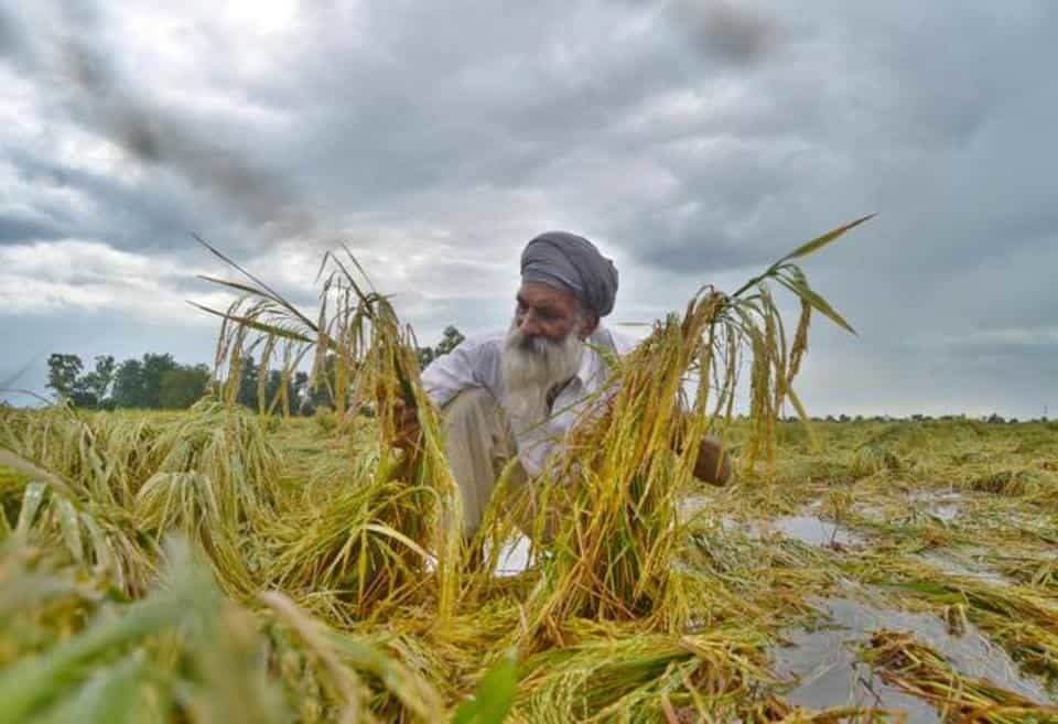
The heavy rainfall has also damaged paddy crop in large parts of Punjab and Haryana. According to farmers, paddy, which is at the maturing stage, has got flattened at several areas. "Paddy grown in low-lying areas is vulnerable to damage due to rains, as it usually gets submerged in water. We are assessing the damage," said JS Bains, a director of the Punjab agriculture department.

In Bangalore, several low-lying areas were inundated because of heavy rainfall leading to flooding of roads and uprooting of trees.
"Bengaluru got between 12 to 20 cm of rain due to south-west monsoon in the last 24 hours," said IMD's Bengaluru director CS Patil. This was double the normal rainfall for this period of the season. Ramesh said that monsoon is expected to start retreating from north India later this week, which will lead to a rise in temperature. Normally, the south-west monsoon withdraws from the southern peninsula in first week of October.


Comment: In addition see: North India wreaked by rains: Death toll jumps to 25 as floods, landslides hit Jammu & Kashmir, Himachal Pradesh, Punjab and Haryana
20 rescued from Rohtang Pass after 4 foot of fresh snowfall in Himachal Pradesh, India
2 foot of September snow in 24 hours damages apple, potato crops in Himachal Pradesh, India