Volcanoes
S


Bizarro Earth

Details of New Zealand Eruption Emerge

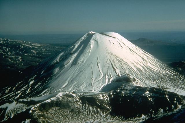
Tongariro Volcano
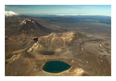
© Don Swanson, 1984 (U.S. Geological Survey)The snow-capped Ngauruhoe cone of New Zealand's Mount Tongariro volcano is one of the youngest and more active parts of the volcano.
New Zealand's Mount Tongariro volcano, located in the central part of the North Island, erupted at 11:50 p.m. local time Monday night (Aug. 6).

Details were slow to emerge because of the lateness of the eruption and cloudy weather conditions that blocked some monitoring efforts, but as daylight broke, scientists were able to shed more light on what happened.

Michael Rosenberg, the duty volcanologist at GeoNet (run by New Zealand's GNS Science and the Earthquake Comission), wrote that the eruption at the Te Māri craters was a short-lived phreatic one. Phreatic eruptions are stream-driven eruptions that happen when water beneath or above the ground is heated up, potentially causing it to boil and "flash to steam," creating an explosion, according to the U.S. Geological Survey. These eruptions can send ash and rocks flying, which this eruption seemed to do.

Bizarro Earth

Increased activity seen at volcanoes in Italy and Mexico

Image
Strombolian eruption from Etna's Bocca Nuova on 5 Aug
News have been dominated by Tongariro volcano's first eruption in 115 years (New Zealand). At the moment, the volcano is quiet, but eruptions could resume any time.

Etna (Italy): Strombolian activity continues at varying levels. Following a phase of weak activity during 4-6 Aug, an increase of activity was observed at the Bocca Nuova during the night 6-7 Aug.

Also in Italy, the activity at Stromboli (Eolian Islands) has been at relatively high levels over the past days. The number and size of explosions from the summit vents has increased.

Popocatépetl in Mexico: About 1 explosion occurs per hour, and strong glow is visible at night. A relatively powerful eruption late on 6 Aug sent ash to up to 30,000 ft (10 km) altitude.

The volcanoes in Guatemala have shown little changes in activity over the past days.

Bizarro Earth

Update: Mount Tongariro eruption takes New Zealanders by surprise: volcanic lesson will be repeated many more times in the future

A volcano quiet for more than a century erupted in a New Zealand national park, spreading thick ash for several miles and causing some residents to evacuate their homes. Some domestic flights were canceled Tuesday. Mount Tongariro spewed ash and rocks for about 30 minutes late Monday night after a few weeks of increased seismic activity. It didn't cause any injuries or damage in the sparsely populated central North Island region. Tongariro National Park has three active volcanos, is a popular tourist destination and was the backdrop for many scenes in the Lord of the Rings movies.


Bizarro Earth

Mount Tongariro erupts in New Zealand- loud explosions, lightning, plumes of smoke; first activity in 100 years

Image
© Greg Bowker NZ HeraldThe alert level for Mt Tongariro has been raised from 1 to 2 after a possible eruption.
The volcanic alert level for Mt Tongariro has risen from 1 to 2 after the central North Island volcano erupted for the first time in more than a century late last night.

GNS science is reporting that at approximately 11:50pm on Monday night ash fall began to be reported in the volcano's vicinity - it has since been reported as far east as SH5 near Te Haroto and in Napier.

GNS duty volcanologist Michael Rosenberg told Radio New Zealand that some people are reported to have left their houses on the southern shores of Lake Rotoaira, though no formal notices of evacuation have been issued so far by Civil Defense.

He said residents in the area have told GNS of hearing several loud explosions, lightning and plumes of smoke and police have been told by an onlooker that "a new hole in the side of the mountain" had formed.

They have also reported bright red rocks flying out of the mountain.

Bizarro Earth

New Zealand's White Island volcano showing growing signs of unrest

Image
© Unknown
White Island volcano is showing signs of increased activity, GNS Science says.

The volcano, about 49 kilometres off the coast of Whakatane, is a popular tourist spot, but GNS volcanologist Michael Rosenberg says those visiting it should be cautious even though the alert level for the island had not changed.

"Eruptions can occur at any time with little or no warning. The recent changes in activity suggest that the hydrothermal system has become unstable, and as a result the risk has increased," Rosenberg said.

GNS Science has changed the volcano's code from a "normal, non eruptive state" to "experiencing signs of elevated unrest above known background levels".

The volcano's lake level quickly rose by about three to five metres sometime between Friday and Saturday last week, exposing a "vigorous" flow of gas and steam into the air, Rosenberg said.

It has risen in the past, but took much longer than the 24 hours it took to rise three to five metres on Friday and Saturday, he said.

During the past few weeks there had also been some minor volcanic tremor, including several hours on Saturday, Monday and Tuesday.

Radar

Global volcano activity report: July 28, 2012

This (almost) daily post intends to follow up the activity changes of volcanoes all over the world.

This post is written by geologist Richard Wilson who specializes in Volcano seismicity and Armand Vervaeck. Please feel free to tell us about new or changed activity if we haven't written about it.

July 28, 2012 volcano activity

Surface activity has been subdued the past week at Popocatepetl (Mexico) with an average of only one exhalation per hour the past few days, versus 3-4 per hour during periods the past month. Tremor is barely visible on the Popo seismogram this morning. A software "glitch is producing the repeating pattern from 20 UTC onward.

In Guatemala, volcanic tremor is elevated this morning at Fuego volcano. Perhaps we will see another outburst similar to those affecting the volcano through most of this spring and summer in the near future. (station FG3)

At nearby Santa Maria volcano, seismic signals indicative of small explosions and/or pyroclastic flows are visible on station STG3 this morning.

Satellite imagery this morning shows weak plumes of SO2 eminating from Masaya volcano (Nicaragua) and a slightly stronger one over Rincon De La Vieja volcano (Costa Rica).

Weak volcanic tremor is apparent on the Masaya seismogram, but it is not any stronger than "normal" tremor levels at the volcano. (station MASN)
Image
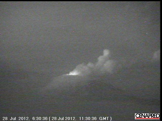
Popocatepetl, Mexico - webcam image at night

Comment: For graphs and charts with data on each volcano reported, go to original article here.


Arrow Up

Japan's Sakurajima volcano erupts again, over 600 eruptions so far this year

Mount Sakurajima erupts in south Japan on Tuesday, spewing ash onto Kagoshima City. Severe ash on the road delayed public transport. Residents wore face masks to protect themselves from the volcanic ash and also helped with the clean-up. It has erupted more than 600 times this year and is one of Japan's most active volcanoes.


Bizarro Earth

New Zealand's Volcano Alert at New High

Mt. Tongariro
© Greg BowkerAn aerial view over the Tongariro National Park.
A "sudden rise" in volcanic activity at Mt Tongariro has prompted scientists to lift its volcanic alert status for the first time.

But local businesses and conservation authorities remain unconcerned as they seek to reassure visitors it is "business as usual" at National Park.

GNS Science this afternoon lifted Mt Tongariro's volcanic alert status from level zero to level one, and increased the aviation status from green to yellow.

It said a series of more than 20 "small" volcanic earthquakes had been recorded at Tongariro since July 13 - more than the average of two per year according to historic seismic data.

The quakes, below a magnitude of 2.5 and between 2-7km deep, were recorded in a cluster zone between Emerald Crater and Te Maari craters.

The sequence of earthquakes soon declined but restarted on Wednesday and increased in number yesterday and today.

Radar

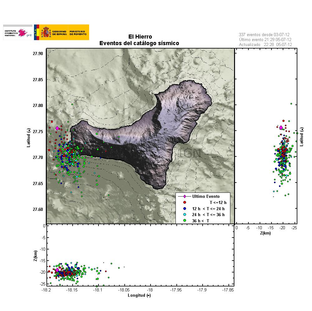
Continuous earthquake activity recorded in El Hierro volcano

Image
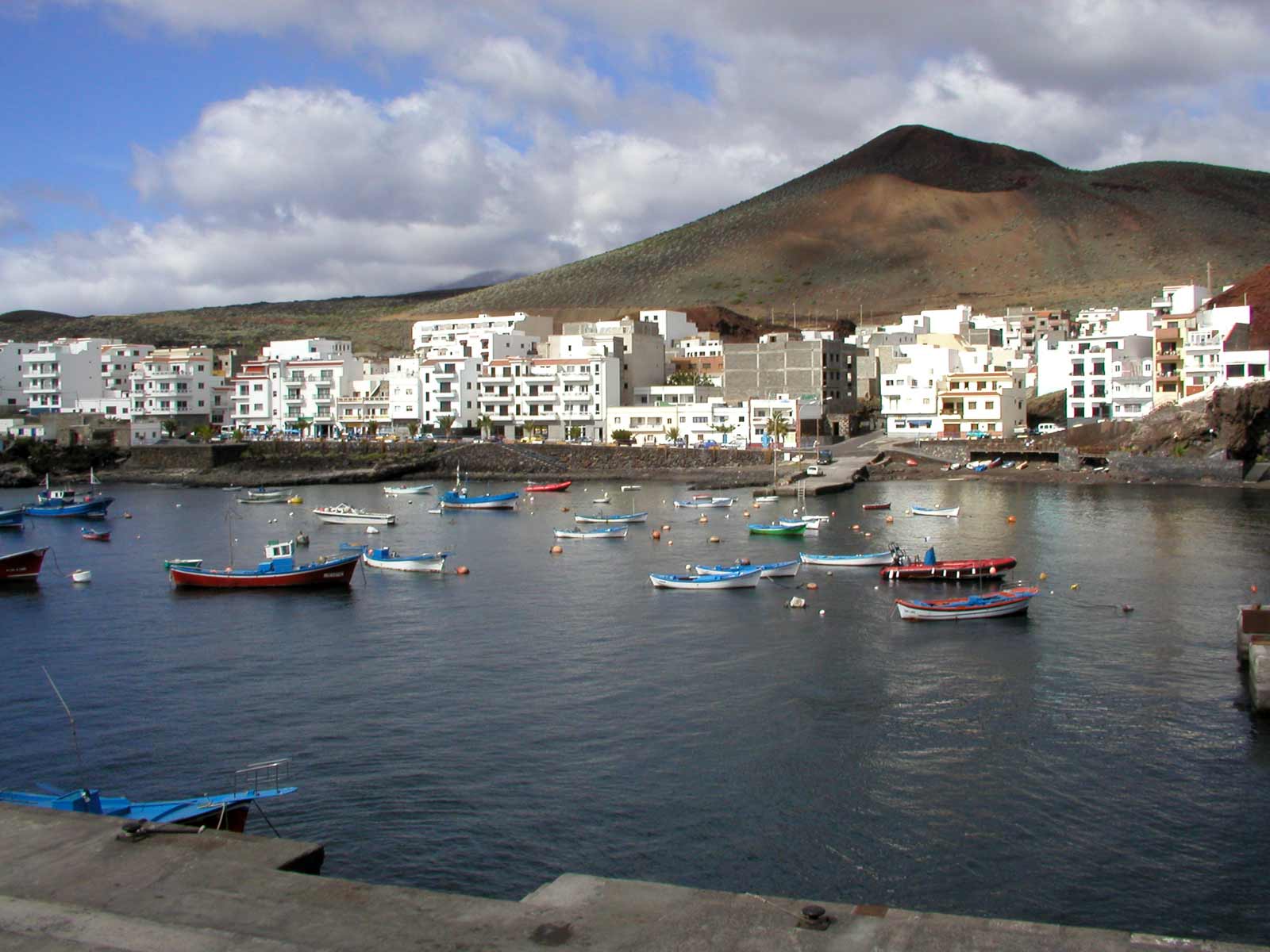
Fishing boats in La Restinga, El hierro Island, Canary Islands
There have not been great changes in El Hierro volcano. Currently no eruption has taken place. There are also no signs of magma movement on tremor plots on seismometers stations that are located on El Hierro Island. The dike intrusion in El Hierro volcano is continues, but at slower rate then before. But that it is continuing means there is continued risk of an eruption where the earthquakes are currently taking place. Currently the rate of earthquake is around 3 to 8 earthquakes during the hour. Most of the earthquakes are around ML1.5 to 3.4 in magnitude. Please note that I am missing all earthquakes with the magnitude of ML0.0 and up to ML1.5. So there might well be a lot more earthquakes taking place in El Hierro volcano then I am seeing on IGN web page.
Image
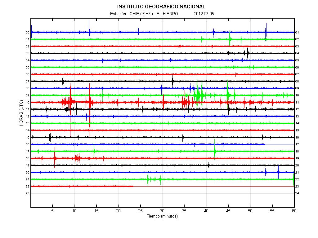
© IGNCurrent tremor plot of El Hierro volcano. The spikes are earthquakes in most cases.
Image
© IGNLast 36 hours of earthquakes in El Hierro volcano. It shows clearly where magma has pushed it self into the crust. Creating inflation and earthquakes. The spikes are earthquakes in most cases.

Bizarro Earth

New hydrothermal vents form at Indonesia's Anak Krakatau volcano

Image
Panorama of the summit crater of Anak Krakatau (2 July 2012)
During our recent expedition to Krakatau volcano, we could no longer see the lava dome active during Feb-May this year. Probably, the magma column had dropped in mid to late May and the dome collapsed. At its place, there were only 2 collapse pits, very hot ground and intense degassing from numerous fumaroles inside and outside of the now large summit crater. Seismic activity when visiting the local volcano observatory was at very low levels, suggesting that Anak Krakatau is at the moment in a phase of repose.

Interestingly, a number (at least four) areas with apparent submarine hydrothermal iron-bearing vents were observed that had not been there last year. In these areas, bubbling could be seen in the water, and where accessible, iron-rich greenish warm mud was found at the sea floor, which oxidized to orange when brought to the surface. The sea water around these areas had an intense yellow stain. Very similar submarine activity is known from around Nea Kameni Island, Santorini.