Volcanoes
S


Arrow Down

California's Lassen Peak is sinking and volcanologists don't know why

Lassen Peak
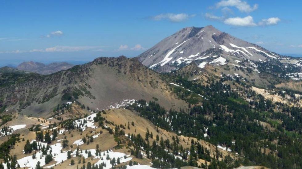
© US Geological Survey/Amanda SweeneyA view of Lassen Peak in California from the south of the summit of Brokeoff Volcano in Lassen Volcanic National Park.
With no explosion in over a century, it might appear that California's Lassen Peak hasn't changed much. However, recent findings show the volcano has been slowly sinking for the past three decades, but volcanologists can't figure out why.

In a recent study, researchers used multiple sets of data from an Interferometric Synthetic Aperture Radar (InSAR) to look at the more than 10,000-foot high volcano located in the Shasta Cascade region of Northern California and track characteristics of deformation in the peak's vicinity between 1992 and 2010. They discovered that there was a broad range of sinking measuring about 18 to 24 miles and progressing at the rate of about a centimeter per year.

InSAR uses radar images of earth's surface to track changes on the ground, according to the U.S. Geological Survey. Unlike visible or infrared light, radar waves are able to see through clouds and are equally effective in the dark, allowing researchers to see changes at night and during bouts of bad weather, which comes in handy during a volcanic crisis. The images collected by the radar are compared to each other to determine if there was any movement of the ground surface.

The scientists' research lead them to believe that this slow sinkage of Lassen Peak has been going on since the 1980s. They believe the source of the sinking is a point located about 5 miles beneath the volcano's center.

"Time-series analysis suggests that the rate of volume change of this source may have varied over time," the researchers wrote. "The source geometry and the temporal evolution of deformation contrasts to subsidence observed at nearby Medicine Lake Volcano since the 1950s."

Red Flag

Covered in ash: Chinstrap penguins threatened by volcanic eruption

chinstrap penguins
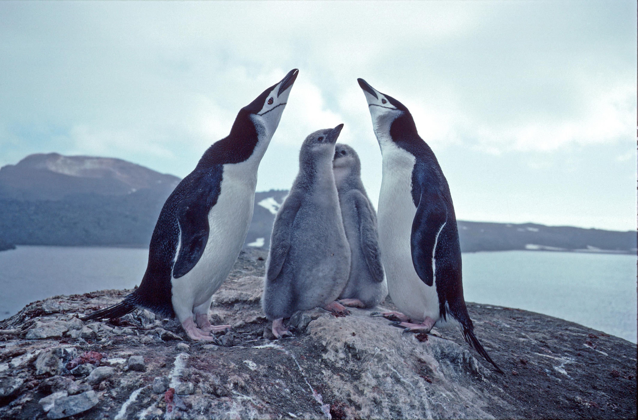
© Pete Bucktrout, British Antarctic SurveyVolcanic ash threatens an enormous colony of chinstrap penguins.

The hatcheries of migratory penguins can be magical places, full of fluffy chicks and doting parents. But things are less picturesque when you add volcanic ash to the mix. A volcano on the northernmost island of an archipelago in the South Atlantic Ocean has been spewing ash and smoke since March, threatening one of the largest colonies of penguins in the world, according to a new study.

Zavodovski Island, one of the South Sandwich Islands, is uninhabited by humans, but it is home to more than 1 million chinstrap penguins, according to the British Antarctic Survey (BAS). BAS researchers found the volcanic eruption via satellite imagery and fishermen from nearby South Georgia were able to photograph ash blowing eastward across the island over penguin-nesting grounds.

"We donꞌt know what impact the ash will have on the penguins," Peter Fretwell, a geographer with the BAS, said in a statement. "If it has been heavy and widespread it may have a serious effect on the population."

Comment: Further reading:


Attention

Iceland's Hekla volcano 'ready to blow'

Hekla eruption 2000
© Iceland Monitor/Ragnar AxelssonScenes from the last Hekla eruption in 2000.
Dubbed the "Gateway to Hell," Hekla is a volcano in South Iceland that has not erupted in 16 years. But experts in the field have warned that high pressure readings could point to an imminent explosion.

From 1970 to 2000 Hekla erupted approximately once every 10 years, but has remained dormant ever since.

University of Iceland Geophysics Professor Páll Einarsson told Icelandic news agency Visir that people should not visit the volcano, which is now a popular tourist destination, due to an increased risk of eruption.

"Hekla is a dangerous volcano," says Einarsson. "We could be looking at a major disaster when the next eruption begins if we are not careful."

Einarsson also expressed concern about the fact that airplanes currently fly directly over the volcano.

"There are also 20-30 planes full of passengers flying right over the top of Hekla every day," he warns. "This is a risky moment which we need to take seriously."

Readings indicate that magma has been collecting and that the pressure will need to be alleviated. Otherwise an explosion could occur without warning.

"Hekla is ready - at any moment," Einarsson said.

Comment: Planetary upheaval: More volcanoes erupted last week than during entire (average) year in 20th century


Arrow Up

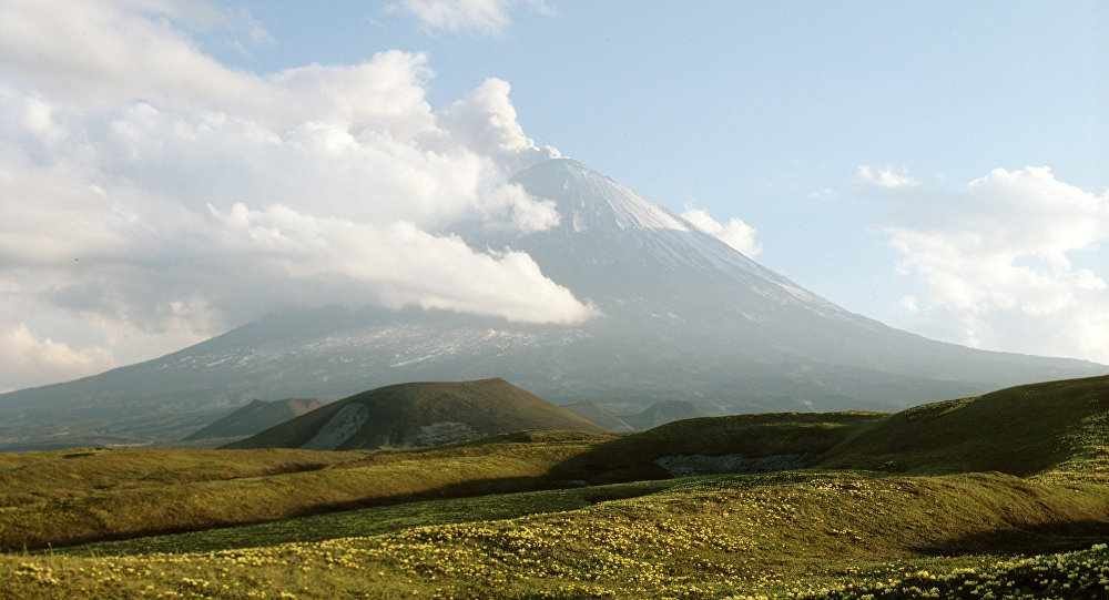
Eurasia's tallest volcano in Russia's Far East spews ash miles into air

Klyuchevskaya Sopka in Russia erupts
© RIA Novosti. Evgeniy Neskoromniy
Eurasia's largest volcano Klyuchevskaya Sopka in Russia's Far East erupted shooting hot ash miles into the air on Tuesday, the local geophysical service said.

"The eruption was detected [Tuesday] morning...the eruption column rose 6 kilometers [3.7 miles]. The steam-gas plume stretched for 47 kilometers to the west of the volcano," a representative of the Russian agency told RIA Novosti.

The 15,580-feet volcano in Russia's Kamchatka peninsula has been rumbling to life since the beginning of April. It has been almost continuously active for the past 50 years but the number of tremors and ash eruptions has been on the rise lately.

According to the geophysical service, ash spews are ongoing, volcanic activity has been registered. The Aviation Color Code has been changed to orange, which means that the volcanic eruption is underway with minor ash emission.

Red Flag

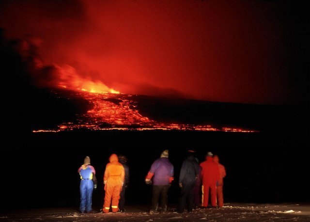
Volcano Alert level for Mauna Loa elevated from 'normal' to 'advisory' status

Mauna Loa eruptions
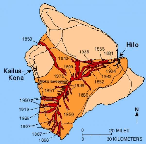
© USGS/Special to West Hawaii TodayPast Mauna Loa eruptions have sent lava toward Hilo, South Kona, Ka’u and Kiholo Bay, as well as other areas in between.
More than 31 years after Mauna Loa last erupted, sending lava within 4.5 miles of Hilo, the largest active volcano in the world is showing signs of unrest.

Scientists at the U.S. Geological Survey Hawaiian Volcano Observatory Thursday elevated the Volcano Alert Level for Mauna Loa from "normal" to "advisory." There are four levels of alerts: "normal" — or background level, "advisory," "watch," and "warning" to inform the public about a volcano's status.

The change in status indicates the volcano is showing signs of unrest that are above known background levels, but it does not mean an eruption is imminent or certain, officials said.

Arrow Up

Philippines' Mount Bulusan erupts spewing 2,000 meter high ash plume

Mt. Bulusan eruption June 2016
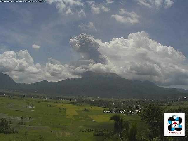
© PHOTO FROM PHIVOLCS’ TWITTER PAGEMt. Bulusan in Sorsogon province spewed a 2-kilometer ash column around 11:35 a.m., Friday, the Philippine Institute of Volcanology and Seismology (Phivolcs) reported.
Mt. Bulusan erupted at around 11:35am on Fri, Jun 10. The eruption is expected to affect several villages in Casiguran, Sorsogon, specifically the western part of the province.

"The phreatic explosion (also called a steam-blast eruption, which happens when magma heats ground or surface water) was confirmed by Raffy Alejandro, director of the Office of Civil Defense in the Bicol Region. It lasted for five minutes," reports ABS-CBN News.

As indicated in the eruption notification released by Phivolcs' Volcano Monitoring and Eruption Prediction Division (VMEPD), Mt. Bulusan spewed an ash plume that went up to a height of around 2,000 meters.

Prior to this, Philippine Institute of Volcanology and Seismology (Phivolcs) recorded at least 113 volcanic earthquakes around Mt. Bulusan in the past 24 hours.

"The local government units and the public are reminded that entry into the four-kilometer radius Permanent Danger Zone (PDZ) is strictly prohibited due to the possibility of sudden and hazardous steam-driven or phreatic eruptions," the advisory noted.

Info

Ancient plate tectonic boundaries may reactivate

Ancient Fault Lines
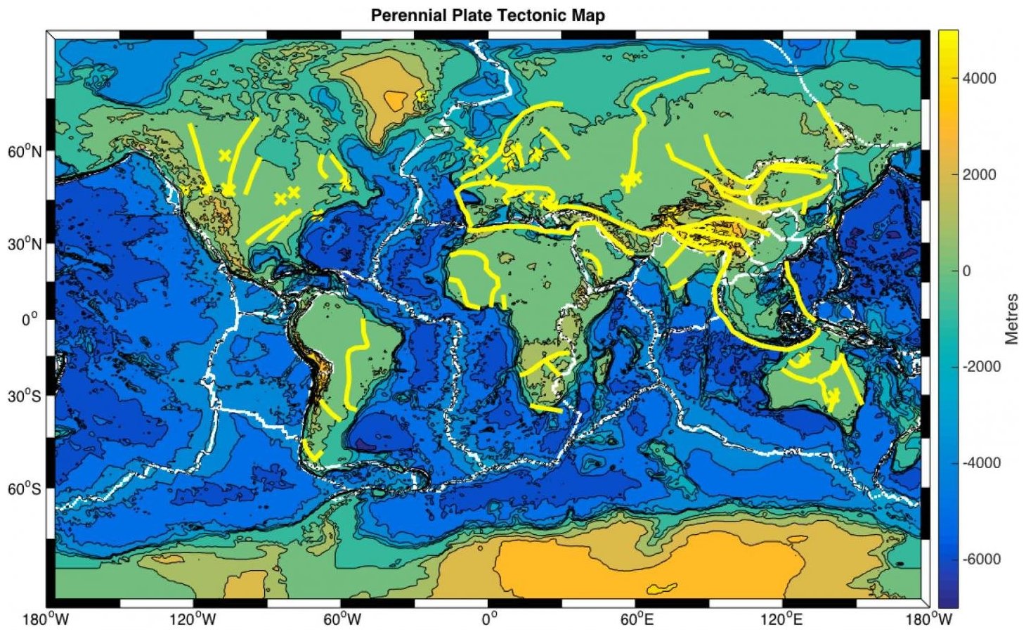
© Russell Pysklywec, Philip Heron, Randell StephensonA proposed perennial plate tectonic map. Present-day plate boundaries (white lines), with hidden ancient plate boundaries that may reactivate to control plate tectonics (yellow lines). Regions where mantle lithosphere heterogeneities have been located are given by yellow crosses.
Super-computer modelling of Earth's crust and upper-mantle suggests that ancient geologic events may have left deep 'scars' that can come to life to play a role in earthquakes, mountain formation, and other ongoing processes on our planet. This changes the widespread view that only interactions at the boundaries between continent-sized tectonic plates could be responsible for such events.

A team of researchers from the University of Toronto and the University of Aberdeen have created models indicating that former plate boundaries may stay hidden deep beneath the Earth's surface. These multi-million-year-old structures, situated at sites away from existing plate boundaries, may trigger changes in the structure and properties at the surface in the interior regions of continents.

"This is a potentially major revision to the fundamental idea of plate tectonics," says lead author Philip Heron, a postdoctoral fellow in Russell Pysklywec's research group in U of T's Department of Earth Sciences. Their paper, "Lasting mantle scars lead to perennial plate tectonics," appears in the June 10, 2016 edition of Nature Communications.

Heron and Pysklywec, together with University of Aberdeen geologist Randell Stephenson have even proposed a 'perennial plate tectonic map' of the Earth to help illustrate how ancient processes may have present-day implications.

"It's based on the familiar global tectonic map that is taught starting in elementary school," says Pysklywec, who is also chair of U of T's Department of Earth Sciences. "What our models redefine and show on the map are dormant, hidden, ancient plate boundaries that could also be enduring or "perennial" sites of past and active plate tectonic activity."

Better Earth

A zombie volcano is slowly growing beneath New Zealand

Champagne Pool
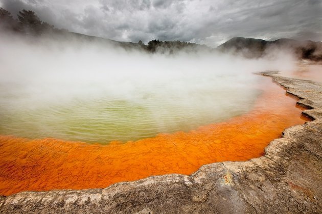
© Colin Monteath/Minden/NGCChampagne Pool is a lake in Rotorua, one of New Zealand’s most active volcanic regions.
Geologists in New Zealand have discovered a magma chamber being born in a surprising place—not under the country's most active volcanoes, but off to one side.

The finding suggests that molten rock can accumulate underground in complex and unexpected patterns, but does not indicate that an eruption is imminent.

"There's no need to panic, but chances are there are lots of bodies of magma dotted throughout the crust," says Ian Hamling, a geophysicist at GNS Science in Lower Hutt, New Zealand. He and his colleagues describe the discovery on June 3 in Science Advances.

Bizarro Earth

Magma buildup in northern New Zealand explains spate of recent earthquakes, may signal beginning of new volcano

Taupo volcanic zone new zealand
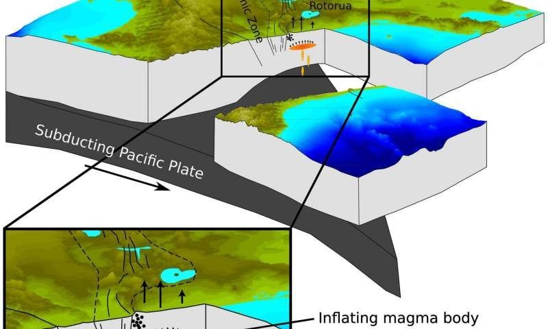
© Ian Hamling A drawing looking south along the Taupo Volcanic Zone showing the subduction of the Pacific Plate under the North Island of New Zealand. Uplift of the surface measured by satellite radar and GPS suggests the presence of a magmatic body beneath the Bay of Plenty coast at a depth of 9.5 km
Scientists say they've discovered a magma buildup near a New Zealand town that explains a spate of recent earthquakes and could signal the beginnings of a new volcano—although they're not expecting an eruption anytime soon.

Geophysicist Ian Hamling said that since 1950, enough magma to fill 80,000 Olympic-size swimming pools has squeezed up beneath the surface near the coastal town of Matata, about 200 kilometers (120 miles) southeast of Auckland.

A paper published Saturday in the online journal Science Advances outlines the findings. Hamling, the paper's lead author, said that while other parts of New Zealand have active volcanoes, there have been none near Matata for at least 400,000 years.

"It was quite a big surprise," he said in an interview with The Associated Press.

Using GPS data and satellite images, the scientists say they discovered an area of land about 400 square kilometers (154 square miles) has risen by 40 centimeters (16 inches) since 1950.

Hamling said a period of quick uplift between 2004 and 2011 likely triggered thousands of small earthquakes. Scientists had previously thought tectonic shifts caused the quakes.

Bizarro Earth

Magma chamber discovered growing outside volcanic zone in New Zealand

Champagne Pool
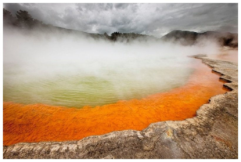
© Colin Monteath/Minden/NGCChampagne Pool is a lake in Rotorua, one of New Zealand’s most active volcanic regions.
Geologists in New Zealand have discovered a magma chamber being born in a surprising place — not under the country's most active volcanoes, but off to one side.

The finding suggests that molten rock can accumulate underground in complex and unexpected patterns, but does not indicate that an eruption is imminent.

"There's no need to panic, but chances are there are lots of bodies of magma dotted throughout the crust," says Ian Hamling, a geophysicist at GNS Science in Lower Hutt, New Zealand. He and his colleagues describe the discovery on 3 June in Science Advances1.

The team used radar data from satellites, such as the European Space Agency's now-defunct Envisat, to study ground motions in the Taupo Volcanic Zone. This region, which runs down the centre of New Zealand's North Island, has seen 25 enormous eruptions in the past 1.6 million years. Today, it is home to some of the country's most spectacular volcanic features, from the bubbling hot pots of Rotorua to frequent eruptions at Whakaari, or White Island, in the Bay of Plenty off of the North Island. The most recent eruption at Whakaari was in April.