Volcanoes
S


Bizarro Earth

Turrialba volcano in Costa Rica shows significantly increased activity

Turrialba Volcano
© Via CNEOne of the explosions at Turrialba Volcano on May 19, 2016.
Activity at Turrialba Volcano, located some 50 kilometers east of the capital, San José, increased significantly on Thursday with constant emanations of ash and at least three big explosions.

According to the University of Costa Rica's National Seismological Network (RSN), the first explosion occurred at 2:05 p.m. and formed a plume of gas and ash that reached nearly 1 km high.

The second, and most prolonged one, occurred at 3:46 p.m. and lasted three minutes. A few minutes later, at 4:09 p.m., a third explosion was recorded.

The column of gases and ash at about 4:20 p.m. rose to more than 500 meters above the crater and wind conditions at that time caused ash to disperse from the volcano, mostly to the southwest, RSN reported.

Ash has been reported in San José and Heredia provinces.

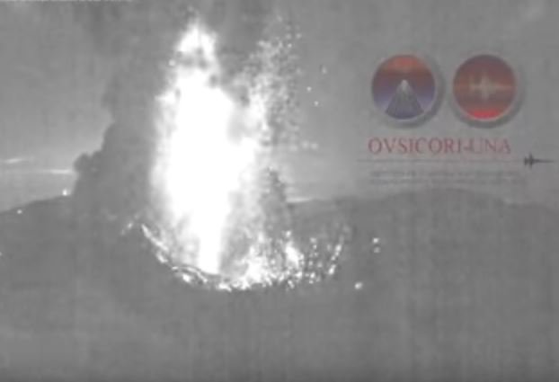
Turrialba Volcano has seen increased activity following explosions in late April, some of which extended for several hours. The National University's Volcanological and Seismological Observatory of Costa Rica (OVSICORI) reported that micro-tremors and ash eruptions from the volcano have been constant since an eruption recorded at 10:07 p.m. Wednesday.

Arrow Up

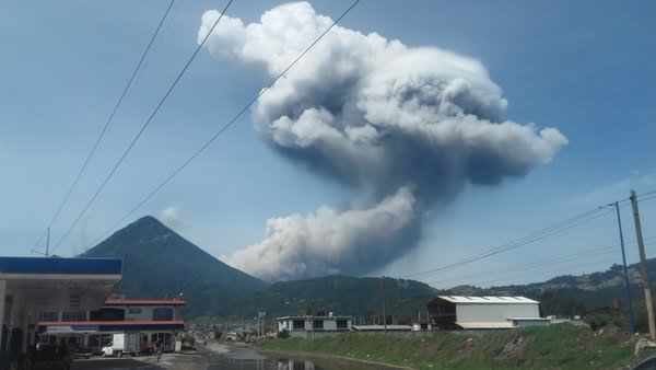
Two volcanoes in Guatemala erupt strongly within 24 hours: Santiaguito Volcano sends ash 4,500 meters above sea level

Santiaguito volcano in Guatemala
© Foto Prensa Libre/Carlos Ventura
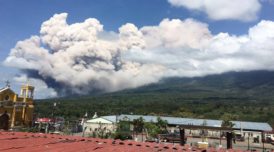
Guatemala volcanoes are currently recording strong eruptions one after the other. After Volcan de Fuego, yesterday, the Santa Maria volcano sent a thick column of ash 4,500 meters above sea level.

Two volcanoes in Guatemala erupted strongly within 24 hours. Yesterday, the Volcano of Fire covered the area with ash in a loud detonation.


Today, the Santiaguito Volcano erupted violently at 9:32 am local time.

The volcano has remained in constant activity within last month and is expected to continue in the coming days.

The National Institute of Seismology, Volcanology, Meteorology and Hydrology (Insivumeh) reported that the strongest explosion occurred at 9.34 am.

The resulting thick column of ash rose 4,500 meters above sea level and has already moved 25 kilometers south and southwest.

Ashfall has been reported in farms and different villages around the volcano.

Reportan fuerte explosión del Volcán Santiaguito


Fire

Guatemala's Volcan de Fuego erupts, prompting evacuations

Guatemala’s Volcan de Fuego
© Conred / Facebook
A volcanic eruption at Guatemala's Volcan de Fuego, one of the most active volcanoes in Central America, has sparked the evacuation of the area surrounding the peak.

Guatemala's National Institute for Seismology and Vulcanology are reporting that an ash column reaching 5,500 meters (18,000 feet) above sea level has emerged, while "moderate" lava flow is pouring out of the mountain.

"This pyroclastic flow was accompanied by moderate rumble of the volcano [and] fallen ash is reported in the villages of El Rodeo, La Rochelle, Osuna, Panimache, Morelia, Sangre de Cristo and Yepocapa," a statement by the government agency confirmed.

The alert also recommends that people steer clear of the canyon near the volcano.

Bombero de Antigua, a disaster relief team in the area, has tweeted that at least one school has been evacuated in the municipality of Alotenango.

Fire

Earthquake swarms reported at Mt. Hood, Mt. Rainier and Mt. St. Helens: Is a major eruption imminent?

Volcanic eruption
Is an eruption of one or more of the major volcanoes in the northwest United States imminent? In recent days, very large earthquake swarms have been reported at Mt. Hood, Mt. Rainier and Mt. St. Helens. It is certainly not unusual for each of these volcanoes to experience earthquake swarms from time to time, but right now we are seeing this happen at all three volcanoes simultaneously, and this comes at a time when seismic activity along the Ring of Fire is on the rise all over the planet. If you have followed my work for a while, then you probably already know that I have been consistently warning that an eruption of Mt. Rainier is coming, and of course Mt. Hood and Mt. St. Helens are exceedingly dangerous volcanoes as well. If any one of the three were to erupt on a massive scale, it would instantly become the biggest news story of the year.

Mt. St. Helens

Many of my older readers remember the devastating eruption of Mt. St. Helens back in 1980 very well. This volcano is probably not as dangerous as Mt. Hood, and it is definitely not as dangerous as Mt. Rainier, but a full-blown eruption could still do an immense amount of damage to nearby communities.

Over the past couple of months, there has been a very disturbing series of earthquakes at Mt. St. Helens, and just within the last 30 days there has been a total of 103 quakes. In this article, I am going to share with you a series of maps that come from the Pacific Northwest Seismic Network via Google Earth. On this first map, you can see that the earthquake swarm that has been striking Mt. St. Helens in recent days is centered right at the core of the volcano...

Fire

Mount Etna in Sicily erupts spewing ash and smoke hundreds of metres into the skies

Mount Etna eruption May 2016
© INGVThe volcano's north-east crater at 13:42pm on Wednesday.
Sicily's Mount Etna is erupting again.

Europe's most active volcano has spent the last 24 hours sending huge plumes of ash and smoke hundreds of metres into the skies above Sicily.

The 3350-metre high volcano began to stir on Tuesday, with emissions from its north-east crater growing in intensity throughout the day.

"On May 17th we witnessed an increase in the amplitude of volcanic tremors and recorded intense degassing accompanied by occasional, weak emissions from the north-eastern crater," explained the Catania branch of Italy's National Vulcanology and Geophysics Institute (INGV).

Vulcanologists are classing the eruption as 'Strombolian' - a category characterized by explosive bursts of activity during which cinder, ash and smoke are ejected from the crater with great force.


Arrow Up

New volcanic eruptions at Turrialba (Costa Rica) and Sakurajima (Japan) on May 12, 2016

Turrialba volcano eruption
© New China TV/YouTube
Just to let you know that the Turrialba and the Sakurajima volcanoes erupted again on May 12, 2016. And the pictures and video below show you how explosive it was. Large blast at Turrialba volcano in Costa Rica.

A large blast was reported at Turrialba volcano, Costa Rica on May 12, 2016 at 07:19am (UTC) sending a column of gas and ash 3 kilometers over the top of the summit.

The eruption lasted between 8 and 11 minutes and ash fall was recorded across the Central Valley, closing the airport tobias bolaños, West of San Jose.

Roads and access to the volcano have been closed and evacuation has been started for villages in a radius of 1,6 km (1 mile) around the volcano.

This single blast was very strong meaning that there was a high pressure in the interior of the volcano. Some more to come?


Bizarro Earth

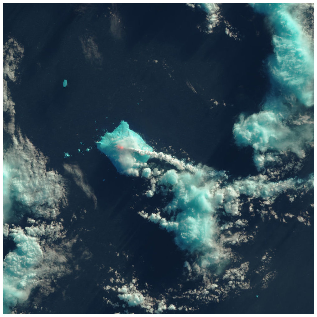
Mount Sourabaya erupts - first time in 60 years

Mount Sourabaya
© NASA Earth Observatory image by Jesse Allen, using Landsat data from the U.S. Geological Survey
Nobody lives near Mount Sourabaya, but a NASA satellite captured its eruption in the South Atlantic in this false-color image.
For the first time in 60 years, Mount Sourabaya erupted with a spectacular show of fiery lava — in fact, it erupted twice. But there wasn't a single human soul who saw the eruptions live; nobody lives on the volcano's remote island in the South Atlantic Ocean, according to NASA Earth Observatory.

Instead, satellites captured images of the eruptions, which happened on April 24 and May 1, 2016, NASA reported.

Volcanic eruptions in far-flung places, such as the South Atlantic, used to go unnoticed. But the advent of satellites and seismic monitoring has given scientists new insight into volcanic events worldwide, NASA officials said.

"Today, scientists can pick up signatures of events occurring far from any human observers," NASA's Earth Observatory said in a statement.

That's exactly what happened when Mount Sourabaya erupted. The volcano sits on Bristol Island, one of the largest islands in the South Sandwich Islands chain. The archipelago is located about 1,725 miles (2,776 kilometers) southeast of Buenos Aires, Argentina, which is about the distance from Los Angeles to Chicago.

Bizarro Earth

North American tectonic plate peeling off

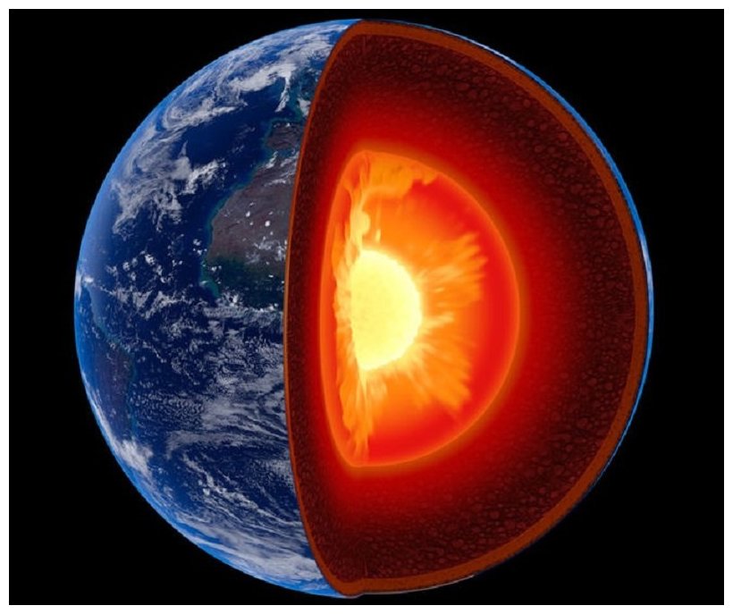
Earth's Mantle
© Johan Swanepoel/ShutterstockScientists suspect that chunks from the bottom of the North American tectonic plate, which is the upper portion of the mantle, are peeling off and sinking. Replacing the resulting void is gooey material from the asthenosphere.
An odd phenomenon may explain why the Southeastern United States has experienced recent earthquakes, even though the region sits snugly in the middle of a tectonic plate and not at the edges, where all the ground-shaking action usually happens.

This seismicity — or relatively frequent earthquakes — may be the result of areas along the bottom of the North American tectonic plate peeling off, the researchers said. And this peeling motion is likely to continue, leading to more earthquakes in the future, like the 2011 magnitude-5.8 temblor that shook the nation's capital.

To figure out the cause of these earthquakes, Berk Biryol, a seismologist at UNC Chapel Hill, and colleagues created 3D images of the uppermost part of Earth's mantle, which is just below the crust and comprises the bottom of a tectonic plate. These tectonic plates scoot around atop a layer of warm, viscous fluid called the asthenosphere.

The resulting X-ray images revealed that the plate's thickness in the southeast United States was uneven, with thick regions of dense, old rock combined with thinner areas composed of younger rocks that were also less dense.

Attention

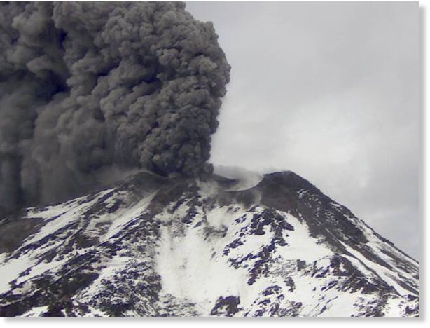
Nevados de Chillán volcano erupts in Chile

Nevados de Chillán volcano
© SernageominNevados de Chillán volcano
The volcano Nevados de Chillán in Chile has erupted at 5:03 UTC on May 9, 2016.

The explosion sent ash and gas to an altitude 1700 meters above the main crater.


Bizarro Earth

Earthquake swarms a sign Mount St. Helens is recharging

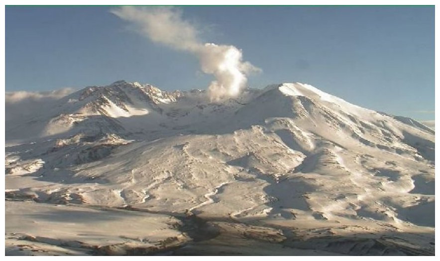
Mount St Helen Live Cam
© www.mountsthelens.comThis live image of Mount St. Helens is from the USFS HD Volcano Cam at Johnston Ridge Observatory on May 8, 2016.
Seattle - Washington state's Mount St. Helens is letting the USGS know it is waking up again. For the past eight weeks, there have been a swarm of over 130 low-magnitude earthquakes.

"At this point, there is absolutely no sign that it will erupt anytime soon, but the data we collect tells us that the volcano is still very much alive," the U.S. Geological Survey said.

The low-magnitude quakes have increased in frequency to about 40 a week, as recorded by the Pacific Northwest Seismic Network (PNSN). The PNSN has a network of 300 seismology stations in Washington and Oregon, working to monitor earthquake and volcanic activity across the Pacific Northwest.

There have been no signs indicating any change in gas emissions, and no signs of magma formation beneath the surface, says the USGS, and more importantly, no signs of an imminent eruption, reports CNN. The agency reminds us that a recharge can continue for many years beneath a volcano without an eruption.