Extreme Temperatures
S


Snowflake Cold

Coldest temperatures hit Australia's Sunshine Coast in over a century

Image
© Terry West, Southern Downs Weather and StormchasingCows among the frost.
If you are lucky enough to be reading this from the comfort of your blankets, it might be best to stay there, as Brisbane has hit its coldest temperatures in 103 years. Not since July 28 1911 has Brisbane felt this cold, getting down to a brisk 2.6C at 6.41am.At 7am, it inched up to 3.3C.

Matt Bass, meteorologist from BOM, said the region was well below our average temperatures.
"If it felt cold, that's because it was, breaking that record is pretty phenomenal for Brisbane," Bass said. "The average for this time of year is 12C, so Brisbane was about 9C below average, it is pretty impressive really, to have the coldest morning in 103 years is a big record."

The coldest place across the state was Oakey which got down to -6.1C, which was the coldest temperature for the town since 2011. Brisbane wasn't the only town hitting landmark temperatures with Clermont breaking its coldest record two days in a row. "Clermont in the coal fields got down to -4.5 which is a new record for them, their previous record was -3.7, which was set yesterday, so they've re-broken their record two days in a row."


Snowflake

French Alps hit by some very unseasonal July snowfalls

Image
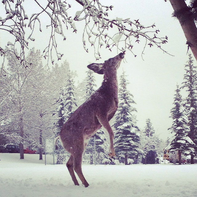
© WebcamThe French Alps looked more like a winter wonderland this week as the rotten summer weather continued in France.
Holidaymakers in the Alps in recent days would have been forgiven for thinking they had come in the wrong season after the region was hit by some very unseasonal snowfalls. There was bad news for sunseekers too with the sun set to stay away for much of July.

Parts of the Alps looked like a winter wonderland on Thursday as summer snow continued to fall, disrupting the usual holiday activities.

The regional newspaper Dauphiné Libere reported that tourists in the town of La Rosière were asking shopkeepers for toboggans so they could go sledging on the slopes.

At the resorts of Tignes and Val d'Isere, the snowfall ruined the chances of activities such as flyboarding and mountain biking.

Image
The resort of La Rosiere

Ice Cube

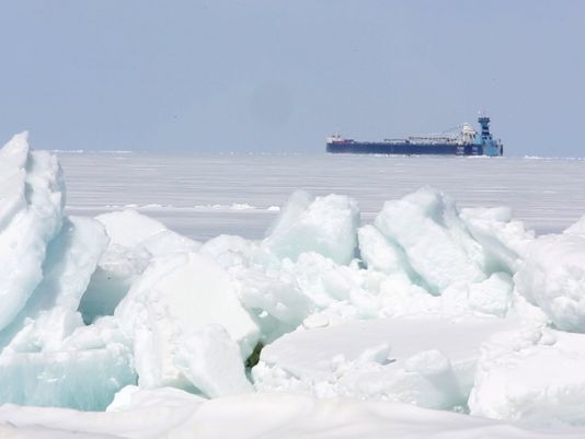
Ice still present on Lake Superior in July!

Image
The mainstream media tries to pretend that ice remained on Lake Superior "only" into June.

"How about July?"asks reader E Stephens.

"We should name icebergs still floating in Lake Superior in July after infamous AGW scientists. This one is Gavin," says Tilly LaCampagne via Twitter.

See photo dated 11 July 2014:

Thanks to E Stephens for this link

Snowflake Cold

Coldest June ever recorded in Antarctica

Image
© John Weller
Antarctica continues to defy the global warming script, with a report from Meteo France, that June this year was the coldest Antarctic June ever recorded, at the French Antarctic Dumont d'Urville Station.

According to the press release, during June this year, the average temperature was -22.4c (-8.3F), 6.6c (11.9F) lower than normal. This is the coldest June ever recorded at the station, and almost the coldest monthly average ever - only September 1953 was colder, with a recorded average temperature of -23.5c (-10.3F).

June this year also broke the June daily minimum temperature record, with a new record low of -34.9c (-30.8F).

Other unusual features of the June temperature record are an unusual excess of sunlight hours (11.8 hours rather than the normal 7.4 hours), and unusually light wind conditions.

Snowflake Cold

Shocking summer return of poor man's polar vortex to eastern U.S. next week

Image
© Washingtonpost.com
Call it the ghost of the polar vortex, the polar vortex sequel, or the polar vortex's revenge. Meteorological purists may tell you it's not a polar vortex at all. However you choose to refer to the looming weather pattern, unseasonably chilly air is headed for parts of the northern and northeastern U.S at the height of summer early next week.

Bearing a haunting resemblance to January's brutally cold weather pattern, a deep pool of cool air from the Gulf of Alaska will plunge into the Great Lakes early next week and then ooze towards the East Coast.

Of course, this is July, not January, so temperatures forecast to be roughly 10 to as much as 30 degrees below average won't have quite the same effect.

But make no mistake, in parts of the Great Lakes and Upper Midwest getting dealt the chilliest air, hoodies and jeans will be required. Highs in this region could well get stuck in the 50s and 60s - especially where there is considerable cloud cover.

Wednesday morning's lows may drop into the 40s over a large part of the central U.S. Remember, this is July!


Igloo

Co-founder of Greenpeace: 'I fear global cooling'

Image
© Cfact.org
Moore: 'President Obama seems to say it is sufficient to say the 'science is settled'. It is hollow statement with no content.

On Kids: 'Change the way our kids are being taught about this subject because if we don't there will be a whole generation of people who are just blindly following this climate hysteria.'

Ecologist Dr. Patrick Moore, co-founder of Greenpeace, warned "I fear a global cooling," during his keynote address to the Ninth International Conference on Climate Change in Las Vegas on Tuesday. Moore, who left Greenpeace in 1986 because he felt it had become too radical, is the author of "Confessions of a Greenpeace Dropout: The Making of a Sensible Environmentalist." (Watch climate conference live here)

Moore noted that a cooling would adversely impact agriculture, and said: "Let's hope for a little warming as opposed to a little cooling. I would rather it got a little warmer." (Watch Moore video here at the Heartland Institute event)

Moore noted that "the U.S. is currently been cooling" and noted that there has been "no global warming for nearly 18 years." He also mocked the notion that "everything is due to global warming."

"If it warms two degrees, hopefully more in Canada in the North...maybe it would be a good thing if it did," Moore explained.

Comment: To understand what is going on with the climate change here on the big blue marble, read the Comet and Catastrophe Series on SOTT.


Igloo

Get ready! Unseasonable cold blast looming; pattern similar to last winter

An unseasonably cold airmass looks to wash over the northern United States, in a pattern eerily similar to the one seen this past winter.
cool summer
© CPC
The Climate Prediction Center's 6-10 day temperature outlook shows significantly above normal temperatures across the West US, most severe over Washington, Oregon, Nevada, Idaho and California. In response to this warmth, we see a deep airmass of unseasonably cool temperatures pushing south across the Midwest, with states like Minnesota, Wisconsin, Illinois, Iowa, South Dakota, Nebraska, Kansas and Missouri all affected on the highest level. Warmer than normal weather looks to retreat to the Gulf Coast and coastal regions along the Eastern Seaboard, but the main story here is indeed the colder than normal weather.
cool summer
Shown above is a long range forecast of temperatures on the morning of July 15th, in the middle of this unusually cold spell. We see temperatures on this morning plummeting to as low as the mid-40s in the Midwest, where the heavy blankets might need to make a surprise appearance. Temperatures in the far northern Plains into the upper Midwest might even flirt with the low-40s, possibly even into the upper-30s if there will be clear skies. Those finer details will need to be ironed out in days to come, but the general idea is that things are looking pretty cold for a wide swath of the country in the next week or two.
cool summer
© PSU
Oddly enough, the atmospheric pattern behind this expected cold blast is quite similar to the pattern we observed this past winter. On the top-left image, we see the mid-level atmospheric flow valid on July 14th. Here, we can see a strong vortex dropping anomalously south from Canada, nearly pushing into the United States. If you recall, we had the polar vortex take a very similar path down south more than once last winter, which is how the weather got so cold so often. So what's provoking this to happen again, only this time in mid-July? The same thing that made it happen six months ago. We see a very strong ridge pushing north across the northeast Pacific and into the Gulf of Alaska, which is how the West US should end up with those much warmer than normal temperatures. And, bringing things back full-circle, that ridge is likely being caused/enhanced by the body of above-normal water temperatures in the Gulf of Alaska that we targeted as the mechanism responsible for the brutality of last year's winter. The latest water temperature anomaly image is shown below, which identifies the body of much warmer than normal water in the northeast Pacific.

Cloud Lightning

Heavy hailstorm damages windows and trees in Sofia, Bulgaria

Image
© BGNES/Gergana Kostadinova.Extremely heavy hailstorm hit Sofia, Tuesday afternoon.
A powerful hailstorm hit Bulgaria's capital city of Sofia, Tuesday afternoon minutes before 5 o'clock.

Pieces of ice the size of a walnut poured down for more than ten minutes without stopping. The disastrous hail has broken tens of cars' windshields, windows of buildings, tree branches all over the city.

The downpour caused traffic jams in the city center. Some of the main streets have been flooded and traffic is hampered.


Cloud Lightning

Reports of extreme hailstorms in North America and Europe

Image
© Norman LucasA hole in Norman Lucas' roof caused by baseball sized hail.
"This is Mini-Ice-Age/Wild Jet Stream Age stuff," says astrophysicist Piers Corbyn.

------------------------------------------------------------------------------------------------------------------

"The news about damage caused by very large hail keeps popping up on the Internet," says reader Argiris Diamantis. "People are hiding in their basements because of the giant hail stones."

-----------------------------------------------------------------------------------------------------------------

Hailstones as big as softballs

Three people sustained head injuries on Saturday afternoon near a lake west of Bismarck, North Dakota after a severe storm dropped hailstones as large as softballs.

Hailstones of this size can be fatal. Luckily, it's been 14 years since the last known fatality directly caused by hail in the United States.

A hailstone slightly larger than a baseball can fall at a rate of more than 100 MPH according to NOAA, so it's a surprising fact that more people aren't injured or killed by hailstorms more often.

Hail Seriously Injures Three in North Dakota

Igloo

Rewriting the history of volcanic forcing during the past 2,000 years

Ice Cire Section
© Joseph McConnell An ice core section is simultaneously analyzed for a variety of elements and chemical species in DRI's ultra-trace ice core laboratory while slowly melting the ice on a heated melter plate.
A team of scientists led by Michael Sigl and Joe McConnell of Nevada's Desert Research Institute (DRI) has completed the most accurate and precise reconstruction to date of historic volcanic sulfate emissions in the Southern Hemisphere.

The new record, described in a manuscript published today in the online edition of Nature Climate Change, is derived from a large number of individual ice cores collected at various locations across Antarctica and is the first annually resolved record extending through the Common Era (the last 2,000 years of human history).

"This record provides the basis for a dramatic improvement in existing reconstructions of volcanic emissions during recent centuries and millennia," said the report's lead author Michael Sigl, a postdoctoral fellow and specialist in DRI's unique ultra-trace ice core analytical laboratory, located on the Institute's campus in Reno, Nevada.

These reconstructions are critical to accurate model simulations used to assess past natural and anthropogenic climate forcing. Such model simulations underpin environmental policy decisions including those aimed at regulating greenhouse gas and aerosol emissions to mitigate projected global warming.

Powerful volcanic eruptions are one of the most significant causes of climate variability in the past because of the large amounts of sulfur dioxide they emit, leading to formation of microscopic particles known as volcanic sulfate aerosols. These aerosols reflect more of the sun's radiation back to space, cooling the Earth. Past volcanic events are measured through sulfate deposition records found in ice cores and have been linked to short-term global and regional cooling.