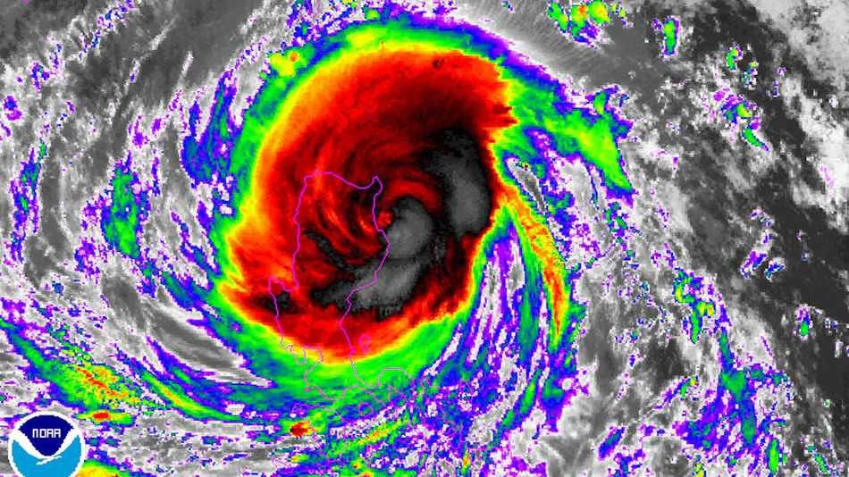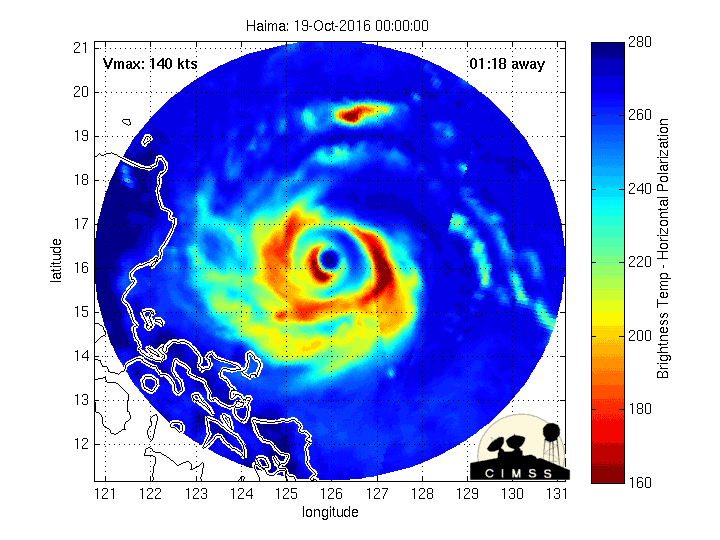
Fortunately, Haima lost some of its punch shortly before striking land, coming ashore at about 10:30 p.m. local time, or 10:30 a.m. EDT, packing maximum sustained winds of 140 miles per hour, according to the Joint Typhoon Warning Center (JTWC). The storm is known locally in the Philippines as Typhoon Lawin.
The weakening trend can be primarily traced to a phenomenon known as an eyewall replacement cycle, known to meteorologists by the acronym "ERC."
During such cycles, which typically occur in the most intense tropical cyclones, the storm's inner eyewall — where the worst winds and some of the heaviest rains tend to be concentrated — collapses, while an outer eyewall forms and gradually contracts inward toward the storm's center. During such a process, the storm's maximum sustained winds tend to diminish slightly, while the area of strong winds expands overall.
Eventually the outer eyewall replaces the inner eyewall, and the storm's maximum wind speed increases once again.
As Typhoon Haima showed, such cycles are unpredictable, and can take 12 hours or more to complete. The storm had been forecast to make landfall as a Category 5 storm.
The replacement cycle that occurred within Super Typhoon Haima was fortuitous, since it spared areas of northern Luzon from a truly catastrophic blow.

Since Super Typhoon Haima comes less than one week after a weaker typhoon hit the same area, the region is primed for flooding. As Hurricane Matthew recently demonstrated in the U.S., water is how these storms kill, not wind.
After the storm exits the Philippines on Thursday, local time, it is forecast to emerge as a Category 1 typhoon, moving south of Taiwan toward mainland China.
Computer model projections and official forecasts show the most likely landfall location to be the city of Shantou, to the northeast of Hong Kong, on Oct. 21. As the remnants of the storm move inland, more flood risks will arise in China.


Comment: Typhoon Sarika leaves two dead, thousands stranded in Philippines