Environment Canada senior climatologist David Phillips told CTV Newsnet that "it looks like a very good chance" it will be a white Christmas for all parts of Canada for the first time since 1971.
"It's just sort of the beginning of winter, and it's a little much to expect when we have so many different climatic types in this country for it to be frozen and snow-covered from right across the huge country," he told CTV Newsnet on Sunday.
Comment: It's a little much to expect? Is that a way of minimizing any significance of this winter's severe weather?

"It may be in 40 years, the first one," he said.
As for Sunday's weather conditions, Phillips didn't mince words.
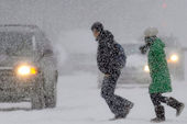
"In 10 provinces, every one of them has got some weather misery out there, and an advisory," he said.
"About the only areas not showing any advisory or warning situations are the Yukon, Northwest Territories and Nunavut."
Environment Canada snowfall warnings for Vancouver predict that up to 20 centimetres of snow will fall by Sunday evening, accompanied by bone-chilling wind-chill effects throughout the evening and into Monday.

The storm system that began in southwestern Ontario Sunday morning has left as much as 20 cm of additional snow in some areas, and is now making its way eastward.
However, much of the region is still under blowing snow warnings thanks to high winds that could gust up to 90 kilometres per hour.
According to the Ontario Provincial Police, the morning snowfall caused more than 100 minor collisions north of the Toronto area between 6 a.m. and 9 a.m. Sunday.
And at Pearson International Airport, dozens of flights were delayed on Sunday morning -- though the runways had mostly been cleared by the afternoon.
With the storm system moving eastward through Sunday afternoon, parts of eastern Ontario, Quebec and much of the Maritimes remain under winter storm or snowfall warnings.
Environment Canada predicts as much as 20 cm of snow to fall in Montreal and 30 cm of snow in other parts of Quebec by the end of the day.
Some 40 flights were cancelled at Montreal's Trudeau Airport on Sunday, and train passengers were experiencing half-hour and hour-long delays.
The weather was bad enough on Highway 40, near L'Assomption, Quebec, that at least 30 cars became embroiled in chain-reaction accident.
Both New Brunswick and Newfoundland were expected to see snowfalls of between 10 and 25 cm, with high-speed winds accompanying some storms.
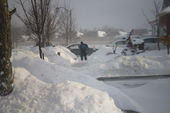
Phillips said some parts of the country are seeing snowfall amounts that have outpaced last year's record and near-record totals at this point in the season.
But he also said it's unlikely that trend will continue.
"Already in many places in eastern Canada, we're ahead of the record from last year," he said.
"But, you know, we have a long, long way to go. I'm thinking that, hey, there's not enough left in nature to give us another one of those years."
Comment: More minimalization of the severe winter conditions.
"We have a long way to go," is a form of self calming, self reassurance.
"hey, there's not enough left in nature to give us another one of those years," - self calming, denial. The global warming alarmists can't have recrod snow, record, ice, record low temperatures messing up all that hot air they are pushing.
Here is what Canadian climatologist Dr. Timothy Ball had this to say about the above article:
David Phillips is listed as a Senior Climatologist at Environment Canada. He has a BA in Geography and made his name by producing a weather calendar; "Weather Trivia." He has been the spokesperson for that department giving lectures all across Canada pushing the AGW thesis. (Anthropogenic Global Warming)
Nature will follow its usual natural course and there will be periods of thaw across the country as the Rossby Wave pattern asserts itself, that is a general 4 to 6 week cycle of general weather conditions. It will result in the pattern of one half the country being warm the other cold with the dividing point being the western end of Lake Superior. They will latch on to the warm portion and emphasize that in their stories to the media - its Phillips' job as spin doctor for his department.
Generally, the weather stories in Canada are a function of what is affecting Toronto, so if the warming occurs in that city so much the better for the spin. The joke in the Canadian west is, "How many Torontonians to change a light bulb?" Answer, "None. They hold on to the bulb and the world revolves around them."
Tim Ball


Reader Comments
to our Newsletter