Volcanoes
S


Attention

Huge underwater volcanoes mapped near Antarctica

Image
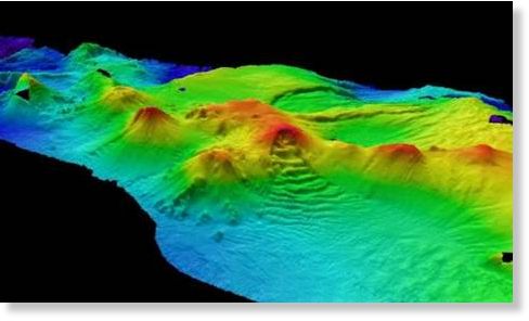
© British Antarctic Survey Newly discovered volcanoes. The peak in the foreground is thought to be the most active, with eruptions in the past few years.
In a first for the region, a dozen massive peaks, some active, are discovered

A string of a dozen volcanoes, at least several of them active, has been found beneath the frigid seas near Antarctica, the first such discovery in that region.

Some of the peaks tower nearly 10,000 feet above the ocean floor - nearly tall enough to break the water's surface.

"That's a big volcano. That's a very big volcano. If that was on land it would be quite remarkable," said Philip Leat, a volcanologist with the British Antarctic Survey who led a seafloor mapping expedition to the region in 2007 and 2010.

The group of 12 underwater mountains lies south of the South Sandwich Islands - desolate, ice-covered volcanoes that rise above the southern Atlantic Ocean about halfway between South America and South Africa and erupted as recently as 2008. It's the first time such a large number of undersea volcanoes has been found together in the Antarctic region.

Leat said the survey team was somewhat surprised by the find.

"We knew there were other volcanoes in the area, but we didn't go trying to find volcanoes," Leat told OurAmazingPlanet. "We just went because there was a big blank area on the map and we had no idea what was there; we just wanted to fill in the seafloor."

Bizarro Earth

Sicily, Italy: Etna Volcano Erupts Again on July 9 2011

UPDATE 09:45 UTC : Due to the volcanic activity and the ash concentration in the air, the (important) regional airport of Catania was closed since yesterday 18:12 (6:12 PM). The airport reopened this morning at 07:00 ( 7 AM).

UPDATE 08:00 UTC : As stated below, the densely populated Catania area got a lot of ash showers covering cars and roofs with a gray layer.

UPDATE : One video tells more than a 1000 words. This YouTube video was recorded by Klaus Dorschfeldt alias KdEtna. We encourage our readers to take a look at his great Etna Channel on YouTube. The strong eruption was short-lived (see in-depth text below), which explains why there are only daylight videos from this eruption

Bizarro Earth

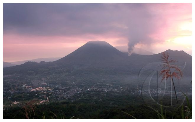
Indonesia Issues Highest Alert for Mt. Lokon Volcano

Mt. Lokon
© Manado Rizky Adriansyah / Tribun ManadoMt. Lokon.
Jakarta - Officials raised the alert for an Indonesian volcano with history of violent explosions to its highest level following a series of eruptions over the weekend.

Disaster managment official Sutopo Purwo Nugroho said Monday people living close to Mount Lokon in north Sulawesi province should be prepared to evacuate if necessary.

Locals and tourists have been urged to stay up to 2.2 miles (3.5 kilometers) away from the 5,741-foot (1,750-meter) volcano.

Radar

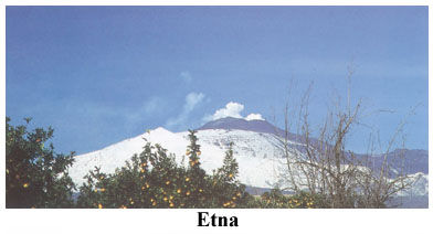
Ash from Mount Etna closes Italian airport

Image
© Unknown
A southern Italian airport was on Saturday closed due to ash from Mount Etna, forcing traffic to be diverted to Palermo, the ANSA news agency said.

Catania airport on the east coast of the island of Sicily was not expected to re-open before Sunday morning while the runway was cleared, the report said.

The volcano, which currently does not present any risk to local residents, spewed lava on to its southeastern slopes on Saturday afternoon and winds carried the ash further afield.

Etna is the highest active volcano in Europe at 3,295 metres (10,810 feet). The last eruption was in May.

A massive flood of meltwater from Iceland's Myrdalsjoekull glacier, meanwhile, has raised fears of an eruption from the powerful Katla volcano there.

Satellite

Three Active Volcanoes Spotted on Satellite Imagery from NASA

From space, NASA keeps a watchful eye on volcanic activity around the world with many satellites. NASA has just released satellite images showing activity this week from volcanoes in the countries of Eritrea, Chile and Indonesia.

NASA's Terra satellite and the GOES-11 satellite captured ash plumes or heat coming from the Nabro volcano, the Puyehue-Cordón volcano, and the Soputan volcano, respectively, over the past week. There are a number of other volcanoes showing activity around the world, but thanks to good visibility these three volcanoes were more easily seen from space this week.

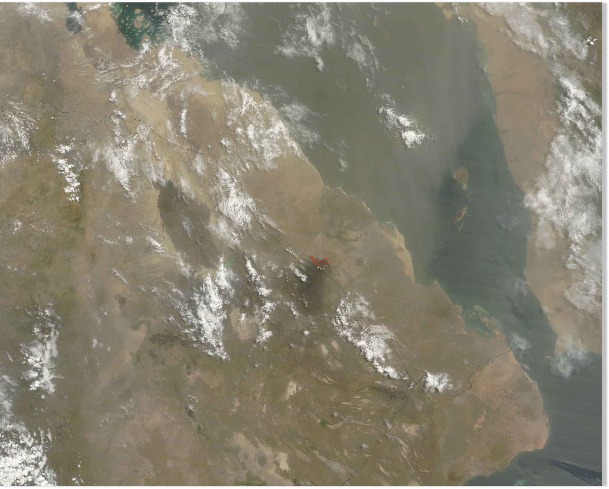
NASA's Terra satellite flew over the Nabro volcano in Eritrea on July 6 at 07:50 UTC (3:50 a.m. EDT) and the Moderate Resolution Imaging Spectroradiometer (MODIS) instrument captured "heat signatures" or hot areas in the volcano. The MODIS images are created by the MODIS Rapid Response Team at NASA's Goddard Space Flight Center in Greenbelt, Md. The team provides images from the MODIS instrument (that flies on both the Terra and Aqua satellite) every day.

Nabro is located in the State of Eritrea, a country in the Horn of Africa. Eritrea's neighboring countries include Ethiopia to the south, Djibouti to the southeast and Sudan to the west. An ash plume was difficult to pinpoint on the imagery because of dust blowing in the direction of the volcano and over the Gulf of Aden from nearby Somalia.
Image
© NASA Goddard MODIS Rapid Response TeamNASA's Terra satellite captured this image of the Nabro Volcano located in the African country of Eritrea. The image was taken on July 6 at 07:50 UTC (3:50 a.m. EDT) and the red spots indicate heat. The light brown area over the Gulf of Aden (right) is blowing dust from northern Somalia (right) in the image.

Bizarro Earth

Scientists monitor Iceland's Katla volcano amid flooding

Katla Volcano
© UnkownKatla Volcano
Scientists are monitoring Iceland's Katla volcano amid signs that a small eruption may be taking place.

The acting head of the Civil Protection Agency Iris Marelsdottir, says flooding is taking place near the volcano, caused by the melting of its ice cap.

But she says the flooding may have other causes - such as high geothermal heat - so it not yet clear whether there is an eruption.

Katla typically awakens every 80 years or so, and last erupted in 1918.

Iceland, in the remote North Atlantic, is a volcanic hotspot. In April 2010 ash from an eruption of its Eyjafjallajokul volcano grounded flights across Europe for days, disrupting travel for 10 million people.

Katla sits beside Eyjafjallajokul.

Source: The Associated Press

Bizarro Earth

Volcano erupts in Indonesia

Image
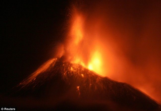
© ReutersSpectacular: Mount Soputan spews out hot lava on the outskirts of Manado of Indonesia's North Sulawesi province
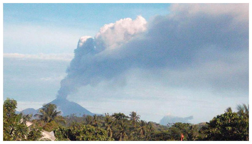
Jakarta - A volcano in North Sulawesi province of central Indonesia erupted earlier Sunday, but there is no evacuation, head of the country's volcanology agency named only Surono said here.

Mount Soputan located some 60 km from Manado, capital of the province, started a small eruption at around 02:00 a.m. local time Sunday, spewing over 1,000-meter high hot ash, then it was followed by a big eruption at 06:03 a.m. local time by spewing over 6,000 meters high ash, the head of the agency told Xinhua by phone.

The agency has declared a dangerous zone with a radius of 6.5 kilometers, said Surono.

"So far, there is no evacuation because the closest area where people live is about 8 kilometers from the mount," he said.

Agus Budianto, head of monitoring and search at the agency also said that based on the character of the 1,874-meter high Mount Soputan and the history of its eruption, the authorities may still not need to order an evacuation, Budianto told Xinhua by phone from the headquarters of the agency in West Java on Sunday.

Bizarro Earth

Mt Soputan Volcano Spews Smoke, Gas in Indonesia

Mt Soputan
© Associated PressVolcanic smoke billows from Mount Soputan as seen in this photo taken from the town of Amurang, North Sulawesi, Indonesia, Monday, Oct. 6, 2008.
Jakarta - A volcano in central Indonesia has erupted in clouds of smoke and searing gas that shot up nearly 20,000 feet (six kilometres) into the air.

State volcanologist Surono, who uses only one name, says no one was injured when Mount Soputan, located on Sulawesi island, exploded early Sunday.

The nearest villages are well outside the danger zone and there are no immediate evacuation plans.

Indonesia, the world's largest archipelago, is located on the so-called Pacific "Ring of Fire," an arc of volcanos and fault lines encircling the Pacific Basin.

Soputan lies around 1,350 miles (2,160 kilometres) northeast of capital Jakarta. It last erupted in 2008, causing no casualties.

Bizarro Earth

Costa Rica's Turrialba Volcano More Active Experts Notice

The Turrialba volcano has been more active in recent days, spewing out greater emission of gases and with sound that appears similar to a jet engine.

"The gas column is more abundant, the noise is more noticeable in parts that were it is not usual", said Eliecer Duarte, volcanologist for the OVSICORI.

Turrialba Volcano
© InsideCostaRica
Duarte and other specialists visited the colossus on Thursday and found that the lake that formed in the western crater "blocked" the escape of gas which means they now soar over the entire crater.

"It is a process we have not seen before. The gases are distributed by sector but now gas is emanating 360-degrees around the crater", said Duarte.

Bizarro Earth

Philippines: Phivolcs Warns Against Activity Near 3 Volcanoes

Image
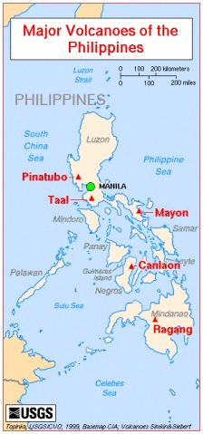
Manila, Philippines - The Philippine Institute of Volcanology and Seismology has warned against any activity near the Taal, Mayon and Bulusan volcanoes as rockfalls and ash explosions may occur due to bad weather.

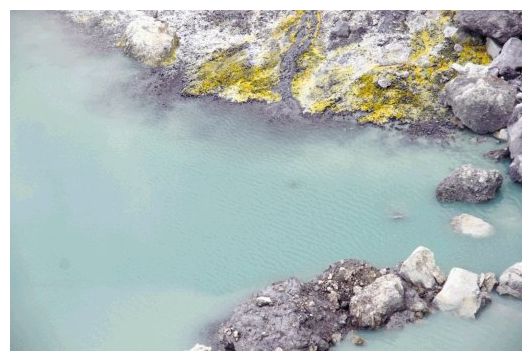
In its 8:00 a.m. bulletin, Phivolcs said that while Taal volcano was still on alert level 2, magma could be seen rising towards the surface as shown by the continuing high emission rate of carbon dioxide being released in the main crater lake and sustained seismic activity.

Phivolcs advised the public to stay away from the main crater, Daang Kastila Trail and Mt. Tabaro, as sudden hazardous steam driven explosions may occur and high concentrations of toxic gases may accumulate, which are lethal to humans and animals.

Phivolcs reiterated that the entire volcano island remains a permanent danger zone.
On the other hand, Mayon volcano and Bulusan volcano are under alert level 1.

But Philvocs said in the same bulletin that while no eruption was imminent in Mayon, the public should not enter the 6-kilometer radius permanent danger zone due to the continuing threat from sudden small explosions and rockfalls from the upper and middle slopes of the volcano.