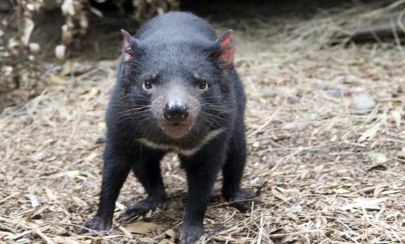
© Cameron Wells, Walter and Eliza Hall InstituteThis Tasmanian devil, photographed at Healesville Sanctuary, is part of the Save the Devil program that has been established to help protect Australia's Tasmanian devils which are at risk of extinction from devil facial tumor disease.
The facial cancers that are devastating populations of Tasmanian devils in Australia are a nerve tumor that escaped its original host and became a parasite of the cultural icon, passing from one devil to the next by bites when the animals are fighting or mating, researchers reported Thursday.
A genetic analysis of tumors from Tasmanian devils widely separated geographically shows that all the tumors are virtually identical and distinct from the animals' own genomes, researchers in the United States and Australia reported in the journal
Science. The tumors probably arose from Schwann cells, which normally play a role in protecting and cushioning nerves.
The analysis provides clues to a way to diagnose the disease early and represents a major step toward the development of a vaccine that could protect the remaining animals in the wild, said biologist Elizabeth P. Murchison of the Cold Spring Harbor Laboratory in Cold Spring Harbor, N.Y., and the Australian National University in Canberra, lead author of the paper.

