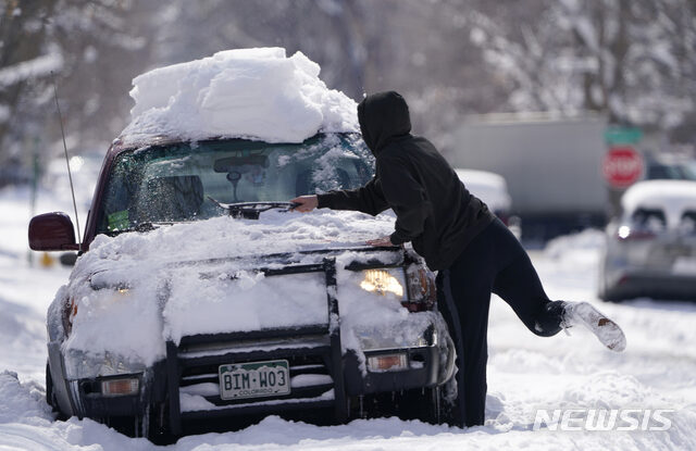
Winter weather advisories advertising a run-of-the-mill snow event were quickly converted into warnings overnight as snow fell at rates topping two inches per hour.
Original forecasts called for an upslope snow event, which means air forced up the Front Range of the Rockies would deposit considerable snowfall at the base of the foothills. But that band ended up 20 miles farther east than expected, parking right over the heart of downtown Denver.
Between 10 inches and a foot fell in the city proper, with 15 inches reported in southeast Denver near Colorado Boulevard. Englewood, a suburb just south of downtown, tallied 16 inches of snow.
Boulder, meanwhile, saw six to nine inches, with less up in the mountains. Aspen only got about five inches.
"It was more than we thought," said Jim Kalina, a meteorologist at the National Weather Service in Boulder, on a phone call Thursday. "We were expecting three to six inches in the Denver metro area. We did have some really good bands develop overnight."
As late as Tuesday afternoon, the Weather Service in Boulder was calling for little snow downtown, the bulk of any accumulations likely to be concentrated in the higher elevations.
"For the Urban Corridor and Metro Denver, a trace to 4 inches will be possible," wrote the Weather Service in an online forecast discussion.
By Wednesday morning, a winter weather advisory had painted a broad three to seven inches as the forecast from the Palmer Divide eastward into the Denver metro, but noted the city would likely see the lower end of the range while areas west ended up closer to six or seven inches.
Then computer models began keying in on some "weak upward vertical velocity," which was expected to enhance snowfall rates, the Weather Service wrote.
Even once snow got underway Wednesday night, it was still looking like a moderate event in Denver.
"We have decided to keep the Winter Weather Advisory in effect as the timing, location, amount and impacts of snowfall have occurred as expected," wrote the Weather Service at 9:03 p.m. "If snowfall were to unexpectedly increase overnight, especially in the foothills, we would consider upgrading the advisory to a warning."
But that's exactly what happened just 90 minutes later, when six to eight inches were already on the ground in Denver as the snow came down at rates near two inches per hour.
Meteorologists at the local Weather Service office are still reviewing data that could support the errant overachieving snow band defying forecasts, but for now have a couple of theories.
"To start with, part of the story is the snow density in the main snow band," said Chad Gimmestad, a meteorologist at the Boulder office. "It was really fluffy snow."
That stemmed from temperatures in the lower to mid-20s combining with steep lift, or upward motion. That intensified snowfall rates.
"The biggest thing that the forecast yesterday was off on was that we were forecasting our typical upslope snow event," Gimmestad said. "That's where the lift comes from the mountains and we have the heavy snow at the foot of the hills."
Instead, he said, "the snow band ended up shifting over the city of Denver." The band was about 25 miles wide.
Gimmestad also thinks the band was self-reinforcing, meaning it probably fed off its own wind patterns. Air exiting the band at the upper levels probably sank to the ground on the periphery of the band, only to hit the ground and converge back inward, keeping the snow band in place.
"Self-generated convergence from the snow band helped snowfall rates of one and a half to two inches per hour," Gimmestad said.
Finally, the overall large-scale, or synoptic, setup also enhanced a local boundary draped across the Denver metro area, focusing precipitation.
"Southeast winds over the Plains ... sometimes generates a boundary over Denver," Gimmestad said. "Everything got into balance in the evening and ... that snow band stopped moving."
Denver's average annual snowfall is about 55 inches, but that varies significantly between the mountains west of the city and the plains off to the east, where the airport is located.
In the meantime, considerable melting was ongoing Thursday afternoon, with sunny weather and highs near 40 slated for Friday.


Reader Comments
R.C.