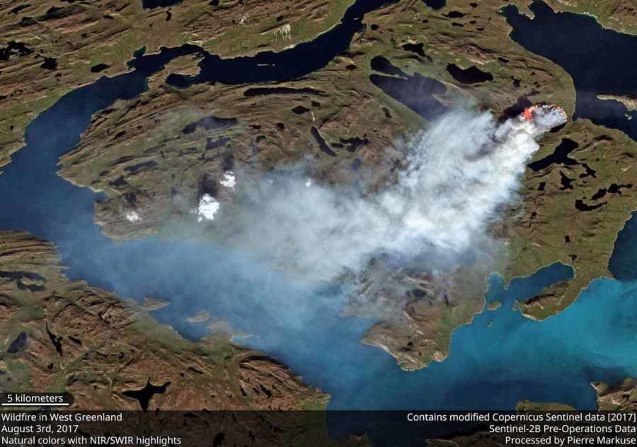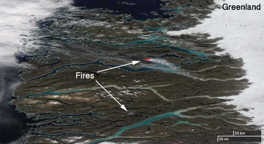
Three-quarters of Greenland is covered by the only permanent ice sheet outside Antarctica, and permafrost is found on most of the rest of the island. These are reasons why it is very unusual, and possibly unprecedented, that two wildfires are burning on the giant island.
The fires are near Sisimiut in Western Greenland north of the Arctic Circle at 66.9 and 67.8 degrees north latitude, which compares to the "Far North" area of Alaska near the Brooks Range.
According to Danish and Greenlandic news reports, they were first spotted from an airplane piloted by Per Mikkelsen who took photos of the fires. The weather forecast for the area indicates no rain in the next 10 days.
"These fires appear to be peatland fires, as there are low grass, some shrub, and lots of rocks on the western edge of the Greenland Ice Sheet", Jessica L. McCarty, an Assistant Professor of Geography at Miami University told us Monday. She continued, "They are likely occurring in areas of degraded permafrost, which are predicted to have high thaw rates between now and 2050 with some evidence of current melt near Sisimiut. Fires in the High Northern Latitudes release significant CO2, CH4, N20, and black carbon. A fire this close to the Greenland Ice Shelf is likely to deposit additional black carbon on the ice, further speeding up the melt. More on black carbon deposition in Greenland from wildland fires can be found here."
"The European Union Earth Observation Programme has stated that wildfires in Greenland are rare but have no data on previous wildland fire activity in this region", Ms. McCarty said.


Comment: Preliminary analysis suggests that MODIS has detected an exceptional increase of fire activity in Greenland in 2017 compared with previous years since the sensor began collecting data in 2002.
One factor for this sharp increase could be outgassing, possibly 'sparked' by an increase in atmospheric electric discharge events, such as lightning strikes and other 'cosmic' ignition sources?
Last year a rare winter wildfire ignited in Alaska, despite a foot of snow on the ground and forest fires broke out in Switzerland (in the dead of winter!)
Last month mysterious plumes of steam were recorded rising from a Greenland glacier which may be another sign of powerful geothermal activity from below. See also:
SOTT Exclusive: The growing threat of underground fires and explosions