Volcanoes
S


Bizarro Earth

Mexico's Popocatépetl Sleeping Volcano Awakens

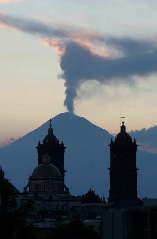
steam rises from the Popocatepetl volcano
© Joel Merino / APA plume of steam rises from the Popocatepetl volcano seen from the city of Puebla, Mexico, Saturday April 14, 2012.
Popocatépetl, the nearly 18,000 foot volcano that hovers like a sentinel on the southeastern fringe of Mexico's capital, awakened again Sunday, punctuating an especially shaky seismic season.

Popo, as the mountain is widely called, spewed at least seven exhalations overnight Saturday and through the day Sunday, sending vapor, smoke and gas billowing into the clear sky. The most serious occurred just after 9 a.m. Sunday, sending a vapor cloud a mile into the air.

Mexico's National Disaster Prevention Center issued a precautionary warning to residents, advising them to stay alert for a worsening situation and to keep at least seven miles away from the volcano's crater.

The service predicted continuing "moderate exhalations, some with ash, sporadic low to moderate explosions with likely burning fragments emitted close to the crater, and flaming magma within the crater visible at night."

Popo's latest fuming comes amid a series of earthquakes striking southern and central Mexico in the past three weeks. Several 6 magnitude quakes struck Wednesday, but no damage. A midday 7.4 quake on March 20 damaged hundreds of buildings in Oaxaca and Guerrero states and sent hundreds of thousands of residents scrambling into Mexico City's streets.
Bizarro Earth

Italy's Mt. Etna volcano rocked by 6th eruption in 2012

Image
© Unknown
Mount Etna is erupting for the sixth time this year with lava and plumes of smoke and ash from a new crater on the volcano's southeast side. The new activity was preceded by new phase that began last night and that, according to experts from the INGV in Catania, has the same characteristics as the one before this one. Ash, carried by wind towards the east, has not yet created problems at the Fontanarossa airport, which is fully operational.

Bizarro Earth

What's Happening Under Gibraltar?

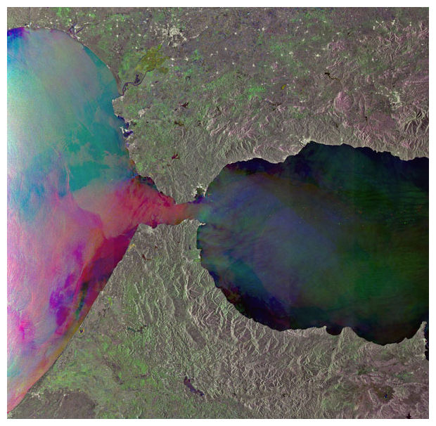
The Strait of Gibraltar
© ESAThe Strait of Gibraltar, which lies between the southern coast of Spain and the northern coast of Morocco, is the only place where water from the Atlantic Ocean mixes with water from the Mediterranean Sea.
The ground beneath Portugal, Spain and northern Morocco shook violently on Nov. 1, 1755, during what came to be known as the Great Lisbon Earthquake. With an estimated magnitude of 8.5 to 9.0, the temblor nearly destroyed the city of Lisbon and its lavish palaces, libraries and cathedrals. What wasn't leveled by the quake was mostly demolished in the ensuing tsunami and fires that raged for days. Altogether, at least 40,000 people were killed.

More than 250 years later, geologists are still piecing together the tectonic story behind that powerful earthquake. A unique subduction zone beneath Gibraltar, the southernmost tip of the Iberian Peninsula, now seems to be culprit. Subduction zones are the spots where one of Earth's tectonic plates dives beneath another, often producing some of the world's strongest earthquakes.

"At a global scale, subduction is the only process that produces magnitude-8 or -9 earthquakes," said Marc-Andre Gutscher, a geologist at the University of Brest in France. "If subduction occurred, and is still occurring here, then it's highly relevant to understanding the region's seismic hazards."

Attention

Los Nevados national park closed over volcano alert

volcano nevado del ruiz
© Wikipedia
Central Colombia authorities closed the national "Los Nevados" park Sunday after an increase in seismic activity of the Nevado del Ruiz volcano.

Meteorological authorities raised the alert level to orange in 17 municipalities in Tolima and Caldas departments while visitors are prohibited to enter the park in an area in four departments.

Bizarro Earth

Guatemalan Volcanoes Increase Activity

Guatemalan Volcano
© Prensa Latina
Guatemalan volcanoes Santiaguito and Fuego increased their activity in the last hours and the authorities recommended on Monday took all the necessary precautions with the surrounding air traffic.

The dispersion of ash in various directions and changes in wind pattern led to the National Institute of Seismology, Volcanology, Meteorology and Hydrology (Insivumeh) to warn about the civil aviation.

An Insivumeh report that Santiaguito volcano recorded 33 explosions in 24 hours, with a range of up to 800 meters above the crater, leaving ashes scattered in the southwest and southeast.

Santiaguito volcano is located in Quetzaltenango district, and its height is 2,550 meters above sea level.

The Insivumeh reported white and blue plume up to 100 meters above the crater, with displacement to the southwest, in the case of Fuego volcano, whose height is 3,763 meters above sea level and is located between the departments of Sacatepequez, Chimaltenango and Escuintla (center south).

Bizarro Earth

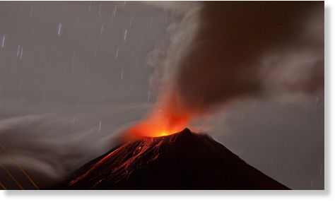
Kamchatka's Karymsky volcano unleashes 3100 meter ash cloud- aviation alert code orange

Karymsky volcano, erupting in Kamchatka, alert level has been raised to a Code Orange threat to aviation, although all routes on the peninsula are stretched so that the planes do not appear in the action zone of active volcanoes. The height of gases and ash that accompanies the eruption has reached three thousand one hundred meters above sea level. Lava has been detected oozing from the slopes of volcano.
Image
© Flickr.com/robnunn/cc-by-nc
The volcano poses no danger to the localities. The Karymsky volcanic summit, with a height of 1536 meters, is one of the most active volcanoes in Kamchatka. Its latest eruptive phase began in January 1996 and continues today.

Binoculars

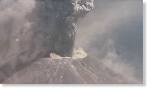
Mexico's Popocatépetl volcano unleashes 9 low-level emissions

Image
The National Center for Disaster Prevention (Cenapred) reported that in the last hours, the volcano Popocatepetl has expelled nine low-intensity exhalations accompanied by emissions of water vapor and gas, and sometimes small amounts of ash.

The Ministry of the Interior reported that the monitoring parameters remain without important changes. He explained that at night, a glow was observed in the crater of the volcano and that for now; there has been a constant emission of steam and gas.

He said the advisory code remains yellow in color phase 2 and the likelihood of prevailing moderate exhalations, some with ash emissions, and sporadic bursts of low to moderate probability of emission of incandescent fragments could be expected within walking distance of the crater.

Cenapred called for authorities to maintain the safety radius of 12 kilometers around the volcano. Civil Protection has been urged to hold preventive procedures in place, according to their operational plans and that people should keep advised by the latest news bulletins.

Bizarro Earth

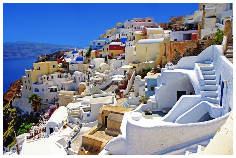
Scenic Greek Island Shows Signs of Volcanic Unrest

Santorini island
© Maugli, ShutterstockThe crowded cliffsides of Santorini island in Greece.

The volcanic caldera on the picturesque tourist island of Santorini is showing signs of unrest. But researchers detecting the caldera's movement say it doesn't necessarily mean an eruption is imminent.

The Greek island was the site of one of the most massive volcanic eruptions in history 3,600 years ago. That eruption, which created tsunamis 40 feet (12 meters) tall, may have spawned the legend of the lost city of Atlantis. The volcano last erupted in 1950, albeit on a much smaller scale.

Global positioning system (GPS) sensors placed on the caldera have detected renewed movement after decades of peace. The earth around the caldera (a depression at the top of a volcano) is deforming, or expanding outward, researchers report in an upcoming article in the journal Geophysical Research Letters. GPS instruments on the northern part of Santorini have moved between 1.9 and 3.5 inches (5 to 9 centimeters) since January 2011, said study researcher Andrew Newman, a geophysicist at Georgia Tech in Atlanta.

"What we're seeing now is the first significant deformation and the first deformation that has any significant earthquake activity associated with it," Newman told LiveScience.

Bizarro Earth

Japan's Sakurajima volcano experiences its most violent eruption in 3 years


Bizarro Earth

Kamchatka's Bezymianny volcano erupts, expels ash cloud 8 km high

Friday saw a new eruption of the Bezymianny volcano on the Kamchatka Peninsula in the Russian Far East.
Image
© EPABezymianny volcano
Earlier in the day, the volcano spewed ash up to 8 kilometers high, seismologists said, adding that the eruption does not pose a threat to population centers in the area.

One of the most active volcanoes in the world, Bezymianny is located 350 kilometers northeast of the city of Petropavlovsk-Kamchatsky.