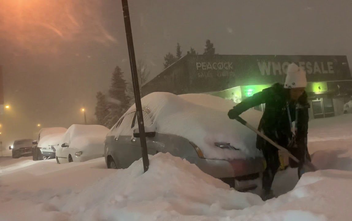
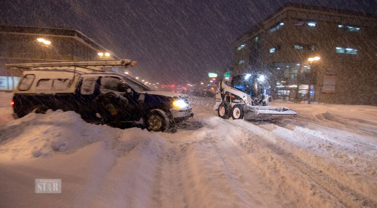
Record volumes of snow and ice began building Sunday afternoon across Alaska and NW Canada, and continued accumulating through Monday. The unprecedented storms soon strangled roads, knocked the power out for tens of thousands, and forced the closure of schools and businesses.
A boundary of cold Arctic air moved farther south than forecasters had originally expected, dramatically dropping temperatures across Alaska and the Yukon.
"It seems like a perfect storm," said Alaska Electric Light and Power's Debbie Driscoll. "We had a lot of snow and also a lot of heavy ice."
Snowfall records were set across the state of Alaska, including in Juneau.
"On Nov. 1, Juneau Airport broke a record when it got 7.6 inches of snow," said NWS meteorologist Kimberly Vaughan, a reading that busted the old mark of 6.6 inches.

Capital City Fire/Rescue assistant chief Ed Quinto had this advice: "Make sure you have some sort of light. Candles are OK, but not really good cause they can catch on fire," -let me grab a pen, this is good stuff- "battery-powered light is better. Think about heat. Stay warm with blankets and such."
Flashlights and blankets and such?
Check!
Thank you, Quinto!!
In Fairbanks, located a short 17 hours drive to the NW, the 22 below zero observed at the city's International Airport marks November 2's third coldest temperature in recorded history. Only 1907's 33 below and the 24 below logged in both 1992 and 1975 beat yesterday's reading.
Meanwhile, the NWS reported lows of 25 below in North Pole and Manley Hot Springs, 27 below for Eagle and the Goldstream Valley, 24 below in Wiseman, 30 below in Circle and a whopping 40 degrees below zero in Chicken.
These readings mark the first time since 2008 (solar minimum of cycle 23) that 40 below has been recorded this early in the season for the entire state.
This is also the earliest day in the season that Fairbanks has reached 20 below since 1996 (solar minimum of cycle 22).
Alaska's unseasonable cold will persist throughout the week with highs struggling to the mid-20s, and yet more snow in the forecast.
To the east, and across the border into the Yukon, long sections of the Alaska Highway and Klondike highways were closed on Monday after a morning of heavy snowfall — snow that also forced the territory's main airport to shut.
"We just want people to be patient," said Oshea Jephson of Yukon's highways department. "Everyone is dealing with the snow."
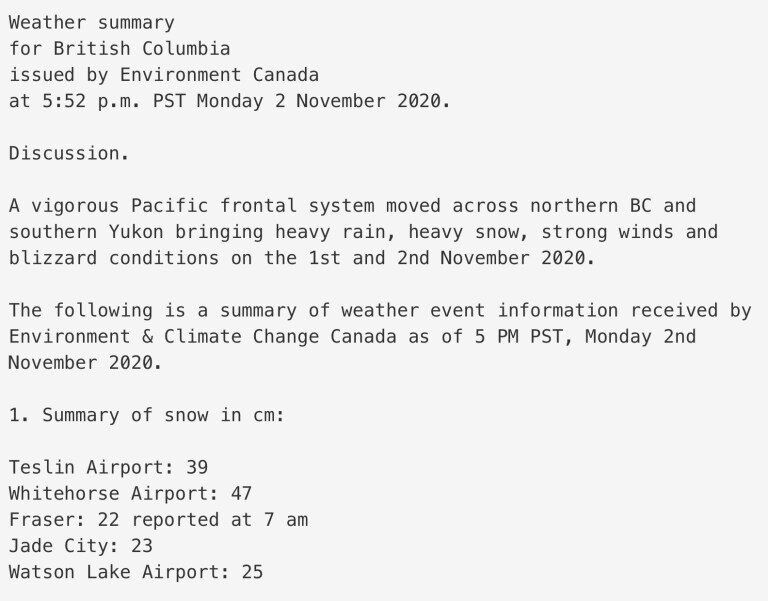
Doug Lundquist, a meteorologist with Environment Canada, has worked in B.C. and Yukon for over three decades, but says he's "never quite seen a storm like this."
On Monday alone, accumulating snow in Whitehorse topped 47 cm (1.54 ft) — an amount that far exceeds daily records for November, which Lundquist said range from 5 to 15 cm (2 to 6 inches). In fact, it turns out that Monday's snow was Whitehorse's highest daily snowfall for any day in any month!
"We've had three days in a row where we are in record-breaking territory ... there were no days in the month, in the old way of measuring things, that we came even close to (47 cm)," concluded Lundquist.
"It's right out of the ballpark."
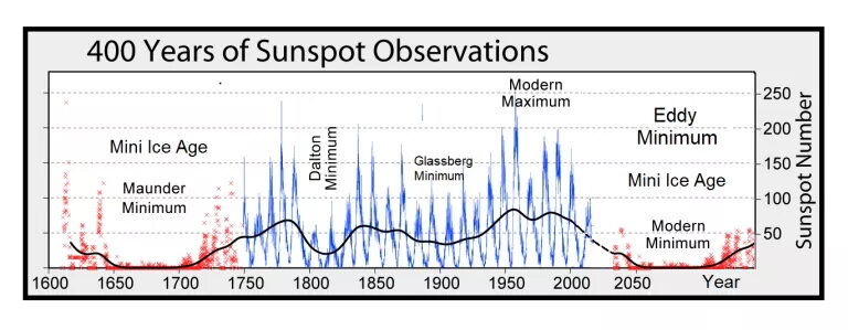
The COLD TIMES are returning, the mid-latitudes are REFREEZING in line with historically low solar activity, cloud-nucleating Cosmic Rays, and a meridional jet stream flow.
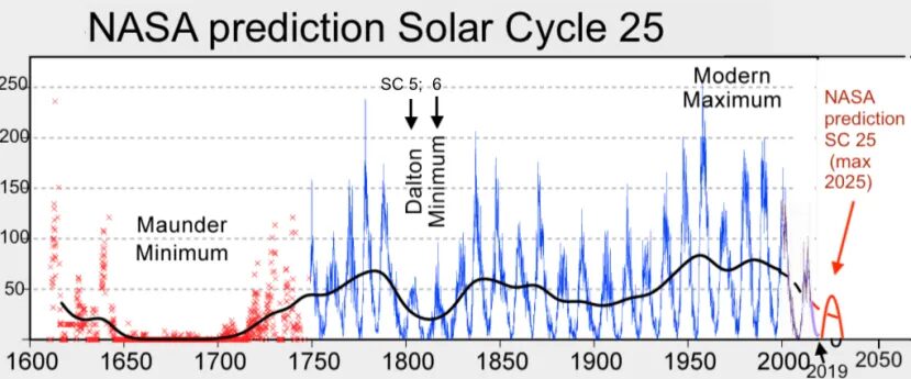
Both NOAA and NASA appear to agree, if you read between the lines, with NOAA saying we're entering a 'full-blown' Grand Solar Minimum in the late-2020s, and NASA seeing this upcoming solar cycle (25) as "the weakest of the past 200 years", with the agency correlating previous solar shutdowns to prolonged periods of global cooling here.
Furthermore, we can't ignore the slew of new scientific papers stating the immense impact The Beaufort Gyre could have on the Gulf Stream, and therefore the climate overall.
Prepare accordingly — learn the facts, relocate if need be, and grow your own.
Social Media channels are restricting Electroverse's reach: Twitter are purging followers while Facebook are labeling posts as "false" and have slapped-on crippling page restrictions.
Be sure to subscribe to receive new post notifications by email (the box is located in the sidebar >>> or scroll down if on mobile).
And/or become a Patron, by clicking here: patreon.com/join/electroverse, and/or consider "allowing ads" for www.electroverse.net if you use a blocker.
The site receives ZERO funding, and never has. So any way you can, help us spread the message so others can survive and thrive in the coming times.


Comment: See also: