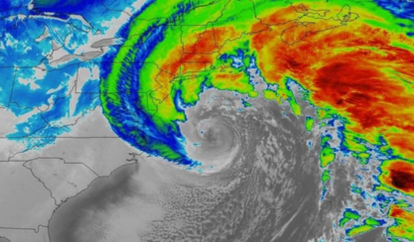
Update: Preliminary analyses from NOAA/NWS Weather Prediction Center as of midday Thursday show that Grayson deepened by an incredible 59 millibars in just 24 hours, which would be a record for midlatitude storms in this part of the Northwest Atlantic. The central pressure at 10 AM EST was analyzed by WPC at 951 mb.
As of late Wednesday, blizzard warnings covered parts of each coastline from North Carolina to Maine. Some uncertainty in the storm track remained on Wednesday night-complicated by the storm's rapid development and unusual strength-but Grayson's center should remain just far enough offshore to keep the worst impacts east of the I-95 corridor until the storm reaches southeast New England. There, Grayson may produce a strong enough blizzard to impress even the hardest-bitten Yankee. Snow amounts won't be off the charts, but the impact will be worsened by winds at gale force or stronger and frigid temperatures, especially in the 24 to 48 hours after Grayson has passed.
Update (12:45 pm EST): Winds had already gusted to 75 mph at Wellfleet, MA, as of midday Thursday. Hurricane Force Wind Warnings were in effect for Outer Cape Cod and Nantucket Island.

The Deep South's second major snowfall of this winter is carving a path even further southeast than the first one, back in December. Freezing rain coated parts of far northeast Florida on Wednesday, closing a 50-mile stretch of Interstate 10 and depositing a quarter-inch glaze all the way to Lake City, about 50 miles west of Jacksonville. Icing up to a half-inch was reported in Brunswick, GA, and a band of snow dropped 1" to 3.5" across far southeast Georgia, according to an NWS/WPC storm summary issued Wednesday afternoon.
Grayson intensified quickly on Wednesday afternoon off the Southeast coast, generating even heavier snow along and just inland from the South Carolina shoreline. Charleston picked up 5.3", with even larger amounts at some nearby points. The only other storms ever to officially produce at least 4" of snow in Charleston were in February 1973 (7.1") and December 1989 (8").
What's expected up the coast
Hampton Roads and vicinity (far southeast VA and far northeast NC): High-resolution computer models-especially the HRRR model-have been consistenly targeting this small area for a pocket of heavier snow, perhaps 8-12" or more.
Washington, D.C.: The metro area lies on the outer edge of Grayson's predicted snow shield. Amounts will probably range from flurries toward Dulles Airport to several inches toward Chesapeake Bay. Even an inch or two in the city could mess with Thursday-morning commutes, noted Capital Weather Gang. Heavier amounts up to 10" are possible over far southeast Maryland, Delaware, and southeast New Jersey, where a blizzard warning was in effect. "Travel will be very dangerous to impossible" late Wednesday into Thursday, warned the NWS office in Mt. Holly, NJ.
Philadelphia, PA: Much like D.C., the city will be on the outer edge of the expected snow shield, so amounts should be relatively light, especially toward northwest parts of town. Here again, high winds and sharp cold will make any snowfall that much worse.
New York, NY: As is so often the case, snow amounts could range wildly across the broad New York area, from a dusting over the western suburbs to a foot or more across eastern Long Island. The city itself is most likely to get a garden-variety snow of several inches, albeit with fierce winds and very cold temperatures.
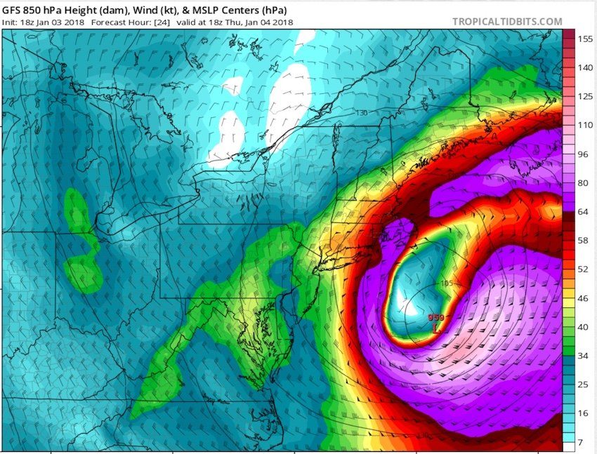
New England: Grayson will be a mature storm by the time it passes within about 100 miles of Cape Cod late Thursday. Models are projecting Grayson's central pressure could be in the 950-mb range by this point-on par with many hurricanes! Intense snowfall, with a chance of thundersnow, is a good bet across Rhode Island, eastern Massachusetts, the New Hampshire shore, and coastal and eastern Maine. A foot or more could fall in some areas.

Update: Numerous reports of inundation were being received by the NWS/Boston office as of 11:30 am EST Thursday, in association with Grayson as well as the atmospheric high tide. A coastal flood warning was in effect until 4 pm EST.
In a Wednesday afternoon discussion, the NWS/Boston office warned: "We think the coastal flooding along vulnerable shore roads and in vulnerable basements will be widespread and could have pockets of inundation up to 6 feet in low lying areas. Waves on top of the very high water levels will likely damage vulnerable structures such as decks, docks, beach access stairs, parking lots, etc. along the shoreline. Some homes and businesses, especially along the Plymouth County coast, may be damaged by the combination of high water and wave action. Still another potential issue is that the cold temperatures will result in freezing spray on some structures along the exposed shoreline from Salisbury to Plymouth. More widespread damage of homes and businesses is possible if waves should build several feet higher than currently forecast."
Canadian Maritimes: Nova Scotia Power launched the biggest pre-storm mobilization in its 45-year history on Wednesday. Models agree that Grayson will sweep into Nova Scotia early Friday at close to full strength, bringing damaging winds across the Maritimes region. Gusts could top 75 mph on the Nova Scotia coastline; the provincial capital of Halifax may be especially hard hit. Blizzard conditions are expected in New Brunswick, and a complex, evolving mix of heavy rain and snow will play out across Nova Scotia and Prince Edward Island, according to The Weather Network.
In Grayson's aftermath, yet another round of brutal cold
The extended cold that's kept parts of the U.S. Northeast below 32°F for more than a week will continue through the coming weekend, producing some of the longest below-freezing stretches on record. A few record lows will be possible on Friday and Saturday. All along the East Coast, any power outages could pose a bigger problem than usual because of the dangerous cold that will sweep in on Friday and Saturday.
We'll be updating this post on Thursday as the storm evolves.
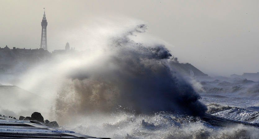
Europe has been dealing with its own blockbuster winter storm, dubbed Eleanor. Winds of up to 100 mph socked Great Britain on Tuesday night, including gusts of more than 70 mph in the London area. BBC reported that a huge wave on the northern coast of Spain killed two onlookers, while a falling tree killed a skier in the French Alps. At least 200,000 customers in northern France reportedly lost power. Falling trees injured at least four people in Great Britain, and the Guardian reported that power outages affected 23,000 residents of Northern Ireland, where one factory was partially unroofed.
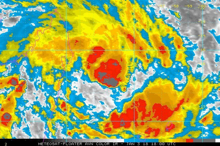
Thousands of miles to the south, Tropical Cyclone Ava was on track to produce what could be the planet's first hurricane-strength landfall of 2018. As of 4 pm EST Wednesday, Ava was located about 300 miles north-northwest of the island of Reunion, heading south at about 12 mph with top winds of around 45 mph. Ava was fairly disorganized, but it included several clusters of strong showers and thunderstorms (convection).
In the Northwest Pacific, weakening Tropical Storm Bolaven was on track to make an uneventful landfall in Vietnam after becoming the third named storm in a month to drench the Philippines, where at least two deaths were reported.



Comment: Also See: