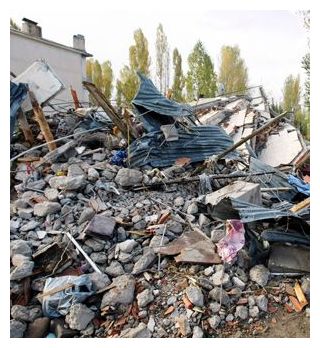
Earthquakes
Monday, December 20, 2010 at 18:41:59 UTC
Monday, December 20, 2010 at 10:11:59 PM at epicenter
Location:
28.439°N, 59.098°E
Depth:
12.4 km (7.7 miles) set by location program
Region:
SOUTHEASTERN IRAN
Distances:
213 km (133 miles) SW (236°) from Zahedan, Iran
283 km (176 miles) SE (136°) from Kerman, Iran
310 km (193 miles) ENE (63°) from Bandar-e Abbas, Iran
538 km (334 miles) N (5°) from MUSCAT, Oman
Earthquakes, heat waves, floods, volcanoes, super typhoons, blizzards, landslides and droughts killed at least a quarter million people in 2010 - the deadliest year in more than a generation. More people were killed worldwide by natural disasters this year than have been killed in terrorism attacks in the past 40 years combined.
"It just seemed like it was back-to-back and it came in waves," said Craig Fugate, who heads the U.S. Federal Emergency Management Agency. It handled a record number of disasters in 2010.
"The term '100-year event' really lost its meaning this year."
And we have ourselves to blame most of the time, scientists and disaster experts say.
Comment: This article supports the idea of human-caused global warming, and, as the above sentence says, blames us humans for most of the disasters that befell the world this past year. Find an analysis and rebuttal to this story here.
Even though many catastrophes have the ring of random chance, the hand of man made this a particularly deadly, costly, extreme and weird year for everything from wild weather to earthquakes.
Poor construction and development practices conspire to make earthquakes more deadly than they need be. More people live in poverty in vulnerable buildings in crowded cities. That means that when the ground shakes, the river breaches, or the tropical cyclone hits, more people die.
Athens Geodynamic Institute, a state earthquake monitoring agency, said the undersea quake occurred at 11:37 a.m. (0937GMT), 120 kilometres (75 miles) south of Athens, near the island of Milos. It struck at a depth of 103 kilometres (64 miles).
That part of central Arkansas isn't even part of the New Madrid Fault Zone, so researchers are trying to figure out what's causing all those earthquakes. Horton thinks, the earthquake swarm could be the result of injecting salt water into old natural gas wells to force more gas production. "There's salt water that's a by product of the natural gas industry in that area and then disposed in a well," said Dr. Horton.
Even though the two areas are not connected, Horton's biggest worry is along the New Madrid Fault where he said damage from a magnitude six earthquake could be catastrophic to Mid-Southerners. "A probability of having that in a 50-year period is about 25 to 40-percent chance," said Dr. Horton.
Monday, December 13, 2010 at 01:14:43 UTC
Monday, December 13, 2010 at 11:14:43 AM at epicenter
Time of Earthquake in other Time Zones
Location:
6.563°S, 155.658°E
Depth:
144.8 km (90.0 miles)
Region:
BOUGAINVILLE REGION, PAPUA NEW GUINEA
Distances:
40 km (25 miles) SSE of Arawa, Bougainville, PNG
100 km (65 miles) W of Chirovanga, Choiseul, Solomon Islands
990 km (610 miles) ENE of PORT MORESBY, Papua New Guinea
2325 km (1450 miles) N of BRISBANE, Queensland, Australia
The Log Cabin Democrat newspaper at Conway reported Thursday that the earthquakes, all of them small, were recorded as occurring in the vicinity of Guy in the northern part of the county from Dec. 3 through Wednesday, with 25 quakes recorded on Sunday.
The largest of the quakes had a magnitude of 2.6. Researchers say quakes of 2.5 to 3.0 magnitude are typically the smallest felt by humans.
There were no reports of injuries or structural damage.
The quake struck at 4:17 am with its epicenter 64 kilometres east of Zhob in Baluchistan, at a depth of 19 kilometers, the United States Geological Survey said. Tremors were felt in Faisalabad, Vehari, Jhang, Dera Ismail Khan as well as tribal areas. Unsettled by the sudden shocks, people came out of their houses, whereas no reports of any kind of losses have been received.
From USGS:
Date-Time:
Thursday, December 09, 2010 at 23:17:32 UTC
Friday, December 10, 2010 at 04:17:32 AM at epicenter
Time of Earthquake in other Time Zones
Location:
31.557°N, 70.140°E
Depth:
9.8 km (6.1 miles)
Wednesday, December 08, 2010 at 06:47:18 UTC
Wednesday, December 08, 2010 at 02:47:18 PM at epicenter
Time of Earthquake in other Time Zones
Location:
7.380°N, 126.603°E
Depth:
69.6 km (43.2 miles)
Region:
MINDANAO, PHILIPPINES
Distances:
115 km (70 miles) SSE of Hinatuan, Mindanao, Philippines
115 km (70 miles) ENE of Davao, Mindanao, Philippines
210 km (130 miles) SE of Butuan, Mindanao, Philippines
1005 km (630 miles) SE of MANILA, Philippines
Wednesday, December 08, 2010 at 05:24:33 UTC
Wednesday, December 08, 2010 at 03:24:33 AM at epicenter
Time of Earthquake in other Time Zones
Location:
56.440°S, 25.866°W
Depth:
17.3 km (10.8 miles) set by location program
Region:
SOUTH SANDWICH ISLANDS REGION
Distances:
85 km (55 miles) ENE of Visokoi Island, South Sandwich Islands
290 km (180 miles) N of Bristol Island, South Sandwich Islands
3480 km (2160 miles) SE of BUENOS AIRES, D.F., Argentina
From USGS:
Date-Time:
Thursday, December 02, 2010 at 03:12:10 UTC
Thursday, December 02, 2010 at 01:12:10 PM at epicenter
Time of Earthquake in other Time Zones
Location:
6.059°S, 149.851°E
Depth:
34.8 km (21.6 miles) set by location program
Region:
NEW BRITAIN REGION, PAPUA NEW GUINEA
Distances:
40 km (25 miles) ENE of Kandrian, New Britain, PNG
65 km (40 miles) SSW of Kimbe, New Britain, PNG
475 km (295 miles) NE of PORT MORESBY, Papua New Guinea
2400 km (1490 miles) N of BRISBANE, Queensland, Australia
Comment: There seems to be a good deal of activity in this area. See USGS Records 53 Quakes In Week In Arkansas County