Secret HistoryS

Colosseum

Double helix of masonry revealed as the secret of Italian renaissance domes

Santa Maria del Fiore
© Mark Boss on UnsplashSanta Maria del Fiore in Florence, Italy, a World Heritage site, is the largest masonry dome standing today. Through computational methods, researchers from Princeton and the University of Bergamo have mathematically proven the structural physics at work in domes of this type.
What can modern engineering learn from an erstwhile jeweler who built the largest masonry dome in existence?

The construction of the Florentine duomo by Filippo Brunelleschi has been an engineering marvel for more than 500 years, showcasing ancient techniques that still hold valuable insights for modern engineering. Until now, it has remained a mystery how the master goldsmith and sculptor managed to build the masterpiece that pushes the limits of what is possible to construct even with modern building technologies, and how the masters who followed Brunelleschi carried on the tradition.

In a collaborative study in the July 2020 issue of Engineering Structures, researchers at Princeton University and the University of Bergamo revealed the engineering techniques behind self-supporting masonry domes inherent to the Italian renaissance. Researchers analyzed how cupolas like the famous duomo, part of the Cathedral of Santa Maria del Fiore in Florence, were built as self-supporting, without the use of shoring or forms typically required.

Comment: It's rather incredible that such important knowledge, and from what seems to be only our recent past, could have been lost. And yet it is but one of the many stunning reminders that this forgetting seems to be part of a repeating pattern:


Info

Global cooling 4,200-years ago spurred rice's evolution

Rice
© Getty Images
A major global cooling event that occurred 4,200 years ago may have led to the evolution of new rice varieties and the spread of rice into both northern and southern Asia, an international team of researchers has found.

Their study, published in Nature Plants and led by the NYU Center for Genomics and Systems Biology, uses a multidisciplinary approach to reconstruct the history of rice and trace its migration throughout Asia.

Rice is one of the most important crops worldwide, a staple for more than half of the global population. It was first cultivated 9,000 years ago in the Yangtze Valley in China and later spread across East, Southeast, and South Asia, followed by the Middle East, Africa, Europe, and the Americas. In the process, rice evolved and adapted to different environments, but little is known about the routes, timing, and environmental forces involved in this spread.

In their study, the researchers reconstructed the historical movement of rice across Asia using whole-genome sequences of more than 1,400 varieties of rice โ€” including varieties of japonica and indica, two main subspecies of Asian rice โ€” coupled with geography, archaeology, and historical climate data.

Syringe

The Head of the Hydra: Rise of Robert Kadlec

Kadlec and syringe
© unknownRobert Kadlec
A POWERFUL NETWORK OF POLITICAL OPERATIVES, A GLOBAL VACCINE MAFIA AND THEIR MAN IN WASHINGTON.

Last Friday, a group of Democratic Senators "demanded" that the Department of Health and Human Services (HHS) Assistant Secretary for Preparedness and Response (ASPR) Robert Kadlec, "accurately disclose all his personal, financial and political ties in light of new reporting that he had failed to do so previously" after it was revealed that he had failed to note all "potential conflicts of interest" on his nomination paperwork.

The report in question, published last Monday by The Washington Post, detailed the ties of Kadlec to a man named Fuad El-Hibri, the founder of a "life sciences" company first known as BioPort and now called Emergent Biosolutions. Kadlec had previously disclosed his ties to El-Hibri and Emergent Biosolutions for a separate nomination years prior, but had failed to do so when nominated to head ASPR.

Though The Post does note Kadlec's recent failure to disclose these connections, the article largely sanitizes Kadlec's earlier yet crucial history and even obfuscates the full extent of his ties to the BioPort founder, among other glaring omissions. In reality, Kadlec has much more than his ties to El-Hibri looming large as "potential conflict of interests," as his decades-long career in shaping U.S. "biodefense" policy was directly enabled by his deep ties to intelligence, Big Pharma, the Pentagon and a host of corrupt yet powerful characters.

Thanks to a long and deliberate process to introduce biodefense policy, driven by Robert Kadlec and his sponsors, $7 billion dollars-worth of federally-owned vaccines, antidotes and medicines - held in strategically arranged repositories across the country in case of a health emergency - are now in the hands of one single individual. Those repositories, which compose the Strategic National Stockpile (SNS), are the exclusive domain of HHS' ASPR, a post created under Kadlec's watchful eye and tailored over the years to meet his very specific requirements.

Sherlock

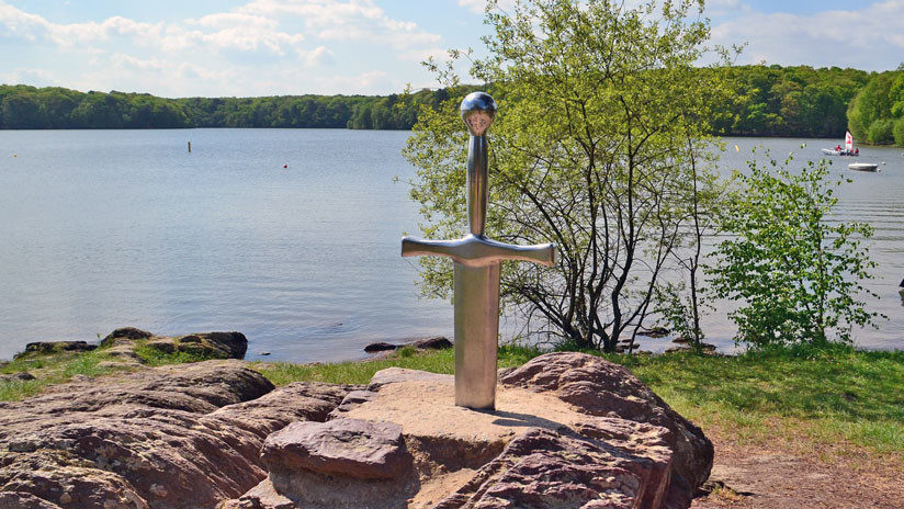
King Arthur: A legend felled by archaeology and DNA

king arthur
© Pixabay / juliacasado1Imagen ilustrativa.
Another fascinating program, King Arthur's Britain: Truth Unearthed

As a boy, I read in children's books that after the Romans evacuated Britain early in the fifth century the indigenous peoples fell into warlike anarchy and only came together again under the leadership of King Arthur to confront the new invaders from Europe, the Angles, Saxons and Jutes, who had driven the Britons back to the western part of the isles.

Just like the biblical story of King David, I am almost certain that the literary legends are fantasy. Archaeology and DNA, in their current state, appear to leave no room for such scenarios of mass invasions, displacements or a heroic King Arthur rising to save such a day.

Comment:


Bizarro Earth

Remembering Mount St. Helens eruption: 40 years later

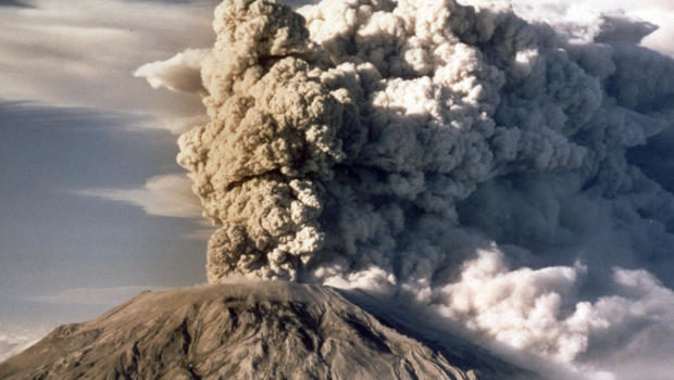
Mount St. Helens spews smoke, soot and ash into the sky in Washington state following a major eruption on May 18, 1980
© JACK SMITH/APMount St. Helens spews smoke, soot and ash into the sky in Washington state following a major eruption on May 18, 1980.
May 17, 1980, 40 years ago today, was a beautiful day on the mountain in southwest Washington. It was also the most significant day of Carolyn Driedger's life.

She and a colleague had traveled to the active volcano Mount St. Helens to drop off equipment at a U.S. geological station. They planned to stay the night, but geologist David Johnston, tasked with monitoring the mountain, warned them against it.

"He said, 'Let's just have as few people here as possible,'" Driedger recalled. "We were very disappointed that we were not going to spend the night looking at this beautiful volcano. The sun was just starting to set. We stopped and I took a couple of last photos of Mount St. Helens."

The next morning, at 8:37 a.m., Mount St. Helens erupted - a disaster unlike any other in American history.

The news reported it as "the most violent eruption of this volcano in 32,000 years."

"The energy that came out of Mount St. Helens that day is bigger than any nuclear weapon than we have in our arsenal," said Steve Olson, author of "Eruption: The Untold Story of Mount St. Helens" (W.W. Norton). "The whole northern flank of the volcano collapsed into this valley," he said, "and that let out this burst of pressure that had been building up inside the volcano."

The blast triggered the largest landslide in recorded history, flattening trees for 220 square miles, with a cloud of smoke, ash and pumice. In all, 57 people died.


Comment: Scientist reveals molten rock 'rising five metres a day' at Mount St Helens, Washington


Dig

Feast of gazelle, pig and snails sheds light on Hellenist life in ancient Galilee

galilee
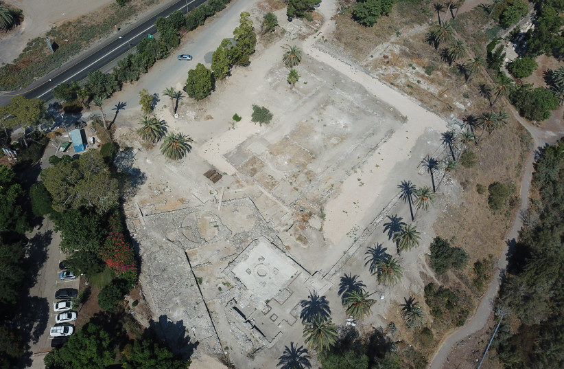
© COURTESY OF THE TEL BET YERAH ARCHAEOLOGICAL PROJECT
The remains of a Hellenist banquet dating back to 2,200 years ago recently uncovered by a group of archaeologists from the Tel Aviv University (TAU) have helped to shed light on the everyday life of Greek settlers in the land of Israel before the Galilee was conquered by the Hasmonean Kingdom.

The pit was revealed during excavations at Tel Bet Yerah, headed by TAU Prof. Rafi Greenberg and Dr. Sarit Paz. Read More Related Articles

As explained to The Jerusalem Post by Miriam Pines, one of the authors of the article, published in the latest issue of the Journal of Eastern Mediterranean Archaeology & Heritage Studies, the project was conducted "within inter-discipline research aimed at discovering the small forgotten things of the past societies in this land."

Comment: See also: And check out SOTT radio's: The Truth Perspective: Interview with Russell Gmirkin: What Does Plato Have To Do With the Bible?


Colosseum

A perfect storm: How early Christian farming in the Negev collapsed

Negev
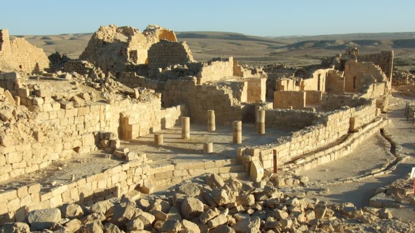
© Yotam TepperShivta, an early Christian farming settlement in the Negev that did spectacularly well, until it didn't any more
The Negev Desert isn't the first place that comes to mind when one thinks about agricultural abundance, yet beginning over 2,000 years ago and up to about 1,500 years ago very roughly, slightly less inhospitable parts of the desert were intensively farmed. From early Roman times, villagers in the Negev worked the bitter land.

By the early Byzantine era, which began in 324 C.E., the farmers were flourishing by dint of remarkable water management and by strategically locating towering dovecotes in agricultural fields. The people grew olives, grapes and subsistence crops in the nutrient-poor loess soil, literally fertilized by the birds' copious emissions.

And then they were gone. What happened to the ancient dryland farmers of the Negev and when it happened - before or after the advent of the early Islamic period - has been a mystery. Some have thought agriculture disappeared in the late Byzantine period, which ended in 638 C.E., while others thought it persisted well into the Islamic period, to the 10th or 11th century.

Comment: One of the driving factors to all the disasters mentioned in the article above, and recorded by many peoples of the time - although strangely absent from the article - are cometary events. For more see Pierre Lescaudron's: The Seven Destructive Earth Passes of Comet Venus

See also: And check out SOTT radio's:


Info

Petroglyphs and cave painting in Iran suggests prehistorical Iranians migrated to Americas

Ancient Petroglyph
© Tehran Times
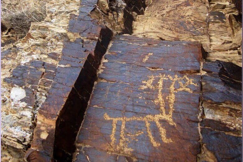
Tehran - Some prehistorical residents of the Iranian plateau migrated to the Americas, an Iranian archaeologist and researcher says based on evidence from similarities between the petroglyphs and cave painting symbols in central Iran and the ones found in the Americas.

"After years of exploring ancient paintings inside Iran's caves and mountains and other parts of the globe, amazing achievements have been made in this regard," Mohammad Nasserifard told IRNA in an interview released on Tuesday.

"The ancient paintings of cave walls and mountains in Iran have been compared with ones in other parts of the world, their similarities in appearance and motifs have been 'amazing', according to quotes by professors Jan Brouwer and Gus van Veen," Nasserifard said, adding "His research and findings are presented to enthusiasts and researchers for the first time."

The archaeologist underlined that such petroglyphs may be a missing link in human history and arts.

"Appearance similarities, artistic styles, and uniform themes of ancient petroglyphs and cave paintings of this land (Iran) reveal many missing links in human history and arts one of which is the resemblance of ancient artifacts in Iran with ones found in the American continent."

"The discovery of equestrian motifs with leopard-like horses in Iran, which the Indians called 'Appaloosa', is one of the reasons for this migration, which can be seen on the walls of caves and mountains of Qasr-e-qand and Neyshekar regions which date from 11,000 years ago. They are similar to the leopard-like horses of Baluchestan."

Radar

Dozens of archeological sites discovered by volunteers from home during lockdown

site map
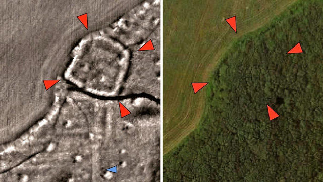
© University of ExeterA probable Iron Age or Roman enclosed settlement (red arrows) and associated field system (blue arrows)
revealed by LiDAR data but hidden today beneath woodland
Dozens of previously-unrecorded Roman, prehistoric and medieval sites have been discovered by archaeology volunteers based at home during the coronavirus lockdown.

Digging may be on hold due to the pandemic, but the team have found parts of two Roman roads, around 30 prehistoric or Roman large embanked settlement enclosures, around 20 prehistoric burial mounds, as well as the remains of hundreds of medieval farms, field systems and quarries. Those leading the project believe they will make many more discoveries in the coming weeks.

The team, led by Dr Chris Smart from the University of Exeter and working as part of the National Lottery Heritage Fund supported Understanding Landscapes project, are analysing images derived from LiDAR, or light detection and ranging, data. This laser technology is used during aerial surveys to produce highly detailed topographical maps.

Comment: See also:


Question

Mystery of 60 peculiar lead cubes with 'Sanskrit inscriptions' pulled from British river

sanskrit cubes
© WillRead8888/Imgur
A magnet fisherman out with his two young sons at a river in Coventry reeled in almost 60 mysterious cubes thought to show a sacred numerical inscription.

Will Read found the haul of engraved lead squares - believed to be connected to a mystical Hindu prayer ritual - while out sifting through shallow water.

The faces of the objects, small enough to hold between finger and thumb, are set into neat grids with inscriptions thought to be in Sanskrit.

At first, Will, 38, from Finham, thought the cubes were just random pieces of debris littering the bottom of the River Sowe in south Coventry.