

© Heinz Plenge Pardo/World Monuments Fu ndThis marks the first major discovery in the region since the 1980s and more than doubles the number of known archaeological structures at the Chachapoya complex
Researchers working in Peru have discovered more than 100 previously unknown structures at the Gran Pajatén archaeological complex
, an ancient site located within Río Abiseo National Park, 500 km north of Lima. The park is a Unesco Mixed World Heritage site, and famous for the ruins left by the Chachapoya, a civilization that lived in the northeastern Andes of Peru from the 7th to the 16th centuries.
"Everyone on the team is very excited," says Juan Pablo de la Puente, the executive director of the World Monument Fund in Peru. "Contributing to a deeper understanding of the Chachapoya legacy is both a responsibility and a privilege. Indeed, it's a great responsibility we Peruvians have to the world."
As well as identifying more than 100 archaeological structures — significantly expanding on the 26 buildings known since the 1980s — the team revealed that the Chachapoya lived at Gran Pajatén from at least the 14th century. They also conducted fieldwork on a network of pre-Hispanic roads that connect sites across the Río Abiseo National Park.
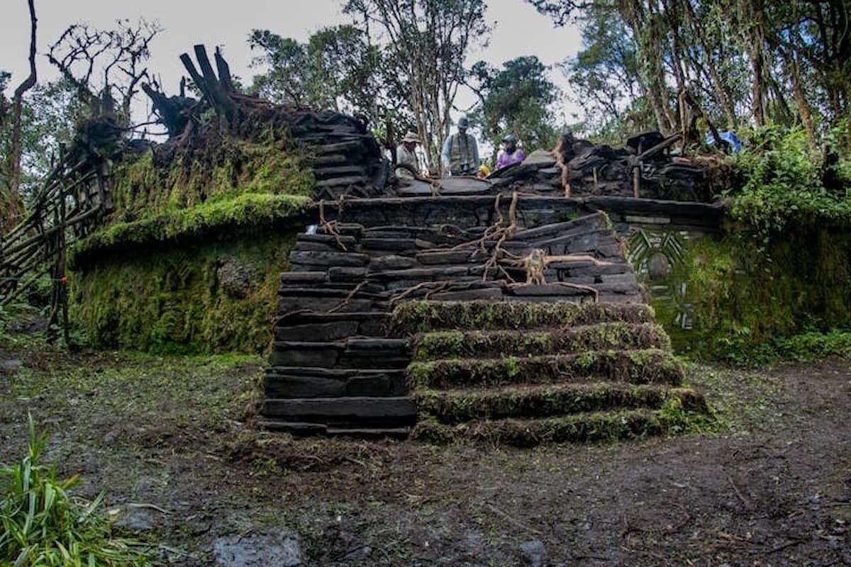
© Heinz Plenge Pardo/World Monuments FundA partially excavated staircase at a structure at Gran Pajatén Peru during a 2024 expedition
Discovered in the 1960s, Gran Pajatén is located on a ridge with defensive and symbolic significance to the Chachapoya and features high-relief friezes and ceremonial buildings decorated with stone mosaics. "The architectural layout, the visual prominence of the site and its connection to nearby sites by a network of ancient roads suggest that it served ceremonial, administrative and social functions along the river Montecristo Valley," De la Puente says. "It was likely a spiritual centre and a cultural waypoint — an expression of how the Chachapoya organised and navigated their environment."
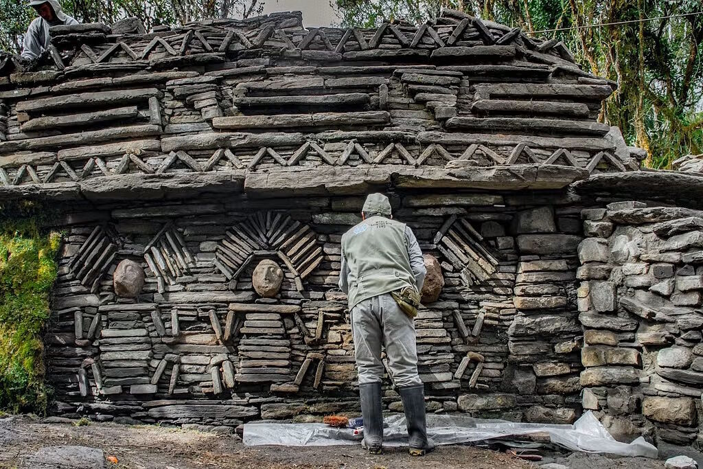
© Heinz Plenge Pardo/World Monuments FundConservation work on the North Basing of Building 1 in Pajatén, Peru.
Thriving for a thousand years, the Chachapoya civilisation eventually fell to Inca expansion during the late 15th century. They built their settlements between 2,000m and 3,000m above sea level, adapting to the rugged terrain, often in remote locations — consequently, they are sometimes called the "people of the cloud forest". The team's findings shed new light on Chachapoya culture, long-distance connections and regional influence, with more to be discovered.
"What excites me most is that we're only scratching the surface," De la Puente says. "So far we have processed only 10% of all the data recorded by Lidar. These new structures raise profound questions: Considering the rugged terrain and harsh weather, how did the Chachapoyas maintain a settlement network of this magnitude in this area? What was the source of their resources? What motivated them to settle in this area? The path ahead is full of possibility, and we're just beginning the journey."










Did the Incas kill them off or force them into slavery?